Exclusive Alert: Four Tropical Systems Brewing – What You Need to Know Now!
Meteorologists worldwide are increasingly focused on an unusually active early summer across both the Atlantic and Pacific basins. As of July 5, 2025, four distinct tropical systems are being closely watched: Tropical Depression Three in the Atlantic (soon to be Chantal), Invest 96E in the Eastern Pacific, Tropical Storm Mun in the Western Pacific, and Tropical Storm Danas approaching Taiwan and southern China. Drawing on live data from Windy, NHC, JTWC, and regional weather services, here’s your comprehensive deep dive.
Breaking – The NHC will initiate advisories on Tropical Depression 3 at 5pm edt. Should become #Chantal prior to landfall in SC tomorrow. pic.twitter.com/BPUjrrMYBX
— Hurricane Tracker App (@hurrtrackerapp) July 4, 2025
Atlantic Alert: Tropical Depression Three Set to Explode into Chantal
Off the coast of Georgia lies Tropical Depression Three, barely named but already gaining attention. Positioned about 150 miles south-southeast of Charleston, South Carolina, this system churns with sustained winds around 35 mph and drifts north at a mere 2 mph.
The National Hurricane Center and major media outlets confirm it will become Tropical Storm Chantal by Saturday, July 5, with a probable South Carolina landfall by Sunday morning. Although not yet a hurricane, Chantal will bring tropical-storm-force winds, waves rising an additional 1 to 2 feet, and steady rain totaling 2 to 6 inches—enough to trigger flash flooding and dangerous rip currents along the Southeast coast .
Warnings are already in effect. The Cautious issuance of a Tropical Storm Watch from Edisto Beach through Little River Inlet indicates serious concern for community safety. Ocean surfers, beachgoers, and low-lying neighborhoods should take note: this holiday weekend is anything but routine.
This reminds us of storms past—last year, Tropical Storm Barry in the Gulf hit with similarly modest winds yet unleashed deadly floods and caused billions in damages. Chantal, though small, mirrors Barry’s deceptive potential.
Turning west, Invest 96E has formed roughly 520 miles southwest of Acapulco and about 380 miles from Puerto Vallarta. With winds near 30 knots (35 mph) and central pressure around 1010 mb, the system exists within warm waters and favorable winds.
Forecast models and the NHC expect it to strengthen into Tropical Depression Six-E, and possibly Tropical Storm Gil, sometime over the weekend or early next week. Its trajectory aims northwest toward the coast of southern Mexico—Oaxaca, Guerrero, or Michoacán.
Expect copious rain inland and a surge of coastal waves. Though no formal alerts have issued yet from the NHC, Mexico’s SMN is on heightened watch. If conditions hold, they will issue Tropical Storm Warnings soon, and residents should prepare for flooding and mudslides, reminiscent of last year’s Cyclone Rae in the same region.
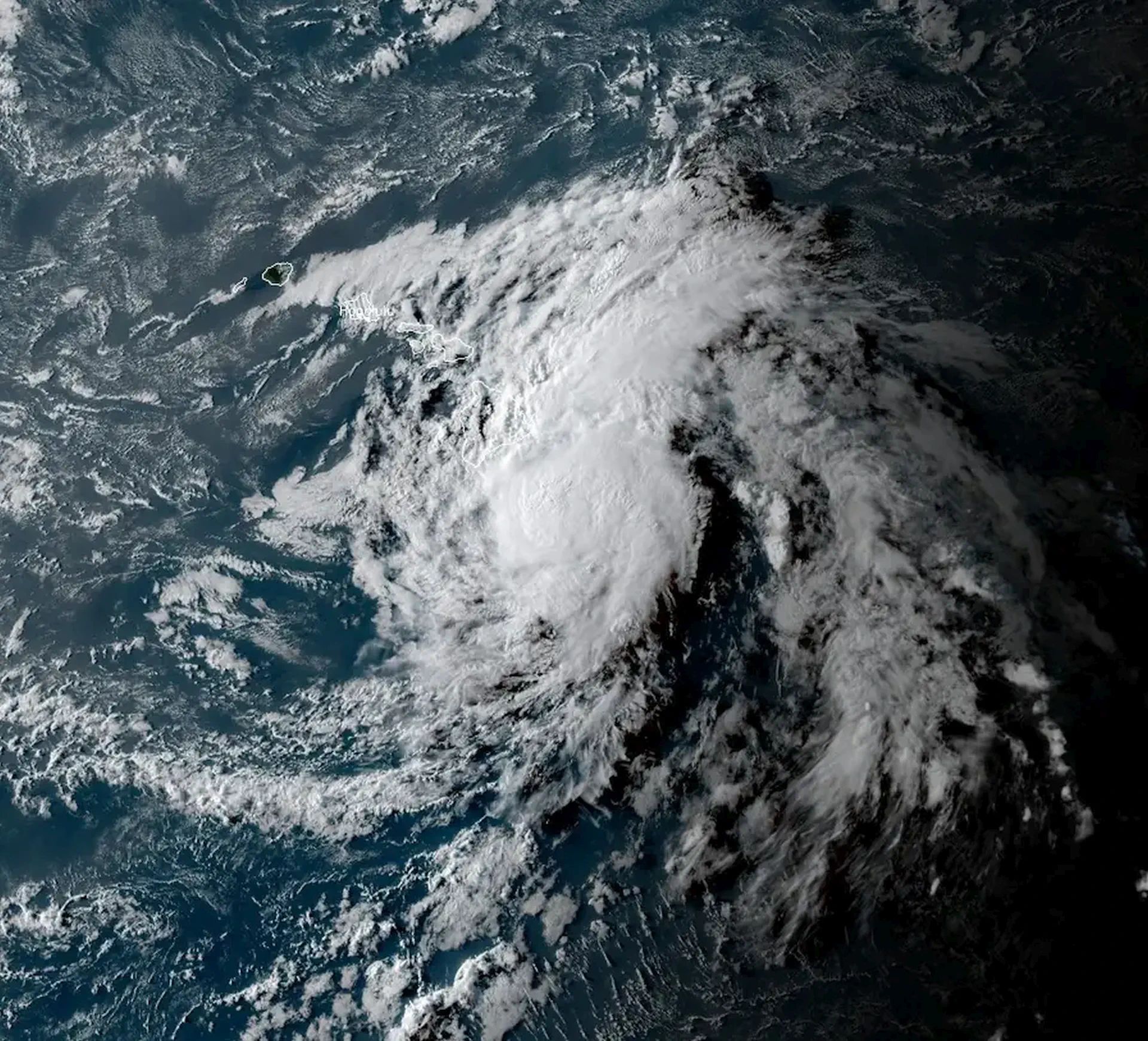
– #Danas (fmr. #BisingPH) intensifies into a severe tropical storm, with a chance to further intensify into a typhoon. Keep watch. – Severe tropical storm #Mun has maintained its intensity for the past day. It also still has a chance to become a brief typhoon. Stand by. pic.twitter.com/H12EId8spj
Western Pacific Disturbance: Tropical Storm Mun Builds Strength
In the Western Pacific, Tropical Storm Mun (designated 04W) continues to intensify over warm ocean waters. As of July 5, it packs winds of approximately 55 knots and center pressure near 982 mb, located east-southeast of Yokosuka, Japan.
Mun is forecast to steadily intensify, passing typhoon thresholds near 65 knots within 24 hours. Its northward drift indicates potential threat to marine operations and possibly Japan’s southern islands before encountering cooler temperatures.
Although Mun currently poses little risk to populated areas, sea conditions will deteriorate sharply. Heavy swells, pounding surf reaching 20+ ft, and gale-force winds will impact maritime routes—harboring risks for fishing vessels and cargo ships in the region. Ships should prepare accordingly, especially considering how fast these systems can escalate.
Danger Waves Approaching Taiwan: Tropical Storm Danas
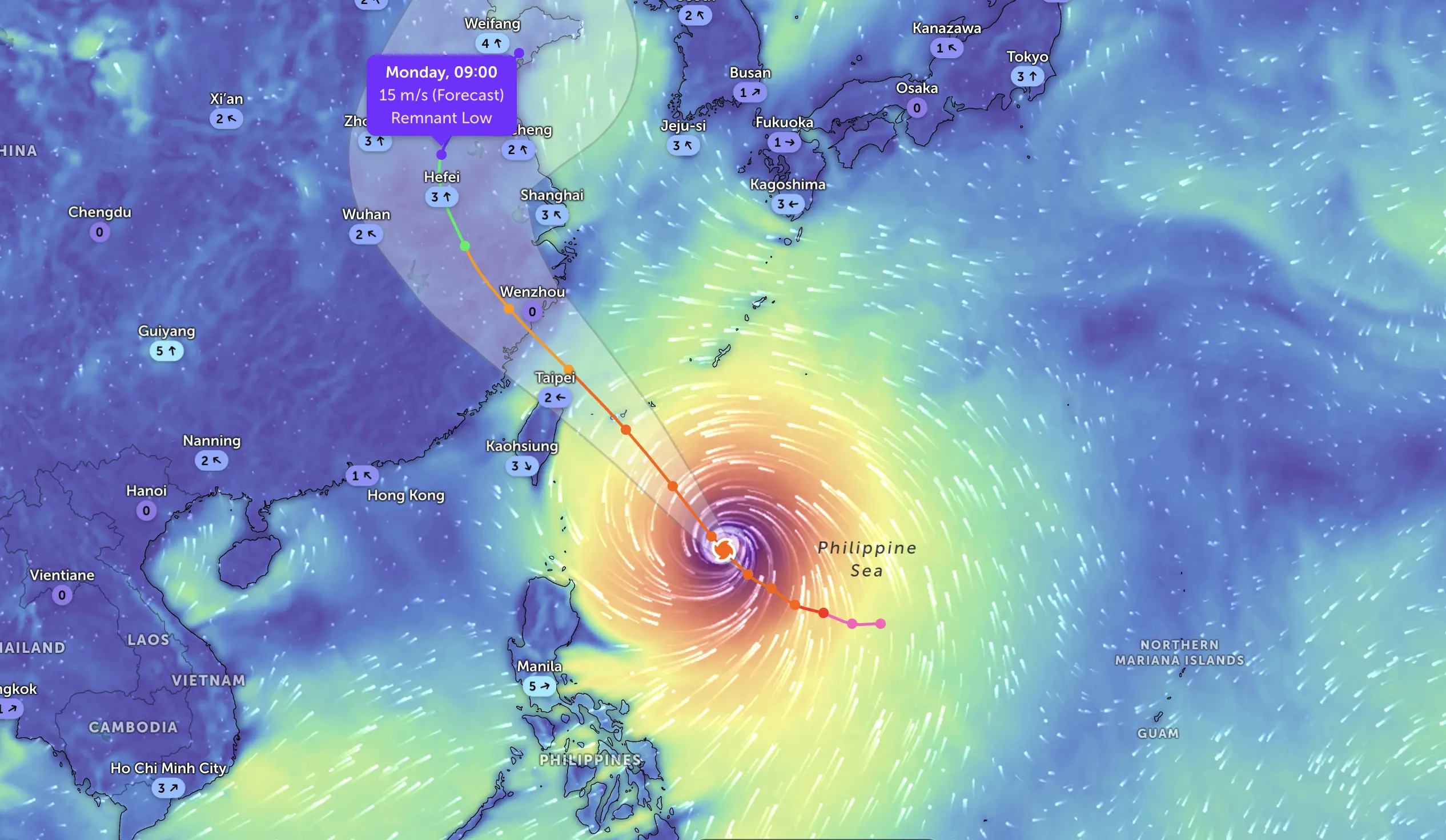
Also brewing in the Western Pacific is Tropical Storm Danas (05W / Bising), currently positioned about 368 nm (682 km) southwest of Taipei, with winds around 45–55 knots and sea waves cresting at nearly 5 meters .
Taiwan’s Central Weather Administration slapped a sea warning and is evaluating a land warning due to Danas’ gradual approach and growing circulation. Danas is expected to bring intermittent heavy rainfall across central and eastern Taiwan, especially offshore islands like Penghu and Kinmen, elevating the flood and landslide risk.
Thailand has already issued heavy rain advisories for its northern and northeast regions, as Danas reinforces the monsoon trough. Meanwhile, Macau is preparing for the possible issuance of their Tamar Typhoon Signals No. 1 or No. 3 depending on Danas’ evolution.
Historical Echoes: Why We Can’t Ignore These Systems
Last year’s storms bear stark reminders. Tropical Storm Barry (June 2024) made landfall with minimal wind but unleashed fierce floods and claimed lives across multiple U.S. states. In the Eastern Pacific, Cyclone Rae drenched southern Mexico and triggered mass evacuations. In Southeast Asia, numerous monsoon-enhancing storms brought deadly floods and landslides. These examples underline that you don’t need a Category 3 storm to reshape a region.
Fast development and localized impacts are common among tropical systems that brew near coastal and island regions, particularly where terrain amplifies rainwater.
What to Watch, What to Expect
A few simple insights for the coming days:
For Chantal (Atlantic): Turn on coastal alerts from Florida up to the Carolinas. Heavy rain and flash flooding can strike quickly, even before winds intensify.
For Invest 96E / Gil: Villagers in Oaxaca, Guerrero, and Michoacán should prepare for severe rain, landslides, and highway flash flooding. SMN warnings will likely come soon.
For Mun: International maritime interests must monitor swell forecasts and adjust shipping lanes. Though land impact may be minimal, the sea will be dangerous.
For Danas: Taiwan must ready local authorities for flooding and coastal warnings, while Macau and southern China need to brace for storm surges and rain-driven emergencies.
July 5, 2025, marks a turning point: four tropical systems are active in three ocean basins. Of those, Chantal is closest to striking US shores. 96E looms off Mexico. Mun and Danas are shaping up for Pacific typhoons, bearing dangerous seas and storm surges. History reminds us that even moderate storms can devastate lives and infrastructure—be vigilant, not complacent.
The Founder and Chief Meteorologist at Pogodnik.com. With over 15 years of operational experience in synoptic analysis and climate forecasting, he specializes in storm tracking, magnetic storms, and atmospheric dynamics. A recognized expert in Ukraine’s meteorological sector, he maintains strategic collaborations with global agencies, including NOAA and ECMWF, to ensure high-precision data integration. His analytical reviews and scientific contributions are regularly featured in leading media outlets dedicated to weather science and environmental trends.