🔥 Long-Range Forecast · Summer 2026 · United States & Canada
Summer 2026 Forecast: El Niño Is Rising Fast — Will the U.S. Bake, Canada Burn, and the Great Lakes Turn Stormy?
La Niña is dying faster than the models expected. El Niño is building from below. The western United States walked into spring already carrying the worst snowpack deficits in years, and March delivered a heat shock that left soil moisture in free fall across a half-dozen states. Summer 2026 is not shaping up as a simple “hot year” story. The picture is sharper, more uneven, and more regionally split than that — and the data is no longer ambiguous about where the danger is greatest.

NOAA CPC — Official JJA 2026 Temperature Outlook. Strongest warm signal centers on the Intermountain West and Southwest, spreading across most of the country. The Great Lakes zone shows the most uncertainty.

NOAA CPC — Official JJA 2026 Precipitation Outlook. Below-normal precipitation favored in the West, Pacific Northwest, and northern Rockies. Above-normal moisture signal from the Gulf Coast into the Great Lakes corridor.
The Ocean Is Changing. The Land Already Changed. Why Both Matter for Summer.
If you want to understand what summer 2026 is likely to bring, you have to start with two simultaneous realities — one in the ocean, one on the land — and understand why they are reinforcing each other.
The ocean story is the one getting most of the attention: La Niña is collapsing. After spending the better part of a year cooling the tropical Pacific and tilting winter weather patterns toward colder, snowier conditions in the northern tier, La Niña is now clearly in its final chapter. NOAA’s official ENSO Diagnostic Discussion has issued a La Niña Advisory alongside an El Niño Watch — a pairing that, in forecaster language, means the system is actively transitioning, and the models have enough agreement on the next step that monitoring alone is no longer sufficient.
🌊 ENSO Status: Exactly Where the Transition Happens
Summer 2026 sits directly on the hinge between La Niña’s end and El Niño’s emergence. The timing matters as much as the direction.
NOAA says El Niño is likely to emerge in June through August — with a 62 percent probability — and continue into the second half of the year. That is not a minor footnote. It is the most consequential shift in the Pacific background state since the La Niña cycle began, and it has direct implications for where summer heat digs in, how storm tracks organize, and whether hurricane season runs wild or gets suppressed by increased wind shear.
But here’s the part that’s getting less attention than it should. The land surface is already ahead of the ocean signal. The western United States did not need to wait for El Niño to arrive before running into trouble. March 2026 produced record-breaking heat under a powerful Southwest ridge. NOAA’s GOES-West satellite documented a heat wave that was anomalous even by modern standards. Meanwhile, across Colorado, Oregon, Washington, parts of California, Nevada, Arizona, and New Mexico, the NRCS snowpack data told a grim story: widespread snow drought, with snow water equivalent sitting at 25 to 50 percent of normal in many western basins — and in some locations, far below that.
As of mid-March 2026, snow water equivalent across many western basins ran at 25–50% of the seasonal average. Drought.gov confirms active snow drought across the Colorado Rockies, Cascades, Sierra Nevada, and the Great Basin. That is not a spring weather footnote — it is preconditioning for summer. Dry soils heat faster. Depleted reservoirs provide less atmospheric cooling. Vegetation cures weeks earlier. Fire season starts earlier and runs hotter.
The practical takeaway is this: even if El Niño arrives on the slow side, the western United States is entering summer with the land surface already loaded for a difficult fire and heat season. The ocean sets the background regime. The land surface decides how intense it gets.
What the Models Agree On — and Where They Disagree
Seasonal forecasting is not about one model. It is about finding where multiple independent systems — ECMWF, GFS, NOAA’s CFSv2, NMME, Copernicus — cluster together and where they diverge. The Summer 2026 outlook has unusually clear agreement in some areas and genuine uncertainty in others.
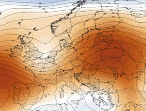
The Severe Weather Europe summer analysis, built on the latest ECMWF ensemble, shows a pressure ridge over western Canada and a lower-pressure belt sitting over eastern Canada and the northern tier of the United States. In practical terms, that supports above-normal heat in the northwestern, western, and southern United States and far western Canada — while keeping much of central and eastern Canada, and parts of the northern and eastern United States, closer to normal. That is not identical to NOAA’s temperature probability map, but the two pictures are not contradictory, either.
Where Severe Weather pushes further is in labeling the emerging Pacific event as a potential “super El Niño.” That is a real scenario to monitor. Copernicus confirms that multi-system agreement on positive sea-surface temperature anomalies in the equatorial Pacific is unusually strong for this time of year. But the official forecasting agencies remain more conservative on intensity — and that conservatism is warranted. An El Niño that is strong by December is not the same as a strong El Niño in June or July. Timing, again, is everything.
The better approach is not to pick a side between the aggressive scenario and the cautious one. It is to separate what is already high-confidence from what is still speculative. El Niño is coming — that is high-confidence. How strong it gets by late summer — that is still uncertain. For the purposes of this summer forecast, the transition is the story, not the final amplitude.
Why the Polar Vortex — Yes, That Polar Vortex — Still Shapes Your Summer
Summer forecasts are supposed to be about heat ridges, monsoon timing, and tropical sea-surface temperatures. The stratospheric polar vortex is a winter concept. So why does it belong in a summer article?
Because the atmosphere has memory. And in 2026, it is carrying more of it than usual.
The late-winter stratospheric disruption — a major Sudden Stratospheric Warming event that fractured the polar vortex in February and March — did not just cause the March Arctic outbreak across the eastern United States. It shaped how spring unfolded. It influenced where cold air held on the longest, how the pressure pattern was organized over Canada and the northern tier, and — critically — how quickly the western ridge was able to lock in and amplify.
A disrupted spring polar vortex helped preserve colder air in Canada and the northern United States longer than a normal seasonal transition would allow, while simultaneously allowing the southwestern ridge to become extraordinarily efficient once it established itself. The result is not a direct “the polar vortex will cause cold in July” story. It is a spring-to-summer handoff story — one where the West arrived at summer ahead of schedule, and the North arrived late. In a transition year, that kind of offset in timing can drive regional extremes far beyond what a simple seasonal average would suggest.
Month by Month: June, July, and August 2026
Regional Breakdown: Who Gets What This Summer
| Region | Temperature vs. Normal | Precipitation | Primary Concern |
|---|---|---|---|
| 🇺🇸 United States | |||
| Pacific Northwest WA, OR, ID | Above normal | Below normal | 🔥 Snow drought carries into summer; early fire season; low water year |
| California / Southwest CA, NV, AZ, NM | Well above normal | Below normal (pre-monsoon) | 🔥 Extreme heat, expanding drought, wildfire; monsoon relief possible late |
| Rockies / Interior West CO, UT, MT, WY | Well above normal | Below normal | 🔥 Strongest NOAA warm signal (60–70%); fire weather; low reservoir risk |
| Northern Plains / Upper Midwest MN, ND, SD, NE | Above normal | Near normal to variable | 🌡 Heat stress for agriculture; dry spells between storm events |
| Great Lakes IL, IN, OH, MI, WI | Near normal (most uncertain) | Above normal | ⛈ Storm corridor; flash flooding; heat in bursts; NOAA’s lowest-confidence zone |
| Northeast NY, NJ, PA, MA, CT, ME | Near to slightly above | Near normal | ⛈ Warm overall, but interrupted by storm tracks; humidity-driven heat more likely than dry dome |
| Mid-Atlantic DC, MD, VA, DE | Above normal | Near normal | 🌡 Hot spells likely; some storm relief; heat index events possible in July–Aug |
| Southeast / Gulf Coast FL, GA, AL, MS, LA, SC | Above normal | Above normal | ⛈ High humidity + heat; active tropical season watch; heavy rain events |
| Southern Plains / Tornado Alley OK, KS, TX, MO, AR | Above to well above | Near to below normal | 🌡 Hot, dry evolution through mid-summer; critical ag windows; fire weather risk TX panhandle |
| 🇨🇦 Canada | |||
| British Columbia | Above normal | Below normal | 🔥 Early and aggressive fire season; cross-border with adjacent U.S. drought zones |
| Alberta / Saskatchewan (Prairies) | Above to well above | Below normal | 🔥 Most heat-vulnerable Canadian region; wildfire smoke risk escalating in July |
| Ontario / Quebec | Near to slightly above | Above normal | ⛈ Variable summer; storm-track influence; heat possible but not dominant; flood risk |
| Maritime Provinces | Near normal | Above normal | 🌧 Wetter and stormier than usual; lower heat confidence; fog and coastal impacts |
The Western United States: This Is Not Just a Hot Summer — It Is a Pre-Stressed Summer
The difference between a hot summer and a dangerous summer often has less to do with peak temperatures and more to do with what the land surface looks like when those temperatures arrive. And the western United States is entering Summer 2026 in a state of significant preconditioning.
Start with the snowpack. NRCS data from mid-March shows snow water equivalent — the measure that actually tells you how much moisture is locked in the mountain snowpack — running at catastrophically low levels across multiple basins. Colorado’s major drainages, Oregon, Washington, parts of California, Nevada, Arizona, and New Mexico all show values at or near record lows for this time of year. This is not a minor deficit. It is the kind of snowpack failure that translates directly into low streamflows in June, declining reservoir levels by July, dry vegetation through August, and extended fire conditions well into autumn.
Layer on top of that the March heat shock. NOAA’s NESDIS division documented record-breaking temperatures under a powerful Southwest ridge during a late-winter heat event that had all the attributes of an early-season heat dome. Soils that were already dry from below-normal winter precipitation lost their remaining moisture buffer under those conditions. The ground is essentially entering summer with weeks of evaporation head start compared to a typical year.
The Great Lakes and Northeast: Not Exempt from Heat, but Not a Heat-Dome Zone Either
There is a real temptation to translate a warm NOAA summer outlook into a coast-to-coast heat dome story. That translation would be wrong for the Great Lakes and the Northeast, and it would leave people unprepared for the actual weather pattern they are more likely to experience.
The physical mechanism that keeps this region’s summer more complicated is the same one that kept winter colder here longer: lower pressure tends to remain more active over eastern Canada. When a low-pressure system parks or tracks frequently near eastern Canada, it creates a pathway for storm systems — and storm systems cap heat, deliver rain, and bring in temporary cool-downs. The heat that does arrive tends to come in waves separated by storm breaks rather than in a persistent ridge that bakes everything for weeks straight.
That is not inherently safe or comfortable weather. Heat waves that are followed by violent thunderstorms and flash flooding are still dangerous. High humidity under a partially suppressed ridge can make temperatures feel far worse than they read on a thermometer. Severe weather windows — the kind that produce damaging winds, large hail, and isolated tornadoes — remain elevated across this corridor, especially when moisture from the Gulf runs north and finds residual instability from the polar influence aloft.
Canada in Summer 2026: From Cold Reservoir to Fire Season Problem
Canada played an unusual climate role in the winter and spring of 2026. Rather than being a source of warmth or a passive bystander, it acted as the continent’s cold reservoir — holding Arctic air in place over the Prairie provinces, Ontario, and Quebec through a series of polar vortex events that kept the northern tier of the United States colder and more volatile than typical spring patterns would suggest.
By summer, that role reverses — at least for the western half of the country. The same pressure pattern that Severe Weather Europe and ECMWF ensemble guidance identify for Summer 2026 — a ridge over western Canada, lower pressure over the east — sets up a stark split between the two halves of the country.
British Columbia, Alberta, and the western Prairies are the most exposed Canadian regions in the summer outlook. The warm signal over western Canada is strong enough in both the NOAA-based analysis and the ECMWF-derived pressure maps to raise serious concern about an early and aggressive fire-weather season. Western Canada’s snowpack and water supply indicators already run weak on the border side, and cross-border climate patterns do not stop at the 49th parallel. The fire and drought story that starts in the American West bleeds directly into British Columbia and Alberta without any convenient geographic barrier.
Central and eastern Canada read differently. The lower-pressure belt sitting over eastern Canada acts as a brake on heat domination — keeping Ontario and Quebec in a more variable pattern with stormier, cloudier interludes rather than sustained heat. That does not mean a cool Canadian summer east of Manitoba. It means the hazard profile is different: less dominated by heat and fire, more challenged by storms, flooding, and agricultural timing disruptions.
What Summer 2026 Means for Agriculture, Water, and Wildfire
For anyone managing land, water, crops, or public safety in the western half of North America, the most important takeaway from this forecast is not any single temperature number. It is the compounding effect of multiple stressors arriving in sequence.
Record March heat depleted soil moisture. Below-normal winter precipitation reduced groundwater recharge. Record-low snowpack means streamflows are likely to drop sharply in June, just as irrigation demand peaks. Reservoirs enter summer at low-to-critically-low levels in key western basins. Vegetation is already curing weeks earlier than average. Every one of these factors individually creates a difficult summer. Together, they create conditions where a heat wave that would be manageable in a normal year becomes a major emergency.
In the central and southern Plains, the picture is subtler but still concerning. Agriculture in the Kansas-Oklahoma-Nebraska corridor faces a credible path toward a hotter, drier summer overall — even accounting for storm episodes. Timing matters more than averages here. A badly timed hot and dry stretch during pollination or grain fill can do more damage than a difficult seasonal mean, and the July signal in this corridor is one of the more concerning signals in the entire summer forecast.
📊 Weather Forecast Summer 2026
This is not a one-storyline summer. It is a transition summer, and transition summers tend to hit hardest where the land is already stressed. In 2026, the land is already stressed most severely in the western United States — and the data is clear on that point regardless of exactly how fast El Niño develops.
The West and Southwest carry the highest-confidence and most dangerous heat and drought signal in the forecast — backed by NOAA’s official JJA outlook, ECMWF ensemble guidance, and the reality of what March already did to snowpack and soil moisture across a half-dozen states.
Western Canada transitions from spring’s cold reservoir into summer’s fire-weather problem. British Columbia, Alberta, and the western Prairies face an early and aggressive wildfire season.
The southern Plains and south-central corridor are vulnerable to a hotter, drier evolution as summer matures — particularly in July, when the ridge signal strengthens and storm relief becomes less reliable.
The Great Lakes, Northeast, and eastern Canada sit in a lower-confidence zone where heat arrives in bursts rather than locks in cleanly — but where storm tracks, flooding, and humidity-driven discomfort represent their own set of hazards.
The simplest way to say it: Summer 2026 is not just an El Niño summer. It is a transition summer on top of an already-stressed land surface. The forecast is sharpest and most dangerous where those two things converge — and in 2026, that convergence points loudest and clearest to the western United States and western Canada.
Summer 2026 Forecast: Frequently Asked Questions
Forecast methodology and disclaimer: This summer outlook synthesizes NOAA CPC’s official JJA 2026 temperature and precipitation probability outlooks, NOAA’s ENSO Diagnostic Discussion, CFSv2 and NMME seasonal guidance, ECMWF IFS ensemble and seasonal guidance as interpreted by Severe Weather Europe, and Copernicus C3S multi-system seasonal forecasts — all current as of March 25, 2026. Land-surface conditions are drawn from NRCS snowpack reports, Drought.gov snow drought status updates, and NOAA NESDIS satellite analysis of the March western heat event. Long-range forecasts beyond 30 days carry significant uncertainty. Temperature and precipitation outlooks represent probability distributions across ensemble members, not guaranteed outcomes. Readers are strongly encouraged to monitor NOAA’s Climate Prediction Center (cpc.ncep.noaa.gov) and the National Weather Service (weather.gov) for the most current official guidance.
April 2026 Weather Forecast: Polar Vortex, Late Snow & La Niña