Severe Weather Sweeps Europe September 16–19: Heavy Rain Moves From Spain to Italy and the Adriatic
A dangerous spell of severe weather is moving east across the Mediterranean. After torrential rain affected parts of Spain on Wednesday, September 16, the main storm zone shifted toward northern Italy and the Adriatic on Thursday, September 17. Orange-level warnings cover parts of Italy, Croatia and Slovenia, while Spain is still dealing with localized flood risk, thunderstorms and hail.
At a glance:
Spain: orange warnings affected Catalonia, Aragon, the Balearic Islands and the Valencia region on Wednesday and Thursday, with the main active phase easing later Thursday.
Italy: on Thursday, September 17, orange warnings were active across eight northern regions, from Tuscany and Liguria to Piedmont and Friuli Venezia Giulia.
Friuli Venezia Giulia: the longest orange-warning window extends into the night of Saturday, September 19.
Croatia and Slovenia: the Rijeka region and southwestern Slovenia also face orange-level conditions on Thursday.
Spain hail risk: storms in inland Valencia and Gúdar y Maestrazgo in Teruel may produce hail up to about 2 cm.
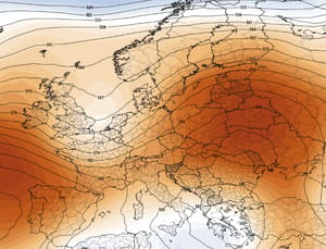
Big picture: an unstable air mass and active upper-level trough are progressing eastward across the Mediterranean.
120 mmin 12 hours in northern Alicante warning data
Spain: Wednesday–Thursday, from Mallorca to Murcia
AEMET issued a series of orange-level warnings across several regions. The event developed in waves: mainland Catalonia, Aragon and southern Mallorca were affected first; the warning area then expanded across Mallorca overnight; by Thursday morning, stronger storms and heavy rain had shifted toward Murcia, Almeria, Albacete and both northern and southern Alicante.
Up to 120 mm/12 hours in the north / up to 60 mm/hour in the south
More than 120 mm may fall in 2–3 hours
Ibiza and Formentera
Thursday, September 17 into early Friday
Thunderstorms and rain
Travel disruption possible
Italy and the Adriatic: Thursday, September 17
As the Spanish phase began to ease, the storm system shifted toward northern Italy and the Adriatic. Orange-level warnings covered multiple Italian regions on Thursday, September 17, while Croatia and Slovenia also faced elevated risk.
Region
Period
Main hazard
Tuscany and Liguria
Thursday, September 17
Thunderstorms and heavy rain
Emilia-Romagna, Veneto, Lombardy, Piedmont
Thursday into early Friday, September 18
Thunderstorms and heavy rain
Trentino-Alto Adige
Thursday into early Friday, September 18
Thunderstorms and heavy rain
Friuli Venezia Giulia
Thursday, September 17 into early Saturday, September 19
Thunderstorms and rain; longest warning window
Rijeka region, Croatia
Thursday into early Friday, September 18
Thunderstorms
Southwestern Slovenia
Thursday, September 17
Heavy rain
Official rainfall totals for Italy are published in greater detail by Protezione Civile and the Italian Air Force weather service. Meteoalarm confirms the warning level and hazard type across the broader European warning network.
Where the risk is highest
The most dangerous Spanish zones are the Barcelona coast and both northern and southern Alicante, where very heavy multi-hour rainfall may be compressed into only a few hours. That kind of short-duration intensity can overwhelm drainage systems and quickly flood roads, underpasses and normally dry channels.
In the Italian phase, Friuli Venezia Giulia stands out because its orange-warning window lasts almost two days. A long warning period does not automatically mean nonstop extreme rain, but it does indicate a prolonged period in which repeated thunderstorms and heavy rain may affect the region.
Why this is happening
The broader setup is being driven by an unstable air mass and an active upper-level trough moving east across the Mediterranean. The sequence began over the Iberian Peninsula and the Balearic Islands and then progressed toward the Alps, northern Italy and the Adriatic.
This type of autumn Mediterranean setup becomes more dangerous when cold air aloft interacts with a still-warm sea surface. The contrast increases instability and can fuel deep convection, intense thunderstorms and very high short-duration rainfall rates.
What happens next
In Spain, the most active phase is expected to ease during the second half of Thursday, September 17. In northern Italy and around the Adriatic, however, the main risk is still unfolding.
Most orange-warning windows in Italy run through Thursday night or early Friday, September 18. In Friuli Venezia Giulia, the elevated-risk period extends into the early hours of Saturday, September 19.
Travel note:
Storm cells can be highly localized. A city may remain relatively calm while nearby districts experience torrential rain, hail or flash flooding. Always check the latest local warning immediately before travel.
What residents and travelers should do
Never drive across a flooded roadway.
Avoid underground garages, underpasses and normally dry riverbeds during intense rain.
Keep vehicles under cover where 2 cm hail is possible.
In northern Italy and the Adriatic, follow local updates from Protezione Civile, DHMZ in Croatia and ARSO in Slovenia.
Allow extra travel time during the main warning windows, especially overnight and early in the morning.
Track severe weather with Weather Forecaster
Check local forecasts and follow precipitation changes in Weather Forecaster. During severe thunderstorms, the heaviest rain cells can shift quickly from one district to another.
The Founder and Chief Meteorologist at Pogodnik.com. With over 15 years of operational experience in synoptic analysis and climate forecasting, he specializes in storm tracking, magnetic storms, and atmospheric dynamics. A recognized expert in Ukraine’s meteorological sector, he maintains strategic collaborations with global agencies, including NOAA and ECMWF, to ensure high-precision data integration. His analytical reviews and scientific contributions are regularly featured in leading media outlets dedicated to weather science and environmental trends.