US Tornadoes in 2026: confirmed events so far, the Feb 14 outbreak explained, and what to expect from tornado season
Updated for February 16, 2026: the verified tornado log (so far), a clear look at what happened across Texas–Louisiana–Mississippi, a 2025 benchmark, and a practical do/don’t safety checklist.
Tornado season in the United States is not a single month on a calendar — it is a moving target shaped by jet-stream position, Gulf moisture, and short, violent windows of instability. In 2026, the year is still young (today is February 16, 2026), yet the Southern Plains and the Deep South have already seen multiple tornado-producing storms. Below is a Pogodnik-style longread: what is confirmed so far in 2026 (with the key NWS surveys), what happened on February 14–15 across Texas–Louisiana–Mississippi, what 2025 tells us as a baseline, and a realistic outlook for the rest of 2026 — plus a strict “what to do / what not to do” tornado checklist you can actually use.
As of February 16, 2026, official NWS surveys have already confirmed multiple tornado events in the U.S., including five tornadoes in Oklahoma on January 8 (max EF2) and two EF0 segments in southeast Texas on February 3. For the February 14–15storm, the NWS in Jackson, MS has confirmed at least two EF1 tornadoes with more surveys ongoing. The “rest of 2026” forecast is not a single number: expect the familiar pattern — a spring peak shifting from the South to the Plains and then north/east — with the biggest risk windows tied to strong troughs, rich Gulf moisture, and high wind shear. Use the checklist: multiple alert channels, a shelter plan, and zero “Hollywood myths” like opening windows or hiding under overpasses.
2026 tornado tracker: what is confirmed so far (updated Feb 16, 2026)
Important: “all tornadoes in 2026” is a moving dataset. The U.S. tornado record is finalized later via NWS Storm Data after surveys, reanalysis, and database publication. So this tracker is built around confirmed NWS damage surveys and clearly labeled “reported / pending” items. If you use this in news or a product page, always keep the wording: confirmed so far and surveys ongoing.
Confirmed (NWS surveys) highlights to date
Date
Where
Confirmed tornadoes
Max rating
Key notes
Jan 8, 2026
Oklahoma (multiple counties)
5
EF2
NWS Norman lists five tornadoes; one EF2 tracked near Purcell with 1 injury reported in the state log.
Feb 3, 2026
Liberty County, Texas (near Plum Grove)
2 segments
EF0
NWS Houston/Galveston survey indicates rotation produced two brief EF0 segments separated by a lift in circulation.
Feb 14–15, 2026
Mississippi (Lincoln County area)
At least 2 (so far)
EF1
NWS Jackson damage survey confirms two EF1 tornadoes (Norfield and Enterprise) and states more surveys are ongoing.
Feb 14–15, 2026: Texas–Louisiana–Mississippi outbreak (what happened)
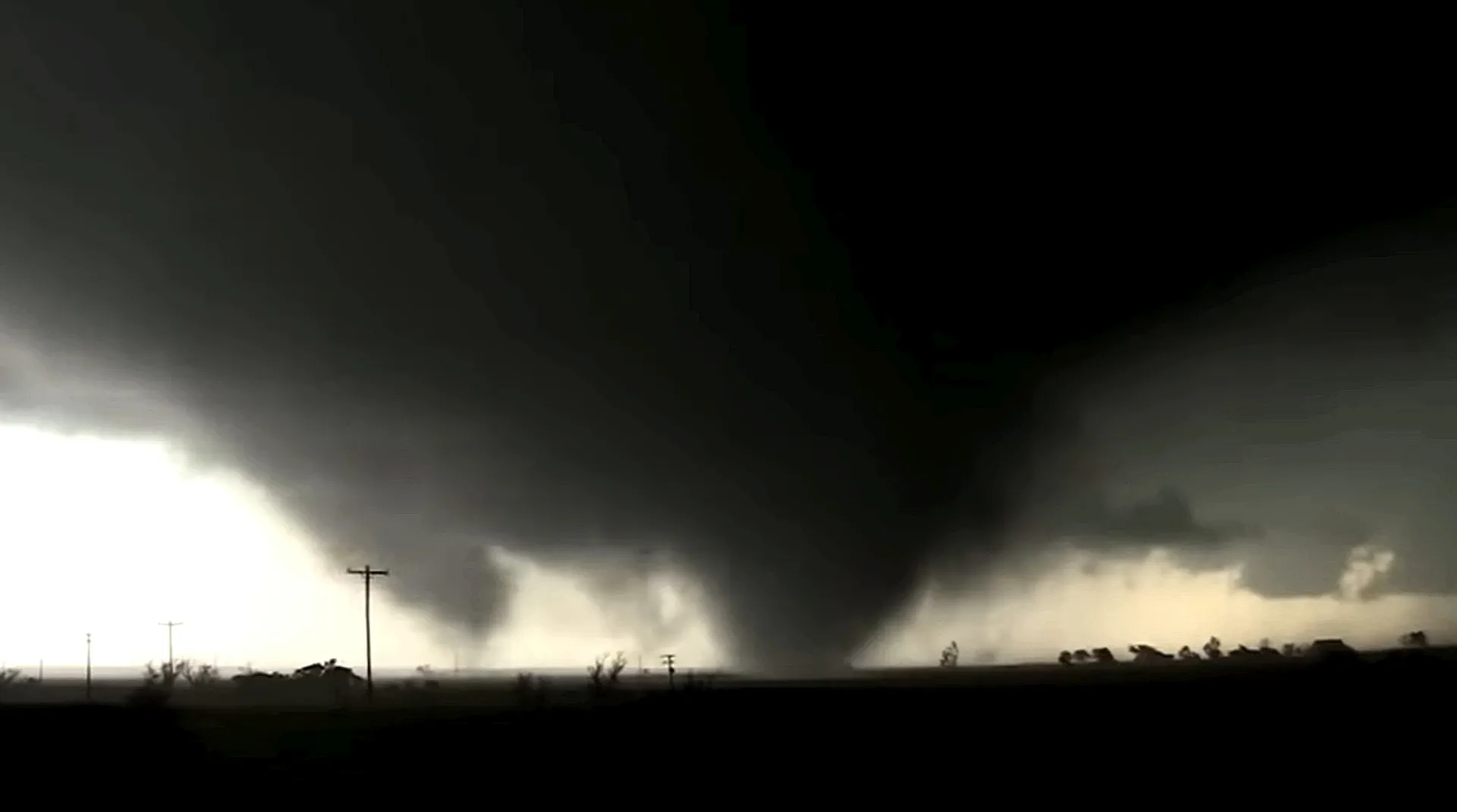
Over Valentine’s weekend, a storm system brought severe thunderstorms, heavy rain, localized flash flooding and widespread wind damage across the Southern Plains and the Lower Mississippi Valley. Tornado reports clustered in Texas, Louisiana, and Mississippi. Early media summaries described at least nine reported tornadoes across the tri-state region and multiple EF1 confirmations; however, the strict “official” picture evolves as NWS completes damage surveys and publishes Storm Data.
What the NWS has confirmed (as of the Feb 15 Jackson, MS statement)
The National Weather Service office in Jackson, Mississippi confirmed two EF1 tornadoes from late Feb 14 into early Feb 15 and explicitly noted that additional surveys were ongoing in multiple Mississippi counties, meaning the count can rise after verification.
Tornado
Rating
Peak wind
Timing (local)
Path length
Where
Norfield (Lincoln County, MS)
EF1
110 mph
Feb 14, 11:46–11:54 PM CST
6.8 miles
Near Summit to near Bogue Chitto area (survey details include tree damage and scattered structural impacts)
Enterprise (Lincoln County, MS)
EF1
100 mph
Feb 15, 12:01–12:04 AM CST
2.1 miles
Near Mount Olive Road across Shell Oil Lane / MS Hwy 583 (roof and tree damage)
What was reported beyond Mississippi
In addition to Mississippi confirmations, tornadoes were also reported in parts of Louisiana and Texas during the same storm. Some were still awaiting official verification at the time of early coverage. Treat these as “reported” until the relevant NWS office publishes a damage survey.
Why this setup produced tornadoes
It was a classic cold-season severe weather recipe: a strong upper-level disturbance providing lift and shear, rich low-level moisture returning from the Gulf, and a sharp boundary focusing storms. In February, instability (CAPE) is often lower than in peak spring — but wind shear can be extreme, and that is enough to spin up tornadoes when storms remain discrete or form intense embedded circulations.
Why tornadoes happen in winter and early spring
People still search “Can you get tornadoes in winter?” because the mental model is “tornadoes = May.” In reality, tornadoes can occur in any month when three ingredients overlap: moisture (often from the Gulf), instability (even modest), and wind shear (often strongest in the cool season). Winter and early spring outbreaks are especially common in the South because surface moisture can surge north while strong jet-stream winds remain active.
EF Scale in plain English: what EF0/EF1/EF2 really mean
The Enhanced Fujita (EF) scale is damage-based. It estimates wind speed from what the tornado did to structures and vegetation, not from a direct “wind gauge inside the tornado.” In plain English: EF0–EF1 are still dangerous, EF2–EF3 can be life-changing, EF4–EF5 are catastrophic.
More widespread tree damage, roofs partially removed, mobile homes heavily damaged, outbuildings destroyed
EF2
111–135 mph
Well-built roofs torn off, large trees uprooted/snapped, vehicles pushed/rolled, significant structural damage
EF3+
136+ mph
Severe to catastrophic structural failure, homes destroyed, debris becomes lethal projectiles
What to do: tornado readiness checklist
Use multiple alert channels: Wireless Emergency Alerts on your phone, a weather app with NWS warnings, and (ideally) NOAA Weather Radio. One channel is not enough.
Know your shelter spot: lowest level, interior room, no windows. A basement is best; if not, a small interior bathroom/closet can work.
Practice a 60-second drill: shoes on, helmet or hard hat (yes), phone + power bank, ID/keys, and into shelter. You want muscle memory.
Plan for nighttime tornadoes: keep your phone loud, alerts enabled, and shoes/flashlight near the bed. Many injuries happen in the dark from debris.
Mobile homes: treat every tornado warning as “leave now.” Identify a nearby permanent shelter in advance.
Cars: if you can reach a sturdy building fast, do it. If not, and a tornado is imminent, the safest option is a low spot away from vehicles/trees — but this is a last resort.
What NOT to do: the mistakes that get people hurt
Do not shelter under an overpass. This is a persistent myth; winds accelerate and debris funnels through.
Do not open windows. You waste time and increase injury risk from glass and debris.
Do not rely on outdoor sirens. Sirens are meant for people outside; you need indoor alerting (phone/radio).
Do not “go look.” Many tornado injuries happen after the warning when people step into debris fields, downed lines, or secondary storms.
Do not assume EF0/EF1 is “weak.” EF1 winds can collapse roofs, flip light structures, and turn everyday objects into projectiles.
A practical tornado “go kit” for 10 minutes’ notice
If you build one kit, build the one you can grab in the dark. Keep it in your shelter area.
Helmet or hard hat (head injuries are common)
Sturdy shoes and gloves (walking through debris without them is a classic post-storm injury)
Flashlight + spare batteries
Power bank + charging cable
Basic first-aid kit
Water + compact snacks
Copies/photos of ID and key documents
Whistle (to signal rescuers if trapped)
Tornado outlook for 2026: what to expect (scenario-based)
A “tornado forecast for the whole year” is never a single deterministic number. The honest approach is scenario-based: which patterns raise risk windows, and where the season is most likely to concentrate as spring evolves.
Scenario A (classic season): South early, Plains peak, then Midwest/Ohio Valley
This is the most common shape: the highest-impact windows begin in the South (late winter to early spring), shift into the Southern/Central Plains (April–June), then migrate north and east into the Midwest and parts of the Ohio Valley as the jet stream and moisture axis evolve.
Scenario B (front-loaded Dixie season): more early-year risk in the Deep South
When strong shear repeatedly overlaps with Gulf moisture surges, the Deep South can stay active into March and early April, including higher nighttime tornado risk. In this scenario, the “tornado season” feels earlier and more persistent for Mississippi/Alabama/Tennessee/Arkansas corridors.
Scenario C (multiple outbreak clusters): fewer days, bigger spikes
Sometimes the year is not “busy every week,” but features a few extreme synoptic setups that deliver concentrated outbreaks. For preparedness, that is arguably worse: long quiet spells reduce vigilance, then one high-end setup arrives.
What you can say safely (and accurately) right now
Early-year tornadoes are already present in the South and adjacent regions, and that aligns with the typical climatology: cool-season shear is strong, and Gulf moisture can still feed severe storms.
Spring remains the primary risk period. Your highest preparedness value comes from having alerts and shelter plans in place before March–May.
Expect updates: the “confirmed tornado log” will expand as NWS surveys continue and Storm Data finalizes events.
2025 recap: the baseline (numbers and takeaways)
To understand 2026, you need the 2025 benchmark. NOAA/NCEI monthly reporting and state summaries describe 1,559 tornadoes reported in 2025 (preliminary) — well above the long-term average — with Texas frequently cited as a leading state in raw tornado counts (for example, a preliminary 162 figure is discussed in state reporting). Treat these as preliminary until final Storm Data tallies are locked.
What 2025 tells you operationally
High-count years happen. If your safety plan is “we usually don’t get tornadoes,” 2025 is the counterexample that breaks complacency.
State leaders can shift. A single active pattern year can reorder the “top states” list — and it is not always only the traditional Great Plains narrative.
Preparedness is not regional pride. Tornadoes have been documented in all 50 states; what changes is frequency and seasonality, not the possibility.
FAQ: short and exact
How many tornadoes have been confirmed in the U.S. in 2026?
As of February 16, 2026, multiple events are confirmed by NWS damage surveys (examples: five tornadoes in Oklahoma on January 8, two EF0 segments near Plum Grove, TX on February 3, and at least two EF1 tornadoes in Mississippi on February 14–15). The year-to-date total will increase as surveys continue and Storm Data finalizes.
What happened on February 14, 2026 across Texas, Louisiana and Mississippi?
A storm system produced severe thunderstorms, damaging winds, heavy rain and multiple tornado reports. NWS Jackson confirmed two EF1 tornadoes in Mississippi in an initial survey statement and noted additional surveys ongoing; other reported tornadoes in TX/LA/MS may be confirmed or adjusted after verification.
Can tornadoes happen in February?
Yes. Tornadoes can occur in any month when moisture, instability and strong wind shear overlap. February can be especially risky in the South because shear is often strong, and Gulf moisture can surge north.
What should I do during a tornado warning?
Go to the lowest level of a sturdy building, into a small interior room without windows, protect your head, and stay there until the warning expires. Do not waste time opening windows or driving around “to see.”
What is the biggest myth about tornado safety?
Hiding under an overpass. It is dangerous and has caused preventable deaths. Your goal is a sturdy interior space, not a wind tunnel.
The Founder and Chief Meteorologist at Pogodnik.com. With over 15 years of operational experience in synoptic analysis and climate forecasting, he specializes in storm tracking, magnetic storms, and atmospheric dynamics. A recognized expert in Ukraine’s meteorological sector, he maintains strategic collaborations with global agencies, including NOAA and ECMWF, to ensure high-precision data integration. His analytical reviews and scientific contributions are regularly featured in leading media outlets dedicated to weather science and environmental trends.