Europe Wildfire Emergency: Tens of Thousands Evacuated as Spain, France and Italy Burn
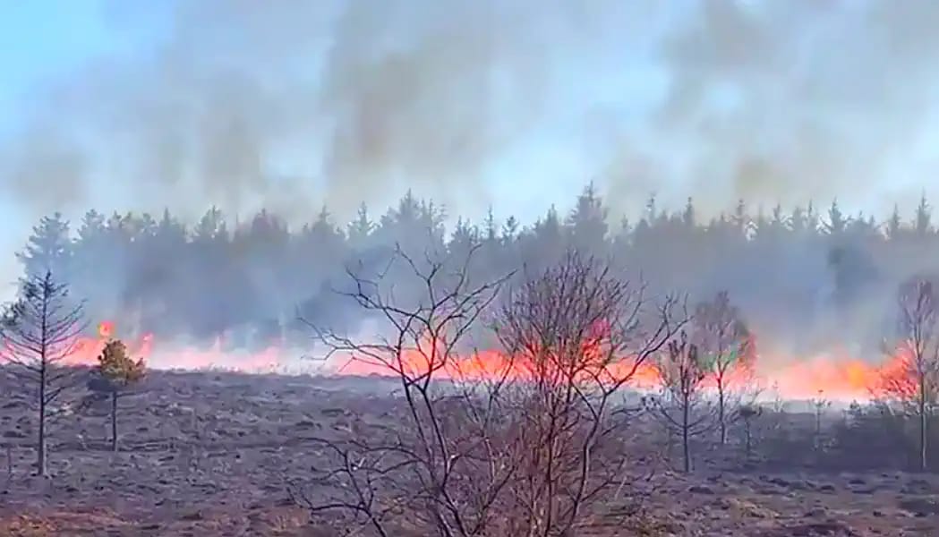
Southern and western Europe are facing one of the most dangerous wildfire outbreaks of summer 2026. Spain has declared a national emergency as fires spread west of Madrid and across Ávila and Guadalajara. France has ordered mass evacuations from the Atlantic coast, including Lège-Cap-Ferret, Biscarrosse and Parentis-en-Born. In Italy, more than 1,000 firefighting interventions have been recorded in Sicily since July 18, homes have been evacuated, and a firefighter has died while battling a blaze near Caltanissetta.
Spain: more than 10,000 people have been evacuated around Madrid and Ávila, while the huge Guadalajara fire has burned about 32,000 hectares and forced dozens of villages to evacuate.
France: around 40,000 people were ordered to leave the Cap Ferret peninsula, while a separate fire around Biscarrosse and Parentis-en-Born burned more than 2,500 hectares and forced over 23,000 evacuations.
Italy: Sicily remains the main fire hotspot, with more than 1,000 interventions since July 18. Fires have threatened homes in Ragalna and Monreale, while over 100 people were evacuated near Santo Stefano di Quisquina.
Europe-wide: EFFIS reported 254,388 hectares burned in the EU by July 22, more than double the long-term average number of fires for this point in the year.
Next danger:thunderstorms and cooler air may help parts of France and Spain, but gusty winds, lightning and exceptionally dry vegetation can also cause flare-ups and new ignitions.
Europe wildfire map: where fires are burning now
Check the live Pogodnik wildfire map before travelling. The map shows recent thermal anomalies and active fire detections from satellite data across Europe.
The map is a monitoring tool, not an evacuation map. Satellite hotspots may be delayed, obscured by cloud or include industrial heat sources. Always confirm local danger through official emergency services.
The wider European fire season is already far above normal. The European Commission’s Joint Research Centre reported that, by July 22, the EU had recorded 1,254 fires larger than 30 hectares, compared with a long-term average of 569. The total burned area reached 254,388 hectares, and estimated wildfire emissions reached 8.31 million tonnes of CO₂.
EFFIS forecasts very extreme fire danger from southwestern France into northern Spain through July 29, with extreme conditions across wider Iberia and western and central France. That means the crisis may continue even where temperatures begin to fall.
Where are the fires? Which roads are closed? Is Biscarrosse being evacuated? Where is the Madrid wildfire? Is there a live fire map? https://pogodnik.com/en/fire
Spain wildfires: national emergency near Madrid, Ávila and Guadalajara
Spain declared a national emergency as several fires exceeded the capacity of regional services and forced mass evacuations. The emergency allows the national government to coordinate military, national and regional firefighting resources.
San Martín de Valdeiglesias and Pelayos de la Presa
A major fire began on July 23 near kilometre 57 of the M-501 at San Martín de Valdeiglesias, west of Madrid. The official Madrid emergency page lists San Martín de Valdeiglesias and Pelayos de la Presa among the affected municipalities.
Authorities used the ES-Alert system for the San Ramón and Jaracruz residential areas, instructed residents to remain indoors, and confined a care home as a precaution. The public was told to avoid the area, close doors and windows, stop air-conditioning systems that draw outdoor air inside, and prepare an evacuation bag with medication and documents.
The active Google Trends spike for incendios Madrid and incendio San Martín de Valdeiglesias reflects the proximity of the fire to densely populated communities, reservoirs, tourist routes and forested residential areas.
Ávila: El Tiemblo and Navaluenga
Fires in Ávila province have driven another major search surge around El Tiemblo, Navaluenga and nearby mountain communities. Residents should monitor provincial emergency notices because narrow roads, forested slopes and rapidly changing wind can complicate evacuation.
Google Trends showed active searches for incendio El Tiemblo, incendio Navaluenga and the affected towns themselves. For residents and tourists, the practical priority is not the visible distance to the flames but whether smoke and wind are moving toward the available road network.
Guadalajara: one of Spain’s largest recent fires
The Guadalajara fire has burned about 32,000 hectares and forced the evacuation of more than 30 villages, making it one of the largest fires recorded in the area. More than 200 firefighters and aerial resources have been deployed.
This fire remains important even when it drops from the immediate news cycle because burned slopes can continue to smoulder, roads may remain restricted and later thunderstorms can trigger runoff, debris flows and water-quality problems.
Why Spain’s fire danger remains extreme
AEMET reported that the latest heatwave brought temperatures of 42–44°C to the hottest parts of southeastern Spain, the Guadalquivir basin and other inland valleys. The official heatwave criteria were expected to end on July 24 as cooler Atlantic air entered from the northwest, but temperatures remain high in the southeast and vegetation remains extremely dry.
Cooling does not immediately remove wildfire danger. Stronger winds behind a weather change can accelerate existing fronts, while dry thunderstorms can produce lightning and sudden gusts without enough rain to wet the ground.
France wildfires: Cap Ferret and Biscarrosse evacuations
Southwestern France is dealing with two exceptionally dangerous fire emergencies along a heavily visited Atlantic coastline.
Lège-Cap-Ferret: up to 40,000 people ordered to leave
Authorities ordered the evacuation of the Lège-Cap-Ferret peninsula, a narrow and heavily forested tourist area west of Bordeaux. Around 40,000 residents and visitors were evacuated, with some people moved by boat because the peninsula has limited road access.
The fire had burned approximately 8,700 hectares in the latest widely reported update. France requested assistance through the EU Civil Protection Mechanism, bringing additional aircraft and international resources into the response.
Cap Ferret is especially vulnerable because pine forest, dunes, campsites, holiday homes and a constrained road network are concentrated on a narrow peninsula. France had already prepared a maritime evacuation plan for this exact scenario after the destructive Gironde fires of 2022.
Biscarrosse and Parentis-en-Born: more than 23,000 evacuated
A separate fire began near the D652 between Biscarrosse and Sanguinet. By the morning of July 24, the Landes prefecture reported:
more than 2,500 hectares affected;
more than 23,000 people evacuated — around 18,000 from Biscarrosse and 5,000 from Parentis-en-Born;
almost 600 firefighters deployed;
homes, campsites, a nursing home and a children’s holiday centre evacuated;
the fire still not under control, with wind keeping the situation highly unstable.
The scale of public interest is visible in Google Trends: Biscarrosse exceeded 200K searches in France within 24 hours, accompanied by queries such as incendie Biscarrosse and feu Biscarrosse.
Will rain stop the France wildfires?
Météo-France expects very hot weather to continue in the southwest on Friday, with widespread 37–39°C and local peaks near 40°C. Thunderstorms are forecast to reach Nouvelle-Aquitaine on Friday evening and overnight, followed by cooler and sometimes wetter conditions over the weekend.
Rain may help firefighters, but the first storms can also create dangerous wind shifts, lightning and erratic fire behaviour. Heavy rain over newly burned terrain may later produce flash flooding, ash runoff and falling trees.
Météo-France says fire danger remains high to very high across the south, southwest, west, Mediterranean coast and Corsica until the wetter weekend pattern arrives.
Italy wildfires: Sicily is the main emergency zone
Italy is facing numerous vegetation and forest fires, with Sicily under the greatest pressure. The island’s fire service recorded more than 1,000 interventions from July 18 through July 23, forcing all island commands to double working shifts.
Caltanissetta and San Cataldo: firefighter killed
A 59-year-old firefighter, Alessandro Marchì, died after becoming unwell while fighting a major blaze near San Cataldo, close to Caltanissetta. The death underlines the extreme heat exposure, smoke and physical strain facing crews.
Ragalna and Monreale: homes threatened
Firefighters reported active operations at Ragalna, in the province of Catania, where vegetation fires threatened homes in Vicolo Leonardi and precautionary evacuations were ordered.
At Monreale, near Palermo, four firefighting teams responded after flames reached some homes. No injuries were reported in that incident.
Santo Stefano di Quisquina: more than 100 evacuated
More than 100 residents were evacuated near Santo Stefano di Quisquina, in the Agrigento area, as a large fire was driven by hot sirocco winds toward the town.
Sicily’s emergency response
On July 22 alone, Sicily’s regional operations room received 344 intervention requests. The regional government reported mobilisation involving approximately:
5,000 forest-service personnel rotating through operations;
130 fire-service teams with around 650 firefighters;
150 civil-protection teams with around 450 personnel.
Recent official monitoring has also covered fires around Siracusa, Enna, Modica, Campofelice di Roccella, Scicli, Acireale, Piedimonte Etneo and other parts of the island.
Calabria and other Italian regions
Fire activity is not limited to Sicily. Calabria, Sardinia, Puglia, Molise, Umbria and Tuscany have also reported fires. In the Vibo Valentia area of Calabria, firefighters handled more than 30 wildfire interventions in one day, including a fire around Torre Galli that burned more than 100 hectares and affected the areas of Drapia, Briatico, Zaccanopoli, Nicotera, Joppolo and nearby communities.
Some rain and thunderstorms are forecast for parts of Calabria and eastern Sicily, potentially bringing temporary relief. However, lightning, gust fronts and uneven rainfall can also produce new ignitions or rapid changes in active fires.
How serious is the 2026 Europe wildfire season?
EFFIS indicator
EU total by July 22, 2026
Context
Burned area
254,388 hectares
Above the long-term average and only slightly below record-setting 2025 at the same point
Fires detected
1,254
More than double the long-term average of 569
Wildfire CO₂ emissions
8.31 million tonnes
Close to the 2025 level for the same date
The key danger is simultaneous emergencies. When Spain, France and Italy need aircraft, specialist crews and international support at the same time, firefighting capacity becomes part of the risk. The EU has pre-positioned aircraft, helicopters and hundreds of firefighters, but extreme fire weather can create new fronts faster than resources can be moved.
Where fire danger remains highest through July 29
EFFIS forecasts the most dangerous conditions in:
southwestern France and northern Spain — very extreme fire danger;
wider Spain, Portugal and western-central France — extensive extreme danger;
Mediterranean France, Corsica, Sicily, Sardinia and southern Italy — locally high to very high danger depending on wind and humidity;
parts of the western Balkans and Türkiye — additional high-risk pockets.
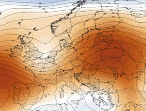
For July 27 to August 2, EFFIS still shows above-average temperatures across southern and central Europe, with a strong warm anomaly over France and northern Iberia. That means one cooler weekend will not end the seasonal fire threat.
Travel warning for Spain, France and Italy
Travellers should avoid assuming that a destination is safe because the hotel, campsite or beach remains open. Roads can close abruptly, mobile networks can become overloaded and smoke can make daytime driving dangerous.
Check the Pogodnik fire map before driving, but confirm every route with local authorities.
Do not enter forest roads, campsites or beaches with only one exit when fire danger is high.
Keep passports, medication, water, chargers and a power bank ready.
Do not drive into smoke. Visibility can fall to zero and fire can cross a road in seconds.
Keep access roads clear for fire engines, ambulances and evacuation buses.
Call the European emergency number 112 if you see a new fire or are trapped.
Wildfire smoke: who is most at risk?
Smoke can affect towns far beyond the flame perimeter. Fine particles are especially dangerous for people with asthma, chronic lung disease, heart disease, older adults, pregnant women, infants and outdoor workers.
Close windows when dense smoke arrives.
Switch air-conditioning systems to recirculation.
Avoid outdoor exercise when air smells strongly of smoke or visibility is reduced.
Use a well-fitted FFP2 or FFP3 respirator when outdoor exposure cannot be avoided.
Seek medical help for chest pain, severe breathing difficulty, confusion or fainting.
What caused the Europe wildfire emergency?
No single factor explains every ignition, and authorities will investigate each fire separately. But the conditions allowing fires to spread are clear:
repeated heatwaves and temperatures above 40°C;
exceptionally dry soil and vegetation;
strong regional winds, including mistral, tramontane and sirocco flows;
large quantities of dry grass and forest fuel;
tourist-season pressure in forests, campsites and coastal zones;
human ignition, negligence, machinery, power infrastructure or deliberate fires.
Météo-France notes that nine out of ten fires in France have a human origin and that half are linked to carelessness or dangerous behaviour. Heat and drought do not create every ignition, but they determine how quickly a small spark can become an uncontrollable emergency.
Europe wildfires FAQ
Where are the biggest wildfires in Europe now?
The most serious current emergencies are in central Spain near Madrid, Ávila and Guadalajara; southwestern France around Lège-Cap-Ferret, Biscarrosse and Parentis-en-Born; and Sicily, with additional fires in Calabria and other Italian regions.
How many people have been evacuated?
More than 10,000 people have been evacuated around Madrid and Ávila. France ordered around 40,000 people to leave Cap Ferret, while more than 23,000 were evacuated around Biscarrosse and Parentis-en-Born. Italy has ordered smaller local evacuations, including more than 100 people near Santo Stefano di Quisquina.
Is Cap Ferret being evacuated?
Yes. Authorities ordered a full evacuation of the peninsula as the fire threatened the narrow forested tourist area. Some evacuees were transported by boat.
What is happening in Biscarrosse?
A fast-moving wildfire burned more than 2,500 hectares and forced more than 23,000 evacuations from Biscarrosse and Parentis-en-Born. Nearly 600 firefighters were deployed, and the fire remained uncontrolled in the official morning update on July 24.
Where is the Madrid wildfire?
The main fire began near San Martín de Valdeiglesias on the M-501, affecting nearby Pelayos de la Presa and residential areas west of Madrid.
Is it safe to travel to Spain, France or Italy?
Most of each country remains open, but travel should be avoided near active fires, evacuation zones, closed roads and areas under extreme fire danger. Check local civil-protection notices immediately before departure.
Will thunderstorms stop the fires?
Rain can help, but thunderstorms can also produce lightning, strong gusts and sudden wind shifts. Recently burned terrain may then face flash-flood and debris-flow risk.
Where can I see a live Europe fire map?
Use the Pogodnik Europe wildfire map to view recent satellite hotspots. Always combine it with official evacuation and road information.
This article is a live editorial summary based on official emergency information, meteorological agencies, EFFIS, Google Trends and major news-service updates available on July 24, 2026. Fire size and evacuation figures may be revised.
The Founder and Chief Meteorologist at Pogodnik.com. With over 15 years of operational experience in synoptic analysis and climate forecasting, he specializes in storm tracking, magnetic storms, and atmospheric dynamics. A recognized expert in Ukraine’s meteorological sector, he maintains strategic collaborations with global agencies, including NOAA and ECMWF, to ensure high-precision data integration. His analytical reviews and scientific contributions are regularly featured in leading media outlets dedicated to weather science and environmental trends.