Hurricane Gabrielle: Heading Toward Europe — What Portugal and Ireland Can Expect on September 29

From the Atlantic to Europe: the storm’s journey
Tropical Storm Gabrielle, born in the Atlantic, is expected to strengthen into a Category 2 hurricane on the Saffir–Simpson scale within the next 24 hours. According to the National Hurricane Center (NHC) and several model runs, by 21 September maximum sustained winds may reach 165 km/h (105 mph), with central pressure dropping to 975–980 hPa.
Hurricane Gabrielle: Heading Toward Europe — What Portugal and Ireland Can Expect on September 29#Hurricanes #HurricaneGabrielle #Europe pic.twitter.com/m1gtSUExVJ
— City Weather (@ukcityweather) September 21, 2025
At present, Gabrielle remains offshore, well east of Bermuda, but the system has already triggered dangerous surf and rip currents along the island.
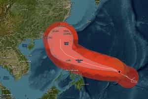
Forecast guidance shows that by early next week Gabrielle will curve north of Bermuda before being caught in the mid-latitude westerlies of the North Atlantic, steering it toward Europe.
Spaghetti plots: where will Gabrielle go?
Ensemble “spaghetti” forecasts agree on a northeastward turn toward Europe, though the precise landfall track remains uncertain. The leading scenarios point toward Portugal and Ireland between September 28–30:
- Portugal: First impacts are expected as early as the evening of 28 September, with rising southwesterly winds and dangerous surf.
- Ireland: The system, or its powerful frontal zone, is projected to reach the island by 29 September, bringing severe conditions.
Some models (ECMWF, GEFS) still allow for a track farther north, toward Iceland. Even in that case, however, southern bands of wind and moisture would likely brush Ireland and western UK.
Transition: from tropical hurricane to European windstorm
By the time Gabrielle approaches Europe, it will likely undergo extratropical transition. This process means the storm won’t simply weaken — it will expand and restructure, producing hazards more typical of Atlantic winter storms:
- A much wider wind field;
- Sustained gale- to storm-force winds (up to 120–130 km/h in Ireland, 90–100 km/h in northern Portugal);
- Heavy rainfall, especially in northern Portugal and Galicia (Spain);
- Large ocean swells and storm surge along exposed coasts.
In other words, Gabrielle may lose its tropical core but will continue to pack destructive energy.
Portugal: wind and flooding rains
The highest risk for Portugal comes during the night of 28–29 September. Forecasts indicate:
- Wind gusts 80–100 km/h, locally up to 110 km/h along the coast;
- Atlantic waves reaching 6–8 m;
- Torrential rain in the north, with a risk of flash floods and landslides.
Southern regions such as the Algarve will feel weaker impacts, mostly showers and breezy conditions.
Ireland: a storm on Michaelmas Day
By 29 September (Michaelmas Day), Ireland is expected to face the brunt of Gabrielle’s extratropical phase:
- Hurricane-force gusts 120–130 km/h along western coasts (Connacht, Munster);
- Rainfall totals 50–80 mm in 24 hours;
- Storm surge and breakers 7–9 m high.
Central and eastern Ireland will see less rain but still face widespread gale-force winds. Mountainous regions (Mourne, Wicklow) could experience severe downpours and localized flooding.
Risks and warnings
- Marine hazards: Navigation in the eastern Atlantic will be extremely dangerous; ships should avoid waters west of Iberia and Ireland between 28–30 September.
- Power grid: High probability of outages in Ireland and northern Portugal from downed trees and power lines.
- Air travel: Flight delays and cancellations likely at Lisbon, Porto, Dublin, and Cork airports.
- Residents: Coastal communities should prepare for storm surge, flooding rains, and damaging winds.
Final outlook
Hurricane Gabrielle is shaping up to be one of the rare Atlantic tropical cyclones to reach Europe with hurricane strength remnants. By 29 September 2025, the storm — in its extratropical phase — will bring winds of 120–130 km/h, torrential rains, and storm surges to Portugal and Ireland.
The main threats include coastal flooding, flash floods, and widespread wind damage, marking Gabrielle as potentially the most powerful storm event of the autumn for Atlantic Europe.
Gleb Perov is the founder and chief meteorologist of POGODNIK, a leading weather forecasting service in Eastern Europe. With over 15 years of hands-on experience in meteorology and climate analysis, he has worked private weather services.
Gleb is the author of numerous scientific and analytical publications on climate, magnetic storms, and atmospheric processes. He regularly collaborates with major international agencies such as NOAA, ECMWF.


