Europe’s Second Heatwave: Heat Dome Brings 40–45°C, Fire Danger and Violent Storms
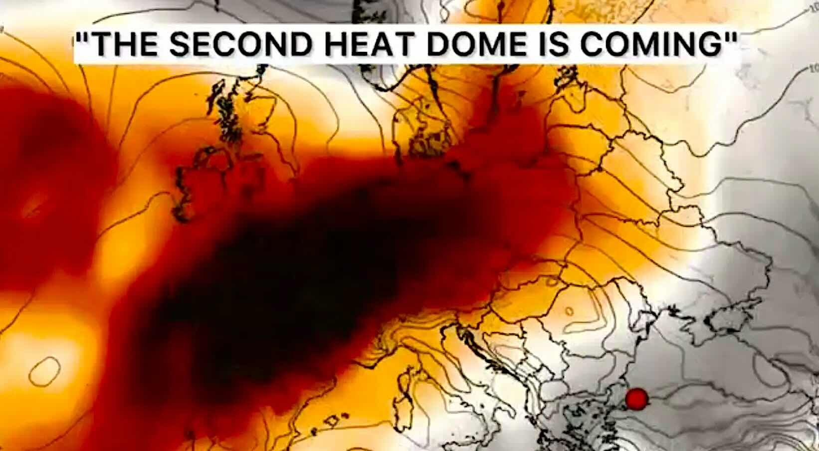
Europe is entering the second dangerous heatwave phase of summer 2026. A powerful heat dome has locked over Western and Southwestern Europe, trapping hot air from North Africa and pushing temperatures toward 40°C, 43°C and locally even 45°C. Spain, Portugal and France are already at the centre of the heat, but the ridge is forecast to expand north and east toward the United Kingdom, Benelux, Germany, the Alps, Italy and the Balkans. The next danger will not only be heat. When cooler Atlantic air or frontal boundaries finally collide with this overheated air mass, Europe could face severe thunderstorms, large hail, damaging wind gusts and isolated tornadoes.
Core heat zone: Spain, Portugal and France are the main heat dome focus from July 7–10, with 41–43°C already observed or forecast across Iberia and the low 40s in southwestern France.
Next expansion: from July 10–14, the heat expands toward the UK, Ireland, Benelux, western Germany, northern Italy, the Alps and the Balkans. Central and western France could locally approach 45°C if the ridge peaks at full strength.
Cooldown timing: western Iberia may get short Atlantic relief first, but the broader European cooldown is uncertain. France may stay hot beyond July 14, while Central Europe may only cool through storm fronts rather than a clean air-mass change.
Storm danger: high CAPE, humidity, frontal lift and wind shear can turn the edge of the heat dome into a severe-storm corridor, with large hail, downbursts, flash flooding, storm-force wind gusts and isolated tornadoes possible.
Track the heat dome, storms, air quality and fire risk in Weather Forecaster App
During a heat dome, the forecast is more than a temperature number. Check hourly weather, storm timing, wind gusts, air quality, wildfire maps and local alerts before travelling, working outdoors or planning events. Pogodnik helps you track heat, storms and changing warnings for your city.
What is happening: a heat dome has locked over Western Europe
The second July heatwave is being driven by a massive upper-level ridge over Western and Southwestern Europe. This ridge acts like a lid over the atmosphere: air sinks, compresses, warms and remains trapped near the surface. Cooler Atlantic air is blocked from reaching the main heat zone, while very hot air continues to spread north from North Africa into Iberia, France and then farther into Western and Central Europe.
The setup is similar to Europe’s historic late-June heatwave. The difference is that the land surface is already hot and dry after the first wave. Soil moisture has been depleted, vegetation is stressed, and cities have stored heat in concrete, asphalt, brick and stone. That makes the second heatwave dangerous even if some places do not break all-time records: the baseline is already hotter than normal.
Model guidance highlighted by Severe Weather Europe shows temperatures running around 12–16°C above mid-July normals in the most anomalous zones, with the core over western and central France, Iberia and nearby western Europe. Daily highs in the upper 30s and low 40s are likely over wide areas, while some model scenarios suggest values up to 45°C across parts of central, western and southwestern France.
Exact dates: where the second heatwave hits first
This second heatwave does not hit every European country at the same time. It begins as a southwestern European event, then expands north and east as the ridge strengthens.
Dates
Countries / Regions
Expected temperatures
Main weather risk
What to watch
July 7–9
Spain, Portugal, southwest France
Spain and Portugal around 41–43°C; Spain locally 42–44°C in hot valleys; southwest France near or above 40°C
Extreme heat
Heat warnings, wildfire danger, tropical nights, power demand
July 8–10
France, including southwest, west, centre, Paris region, Rhône Valley
36–40°C widely; southwest could spike toward 42°C; model scenarios show local 45°C risk later if the dome peaks
Long-duration heat
Warm nights, health alerts, water stress, wildfire risk
July 9–12
United Kingdom, Wales, southern and central England, Ireland
UK low to mid-30s, southeast England around 34°C; Ireland mid to upper 20s
Heat stress
Warm nights, transport stress, vulnerable housing
July 10–14
Benelux, western Germany, northern France, Alpine region
Low to mid-30s in Benelux and western Germany; higher if the ridge expands next week
Heat-to-storm transition
Thunderstorm outbreaks on the northern and eastern edge of the heat dome
July 10–15
Northern Italy, Po Valley, Alps, Slovenia, Croatia, Austria, Czechia, Slovakia
Upper 30s in northern and central Italy; Alpine lowlands warming sharply
Large hail and wind
High CAPE, supercells, downbursts, mountain-triggered storms
Mid to upper 30s; southern Italy and Balkans locally 38–41°C
Severe heat and storms
Heat-health risk, wildfires, severe thunderstorms after frontal contact
After July 14
Central Europe, France, Germany, Alps, Benelux, Italy, Balkans
Forecast confidence decreases; heat may persist or shift depending on Atlantic fronts
Cooldown uncertainty
Daily model updates: ridge rebuild versus Atlantic front breakthrough
France could face the most dangerous part of the second wave
France is becoming the key country to watch. The first heatwave already pushed the country into record territory, and the second wave is arriving before the system has had time to recover. Météo-France reported 40.8°C in Moules-et-Baucels, 40.7°C in Pissos and 40.4°C in Narbonne on July 6. The new heatwave is expected to be intense and prolonged, with much of the south and west reaching 40°C and possible spikes toward 42°C in the southwest.
Some model scenarios go even higher after the weekend, with peak afternoon temperatures potentially approaching 45°C across parts of central, western and southwestern France. That level would challenge regional July records and sharply increase health, wildfire, transport and power-grid stress.
The most worrying signal is duration. The heat may last around 12 days and potentially extend beyond July 14. If the forecasted cold-front scenario fades, France could face another week of tropical nights, hot buildings, stressed hospitals, high water demand and wildfire risk.
Spain and Portugal: short Atlantic relief, then heat may reload
Spain’s second heatwave begins with dangerous temperatures across the south-western quadrant, the Guadiana and Guadalquivir valleys, the Ebro Valley, parts of the southern plateau, the Balearic Islands and the Canary Islands. AEMET-based forecasts point to 42–44°C potential in several regions, while tropical nights with minimum temperatures around 20–26°C — locally even 27–28°C — make recovery difficult.
Portugal is also under heavy heat pressure, especially inland. The most dangerous districts include Beja, Castelo Branco, Évora, Portalegre and the interior valleys. The first hint of relief may come from maritime Atlantic air in western Iberia, especially along coastal areas. But this is not a full European cooldown. Severe Weather Europe notes that scorching heat is likely to return after the weekend as the upper-level heat dome restrengthens and shifts its core back toward the southwest.
The practical forecast is simple: Spain and Portugal may get short local breaks, but the heatwave pattern remains active through mid-July. Fire risk will stay high where wind, dry soil and heat overlap.
United Kingdom, Ireland, Germany and Benelux: heat expands north
The British Isles will not see the same 40°C-level heat as Iberia or France in this episode, but the trend is still dangerous. South-central England, Wales and southeast England could reach the low to mid-30s late this week and over the weekend. Ireland is expected to see the mid to upper 20s, which is still unusually warm for many areas.
Benelux and western Germany should also warm into the low to mid-30s. This is not extreme heat yet, but the pattern needs close monitoring because the heat dome is expected to expand northward and eastward. If the ridge strengthens after July 12–14, Germany, Belgium, the Netherlands and Luxembourg may move from “hot” into a more serious heatwave phase.
The main risk for northern Europe is not only daytime heat. Many homes and public buildings are not designed for long hot spells. If nights remain warm, heat stress accumulates quickly, especially for older people, infants, people with cardiovascular disease and those living in top-floor apartments without cooling.
Italy, the Alps and the Balkans: heat plus thunderstorm fuel
Italy, the Alpine region and the Balkans sit in one of the most volatile zones of the forecast. Temperatures are expected to rise toward the upper 30s across parts of Italy, while southern Italy and the Balkans may locally reach 38–41°C next week. The blocking ridge remains focused farther west, but enough heat and humidity can build to create a dangerous storm environment when fronts approach.
This region is especially sensitive because of terrain. The Alps, Apennines, Dinaric Alps and Carpathians can help initiate storms when hot humid air is forced upward. If CAPE is high and wind shear is present, ordinary thunderstorms can organize into severe multicells or supercells.
Northern Italy has already shown what the transition can look like. After the previous heatwave, storms produced hundreds of emergency calls in Veneto, brought down trees and poles, flooded homes and disrupted infrastructure. Romania also showed the same pattern after intense heat, with one death, hundreds of damaged cars and nearly a thousand trees brought down.
Why high CAPE after a heatwave can trigger violent storms
CAPE — Convective Available Potential Energy — measures how much energy rising air parcels can use to build thunderstorms. After several days of heat, the lower atmosphere can become extremely warm and humid. If a cooler front, sea-breeze boundary or mountain lift arrives, that stored energy can be released very quickly.
High CAPE alone does not guarantee severe storms. The most dangerous setup happens when high CAPE overlaps with strong wind shear, a lifting boundary and enough moisture. Then storms can rotate, intensify and organize. In Europe, this can mean large hail, damaging downbursts, flash flooding and isolated tornadoes.
ESTOFEX convective guidance has already highlighted European severe-weather setups with large hail, strong to isolated severe gusts, heavy rain and isolated tornado potential in zones including northern and central Italy, central Germany and central Poland. During this second heatwave, similar transition zones should be watched closely wherever the heat dome edge meets cooler Atlantic or continental air.
Most likely severe-storm threats
Large hail, violent downbursts, sudden wind gusts above storm-warning thresholds, intense rainfall, urban flash flooding, lightning and local tree damage.
Where isolated tornado risk can rise
Northern Italy, the Adriatic coast, Alpine foothills, central Germany, central Poland, Romania, Hungary, Slovenia, Croatia and parts of the Balkans when wind shear and high CAPE overlap.
When could Europe finally cool down?
A clean, continent-wide cooldown is not yet the leading signal. The heat dome is expected to persist through mid-July, and in some countries the “cooldown” may arrive first as thunderstorms rather than calm fresh air.
Region
Possible first relief
How reliable is it?
What could go wrong?
Western Iberia / Atlantic Portugal / western Spain
Some relief from maritime Atlantic air around July 9–10
Moderate for coastal areas
Interior valleys remain hot; heat may return after the weekend
France
No reliable nationwide cooldown before July 14
Low for true relief
Heat may persist around 12 days; cold-front scenario has become less likely
UK and Ireland
Possible Atlantic moderation after the weekend or early next week
Moderate but timing uncertain
Warm nights and humid air may continue even after peak daytime heat eases
Germany, Benelux, Alpine north side
Storm-front interruptions possible around July 12–15
Medium uncertainty
Heat may escalate first before any real relief arrives
Italy and Balkans
Local thunderstorm breaks, especially near mountains and northern regions
High for storms, lower for stable cooling
Storms may be severe; southern areas remain hot longer
Central and Eastern Europe
Potentially cooler through frontal systems, not a smooth pattern reset
Medium
High CAPE storms may create severe weather before temperatures fall
The main takeaway: Europe may not cool down evenly. Iberian coasts can feel Atlantic relief while inland Spain stays dangerously hot. France may remain locked in heat beyond July 14. Germany and Benelux may warm first, then face storms. Italy and the Balkans may combine high heat with severe thunderstorm potential.
Consequences of the first heatwave: Europe is entering the second wave already weakened
The first major heatwave of summer 2026 was not just a weather event. It damaged human health, ecosystems, agriculture, infrastructure and labour productivity. WMO reported that more than 150 million people in Europe were impacted and that more than 1,300 excess deaths had already been recorded since June 21 in connection with the extreme heat.
France suffered a major mortality signal during the late-June event, with provisional reporting pointing to thousands of excess deaths during the hottest week. Hospitals, emergency services and local authorities are now entering the next heatwave with less recovery time. That matters: a second heatwave shortly after the first one can be more dangerous than a standalone event because people, buildings and natural systems have not reset.
The first wave also dried soils, stressed crops, warmed rivers, increased wildfire danger and exposed infrastructure weaknesses. Railways, roads, power grids and public transport systems are vulnerable when heat persists. In France, wildfire risk has already forced evacuations and disrupted Tour de France planning. Across southern Europe, firefighting resources are under pressure.
Wildfire risk: the second heatwave could worsen an already dangerous summer
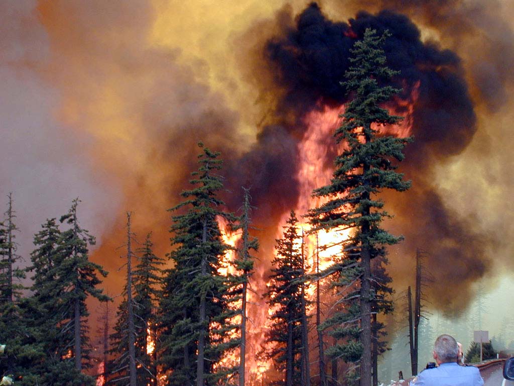
Dry soil and repeated heat are a dangerous combination. Under a heat dome, vegetation dries quickly, and even a small ignition can spread fast when wind is present. Portugal, Spain, southern France, Sardinia, Sicily, Greece and parts of the Balkans should be considered high-risk zones through this heatwave.
Wildfire smoke can also travel far from the fire itself. People with asthma, chronic lung disease, heart disease, pregnant women, infants and older adults should monitor air quality, especially near forested regions, tourist areas, dry grasslands and valleys where smoke can settle overnight.
Check Weather Forecaster before travelling through Europe
If you are travelling through Spain, Portugal, France, Italy, Germany, the Balkans or the UK this week, check the forecast more than once a day. Watch heat warnings, thunderstorm alerts, wildfire maps, wind gusts and air quality. Pogodnik helps you see local conditions before you drive, hike, visit beaches or plan outdoor events.
How to protect yourself during the second heatwave
Watch nighttime lows, not only daytime highs. If the night stays above 20°C, and especially above 25°C, your body does not recover well.
Use the heat index or feels-like temperature where available. Humidity makes heat more dangerous because sweat evaporates more slowly.
Move work and travel to the morning. The safest window is usually before late morning; avoid the hottest afternoon period.
Drink water before you feel thirsty. Add electrolytes if you are sweating heavily, working outdoors or caring for children or older adults.
Cool buildings early. Close shutters and curtains on sun-facing sides, ventilate when outdoor air is cooler, and avoid cooking indoors during the hottest hours.
Find cooling places. Libraries, malls, municipal cooling centres, shaded parks, churches and public buildings may be safer than overheated apartments.
Check on vulnerable people. A short phone call may not be enough. Make sure older neighbours, relatives and people living alone have access to water and cooling.
Never leave children or pets in cars. Vehicle temperatures can become deadly within minutes, even if windows are slightly open.
What to do when storms arrive after the heat
Take thunderstorm warnings seriously. After a heatwave, storms can intensify rapidly because the atmosphere is loaded with energy.
Go indoors if thunder is heard. Lightning can strike well away from the main rain core.
Avoid isolated trees and open fields. They are dangerous during lightning, downbursts and hail.
Do not drive through floodwater. A short flooded underpass can be deeper and faster-moving than it looks.
Secure outdoor objects. Garden furniture, umbrellas, tents, signs and construction materials can become dangerous in storm gusts.
Watch for rotation and sudden wind shifts. Isolated tornadoes are rare but possible in supercell environments, especially near boundaries and coastal zones.
Check radar and alerts before mountain travel. Alpine and Balkan storms can form quickly and become severe before reaching valleys.
Europe’s second heatwave: the main forecast message
The second heatwave is not a repeat of the first one in exactly the same places. It is a new phase. Spain and Portugal remain dangerous, France may face the most prolonged and potentially record-challenging part of the event, the UK and Ireland heat up later, Germany and Benelux move into the expanding warm sector, and Italy and the Balkans face a mixture of heat and severe-storm risk.
The most important forecast window is July 7–14. The most dangerous heat is in southwestern and western Europe first. The storm danger grows on the northern and eastern edge of the dome. A broader cooldown is possible only if Atlantic fronts break deeper into Europe, but for now the ridge remains strong enough to keep the heatwave active into mid-July.
Europe should treat this as a compound event: heat, wildfire risk, warm nights, health stress, water demand, transport disruption and severe storms after the heat are all part of the same pattern.
FAQ
What is the second heatwave in Europe in July 2026?
It is a renewed heat dome event over Western and Southwestern Europe, with extreme heat already affecting Spain, Portugal and France and gradually expanding toward the UK, Benelux, Germany, Italy and the Balkans.
Which countries are most affected first?
Spain, Portugal and France are affected first, with 40°C or higher possible in many regions. France may face the longest and most dangerous part of the heatwave if the ridge remains locked in place.
How hot could it get?
Spain and Portugal may reach 41–43°C, Spain locally 42–44°C in the hottest valleys, and parts of central, western and southwestern France could approach 45°C in some model scenarios if the heat dome peaks after the weekend.
When will Europe cool down?
A full European cooldown is uncertain. Western Iberia may see short Atlantic relief first, but France may remain hot beyond July 14. Central Europe may cool through storm fronts rather than through a smooth air-mass change.
Why can thunderstorms become severe after a heatwave?
Heat and humidity build CAPE, which is storm fuel. If a cooler front, mountain lift or convergence boundary arrives and wind shear is present, thunderstorms can organize into severe cells with large hail, damaging wind gusts, flash flooding and isolated tornadoes.
Where is tornado risk highest?
Tornado risk remains localized, but it can increase along boundaries in northern Italy, the Adriatic region, Alpine foothills, central Germany, central Poland, Romania, Hungary and parts of the Balkans when high CAPE overlaps with wind shear.
What were the consequences of the first heatwave?
The first heatwave brought record temperatures, excess deaths, drought stress, wildfire risk, agricultural losses, transport disruption and pressure on hospitals, labour productivity and infrastructure. The second wave begins before many systems have fully recovered.
What should people do now?
Follow national heat and storm warnings, reduce outdoor exposure, hydrate, check vulnerable people, avoid travel during peak heat, monitor air quality and wildfire risk, and move indoors quickly when thunderstorm warnings are issued.
The Founder and Chief Meteorologist at Pogodnik.com. With over 15 years of operational experience in synoptic analysis and climate forecasting, he specializes in storm tracking, magnetic storms, and atmospheric dynamics. A recognized expert in Ukraine’s meteorological sector, he maintains strategic collaborations with global agencies, including NOAA and ECMWF, to ensure high-precision data integration. His analytical reviews and scientific contributions are regularly featured in leading media outlets dedicated to weather science and environmental trends.