April 2026 Weather Forecast: Polar Vortex Hangover Meets La Niña’s Last Stand — Here’s What’s Coming for the U.S. and Canada
Think winter is done? Think again. A fractured polar vortex, a collapsing La Niña, and the first stirrings of El Niño are conspiring to make April 2026 one of the most complex — and pattern-split — spring months in recent memory.

What March Left Behind: Setting the Stage for April
To understand what April has in store, you first have to look at what March did to the atmosphere — because March 2026 was anything but quiet. An Arctic blast left morning lows 10 to 20 degrees below average throughout much of the eastern half of the country, with more than 180 million people across the broader eastern U.S. experiencing below-average temperatures. Freeze Warnings stretched deep into the Southeast. The Great Lakes piled up snowfall measured in feet, not inches.
That Arctic outbreak wasn’t a fluke. It was the atmospheric debt being called in — the delayed invoice from one of the most consequential stratospheric events of the decade. A powerful Sudden Stratospheric Warming (SSW) event rocked the polar stratosphere in February–March 2026. Temperatures peaked over 40 degrees Celsius above normal at the 10mb level — roughly 18.5 miles above Earth’s surface. The polar vortex didn’t just weaken. It shattered, splitting into two distinct fragments in what meteorologists call a “split-type” disruption — the most impactful kind.
The polar vortex split didn’t just affect the eastern U.S. — it redirected Arctic air toward both North America and Europe simultaneously. While Europe is grappling with its own historic late-March cold snap, a residual vortex fragment has anchored itself directly over Canada and the northern United States. That’s the core driver shaping the April pattern.

What ECMWF, GFS, and NOAA Are Showing for April
The model consensus for April 2026 is clear on the broad strokes, even as individual storm timing remains uncertain beyond two weeks. The latest pressure pattern forecast from ECMWF indicates a high-pressure system in the North Pacific — a legacy of the outgoing La Niña — paired with a low-pressure zone over Canada and the northern United States.
That combination is the defining feature of the April 2026 pattern. The low-pressure zone over Canada and the northern U.S. is the leftover core area of the Polar Vortex, stabilized over North America by the high-pressure area in the North Pacific. When a low-pressure zone parks over Canada, the colder air over western Canada is closer to pushing into the United States on a northerly flow when the pattern allows it.
The NOAA monthly average masks critical week-to-week volatility. Even in a “warmer-than-average” April, individual cold surges from Canada can be ferocious — particularly in the first half of the month when the remnant polar vortex core remains within range of the northern U.S. border.
Week-by-Week Breakdown: April 2026 USA & Canada Forecast
Regional Forecast: U.S. and Canada — Who Gets What
| Region | Temperature vs. Normal | Precipitation | Key Threat |
|---|---|---|---|
| 🇺🇸 United States | |||
| Pacific Northwest | Near normal | Near to slightly below normal | Early April trough, mountain snow, valley rain |
| California / Southwest | +2 to +4°F above | Below normal (drought risk) | Drought intensification; wildfire prep season |
| Rockies / Interior West | +3 to +5°F above | Below normal | Rapid snowmelt, low water season early |
| Northern Plains / Upper Midwest | Near normal to slightly below | Above normal | Late snow squalls; freeze risk through mid-April |
| Great Lakes | Below to near normal (first half) | Above normal | Late-season snow; lake-effect events possible |
| Northeast | Slightly below (wk 1–2), above (wk 3–4) | Near normal | Cold outbreak risk early April; final frost possible |
| Mid-Atlantic | Near to slightly above normal | Near normal | Volatile pattern; warm/cold swings |
| Southeast / Gulf Coast | Above normal | Above normal | Heavy rain events; severe weather corridor |
| Southern Plains / Tornado Alley | Near to above normal | Above normal | ⚡ Elevated tornado & severe storm threat |
| Texas | Above normal | Near to above normal (south) | Heat building early; isolated severe storms |
| 🇨🇦 Canada | |||
| British Columbia | Near normal | Near normal | Mountain snowpack concerns (low water year) |
| Alberta / Saskatchewan | Below to near normal | Above normal | Late-season blizzard risk; cold outbreaks |
| Ontario / Quebec | Below normal (early), near (late) | Above normal | Snow, frost risk; active storm track |
| Maritimes | Near normal | Above normal | Nor’easter threat; coastal flooding |
The Big Shift: La Niña Collapses, El Niño Rises — and April Is the Hinge Point
🌊 ENSO Status: April 2026 is the Transition Point
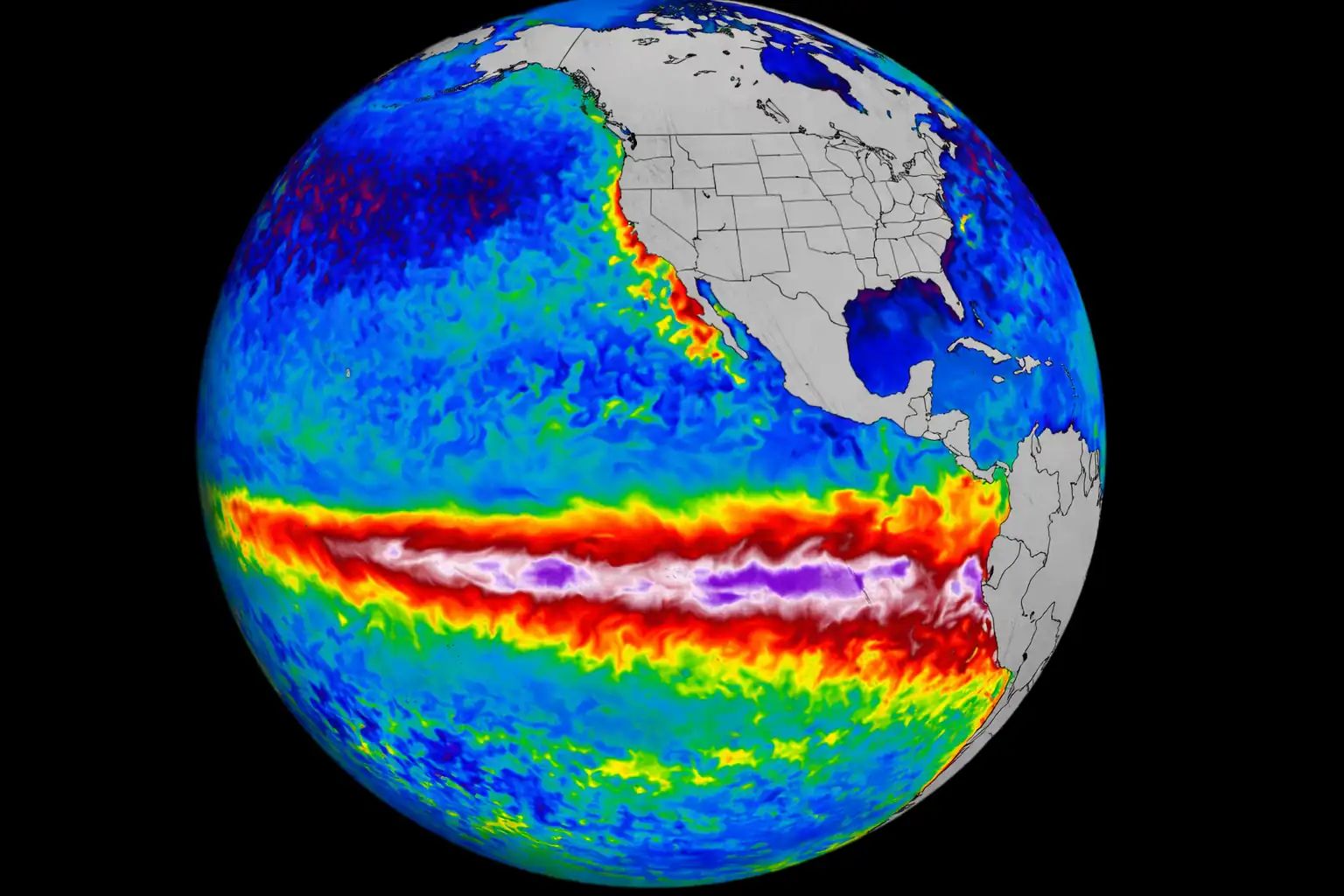
April 2026 sits at the exact hinge of a historic ENSO transition — from La Niña to El Niño — and that shift is actively reshaping the seasonal pattern in real time.
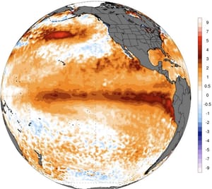
NOAA’s ENSO Alert System status stands at La Niña Advisory / El Niño Watch. A transition from La Niña to ENSO-neutral is expected in the next month, with ENSO-neutral favored through May–July 2026 (55% chance). In June–August 2026, El Niño is likely to emerge (62% chance) and persist through the year.
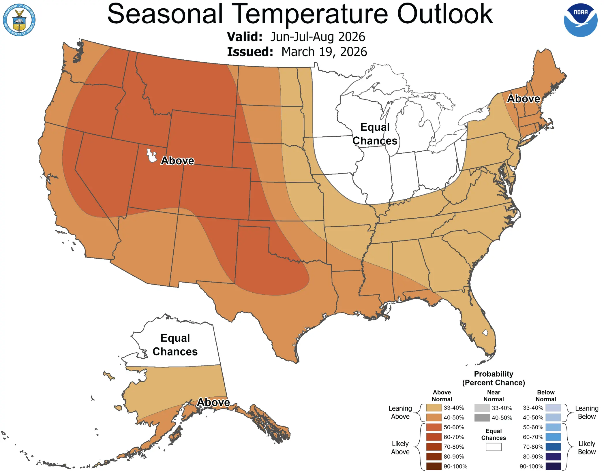
This transition is critical context for the April pattern. In Spring, the southern ridge starts to get stronger, so together with La Niña’s collapse, we usually see an early onset of a warmer airmass over the southern and southwestern United States. That explains the warm signal over the West and South in NOAA’s official April outlook. But the northern counterweight — the polar vortex remnant — is pulling in the opposite direction.
The combination of spring cold and increased precipitation will also impact early-season snowfall potential, which can still surprise across the northern, central, and eastern United States in spring. The merged ECMWF+UKMO forecast shows above-normal snowfall across the southern half of Canada and the northern United States, with more snowfall covering the upper Midwest and the northeastern United States.
Western U.S. and Canada: A Short Sharp Chill Before the Warmth Takes Over
The West Coast gets a brief but notable reminder that winter isn’t completely done. A pattern change is forecast over the West next week as mid-level low pressure near the West Coast progresses eastward. Much cooler temperatures with high-elevation snow is expected over parts of the western contiguous U.S.
For the Cascades, Olympics, and Sierra Nevada, this translates to a meaningful late-season snow dump that could temporarily boost a snowpack that has been running well below average. As of early March 2026, the amount of water held in snowpack across many western U.S. basins was in the range of 25 to 50% of average for the date. The early April trough will help, but it won’t solve the deficit.
After this early-April cool-down, the West trend sharply warmer. Utah, Colorado, Nevada, and the surrounding states show the highest probabilities of above-normal temperatures in April, with some areas in the core zone reaching the 60–70% likelihood range. The interior West heads into May with elevated wildfire risk as vegetation dries early.

Tornado Alley Wakes Up: Severe Weather Outlook for April 2026
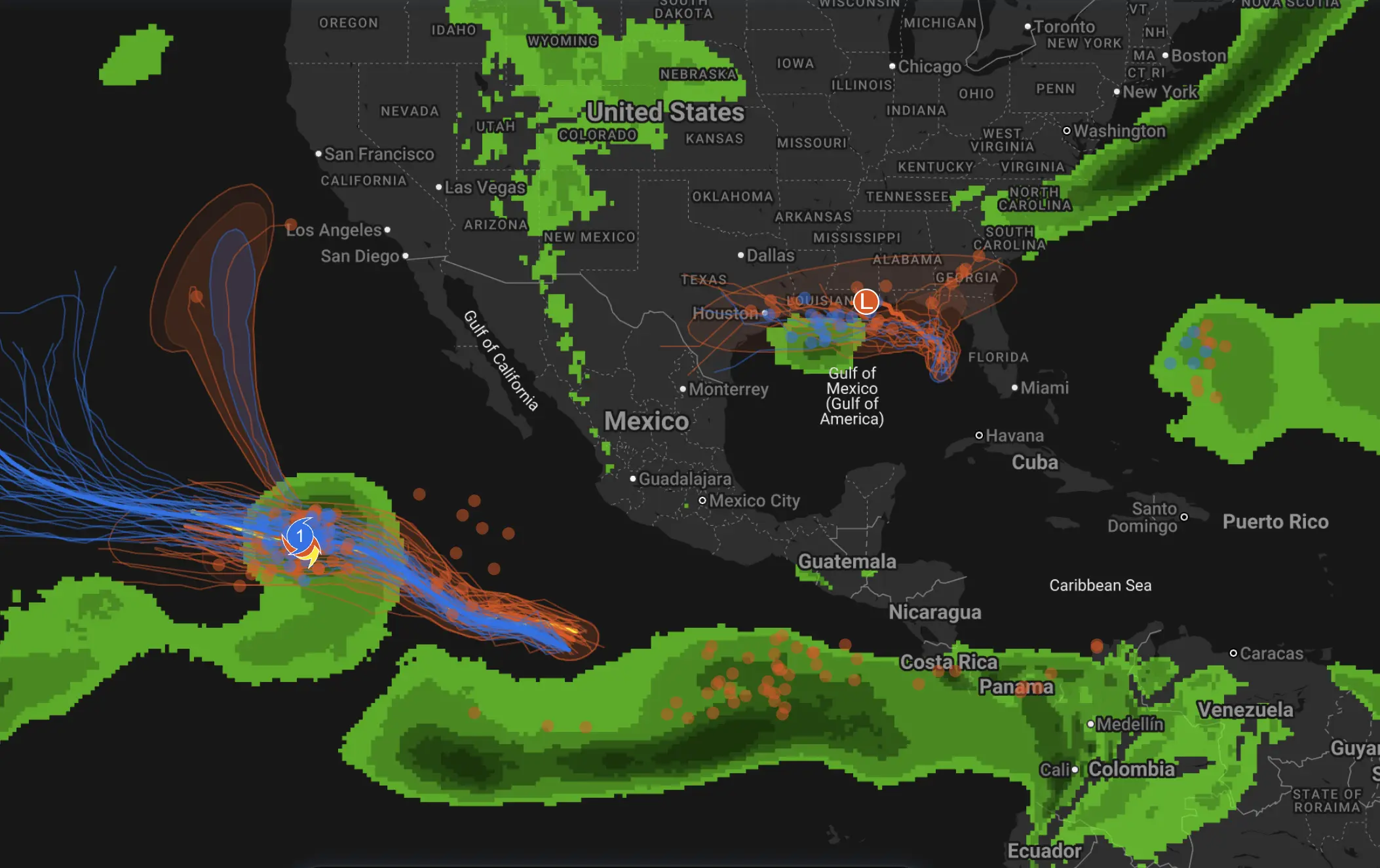
April is historically the beginning of peak tornado season across the Great Plains and Mississippi Valley — and the atmospheric setup for 2026 is favorable for an active period. The collision zone between the advancing El Niño-driven southern ridge (warm, moist Gulf air surging northward) and the lingering polar vortex remnant to the north creates exactly the kind of dynamic instability that fuels severe weather.
A corridor running from the Gulf Coast through the Midwest and into the Great Lakes shows above-normal precipitation chances for April, stretching from roughly Louisiana and Mississippi northward through Illinois, Indiana, and into Michigan, with some areas showing 40–50% odds of above-normal rainfall.
High risk corridor: Oklahoma, Kansas, Missouri, Arkansas, Mississippi, Louisiana — elevated tornado and supercell threat, particularly April 10–20.
Secondary risk: Illinois, Indiana, Tennessee, Alabama — significant severe thunderstorm days likely.
Hail and wind: Texas Panhandle, eastern Colorado, Nebraska — multi-day hail events possible as jet dips into the region.
This is not a record-breaking severe weather year signal — it’s a normal-to-active pattern that demands vigilance.
Canada Forecast: The Cold Core Isn’t Going Anywhere Fast
Canada bears the brunt of the polar vortex remnant throughout April. The ECMWF spring temperature forecast hints at normal surface temperatures over the northern and eastern parts of the United States, with even below-normal temperatures over southern Canada. Southern Ontario, Quebec, and the Prairie provinces all face an April with cold spells that feel more like March.
For Alberta and Saskatchewan, the combination of a polar vortex fragment parked to the north and the active Pacific trough means late-season blizzard potential through mid-April. Above-normal snowfall is forecast across the southern half of Canada, consistent with the persistent cold and moisture available from both Pacific and Arctic sources.
Ontario and Quebec face the most volatile pattern. The proximity of the cold dome over Canada and the warming pattern over the eastern U.S. creates frequent frontal passage — cold snaps followed by mild breaks, with precipitation often falling as a messy wintry mix rather than clean snow or rain. Ice storm risk is not zero for southern Ontario and the St. Lawrence Valley in early April.
Northeast U.S.: One More Punch Before Spring Sticks
The Northeast United States enters April still digesting the brutal late-winter run that defined the season. An intense upper-level trough — part of a dramatic polar vortex “stretch” from the Arctic to the eastern U.S. — got recharged several times after the initial late-January winter storm, resulting in more nor’easters that pulled Atlantic moisture on top of cold air trapped between the Appalachians and the East Coast.
April brings a reprieve — but not immediately. ECMWF ensemble guidance consistently shows a cold anomaly in the first two weeks of April for New England, the Great Lakes, and the Mid-Atlantic. Cities like Boston, New York, Philadelphia, and Pittsburgh should prepare for at least one more meaningful cold outbreak — possibly with accumulating snow — before temperatures finally settle into spring territory.
Historical Analogs: What Does a Post-SSW, La Niña-to-Neutral Spring Look Like?
Forecasters often look to past years with similar large-scale setups to calibrate the outlook. The best analog years for spring 2026 — featuring a split polar vortex SSW event in February–March, a collapsing La Niña, and a building El Niño signal — include spring 2009 and spring 2021.
Spring 2009 featured a late-winter SSW, a La Niña-to-neutral transition, and a volatile April with cold outbreaks in the North and active severe weather in the Plains — followed by a rapid warm-up in May. Spring 2021 produced late-season snowstorms across the Northeast through mid-April, with a historic tornado outbreak in the central U.S. in April, before a dramatic warmth surge in May. The current setup rhymes with both years: volatile, front-loaded cold, rear-loaded warmth.
What to Expect in April 2026
April 2026 is a tale of two months. The first half will carry the polar vortex’s fingerprints — cold outbreaks, late snow, and active storm tracks across the Midwest and Northeast. The second half will increasingly feel like spring as the El Niño signal asserts itself and the southern ridge pushes northward.
The West and Southwest will be warm and dry — the clearest, most consistent signal in the models. The northern tier — Great Lakes, Northeast, Prairie Canada — will see the most volatile, winter-spring battle. The Tornado Alley and Gulf Coast face an active severe weather season ramping up in mid-to-late April.
The key wildcard: if the Arctic high over Canada shifts even slightly southward during early April, a significant late-season cold outbreak — potentially delivering snow to Chicago, Detroit, and Boston — is a credible scenario with roughly 30–40% probability per ECMWF ensemble members.
Winter isn’t quite done with North America yet — but April’s last two weeks will look and feel like spring. Prepare for the split.
April 2026 Weather: Frequently Asked Questions
Forecast Disclaimer: Long-range weather forecasts beyond 10 days carry significant uncertainty. Temperature and precipitation outlooks represent probability distributions, not guaranteed outcomes. Individual storm timing and intensity cannot be predicted with precision beyond the 7-day window. This analysis synthesizes ECMWF IFS ensemble, NOAA/NCEP GFS and GEFS, NOAA CPC official outlooks, UKMET, and CFSv2 seasonal guidance current as of March 24, 2026. Readers are encouraged to monitor NOAA’s Climate Prediction Center (cpc.ncep.noaa.gov) for the most current official outlooks.
Tornado season outlook
Spring Forecast 2026