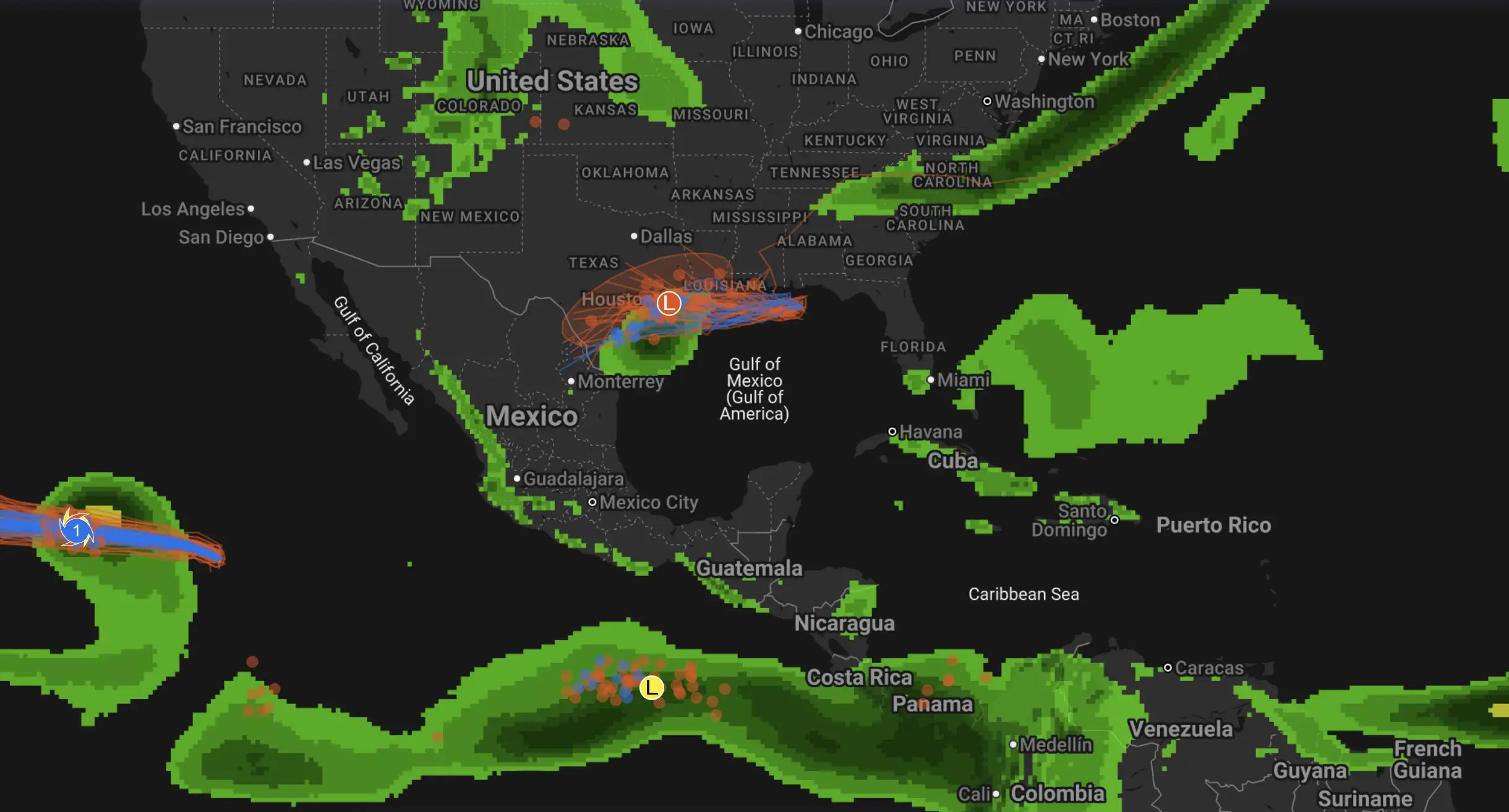
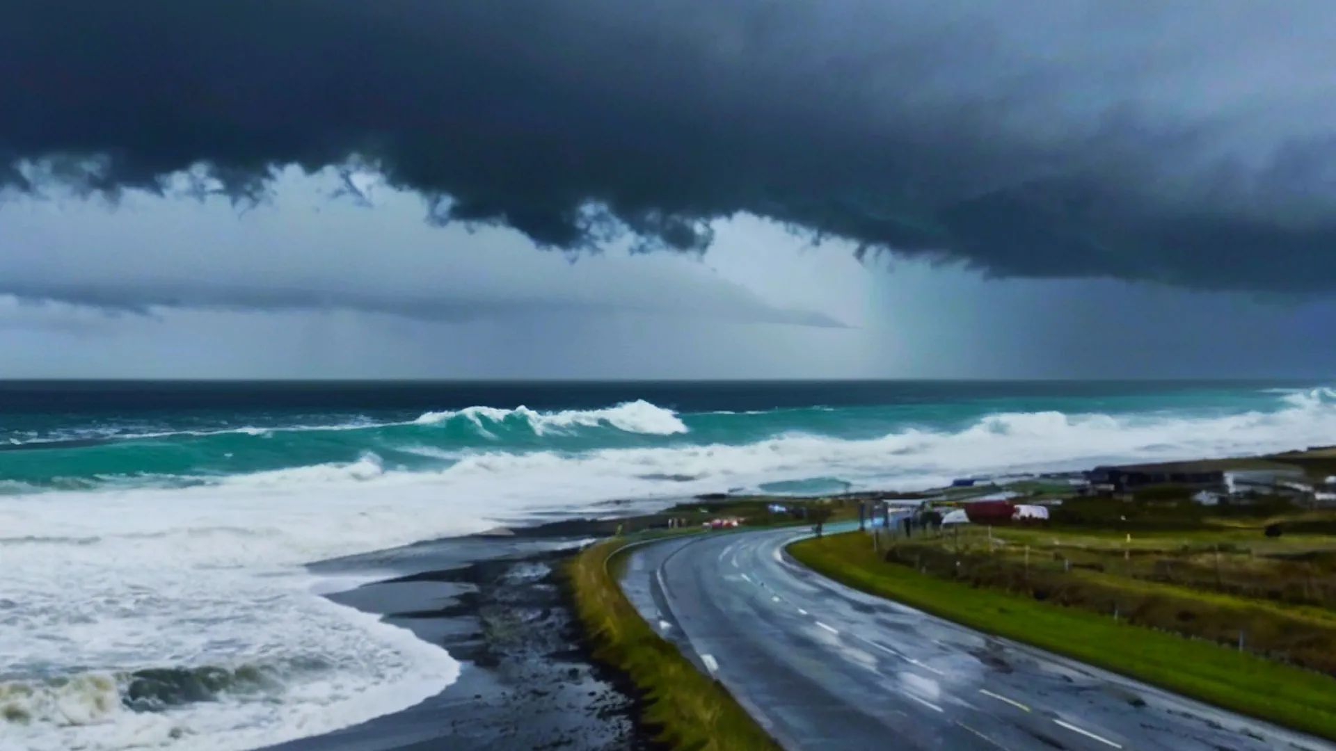
Tropical Storm Bertha is moving along the northern Gulf Coast with storm surge, flooding rain, rough surf and tropical-storm-force wind affecting communities from Florida to Louisiana. In the eastern Pacific, Hurricane Fausto is strengthening over open water and could become a Category 2 hurricane. Two additional Pacific disturbances also have a chance to develop into tropical depressions.
This active tropical cyclone update combines the latest National Hurricane Center advisories with a wider global basin check. Bertha remains the system with the most immediate land impact, while Fausto is the strongest active cyclone. The Pacific development zones are still several days from possible classification and do not currently have coastal warnings.
Active tropical systems today
Tropical Storm Bertha: moving west near the northern Gulf Coast and expected to weaken rather than become a hurricane.
Hurricane Fausto: forecast to strengthen from Category 1 to Category 2 before weakening over cooler water.
Disturbance south of Mexico: a tropical depression is likely to form during the weekend while remaining offshore.
Disturbance southwest of Hawaii: gradual development is possible as the system moves toward the International Date Line.
No additional Atlantic tropical cyclone development is expected outside Bertha during the current seven-day outlook.
System
Current status
Intensity forecast
Forecast path
Warnings and impacts
Tropical Storm Bertha
50 mph, 998 mb
Gradual weakening; hurricane development is not forecast
West along the northern Gulf Coast, then toward southeastern Texas
Tropical Storm Warning and Watch, storm surge, flooding rain and dangerous surf
Hurricane Fausto
Category 1, 80 mph, 984 mb
Strengthening toward approximately 100 mph and Category 2 intensity
West-northwest, then west across the open eastern Pacific
No coastal cyclone warnings; dangerous surf and rip currents near Baja California
Disturbance south of Mexico
Disorganized tropical wave
Tropical depression likely during the weekend
West-northwest and generally offshore of Mexico
No warnings currently in effect
Disturbance southwest of Hawaii
Trough of low pressure
Tropical depression possible during the weekend
West to west-northwest toward the International Date Line
No warnings; forecast to remain away from the main Hawaiian Islands
Tropical Storm Bertha tracker: latest path and Gulf Coast forecast
Bertha was centered near 29.3°N, 87.9°W, about 75 miles east of the mouth of the Mississippi River. Maximum sustained winds were near 50 mph, and the storm was moving west at approximately 6 mph. Tropical-storm-force winds extended outward as far as 115 miles from the center.
The latest Tropical Storm Bertha path keeps the circulation near the northern Gulf Coast before carrying it toward southeastern Texas. Strong northerly wind shear, dry mid-level air and interaction with land are expected to prevent significant strengthening. The circulation should gradually weaken to a tropical depression and then dissipate inland.
Bertha strength forecast
Forecast period
Expected strength
Expected position and impacts
Wednesday morning
Near 50 mph
Off the Louisiana coast with gusty winds, heavy rain and coastal flooding
Wednesday evening
Near 45 mph
Near southeastern Louisiana and partly inland
Thursday morning
Near 40 mph
Moving west along or near the Louisiana coast
Thursday evening
Tropical depression
Approaching the upper Texas coast
Friday
Weak remnant circulation
Moving inland over southeastern Texas and dissipating
Gulf Coast tropical storm warning and storm surge forecast
Tropical storm warnings remain in effectA Tropical Storm Warning extends from the Bay/Gulf County line in Florida westward to Morgan City, Louisiana, including metropolitan New Orleans and Lake Pontchartrain. A Tropical Storm Watch extends west of Morgan City to Cameron, Louisiana, and includes Lake Maurepas.
The Bertha storm surge forecast includes 2–4 feet from the mouth of the Mississippi River to the Mississippi–Alabama border. A surge of 1–3 feet is possible from Cameron to the mouth of the Mississippi River, from the Mississippi–Alabama border to the Aucilla River in Florida, and around Lake Pontchartrain.
Rainfall totals of 1–4 inches are possible from western Florida through southern Louisiana, with isolated amounts near 6 inches. The greatest concerns are urban flash flooding, water covering low coastal roads, tropical-storm-force gusts, dangerous surf and life-threatening rip currents.
Will Tropical Storm Bertha become a hurricane?The current official forecast does not support hurricane intensification. Wind shear, dry air and land interaction should weaken Bertha. Coastal flooding and rainfall are more important threats than destructive hurricane-force winds.
Hurricane Fausto was centered near 16.6°N, 120.3°W, approximately 805 miles west-southwest of the southern tip of Baja California. Maximum sustained winds had increased to 80 mph, with a central pressure of 984 mb. Fausto was moving west-northwest at 9 mph.
The Hurricane Fausto forecast allows additional strengthening because the cyclone has become better organized and wind shear remains light to moderate. Fausto should eventually encounter cooler water and drier air, causing weakening later in the forecast period.
Forecast period
Maximum sustained wind
Expected classification
12 hours
85 mph
Category 1 hurricane
24 hours
85 mph
Category 1 hurricane
36 hours
90 mph
Category 1 hurricane
48 hours
100 mph
Category 2 hurricane
72 hours
85 mph
Category 1 hurricane
Day 4
80 mph
Category 1 hurricane
Day 5
75 mph
Minimal hurricane or near tropical-storm strength
The Hurricane Fausto path should remain over the open Pacific. Fausto is forecast to continue west-northwest before turning west beneath a strengthening subtropical ridge. No direct landfall is indicated, but large swells may produce dangerous surf and rip currents along western Baja California and parts of southwestern Mexico.
Fausto’s most likely peakThe official forecast brings Fausto to approximately 100 mph, making it a Category 2 hurricane. After that peak, lower sea-surface temperatures and drier air should promote gradual weakening.
Tropical cyclone formation forecast south of Mexico
A tropical wave several hundred miles off Central America is producing a broad area of disorganized thunderstorms. Conditions should become more favorable as the system moves west-northwest, remaining offshore of southern and southwestern Mexico.
Development window
Formation chance
Forecast assessment
Within 48 hours
20%
Only limited short-term organization is expected
Within seven days
90%
A tropical depression is expected to form during the weekend
The disturbance could become the next named eastern Pacific tropical storm, but it is too early to forecast hurricane strength. The first reliable signal is development into a depression while moving generally parallel to the Mexican coast.
Hawaii tropical disturbance could develop near the Date Line
A trough southwest of Hawaii is producing disorganized showers and thunderstorms. Development is not expected immediately, but conditions may support gradual organization as the system moves west to west-northwest.
Development window
Formation chance
Forecast assessment
Within 48 hours
Near 0%
No immediate tropical depression formation expected
Within seven days
50%
A tropical depression could form near the International Date Line
The current projected motion carries the disturbance away from the main Hawaiian Islands. No tropical cyclone watches or warnings are in effect for Hawaii.
Are there other active tropical cyclones?
The wider global basin check did not identify another official named cyclone requiring a major warning section at this update. The Japan Meteorological Agency had no active western North Pacific cyclone announcement, while the Australian Bureau of Meteorology and Fiji regional bulletins showed no tropical cyclone warnings.
What residents should do now
Follow official warnings and prepare for rapidly changing conditions
Follow evacuation instructions issued by local authorities.
Never drive across a flooded road or around a barricade.
Avoid beaches, jetties and exposed coastal areas during dangerous surf.
Secure loose outdoor objects before tropical-storm-force winds arrive.
Charge phones and backup batteries before local power disruptions begin.
Marine operators should follow official port, small-craft and offshore advisories.
Check each new National Hurricane Center advisory because paths and warning areas can change.
Follow local conditions with Pogodnik
A tropical cyclone tracker shows the large-scale path, but local impacts depend on your exact location. Use the Pogodnik weather app to monitor hourly rain, wind, temperature, air quality and forecast changes for your city.
This report was prepared by the Pogodnik editorial team using official tropical cyclone advisories and outlooks, supplemented by global event monitoring and experimental AI guidance. Tropical cyclone information may change between advisories, so official warning centers should be used for all safety decisions.
The Founder and Chief Meteorologist at Pogodnik.com. With over 15 years of operational experience in synoptic analysis and climate forecasting, he specializes in storm tracking, magnetic storms, and atmospheric dynamics. A recognized expert in Ukraine’s meteorological sector, he maintains strategic collaborations with global agencies, including NOAA and ECMWF, to ensure high-precision data integration. His analytical reviews and scientific contributions are regularly featured in leading media outlets dedicated to weather science and environmental trends.