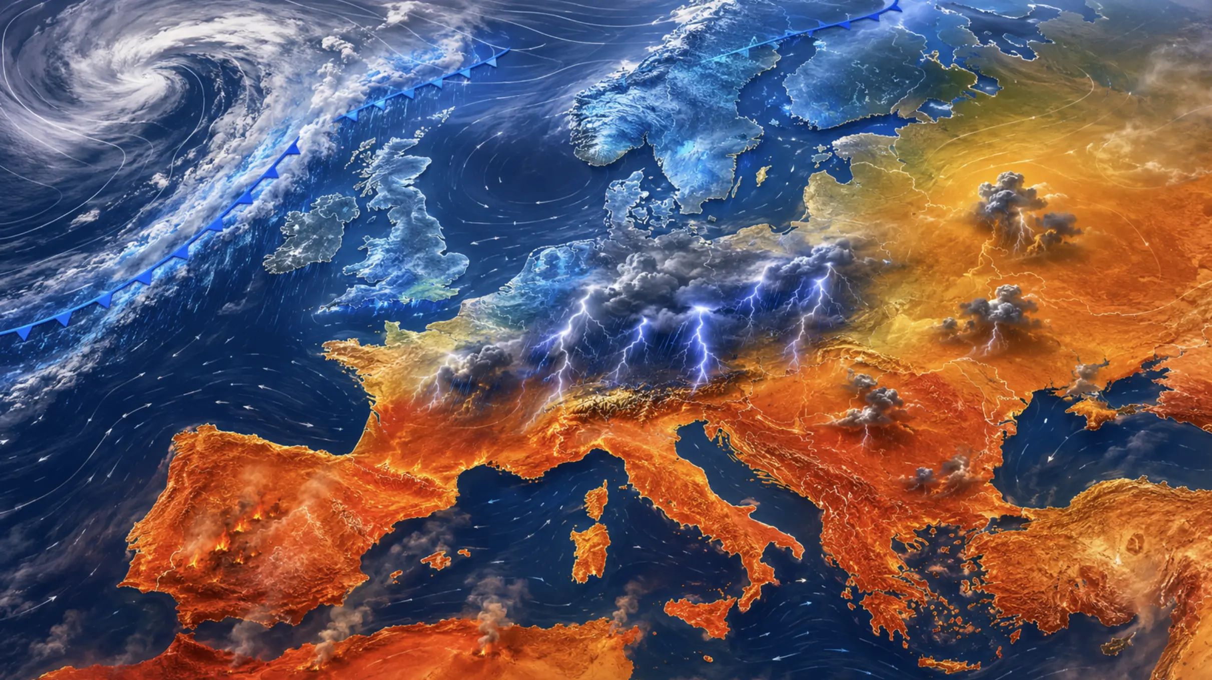
Europe Between Heatwaves and Storm Fronts: August 2026 Weather Outlook
The sharp cool-down expected across parts of Europe in late July may make it look as though summer is beginning to retreat. The latest seasonal guidance points in the opposite direction: the background pattern is likely to turn warmer again in August, with an increased probability of above-average temperatures across most of the continent. The key question is where the next blocking high will settle — and which countries will be caught between intense heat and active storm fronts.
Europe is approaching August after an exceptionally warm and dry start to summer in many areas. Western, Central and South-Eastern Europe have already experienced heatwaves, low river levels, wildfires and depleted soil moisture. This means that even a moderate August hot spell could have a stronger impact than usual, while short-lived thunderstorms may fail to reverse the accumulated water deficit.
Europe weather forecast for August 2026: key points
Average temperatures are likely to remain above the long-term norm across most of Europe.
The greatest risk of prolonged heat will remain across the Iberian Peninsula, France, Italy, the Balkans and South-Eastern Europe.
Central Europe may become the main collision zone between hot air and Atlantic or northern weather fronts.
Northern Europe and Scandinavia also have an increased chance of warm anomalies, although conditions should remain more changeable.
Rainfall will be highly uneven: drought and flash flooding could affect the same region only days apart.
The first half and middle of August currently carry the greatest risk of a new European heat dome.
Ukraine, Romania, Moldova and the Balkans will remain exposed to heatwaves, dry winds and severe thunderstorm lines.
What has changed in the latest seasonal forecasts?
The warm signal has strengthened, but the rainfall outlook remains uncertainThe latest WMO multi-model outlook for August to October supports an increased probability of above-average temperatures across Southern Europe and over much of the Northern Hemisphere’s land areas. Copernicus also indicates temperatures above the 80th percentile of the historical distribution across almost the entire European continent. Rainfall guidance is less consistent: models suggest a wetter signal over parts of southern Europe and a drier signal farther north, but confidence remains low to moderate.
This does not mean that the whole continent will remain under one uninterrupted anticyclone. Atlantic fronts may periodically reach the United Kingdom, France, the Benelux countries, Germany and the Alpine region. At the same time, a ridge of high pressure could shift towards Central, Northern or Eastern Europe and carry hot air much farther north.
Temperature is the most reliable part of the August forecast. Seasonal ensembles consistently favour more warm and hot days than cool ones. Rainfall is much harder to place accurately: one slow-moving low-pressure system could transform the monthly rainfall total in a single country while leaving neighbouring regions in drought.
What the main weather models show
Copernicus C3S
The European multi-model ensemble combines forecasts from ECMWF, the UK Met Office, Météo-France, DWD, NCEP, JMA, ECCC and other forecasting centres. The July update supports temperatures well above average across most of Europe. The precipitation signal is weaker and much more dependent on the exact region.
ECMWF SEAS5
The ECMWF seasonal prediction system uses a 51-member ensemble. Its main message for August is a warmer-than-average European background. The location of rainfall surpluses and deficits is less predictable, so precipitation maps should be interpreted as probabilities rather than as exact monthly totals.
ECMWF Extended Range
Forecasts extending to six weeks use 101 ensemble members. They help track the transition from the late-July cool spell into the August pattern and identify possible blocking episodes. However, the spread between scenarios increases rapidly during the second half of the forecast period.
NOAA CFSv2 and NMME
CFSv2 updates its monthly forecast every day using the latest initial conditions. It is useful as a supporting indicator rather than a single source of truth because global seasonal maps cannot fully resolve Europe’s regional terrain, coastlines and local circulation patterns.
Why no single model can provide the full answerA seasonal forecast is not based on one deterministic run. It is built from the distribution of dozens or hundreds of possible outcomes. The strongest signal emerges where ECMWF, Copernicus, WMO and other systems agree. For August 2026, that shared signal is above-average temperature. Agreement on rainfall is substantially weaker.
El Niño is strengthening: what could it mean for Europe?
El Niño entered a phase of rapid strengthening in July. NOAA estimates a 97% probability that the event will continue into early spring 2027, with an 81% probability of a very strong event during October to December. The latest WMO multi-model outlook for August to October also shows a substantial positive sea-surface temperature anomaly across the central and eastern equatorial Pacific.
European weather, however, is not controlled directly by El Niño. Several important links sit between the tropical Pacific and Europe: the North Atlantic, the North Atlantic Oscillation, the position of the jet stream, Arctic conditions, Mediterranean Sea temperatures and the amount of moisture stored in European soils.
A strong El Niño can therefore increase the probability of certain large-scale circulation patterns without guaranteeing identical weather from Portugal to Ukraine. For Europe, the decisive question is where high pressure becomes established and whether Atlantic fronts can continue to penetrate inland.
Why the late-July cool-down does not cancel a hot August
During the final ten days of July, cooler northern air is expected to spread through Central Europe, the Carpathian region and the Balkans towards the Black Sea. Poland, Czechia, Austria, Slovakia, Hungary, Romania and Ukraine may temporarily experience temperatures several degrees below the seasonal norm.
This cool spell is linked to a specific synoptic configuration: Atlantic blocking and a deep upper-level trough over Central and Eastern Europe. It does not change the long-term ocean temperature background, the condition of dry soils or the broader seasonal outlook.
Once the cold core shifts towards the Balkans and the eastern Mediterranean, a ridge of high pressure may rebuild over Central Europe. If that happens, hot air could once again spread from Spain, North Africa, Italy and the Balkans towards Germany, Poland, Romania, Moldova and Ukraine.
Three most likely August weather scenarios
The probabilities below are an editorial assessment by Pogodnik based on the agreement between seasonal and sub-seasonal ensembles, current soil moisture conditions and the prevailing European circulation. They are not official percentages issued by any single national weather service or model.
Estimated probability: around 50%
Scenario 1: A warm and changeable August
This is currently the leading scenario. Hot spells would last from several days to about a week before an Atlantic or northern front brings thunderstorms and a temporary drop in temperature.
Western and Central Europe: mostly +24…+32°C.
Southern Europe and the Balkans: +30…+37°C.
Locally higher temperatures during the strongest hot spells.
Rainfall would be localised, storm-driven and highly uneven.
Estimated probability: around 30%
Scenario 2: A new European heat dome
A strong anticyclone becomes established over Western, Central or Eastern Europe and blocks active weather fronts for seven to ten days, allowing very hot air to move far north.
Spain, Portugal and southern France: +38…+43°C.
Italy, the Balkans and South-Eastern Europe: +35…+40°C.
Central Europe: +31…+37°C.
Warm nights, drought, wildfires and possible water restrictions.
Estimated probability: around 20%
Scenario 3: A stormier and more changeable August
Atlantic troughs penetrate Europe more frequently and prevent extreme heat from becoming established for long north of the Mediterranean. The continent remains warm overall but experiences more frequent frontal changes.
Western and Central Europe: more often +20…+28°C.
Southern and South-Eastern Europe: +27…+35°C.
More episodes of torrential rain, large hail and damaging wind gusts.
Higher flash-flood risk in the Alps, Carpathians and Balkans.
Europe weather forecast by week
1–7 August: Heat begins to rebuild
Temperatures should recover across Central and Eastern Europe after the cooler end to July. Atlantic influence may remain stronger in the west, while the hottest weather is expected around the Mediterranean, the Balkans and the Iberian Peninsula.
8–16 August: Highest risk of a heat dome
This period currently has the greatest potential for a persistent anticyclone. Under the hotter scenario, heat could spread from Spain, Italy and the Balkans into Central and Eastern Europe.
17–23 August: Possible thunderstorm breakdown
The probability of an Atlantic trough and a cold front may increase. France, Germany, the Alpine region, Poland, Czechia, Austria and the Balkans could face severe thunderstorms, large hail and damaging wind gusts.
24–31 August: Summer may not be finished
Daytime temperatures are still likely to remain above average, although nights should gradually become cooler. Atlantic influence may strengthen across Western and Northern Europe, while southern and eastern parts of the continent could still experience a late heatwave.
The weekly timing is approximateSeasonal models cannot identify the exact date of a heat dome or thunderstorm front several weeks in advance. The weekly periods describe the most plausible evolution of the large-scale circulation. The timing of specific heatwaves, hailstorms or damaging wind events should be refined three to ten days before they occur.
August 2026 forecast by European region
Region
Temperature outlook
Rainfall outlook
Main weather risks
Spain and Portugal
Mostly +30…+38°C During major heatwaves: +39…+43°C
Long dry periods, with isolated thunderstorms in mountain areas and the north.
Extreme heat, drought, wildfires, water shortages and very warm nights
France, Benelux, the United Kingdom and Ireland
Mostly +22…+31°C Up to +33…+38°C in France during hot-air surges
Atlantic fronts should periodically interrupt dry and hot spells.
Urban heat, damaging winds, large hail, flash flooding and transport disruption
Germany, Poland, Czechia, Slovakia and Austria
Mostly +24…+32°C During heatwaves: +33…+37°C
The region may sit close to the main boundary between hot and cooler air masses.
Organised severe thunderstorms, large hail, damaging winds and agricultural drought
Switzerland, the Alps and Northern Italy
Valleys: +26…+35°C Higher during a strong heat dome
High risk of mountain-triggered thunderstorms and locally intense rainfall.
Flash floods, landslides, large hail, severe winds and valley heat
Italy, Greece and the central Mediterranean
Mostly +31…+38°C Locally near +40°C
Long dry spells may be interrupted by isolated but exceptionally intense thunderstorms.
Heat stress, wildfires, water shortages and sudden flooding
The Balkans and South-Eastern Europe
Mostly +29…+36°C During heatwaves: +37…+40°C
Storms will be most dangerous where hot Balkan air meets fronts arriving from Central Europe.
Drought, wildfires, large hail, damaging winds and local flash floods
Scandinavia and the Baltic region
Mostly +18…+28°C Above +30°C under strong blocking
A more variable pattern, alternating between warm ridges and Atlantic intrusions.
Forest fires, dry thunderstorms, smoke and isolated torrential rain
Romania, Moldova, Ukraine and Eastern Europe
Mostly +27…+35°C During major heatwaves: +36…+40°C
Prolonged dry intervals may alternate with severe thunderstorm fronts.
Hot dry winds, steppe fires, hail, damaging gusts and highly uneven rainfall
How much rain could Europe receive in August?
Rainfall remains the most uncertain part of the seasonal outlook. The WMO August-to-October forecast indicates a wetter signal over parts of southern Europe and a drier signal farther north. Copernicus also supports an increased chance of wetter conditions in some southern European regions towards early autumn.
August itself may remain a transition month. Around the Mediterranean, long dry spells could be interrupted by individual episodes of torrential rain. Across Central Europe, the final monthly total will depend heavily on how many frontal systems cross the region. In Northern Europe, the result will be controlled by the position of the Atlantic storm track.
The most plausible outcome is not a uniformly wet month, but several distinct rainfall episodes. A single thunderstorm may deliver a large share of the monthly average, followed by seven to ten days of dry weather.
Why a severe downpour may not end a droughtAfter a prolonged hot and dry period, the upper soil layer becomes hard and less able to absorb water. During an intense thunderstorm, much of the rain runs quickly into low-lying ground and urban drainage systems. Streets may flood while deeper soil layers, reservoirs and river basins continue to experience a moisture deficit.
Drought, wildfires and low river levels
Europe is entering August with an unfavourable hydrological background. In June, Copernicus recorded below-average rainfall, low topsoil moisture and reduced river flow across large parts of Western, Central and Eastern Europe.
A short cool spell or a few local thunderstorms will not automatically reverse that deficit. Recovery requires widespread, steady rainfall over a longer period. If high pressure becomes established during the first half of August, fire danger could rise rapidly in Spain, Portugal, southern France, Italy, the Balkans, Romania, Moldova and Ukraine.
Pogodnik wildfire and air-quality maps
During hot weather, check active fire locations, smoke transport and local air quality before travelling, visiting forests or working outdoors for long periods.
Temperatures close to 40°C are most plausible in Spain, Portugal, southern France, Italy, Greece, the Balkans and South-Eastern Europe. Under a persistent southerly flow, similar values could locally reach Romania, Moldova and southern Ukraine.
However, 40°C is not the baseline forecast for the whole of Europe. Such temperatures require a persistent anticyclone, very dry soils, strong advection from North Africa or the eastern Mediterranean and the absence of active weather fronts.
For most of Central Europe, a more realistic upper range during major heatwaves is +32…+38°C. Higher values would be localised and can only be forecast with confidence several days before the event.
Thunderstorms, hail and damaging winds: the main risk zones
The strongest thunderstorms are likely to develop around the edges of the heat dome rather than beneath its centre. A primary severe-weather corridor could extend from France and the Alps through Germany, Czechia, Austria, Poland and Slovakia towards the Balkans, Romania, Moldova and Ukraine.
In the Alps, Carpathians and mountainous areas of the Balkans, slow-moving thunderstorms could trigger flash floods and landslides. Across the plains of Central Europe, the main hazards would be large hail, damaging wind gusts, frequent lightning and urban flooding.
After a prolonged period of heat, the atmosphere can rapidly become highly unstable. A destructive storm may therefore develop even in a region that has remained dry for most of the month.
Ukraine in the wider European August outlook
Ukraine will remain on the eastern edge of Europe’s main weather patternsIf a heat dome becomes established over Central or Eastern Europe, hot air will reach Ukraine through the Balkans, Romania, Moldova and the Black Sea region. If Atlantic fronts remain more active, western, northern and central Ukraine will experience more frequent thunderstorm-driven cool-downs.
Region of Ukraine
Temperature outlook
Rainfall outlook
Main risks
Western Ukraine and the Carpathians
Mostly +24…+31°C After fronts: +19…+25°C
The greatest probability of thunderstorm fronts and locally intense rainfall.
Flash floods, landslides, hail, damaging winds and crop damage
Central and Northern Ukraine
Mostly +26…+33°C During heatwaves: +34…+37°C
Dry spells may alternate with localised severe thunderstorm complexes.
Heat stress, drought, urban overheating, damaging winds and large hail
Southern and Eastern Ukraine
Mostly +29…+35°C During major heatwaves: +36…+40°C
The greatest risk of below-average rainfall and prolonged dry weather.
Hot dry winds, steppe fires, water shortages, very warm nights and dry thunderstorms
Kyiv
Mostly +26…+32°C Up to +34…+36°C under blocking
Brief downpours may affect only individual districts of the city.
Urban heat, tropical nights, fallen trees and sudden surface-water flooding
How August weather could affect European agriculture
For agriculture, the main issue will not be temperature alone but the balance between heat and available soil moisture. Across Spain, Italy, the Balkans, Hungary, Romania, Moldova and Ukraine, prolonged dry periods could worsen conditions for late-season crops and reduce reserves of productive soil moisture.
France, Germany, Poland, Czechia, Austria and the Alpine region face a different risk. Intense storms may deliver rainfall too quickly, while hail and severe winds could damage maize, sunflower fields, vineyards, orchards and vegetable crops.
A warm August may accelerate crop maturation, but it will also increase the need for strict fire safety during harvesting. Dry stubble combined with gusty winds can allow agricultural fires to spread extremely quickly.
How reliable is the August forecast?
What can be forecast with greater confidence?
Seasonal models are better at identifying average temperature conditions across a large area. Copernicus, WMO, ECMWF and the systems included in their multi-model ensembles all support a warmer-than-average August across Europe.
What remains less predictable?
Rainfall, the precise position of a heat dome and the timing of individual cold fronts depend on synoptic details that only become reliable closer to the event. A rainfall forecast for one country is therefore much less certain than the broad expectation of above-average temperatures across Europe.
Above-average temperatures — higher confidence The signal is consistent across several seasonal systems.
Heat arriving in waves — moderate to higher confidence Hot periods are likely to be interrupted by frontal passages.
Moisture deficits in Southern Europe — moderate confidence The risk is supported by dry initial conditions, although one cyclone could alter the monthly balance locally.
Severe storms in Central Europe — moderate confidence The broad corridor is identifiable, but individual storm tracks may shift by hundreds of kilometres.
A seven-to-ten-day heat dome — moderate to low confidence The scenario is plausible but has not become dominant in all forecast systems.
Specific 40°C temperatures, hail or damaging winds — low long-range confidence Such hazards can only be refined several days in advance.
How to prepare for Europe’s August weather contrasts
During heatwaves, schedule strenuous activity for the morning or evening, drink water regularly and monitor elderly people, young children and anyone with cardiovascular or respiratory conditions.
Before a thunderstorm, secure loose objects on balconies and in gardens. Do not shelter under isolated trees, enter open water or leave a vehicle in a low-lying area that may flood quickly.
During periods of extreme fire danger, avoid lighting fires near forests or dry vegetation. A small spark from machinery, a discarded cigarette or garden-waste burning can start a fast-moving wildfire.
Track your local forecast in the Pogodnik weather app
Seasonal models describe the broad European pattern, but a thunderstorm may pass only a few kilometres from your location. The Pogodnik app provides hourly weather, temperature, rain, wind, cloud cover, air quality, geomagnetic activity and a two-week forecast.
August 2026 is likely to be warmer than average across Europe, but it may not bring uninterrupted heat. The leading scenario features repeated waves of warmth and heat interrupted by Atlantic fronts, thunderstorms and short-lived cool-downs.
The greatest risk of a persistent heat dome will remain across Southern, Central and South-Eastern Europe. France, Germany, the Alpine region, Poland, Czechia, Austria and the Balkans are more likely to sit near the boundary between hot air and active storm fronts.
The key unresolved question for August is where high pressure will become anchored. If it stalls over Central Europe for a week or longer, heat could spread from Spain and Italy towards Germany, Poland, Romania, Moldova and Ukraine. If the blocking pattern remains unstable, the month will still be warm — but much stormier and more changeable.
This forecast was prepared by the Pogodnik editorial team using multi-model seasonal ensembles, ECMWF sub-seasonal guidance, NOAA, WMO and Copernicus data, together with observed soil-moisture conditions. Weekly and regional temperature ranges are analytical scenarios rather than exact daily forecasts for individual cities.
The Founder and Chief Meteorologist at Pogodnik.com. With over 15 years of operational experience in synoptic analysis and climate forecasting, he specializes in storm tracking, magnetic storms, and atmospheric dynamics. A recognized expert in Ukraine’s meteorological sector, he maintains strategic collaborations with global agencies, including NOAA and ECMWF, to ensure high-precision data integration. His analytical reviews and scientific contributions are regularly featured in leading media outlets dedicated to weather science and environmental trends.