North America Could Split in Two: August 2026 Forecast for the USA and Canada
August may divide North America into several sharply different weather zones. NOAA‘s latest outlook favors unusual warmth across the eastern and south-central United States, the West Coast and the Northwest, while parts of the Northern Plains have a cooler signal. Farther west, a stronger monsoon may bring dangerous flash flooding, even as the Pacific Northwest moves deeper into wildfire season. Canada is expected to remain warmer than normal across most provinces and territories, but the biggest story may be where heat overlaps with drought, fire and smoke.
The most likely outcome is not one uninterrupted continental heat dome. The American and Canadian models instead point to a wave-like pattern: heat building over the West, South and East; cooler interruptions reaching the north-central interior; monsoon moisture surging into the Southwest; and wildfire smoke repeatedly crossing the U.S.–Canada border. At the same time, August marks the beginning of the most active portion of the Atlantic hurricane season, even though NOAA currently expects the 2026 season as a whole to finish below normal.
August 2026 weather forecast: the main signals
Above-normal temperatures are favored across the U.S. Southeast, southern Mid-Atlantic, Southern Plains, East Coast, West Coast and Pacific Northwest.
The Northern Plains have a modest cooler-than-normal signal, while much of the central interior remains a low-confidence battleground between warmer and cooler model solutions.
An enhanced North American monsoon is favored from Arizona and New Mexico into the Great Basin, Rockies and portions of the High Plains.
Below-normal rainfall is favored in the Southeast and southern Mid-Atlantic, with a weaker dry signal near the Great Lakes and Pacific Northwest.
Most of Canada is expected to remain warmer than normal, with especially strong warm probabilities in northern and eastern regions.
Dryness is a concern in Manitoba and Northwestern Ontario, while parts of the Northwest Territories and northern Alberta may receive more precipitation.
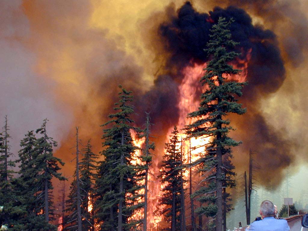
Wildfire potential is elevated across the U.S. Northwest, parts of the Great Basin, Texas, the Lower Mississippi Valley, the Carolinas and southern Florida.
Canada’s August fire risk remains elevated across the Northwest Territories, northern Manitoba, areas surrounding Hudson Bay, northern Ontario and Quebec, and southern interior British Columbia.
What the latest U.S. and Canadian weather models show
The temperature forecast is clearer than the rainfall forecastNOAA’s official August outlook uses CFSv2, NMME, Copernicus C3S, statistical tools, El Niño composites, soil moisture and recent climate trends. The strongest agreement is for warmth across the U.S. South and East and across most of Canada. Rainfall forecasts are more fragmented because tropical moisture, monsoon thunderstorms and individual frontal systems can shift the monthly total over relatively short distances.
NOAA CPC 30-Day Outlook
The official U.S. forecast favors above-normal temperatures across the East, south-central states, West Coast, Northwest and most of Alaska. The highest confidence is in the Southeast and southern Mid-Atlantic. A cooler tilt appears over the Northern Plains.
CFSv2
NOAA’s coupled Climate Forecast System is updated daily. The July 20 run supports the broad August North American pattern used by CPC, including stronger monsoon rainfall in the West and warm signals across several coastal and southern regions.
NMME
The North American Multi-Model Ensemble combines several U.S. and Canadian coupled climate models. It is one of the main sources behind NOAA’s warm Southeast, East Coast and Northwest signals and provides a wider range of possible outcomes than a single model run.
GEFS, ECMWF and Canadian Ensembles
Subseasonal guidance for early August shows conflicting solutions across the central United States. CFS and GEFS lean warmer, while ECMWF and JMA show a greater chance of cooler conditions near the Great Lakes, Mississippi Valley and parts of the Midwest.
ECCC / CanSIPS
Canada’s seasonal prediction system uses coupled atmosphere-ocean-land models. Its July guidance favors above-normal temperatures across nearly all Canadian regions, but skill varies and is lower in parts of Western Canada.
North American Fire Outlook
NIFC and Natural Resources Canada assess weather, drought, fuel dryness and fire behavior. Their August outlook highlights the U.S. Northwest, southern interior British Columbia, northern Canada and several eastern fire-prone zones.
What “above normal” actually meansA monthly outlook does not predict that every day will be hot. It means the average of all daytime and nighttime temperatures during August has a greater chance of finishing in the warmest one-third of the historical 1991–2020 distribution. A region can still experience a sharp cool front and finish warmer than normal overall.
El Niño is already influencing the August outlook
NOAA issued the August forecast against the backdrop of an El Niño Advisory. In mid-July, the weekly Niño 3.4 sea-surface temperature anomaly reached about +1.3°C, consistent with a moderate El Niño that is expected to strengthen.
El Niño usually has a weaker and less consistent effect on North American summer weather than it does during winter. The summer of 2026 is unusual because tropical Pacific convection may be strong enough to launch Rossby waves into the mid-latitudes. That helps explain why some models show heat across the West, South and East while simultaneously opening the door to cooler conditions in the north-central interior.
The Madden–Julian Oscillation, Pacific–North American pattern, North Atlantic Oscillation, sea-surface temperatures and soil moisture will also influence the final outcome. For that reason, the exact location of August ridges and troughs remains less certain than the broader warm signal.
Three most likely August 2026 scenarios
The percentages below are Pogodnik editorial probabilities based on the level of agreement among NOAA CPC, CFSv2, NMME, GEFS, ECMWF, Canadian seasonal guidance and current land conditions. They are not official probabilities issued by NOAA or ECCC.
Estimated probability: 55%
Scenario 1: A divided continent
This is the leading scenario. Heat dominates the West Coast, Northwest, Southern Plains, Southeast and East Coast, while the Northern Plains and parts of the Midwest experience periodic cooler air. Canada stays broadly warm, with regional storms and smoke interruptions.
More heatwaves than cool spells along both U.S. coasts and across the South.
Active Southwest monsoon with flash-flood and debris-flow risk.
Cooler breaks from the northern Rockies into the Upper Midwest.
Wildfire smoke repeatedly affecting both sides of the border.
Estimated probability: 25%
Scenario 2: A continental heat dome expands
A stronger ridge spreads from the West or Southern Plains into the central and eastern United States and southern Canada. The cooler Northern Plains signal fails, and heat becomes more widespread.
Repeated 100–110°F (38–43°C) heat in parts of the Southwest and Southern Plains.
Dangerous humidity across the Gulf Coast, Southeast and eastern cities.
Heat reaching the Canadian Prairies, southern Ontario and southern Quebec.
Rapidly increasing fire danger where storms fail to provide wetting rain.
Estimated probability: 20%
Scenario 3: Monsoon and storm tracks become dominant
Pacific moisture, tropical remnants and stronger frontal systems produce a stormier month. Heat remains present but is interrupted more frequently.
Above-normal monsoon rainfall expands farther north and east.
More flash floods, debris flows and severe thunderstorm outbreaks.
Cooler conditions become more established in the Midwest and Great Lakes.
One or more tropical systems influence the Gulf Coast or East Coast, though landfall location cannot be predicted seasonally.
USA weather forecast for August 2026 by week
August 1–7: Heat around the edges, uncertainty in the middle
The West, South and East have the strongest warm signal. The Southwest and Great Basin should remain active with monsoon thunderstorms. Model disagreement is larger across the central Plains, Mississippi Valley, Midwest and Great Lakes.
August 8–16: Peak heat and monsoon risk
This period carries the greatest risk of a strong ridge over the West or South. Triple-digit heat is possible across the deserts and Southern Plains, while humid heat may intensify along the Gulf and Atlantic coasts. Monsoon storms could trigger dangerous flash floods.
August 17–23: A possible central U.S. pattern shift
Confidence falls during the second half of the month. A northern trough could push cooler air into the Plains and Midwest, while heat persists in the South and West. The main severe-weather corridor may run from the High Plains toward the Mississippi and Ohio valleys.
August 24–31: Fire season and hurricane season intensify
Late August is climatologically important for western wildfires and Atlantic tropical activity. Even in a below-normal hurricane season, one storm can produce major impacts. The Northwest may stay dry, while the East remains vulnerable to heat, humidity and tropical rainfall.
Weekly timing is approximateMonthly models cannot reliably predict the exact date of a heatwave, tropical landfall or severe thunderstorm outbreak. The weekly sections describe the most plausible progression of the large-scale pattern. Local hazards must be updated with short-range forecasts.
United States weather in August 2026: regional outlook
U.S. region
Temperature outlook
Rainfall outlook
Main risks
Pacific Northwest Washington, Oregon, Idaho
Warmer than normal favored Inland hot spells may reach 95–105°F (35–41°C)
A modest dry tilt, especially west and north of the main monsoon moisture.
Large wildfires, dry lightning, smoke, poor air quality and heat stress
California and the Great Basin
Warm inland; coastal moderation Deserts often 105–115°F (41–46°C)
Monsoon moisture may reach the Great Basin, but California remains mostly seasonally dry.
Fire growth, lightning outbreaks, canyon flooding and extreme desert heat
Southwest and Four Corners Arizona, New Mexico, Utah, Colorado
Mixed monthly signal Heat interrupted by clouds and storms
Above-normal precipitation is favored through an enhanced monsoon.
Flash floods, debris flows over burn scars, lightning and damaging winds
Northern Rockies and Northern Plains
Cooler-than-normal tilt in the Northern Plains Large day-to-day swings likely
Above-normal precipitation is favored from parts of the Northern Plains toward the Middle Mississippi Valley.
Severe storms, hail, flooding, agricultural variability and occasional smoke
Southern Plains and Texas
Above normal favored Frequent 95–105°F (35–41°C), locally higher
Low confidence overall; southern Texas has a drier signal early in the month.
Extreme heat, high heat index, drought stress, wildfire potential and tropical rain
Midwest and Great Lakes
Equal chances overall Cooler risk near the western Great Lakes
A slight dry tilt near the Great Lakes, but wetter chances farther south and west.
Drought expansion in the Upper Midwest, severe storms, hail and Canadian smoke
Southeast and southern Mid-Atlantic
Highest-confidence warm zone Very humid nights and dangerous heat index
Below-normal precipitation is favored, despite daily coastal thunderstorms.
Heat illness, drought persistence, wildfire risk, tropical flooding and power demand
Warmer-than-normal tilt Heatwaves possible but not continuous
No strong monthly signal; individual fronts may deliver heavy rain.
Urban heat, flash flooding, severe thunderstorms and smoke episodes
Alaska
Warm favored south of the North Slope North Slope may lean cooler
Above-normal precipitation favored across much of the mainland and Alaska Peninsula.
River flooding in wet zones, lightning fires and sharp local temperature contrasts
Hawaii
Above normal favored
Above-normal rainfall favored across all major islands, strongest toward the southeast.
Heavy showers, humid heat, flash flooding and elevated surf from tropical systems
Canada weather forecast for August 2026
A broadly warm month, but not a uniformly dry oneEnvironment and Climate Change Canada favors above-normal temperatures across most of the country. Many stations in Atlantic Canada, Quebec, the North and parts of Western Canada show a 60–90% probability of finishing in the above-normal category. Forecast skill is lower in portions of the West, so regional heatwave timing remains uncertain.
Canadian region
Temperature outlook
Rainfall outlook
Main risks
British Columbia
Above normal favored Interior heat may reach 32–40°C (90–104°F)
Coastal showers remain possible, but prolonged interior wetting rain is not guaranteed.
Higher-than-normal fire danger in southern interior B.C., smoke and extreme heat
Alberta
Above normal favored Forecast skill is relatively low in some areas
Northern Alberta has a wetter seasonal signal than many southern and western regions.
Heatwaves, lightning fires, hailstorms and rapidly shifting smoke
Saskatchewan and Manitoba
Above normal favored Warm probabilities commonly 60–79%
Dryness is a concern in Manitoba, especially toward the north and east.
Prairie heat, drought stress, wildfire growth, severe thunderstorms and smoke
Ontario
Above normal favored Humid heat possible in the south
Northwestern Ontario has a below-normal precipitation signal.
Wildfire danger in the north, smoke in southern cities, severe storms and heat index
Quebec
Above normal strongly favored Many stations show 60–89% warm probabilities
Rainfall confidence is lower; storms may be local rather than widespread.
Northern fires, smoke, humid heat, hail and urban flooding
Atlantic Canada
Above normal favored Warm nights likely near the coast
No strong uniform signal; tropical remnants could alter monthly totals quickly.
Humidity, coastal flooding, tropical rainfall, wind damage and wildfire flare-ups
Northwest Territories and Nunavut
Above normal favored in most areas Some locations show 70–100% warm probabilities
Parts of the Northwest Territories may be wetter, but dry fire-prone pockets remain.
Large remote fires, smoke transport, difficult evacuations and permafrost impacts
Yukon
Above normal favored
Rainfall remains uncertain and highly dependent on individual systems.
Lightning fires, smoke, heat and localized flooding
Southwest monsoon forecast: more rain does not mean less danger
NOAA favors above-normal August precipitation from the Southwest into the Great Basin, central and northern Rockies and parts of the Northern High Plains. The signal is supported by C3S, CFSv2, El Niño composites and the Week 3–4 outlook.
An active monsoon can reduce drought and fire potential in the Four Corners, but it also creates some of the month’s most immediate hazards. Thunderstorms can form rapidly over the mountains and deserts, producing flash floods in slot canyons, normally dry washes and burn scars.
Rainfall may remain extremely uneven. One community can receive several inches of rain while another only a few miles away remains dry. Lightning outside the main rain core can ignite new fires, and thunderstorm outflow winds can cause existing fires to spread suddenly.
Monsoon safety matters even on a sunny morningDo not enter slot canyons or dry washes when storms are developing upstream. A flash flood can arrive without rain falling at your location. Recently burned terrain is especially vulnerable to debris flows because damaged soil absorbs less water.
Heatwave forecast: where could the worst heat develop?
The most consistent warm probabilities cover the Southeast, southern Mid-Atlantic, Southern Plains, East Coast, Pacific Northwest and much of Canada. The hottest absolute temperatures will still favor the deserts and Southern Plains, but the greatest health impact may occur in humid regions where nighttime temperatures remain high.
Texas, Louisiana, Mississippi, Alabama, Georgia, Florida and the Carolinas could see repeated days with heat indices above 105°F (41°C). Major eastern cities may experience shorter but intense heatwaves, while interior Oregon, Washington and British Columbia face hotter and drier conditions that overlap with severe fire danger.
A monthly warm signal does not justify forecasting specific all-time records. Values above 110°F (43°C) in the deserts or above 100°F (38°C) in the Southern Plains are plausible during strong ridging, but exact extremes should only be stated once supported by short-range ensemble guidance.
Wildfire and smoke outlook for August
North America’s fire risk shifts north and west in AugustThe July 1 NIFC outlook places above-normal August significant fire potential across the entire U.S. Northwest, central Idaho and western Wyoming, with elevated risk persisting in northern Nevada, northern Utah, northeastern California and northwestern Colorado. Elevated potential also extends from central Texas and western Oklahoma into the Lower Mississippi Valley, most of the Carolinas and southern Florida.
In Canada, the July federal update reported 3,137 fires and 1.4 million hectares burned so far in 2026. August fire danger is expected to remain highest in the Northwest Territories, Nunavut, northern Manitoba and areas around Hudson Bay, with elevated potential in northern Ontario and Quebec. Southern interior British Columbia is expected to move into a higher-than-normal fire-danger category.
Smoke does not follow national borders. Upper-level winds may carry Canadian smoke into the northern Plains, Great Lakes, Northeast and Mid-Atlantic, while fires in Washington and Oregon can push smoke north into British Columbia and Alberta. Air quality may deteriorate hundreds or even thousands of miles from the active fire.
A wet thunderstorm day does not necessarily end fire season. Fine fuels can dry quickly after rain, and lightning may create holdover fires that are not detected until hotter and windier weather returns.
2026 hurricane season: what August could bring
Below-normal seasonal activity does not mean zero landfall riskNOAA gives the 2026 Atlantic hurricane season a 55% chance of being below normal, a 35% chance of being near normal and a 10% chance of being above normal. The official 70% range calls for 8–14 named storms, 3–6 hurricanes and 1–3 major hurricanes.
Most Atlantic activity typically occurs during August, September and October. The strengthening El Niño is expected to increase upper-level wind shear and suppress some storm development, but it cannot prevent every hurricane. A quieter basin can still produce one destructive landfall.
Seasonal outlooks cannot predict which state or province will be hit. Gulf Coast, Florida, Southeast, Mid-Atlantic, Northeast and Atlantic Canada residents should monitor the National Hurricane Center and Canadian Hurricane Centre whenever a system forms.
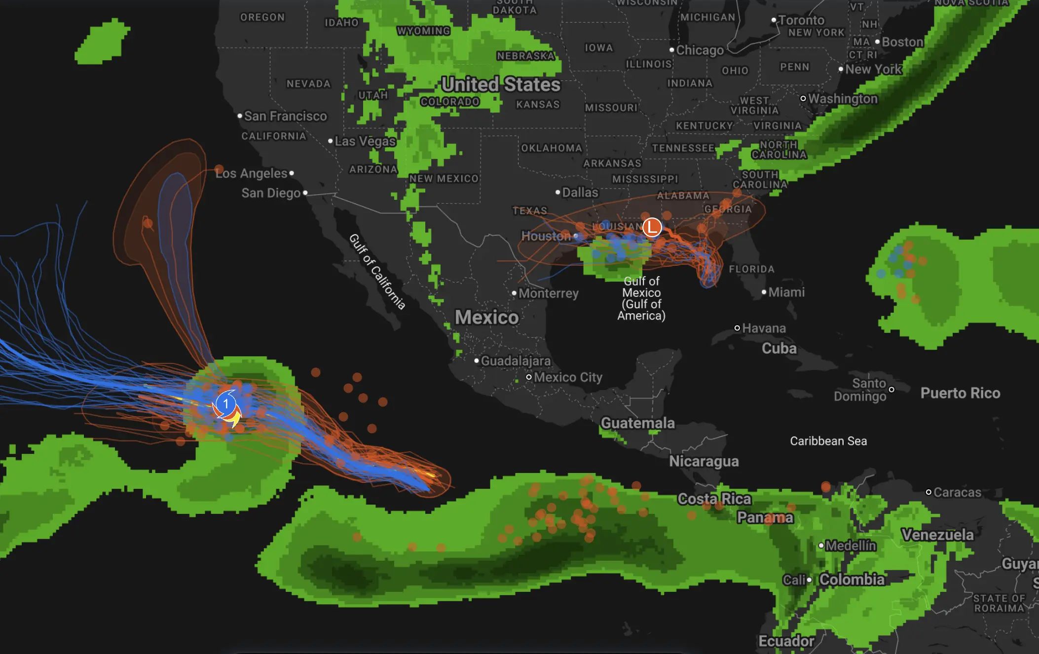
The eastern Pacific may also remain active. Tropical moisture from Pacific storms can feed the Southwest monsoon, enhancing rain far inland even when the cyclone itself stays offshore.
Drought outlook: relief in the Southwest, concern in the Northwest
At the end of June, about 47.8% of the contiguous United States was in drought. Heavy rain brought improvement to parts of the Plains, South and Mid-Atlantic during July, but dryness persisted or intensified in the Northwest, Great Basin, Rockies and western Great Lakes.
The seasonal drought outlook favors monsoon-driven improvement across the Four Corners and much of the Rockies. In contrast, drought may expand in the Northwest and Upper Midwest. Drier August conditions could slow drought relief across the Carolinas and parts of the Southeast.
Canada’s long-standing moisture deficits remain important in southern British Columbia, portions of the Prairies, the eastern Northwest Territories and some northern and eastern regions. Local thunderstorms can reduce short-term fire danger without restoring deep soil moisture, groundwater or river flow.
How August could affect agriculture and energy demand
For U.S. and Canadian agriculture, the most important factor will be the balance between rainfall and heat. A wetter monsoon may improve rangeland and soil moisture in parts of the Southwest, but flooding and erosion could damage roads, irrigation infrastructure and recently burned land.
Hot and dry conditions in the Northwest, Northern California, parts of the Prairies, Manitoba and Northwestern Ontario may increase crop stress and irrigation demand. In the Corn Belt, cooler intervals could reduce heat stress, but rainfall uncertainty remains significant.
High nighttime temperatures in the South and East can increase livestock stress and electricity demand because buildings have less opportunity to cool after sunset. Smoke can reduce solar power generation, disrupt aviation and force outdoor workers to limit exposure.
How reliable is the August 2026 forecast?
Higher-confidence signals
The strongest model agreement favors above-normal temperatures across the U.S. Southeast, southern Mid-Atlantic, Southern Plains, Pacific Northwest and most of Canada. The enhanced Southwest monsoon and elevated Northwest fire risk also have meaningful multi-model support.
Lower-confidence signals
The central U.S. temperature pattern, Southern Plains rainfall, individual Canadian storm tracks and the location of any tropical landfall remain uncertain. These outcomes depend on shorter-lived circulation patterns that seasonal models cannot resolve precisely.
Warm Southeast and southern Mid-Atlantic — high confidence NOAA assigns probabilities above 50% in the strongest zone.
Warm Canada — moderate to high confidence Most ECCC stations favor above-normal temperatures, although regional forecast skill varies.
Enhanced Southwest monsoon — moderate confidence Supported by CFSv2, C3S, ENSO composites and Weeks 3–4 guidance.
Cooler Northern Plains — moderate to low confidence The signal is present in analog tools but has weaker dynamical-model support.
Pacific Northwest fire risk — high confidence Warmth, drought and dry fuels support above-normal significant fire potential.
Exact hurricane landfall — no seasonal predictive skill Landfall location and intensity must be determined from short-range forecasts.
Frequently asked questions about August 2026 weather
Will August 2026 be hotter than normal in the United States?
Many regions have a warmer-than-normal tilt, especially the Southeast, southern Mid-Atlantic, Southern Plains, East Coast, West Coast and Northwest. The Northern Plains may be cooler, while the central interior has greater uncertainty.
Will Canada have a hot August 2026?
Yes, above-normal average temperatures are favored across most Canadian provinces and territories. This does not mean every day will be hot, but warm spells are expected to outnumber cool spells.
Will the Southwest monsoon be stronger in August?
NOAA favors above-normal precipitation across much of the Southwest, Great Basin and Rockies. That can improve drought while increasing the risk of flash flooding, debris flows and lightning.
Will there be a hurricane in the United States or Canada?
NOAA expects a below-normal Atlantic season overall, but seasonal forecasts cannot determine landfalls. August begins the climatological ramp-up toward the peak of hurricane season, so coastal residents must remain prepared.
Where will wildfire smoke be worst?
The greatest source regions include the U.S. Northwest, southern interior British Columbia, northern Canada, northern Ontario and Quebec. The worst smoke at any location will depend on wind direction and active fire growth.
When will the August forecast become more accurate?
Temperature and rainfall trends improve about one to two weeks before a period begins. Specific heatwaves, flood events, severe storms and tropical systems become substantially more predictable within three to ten days.
How to prepare for August heat, storms and smoke
During heatwaves, schedule strenuous work for the morning, drink water frequently and check on people without air conditioning. High nighttime temperatures can be especially dangerous because the body has less time to recover.
During monsoon storms, avoid slot canyons, low-water crossings and burn scars. Do not drive through flooded roads. Severe thunderstorms can produce destructive winds and large hail even when tornado risk is low.
When wildfire smoke arrives, check the Air Quality Index, reduce outdoor exertion and use a properly fitted respirator such as an N95 when exposure cannot be avoided. Keep indoor air as clean as possible with filtered air conditioning or a portable air cleaner.
Coastal residents should review hurricane evacuation routes and emergency supplies before a storm is forecast. Waiting until a warning is issued can lead to fuel shortages, traffic and limited access to essential items.
Track your local weather with Pogodnik
A continental outlook cannot tell you whether a thunderstorm, heat advisory or smoke plume will reach your neighborhood. The Pogodnik weather app provides hourly conditions, precipitation, wind, air quality, wildfire information, geomagnetic activity and a two-week forecast for selected locations.
August 2026 is most likely to produce a divided North American pattern rather than one uniform weather regime. The West Coast, Northwest, South and East have the strongest U.S. warm signal. The Northern Plains may experience cooler conditions, and the central states remain the largest zone of model disagreement.
The Southwest monsoon should be more active than normal, bringing both drought relief and dangerous flash flooding. At the same time, fire potential will increase across the Northwest and remain elevated in several southern and eastern U.S. regions.
Canada is likely to stay warmer than average across most provinces and territories. The most serious overlap of heat, dry fuels and wildfire danger is expected in southern interior British Columbia, northern Canada, northern Manitoba, northern Ontario and Quebec. Smoke will remain a cross-border weather story.
The biggest open question is whether the August ridge remains fragmented or expands into a full continental heat dome. If the ridge broadens, extreme heat could link the western United States, Southern Plains and southern Canada. If the storm track remains active, the month will be more divided — hotter around the edges, cooler in the north-central interior and increasingly stormy from the monsoon region to the Great Lakes.
This outlook was prepared by the Pogodnik editorial team using NOAA CPC, CFSv2, NMME, GEFS, ECMWF, Environment and Climate Change Canada, NIFC, Natural Resources Canada, drought data and observed soil-moisture and wildfire conditions. Regional temperature ranges describe plausible warm-spell conditions rather than exact daily forecasts for individual cities.
The Founder and Chief Meteorologist at Pogodnik.com. With over 15 years of operational experience in synoptic analysis and climate forecasting, he specializes in storm tracking, magnetic storms, and atmospheric dynamics. A recognized expert in Ukraine’s meteorological sector, he maintains strategic collaborations with global agencies, including NOAA and ECMWF, to ensure high-precision data integration. His analytical reviews and scientific contributions are regularly featured in leading media outlets dedicated to weather science and environmental trends.