🚨 Extreme Weather Warning: Destructive Tornado Outbreak and Giant Hail Strike the Central U.S.
Key Takeaways: A violent tornado outbreak is sweeping across the Central United States. The NOAAStorm Prediction Center (SPC) has issued a high-tier “Moderate Risk” warning. Over 25 tornadoes have already touched down, causing severe structural damage across Iowa and Nebraska. Atmospheric conditions remain highly volatile, posing an ongoing threat of long-track tornadoes and baseball-sized hail.
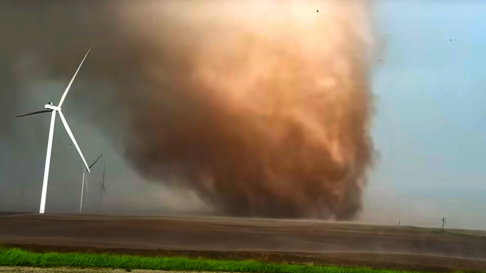
The Central United States is currently enduring a massive meteorological crisis. A volatile cluster of supercell thunderstorms has triggered a series of destructive tornadoes, life-threatening hail, and hurricane-force winds.
According to the latest radar data and storm spotter reports, at least 25 tornadoes have been recorded in the past 24 hours. The states of Iowa and Nebraska have taken the brunt of the impact, suffering extensive damage to residential neighborhoods, farms, and power grids.
In response to this rapidly escalating threat, the U.S. Storm Prediction Center (SPC) has issued a Moderate Risk (Level 4 out of 5) for severe weather covering large portions of Kansas and Nebraska.
🔬 The Meteorology Behind the “Perfect Storm”
Forecasters utilizing the GFS (Global Forecast System) and advanced radar models note that a highly dangerous thermodynamic environment has materialized over Tornado Alley. The primary driver is a deep, negatively tilted upper-level trough ejecting from the Rockies.
Technical Atmospheric Drivers (NOAA/SPC Data): • Extreme Instability (MLCAPE): Values have surged past 3,500 J/kg, fueled by an intense influx of moisture from the Gulf of Mexico. • Potent Wind Shear: Deep-layer shear exceeding 50 knots ensures that updrafts rapidly rotate, leading to sustained supercell development. • Lapse Rates: Extremely steep mid-level lapse rates are allowing updrafts to explode into the upper troposphere, creating the perfect freezing zone for giant hail.
This textbook combination of explosive instability and intense low-level shear has created an environment capable of producing discrete, long-lived supercells.
A mature supercell thunderstorm, the primary driver of intense tornadoes. Source: NOAA (Public Domain).
🚨 Impact Report: Devastation in Iowa and Nebraska
As massive Mesoscale Convective Systems (MCS) ripped through heavily populated counties, emergency services were pushed to their limits.
Nebraska: Massive tornadoes tore through rural and suburban areas. Complicating rescue efforts was the barrage of giant hail—some stones reported over 3 inches in diameter (baseball size), shattering windshields and destroying roofs.
Iowa: Multiple intense twisters crossed major highways. Local news agencies report collapsed barns, flipped semi-trucks, and widespread structural damage to homes.
Infrastructure Collapse: Tens of thousands of residents are currently without power as transmission lines have been snapped by straight-line winds exceeding 75 mph.
⚠️ Ongoing Threats: What to Expect Next
The danger has not passed. The SPC warns that the severe weather risk area will shift eastward, putting new communities in the crosshairs.
Primary Hazards for the Next 24 Hours:
Intense, Long-Track Tornadoes (EF2+): The probability of violent tornadoes remains exceptionally high (over 15-30% within the Moderate Risk zone).
Giant Hail: Updrafts are strong enough to suspend massive hailstones. Falling ice of this size is deadly and causes catastrophic property damage.
Derecho Potential: As discrete supercells merge into a squall line, they may produce widespread, hurricane-force straight-line winds.
🛡️ Critical Tornado Safety Instructions
If you are located in the Enhanced or Moderate Risk zones, emergency management agencies (FEMA) urge strict adherence to the following safety protocols:
Seek Shelter Immediately: Move to an underground basement or a certified storm shelter as soon as a Tornado Warning is issued.
The “Interior Room” Rule: If you do not have a basement, retreat to the lowest floor and get into a small, windowless interior room (such as a bathroom or closet).
Protect Your Head: Use heavy blankets, mattresses, or bicycle helmets to shield yourself from high-velocity flying debris.
Never Stay in a Vehicle: Do not try to outrun a tornado in a car, and never seek shelter under highway overpasses—they act as wind tunnels.
This severe weather bulletin is compiled using official operational data from the NOAA Storm Prediction Center (SPC) and local emergency management reports. Always rely on local weather radio broadcasts and official alerts for immediate, life-saving information.
The Founder and Chief Meteorologist at Pogodnik.com. With over 15 years of operational experience in synoptic analysis and climate forecasting, he specializes in storm tracking, magnetic storms, and atmospheric dynamics. A recognized expert in Ukraine’s meteorological sector, he maintains strategic collaborations with global agencies, including NOAA and ECMWF, to ensure high-precision data integration. His analytical reviews and scientific contributions are regularly featured in leading media outlets dedicated to weather science and environmental trends.