Polar Vortex Split, La Niña Instability and a Storm-Powered Atlantic: What December 2025 Means for Winter Across the U.S., Canada and Europe
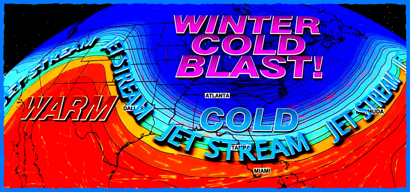
A rapid shift in upper-atmospheric dynamics is reshaping the early winter season across the Northern Hemisphere. New analyses show that the polar vortex is undergoing a significant split, while a weak but persistent La Niña continues to amplify temperature contrasts across the Pacific and North America. The result is a pattern that strongly favors deep Arctic cold across Canada and the United States, while the North Atlantic re-energizes and drives powerful storms into Western Europe.
These combined signals resemble some of the most volatile early-winter years on record — the type that deliver severe cold in North America and storm-driven turbulence in Europe simultaneously.
United States and Canada: Arctic cold intensifies as the polar vortex fractures
Latest model and satellite assessments confirm that the stratospheric polar vortex is not just weakening — it is splitting into separate lobes, a hallmark precursor to strong southward intrusions of Arctic air. When the vortex loses symmetry and its core shifts toward Canada, cold air escapes far more easily into the mid-latitudes.
In December 2025, the primary cold reservoir is forming over northern Canada and the Hudson Bay region. This displaced vortex lobe is now generating a direct pipeline of Arctic air into the central and eastern United States.
Forecast patterns for mid-December and the Christmas holiday period highlight:
Deep cold waves across the northern Plains, Upper Midwest, and Great Lakes
High risk of snowstorms along the U.S.–Canadian border
Enhanced lake-effect snow potential in Michigan, Ohio, Pennsylvania, and New York
Possible southward penetration of Arctic air into Kansas, Missouri, Oklahoma, Kentucky and Tennessee
In Canada, Manitoba, Saskatchewan, Ontario and Quebec face the full force of the Arctic reservoir — with dangerous wind chills and accumulating snowfall.
This setup aligns with historical years when a polar vortex split triggered classic cold Christmas periods across a wide swath of North America.
Christmas Forecast: Higher potential for a cold, snowy holiday season
Long-range ensemble guidance continues to support a wintry Christmas setup for many regions of the United States and Canada. A fractured polar vortex tends to keep Arctic cold “anchored” over the continent, while individual storm systems track along a sharply defined temperature gradient from the central Plains to the Northeast.
As a result, a white Christmas becomes increasingly plausible for:
The Upper Midwest
The Great Lakes region
Interior Northeast
Much of southern Canada
Some model scenarios even suggest that colder-than-normal conditions may extend toward the Mid-Atlantic, raising the possibility of a rare early-season snowfall event there.
Europe: A re-strengthened zonal jet fuels powerful Atlantic storms
While North America deals with Arctic outbreaks, Europe finds itself under a completely different regime — a revived zonal flow across the North Atlantic. This straighter, faster jet stream develops when strong pressure contrasts form between Greenland’s blocking high and a deepening Atlantic trough.
The result: an explosive storm track pointed directly at Western Europe.
One such system — Storm Bram — is already intensifying and is expected to impact:
This is a classic atmospheric split pattern: Arctic cold dominates North America while Europe experiences high-impact storm cycles.
How the fractured polar vortex links both sides of the Atlantic
In many early-winter seasons, a disrupted polar vortex sends cold air into North America while simultaneously strengthening the jet stream over the Atlantic. This happens because:
The vortex lobe over Canada pulls cold southward
The Greenland high increases pressure gradients
The jet stream accelerates into Europe
Storm systems deepen rapidly as they cross the ocean
This explains why December 2025 features:
Severe cold in the U.S. and Canada
Storm-driven warmth and rain in Western Europe
Yet this configuration is rarely stable. As stratospheric disturbances propagate downward, the European pattern can flip toward colder conditions later in winter — especially in January and February 2026.
Winter has only begun to reveal its power
North America is entering a period of Arctic-driven winter, with extreme cold and high snow potential well before Christmas.
Europe is preparing for a storm-intense December, with powerful Atlantic systems and turbulent pressure patterns.
The dual influence of a polar vortex split and La Niña suggests a winter that will remain dynamic, unpredictable, and highly energetic on both continents.
The Founder and Chief Meteorologist at Pogodnik.com. With over 15 years of operational experience in synoptic analysis and climate forecasting, he specializes in storm tracking, magnetic storms, and atmospheric dynamics. A recognized expert in Ukraine’s meteorological sector, he maintains strategic collaborations with global agencies, including NOAA and ECMWF, to ensure high-precision data integration. His analytical reviews and scientific contributions are regularly featured in leading media outlets dedicated to weather science and environmental trends.