Japan Typhoon Forecast: Mekkhala and Higos Track Toward Okinawa, Kyushu and Honshu
Japan is facing a complicated late-June tropical cyclone setup. A very strong Typhoon Mekkhala is moving north from the Philippine Sea, while Tropical Storm Higos has formed near the Mariana Islands and is also curving toward the waters south of Japan. The Google DeepMind Weather Lab spaghetti guidance shows a broad but consistent recurving pattern: storms lift north or northwest, bend northeast near Japan, and then accelerate into the open Pacific. The biggest risk for Japan is not only a direct landfall. Heavy rain, high surf, landslides, swollen rivers and transport disruption can begin before the storm center reaches the islands.
The highest-risk window for Japan is from late Thursday, June 25, through Sunday, June 28. Okinawa and the Sakishima Islands should watch the first serious impacts, followed by Amami, Kyushu, Shikoku, the Kii Peninsula, Kansai, Tokai, the Izu Islands and possibly Kanto. A direct destructive landfall is not guaranteed, but the rainfall threat is real because tropical moisture from Mekkhala and Higos may feed into Japan’s rainy-season front.
This is a two-system forecast. Mekkhala is the stronger typhoon and the main wind and wave threat. Higos is weaker, but its track through the Philippine Sea can add moisture, disturb the steering flow and complicate the forecast near Japan.

What the spaghetti models show
The Weather Lab spaghetti image shows two separate cyclone signals. The stronger system near the northern Philippines and Taiwan corridor is Typhoon Mekkhala. Its ensemble tracks curve northward toward the Ryukyu Islands, then bend northeast toward southern Japan and the Pacific side of Honshu. The second system begins near Guam and the Northern Mariana Islands; this is Higos, and its track cluster also bends north and northeast south or east of Japan.
The most important message from the spaghetti map is clustering. Many lines do not drive straight into the center of Japan. Instead, they sweep along or just offshore of the Pacific side. That reduces confidence in a direct landfall for every city, but it does not reduce the rain threat. In Japan, a typhoon passing offshore can still trigger dangerous rainfall if it pumps moisture into the rainy-season front.
Model interpretation: a tight cluster near Okinawa and the waters south of Japan would mean a higher wind and wave threat. A wider spread toward Shikoku, Tokai and the Izu Islands means track uncertainty grows after June 26. The farther north the storm recurves, the higher the risk for Kansai, Tokai and Kanto; the farther south it stays, the higher the risk for Okinawa, Amami, Kyushu and Shikoku.
Current storm setup: Mekkhala and Higos
| System | Current status | Track signal | Main threat for Japan |
|---|---|---|---|
| Typhoon Mekkhala | Very strong typhoon east of the Philippines, around 925 hPa and 100 kt in JMA / METAREA guidance | Northwest to north, then northeast toward the Ryukyu–Kyushu–Shikoku / Pacific Honshu corridor | High waves, damaging winds near the core, heavy rain, landslides, flooding, transport disruption |
| Tropical Storm Higos | New tropical storm near the Marianas, initially weaker than Mekkhala | West-northwest, then recurving south of Japan and becoming extratropical east of Honshu | Additional moisture, rough seas, outer rainbands, forecast uncertainty through interaction with Mekkhala |
| Rainy-season front | Stationary or slow-moving boundary near Japan | Can be activated by tropical moisture from both systems | Heavy rain may occur before either storm center reaches Japan |

When could the storms hit Japan?
The current timing points to a staggered threat. Higos may pass south of Japan first, while Mekkhala approaches Okinawa and the Ryukyu chain, then turns toward the Pacific side of western and eastern Japan. The exact track remains uncertain, but the danger window is clear enough for preparation.
| Time window, Japan Standard Time | Most exposed areas | Expected impact |
|---|---|---|
| June 23–24 | Okinawa region, Sakishima Islands, Pacific side of Kyushu and Shikoku | Moisture increases; rain bands may become more active even before the typhoon arrives. |
| Late June 25 | Ishigaki, Miyakojima, Yonaguni, Yaeyama Islands, southern Ryukyu Islands | Outer bands, rough seas, dangerous surf and increasing wind risk from Mekkhala. |
| June 26 | Okinawa main island, Naha, Nago, Kumejima, Amami, Tokunoshima, southern Kyushu | Closest approach risk for the Ryukyu chain; high waves, heavy rain, strong winds and ferry / flight disruption. |
| June 26–27 | Kyushu, Kagoshima, Miyazaki, Kumamoto, Oita, Shikoku, Kochi, Tokushima, Kii Peninsula | Heavy rain, landslide risk, river rises, high surf and possible damaging coastal winds depending on the final track. |
| June 27–28 | Kansai, Osaka, Kobe, Kyoto, Wakayama, Nara, Tokai, Nagoya, Shizuoka, Hamamatsu, Izu Islands, Kanto | Rain and wind risk increases if the track comes north; Izu Islands and Pacific-facing coasts are especially exposed. |
| June 28 onward | Eastern Honshu, Tohoku Pacific coast, offshore waters east of Japan | System may become extratropical; strong winds, large waves and trailing rain bands remain possible offshore and along Pacific coasts. |
Real threat: rain may be worse than the landfall question
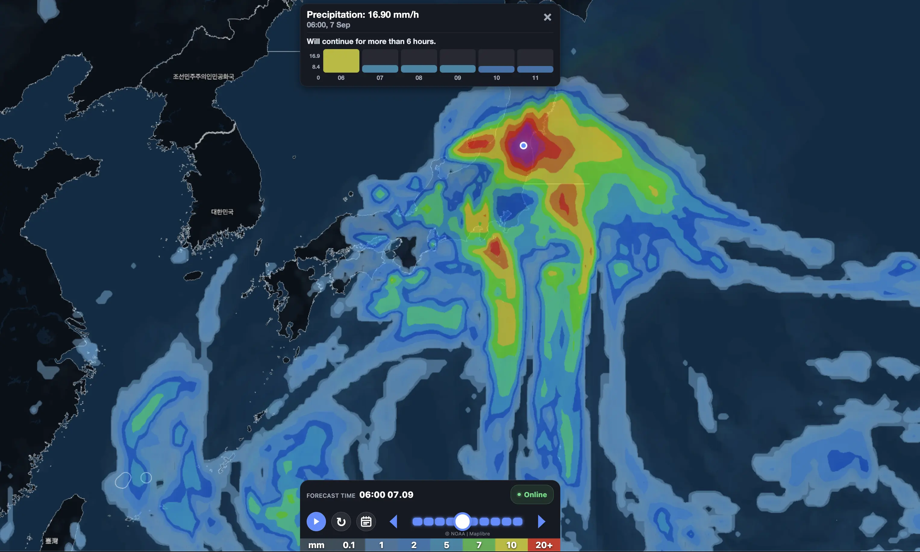
The most realistic danger for Japan is heavy rainfall enhanced by the rainy-season front. Typhoon moisture can flow northward long before the center reaches Japan. That can turn an ordinary rainy-season front into a dangerous rain producer, especially along the Pacific side of Kyushu, Shikoku, Kinki, Tokai and Kanto.
This matters because the public often focuses on whether the typhoon center will make landfall. In Japan, that can be misleading. Landslides, swollen rivers and flash flooding can occur far from the center if warm, moist air repeatedly feeds into the same frontal zone.

Main places to watch
The following list covers the main cities, islands and population centers currently inside or near the risk corridor. The level of impact will depend on the final storm track, but these are the locations that should monitor JMA updates closely.
| Region | Main places to watch | Primary threat |
|---|---|---|
| Sakishima / Yaeyama Islands | Ishigaki, Taketomi, Yonaguni, Miyakojima, Tarama | High waves, strong winds, ferry disruption, heavy rain |
| Okinawa main island and nearby islands | Naha, Okinawa City, Ginowan, Urasoe, Nago, Itoman, Kumejima | Typhoon-force squalls possible if the core approaches, flooding, airport and ferry disruption |
| Amami Islands | Amami, Naze, Tokunoshima, Okinoerabu, Yoron | High surf, heavy rain, landslides, power disruption |
| Southern Kyushu | Kagoshima, Ibusuki, Kanoya, Kirishima, Miyazaki, Nobeoka | Heavy rain, landslides, swollen rivers, coastal waves |
| Northern Kyushu | Fukuoka, Kitakyushu, Kumamoto, Nagasaki, Sasebo, Saga, Oita, Beppu | Rain and wind risk if the track shifts west or crosses Kyushu |
| Shikoku | Kochi, Muroto, Tokushima, Matsuyama, Uwajima, Takamatsu | Heavy rain on Pacific slopes, landslides, river flooding, strong coastal winds |
| Chugoku and Seto Inland Sea | Hiroshima, Okayama, Fukuyama, Kure, Yamaguchi, Shimonoseki, Tottori, Matsue | Rain, transport disruption, localized flooding if the storm bends west |
| Kansai / Kinki | Osaka, Kobe, Kyoto, Nara, Wakayama, Himeji, Otsu | Heavy rain, rail disruption, gusty winds, flooding in low-lying urban areas |
| Tokai | Nagoya, Shizuoka, Hamamatsu, Toyohashi, Tsu, Ise, Owase | High rainfall risk, landslides, coastal waves, possible rail delays |
| Izu Islands | Izu Oshima, Niijima, Kozushima, Miyakejima, Hachijojima | High surf, strong winds, heavy rain, ferry and flight cancellations |
| Kanto | Tokyo, Yokohama, Kawasaki, Chiba, Saitama, Mito, Utsunomiya, Maebashi | Rainfall and flooding risk if the track comes north; transport disruption possible |
| Tohoku Pacific side | Iwaki, Fukushima, Sendai, Ishinomaki, Kamaishi, Miyako, Hachinohe | Offshore wind, high waves and rain risk if the extratropical system tracks close |
| Southern and eastern Hokkaido | Hakodate, Muroran, Tomakomai, Kushiro, Obihiro | Lower confidence; large waves and rain possible if the system recurves farther north |
Three forecast scenarios
| Scenario | Track outcome | Most affected areas | Risk level |
|---|---|---|---|
| Western track | Mekkhala moves closer to Okinawa, Kyushu and the western side of Japan | Okinawa, Amami, Kyushu, Shikoku, Chugoku, Kansai | Higher wind and rain risk for western Japan |
| Central / Pacific-side track | Storm turns northeast south of Kyushu, Shikoku and Honshu | Okinawa, Kyushu Pacific side, Shikoku, Kii Peninsula, Tokai, Izu Islands, Kanto | Highest risk for widespread heavy rain and coastal waves |
| Eastern offshore track | Center stays well offshore and accelerates east of Honshu | Izu Islands, Kanto coast, offshore waters, Tohoku Pacific side | Lower land wind risk, but rain and high surf remain possible |
Why Higos matters even if it is weaker
Higos is not the dominant cyclone in this setup. Mekkhala is much stronger. But Higos matters because it adds uncertainty. Its moisture envelope and track can influence the broader steering pattern south of Japan. If it remains organized longer, it may help pull moisture northward or change how the larger typhoon interacts with the rainy-season front.
This is why the spaghetti map shows a wide spread after the first few days. A small change in the position of Higos or the frontal boundary can shift the heaviest rainfall corridor from Kyushu to Shikoku, from Kii to Tokai, or from Tokai toward Kanto and the Izu Islands.
Main hazards for Japan
| Hazard | Where most likely | What it means |
|---|---|---|
| Heavy rain | Kyushu, Shikoku, Kii Peninsula, Tokai, Kanto, Izu Islands | Flooding, landslides, swollen rivers, dangerous roads |
| Strong winds | Okinawa, Amami, Kyushu, Izu Islands, exposed Pacific coasts | Fallen trees, power outages, roof damage, dangerous travel |
| High waves and storm surge | Ryukyu Islands, Kyushu, Shikoku, Kii Peninsula, Tokai, Izu Islands | Beach closures, ferry cancellations, port disruption, coastal flooding |
| Landslides | Mountain slopes in Kyushu, Shikoku, Kii, Tokai and parts of Kanto | Road closures, isolated communities, evacuation advisories |
| Transport disruption | Okinawa, Kyushu, Kansai, Tokai, Kanto | Flight cancellations, ferry suspensions, Shinkansen delays, highway closures |
| Power outages | Okinawa, Amami, Kyushu, Shikoku, exposed coastal areas | Possible loss of cooling, communications and water pumps |
Travel and transport forecast
Travel disruption is likely to begin first across Okinawa and the Ryukyu Islands, where flights and ferries are highly sensitive to wind and wave conditions. If Mekkhala tracks closer to Kyushu and Shikoku, ferry routes, regional flights and coastal highways may be disrupted from June 26 to June 27.
The most sensitive mainland rail corridors are the Kyushu Shinkansen, Sanyo Shinkansen, Tokaido Shinkansen and local coastal lines in Kyushu, Shikoku, Kii, Tokai and Kanto. Even if winds are not extreme in Tokyo or Osaka, heavy rain can still delay trains and overwhelm drainage in low-lying urban areas.
What residents should do now
- Check JMA warnings several times a day from June 25 through June 28.
- Do not focus only on landfall. Heavy rain may arrive before the center.
- Prepare for flight, ferry and rail disruption, especially in Okinawa, Kyushu and Shikoku.
- Move loose balcony items indoors before strong winds arrive.
- Avoid coastal roads, breakwaters and beaches during high waves.
- Do not cross flooded roads or swollen streams.
- People in landslide-prone areas should know evacuation routes before nighttime rain begins.
- Charge phones, batteries and medical devices before the strongest rain and wind.
Pogodnik app
Before travel across Japan, check rain, wind, waves and local weather changes in the Pogodnik app. Track hourly weather, precipitation, wind, cloud cover and severe-weather changes for your location. Download the Pogodnik Android app: https://play.google.com/store/apps/details?id=com.bitltd.pogodnik
Main takeaway
Japan is not facing a simple single-track typhoon forecast. The real risk is a combined tropical setup: a powerful Mekkhala approaching from the southwest, a weaker but important Higos recurving from the Marianas, and a rainy-season front that can turn tropical moisture into dangerous rainfall.
The first serious impact window is late June 25 into June 26 for the Ryukyu Islands and Okinawa. Kyushu, Shikoku and the Kii Peninsula should watch June 26–27. Kansai, Tokai, the Izu Islands and Kanto should monitor June 27–28, especially for heavy rain and transport disruption. The center may stay offshore, but Japan can still receive a high-impact rain and coastal event.
FAQ: Japan typhoon forecast
Which storm is the biggest threat to Japan?
Typhoon Mekkhala is the stronger system and the main wind, wave and heavy-rain threat. Higos is weaker but can add moisture and increase forecast uncertainty.
When could Japan be hit?
Okinawa and the Ryukyu Islands face the first serious risk from late June 25 into June 26. Kyushu, Shikoku and western Japan should watch June 26–27. Tokai, Kanto and the Izu Islands should monitor June 27–28.
Will the typhoon make landfall in Japan?
A direct landfall is not guaranteed. Many model tracks curve offshore along the Pacific side, but heavy rain, high surf and transport disruption can happen even without landfall.
Which cities should monitor warnings most closely?
Naha, Ishigaki, Miyakojima, Amami, Kagoshima, Miyazaki, Fukuoka, Kumamoto, Kochi, Tokushima, Osaka, Kobe, Kyoto, Wakayama, Nagoya, Shizuoka, Tokyo, Yokohama, Chiba and the Izu Islands should monitor updates closely.
What is the biggest danger?
The biggest danger is heavy rain enhanced by the rainy-season front. Landslides, river flooding and urban flooding may occur before the storm center arrives.
Could Tokyo be affected?
Yes, but the risk depends on the final track. Tokyo’s highest concern is heavy rain and transport disruption if the storm turns north along the Pacific side or if the rainy-season front intensifies over Kanto.
What should travelers do?
Build flexibility into itineraries from June 25 to June 28. Expect possible ferry cancellations, flight delays, rail disruptions and coastal closures, especially in Okinawa, Kyushu, Shikoku, Kansai, Tokai and Kanto.
Sources and methodology
This forecast is based on the user-provided Google DeepMind Weather Lab spaghetti-track image, JMA / METAREA XI tropical cyclone warnings for Mekkhala and Higos, NWS Guam tropical cyclone advisories for Higos, AP reporting on Mekkhala’s projected track from the Philippines toward Japan, Weathernews regional analysis for Okinawa, and model-spread interpretation from Japan, U.S. and European numerical guidance. The article separates track risk, rainfall risk and population-center exposure because Japan can experience serious typhoon impacts even when the center remains offshore.