Severe Frost Warning: Europe Faces Two Arctic Cold Waves in January 2026 (ECMWF)
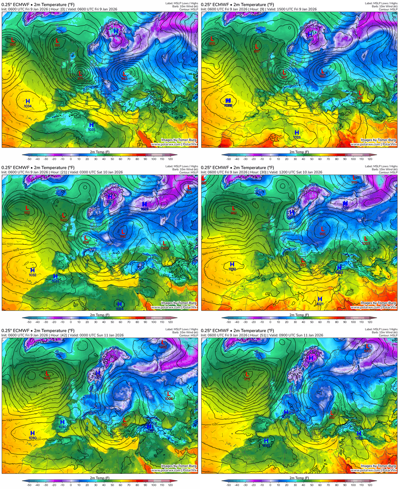
The high-resolution ECMWF model signals two distinct outbreaks of Arctic air across Europe between 9 and 23 January. The first peak arrives 9–12 Jan, the second 19–21 Jan. Minimum temperatures will plunge to −20…−25 °C in parts of Scandinavia, the Baltics, Eastern and Central Europe, with widespread ice risk where daytime thaw is followed by hard overnight refreezing.
At a glance:
Peak #1 (9–12 Jan): Severe frost from Scandinavia and the Baltics into Poland, Czechia, Slovakia, Hungary, Romania and Ukraine; nights −12…−20 °C, locally lower; daytime −6…−10 °C.
Brief lull (13–15 Jan): Slight moderation in W/S Europe; persistent night frost in N/E Europe with black ice.
Peak #2 (19–21 Jan): Renewed deep cold in NE/E Europe; nights −18…−24 °C.
Ease-off (22–23 Jan): Gradual moderation, but slick surfaces linger.
Why it turns so cold in january 2026
A displaced, elongated polar vortex funnels Arctic air from the Barents and Baltic sectors into Central/Eastern Europe. West of the core, Atlantic fronts bring intermittent thaws; clear nights elsewhere allow intense radiative cooling and very low minima, well below climatology.
Who is most exposed : europe weather forecast january 2026
Scandinavia & Finland: Prolonged severe frost; frequent −20 °C or lower. Coastal E6 (NO/DK), E4 (SE) and E75/E18 (FI) face drifting snow and freezing spray inland; rural routes risk ice ruts after brief daytime thaw. Baltic States: Estonia/Latvia/Lithuania endure back-to-back cold spells. Risk corridors include EE: T4/E67; LV: A1/A2/E22; LT: A1 (Vilnius–Klaipėda). Blowing snow and black ice will disrupt intercity buses and regional rail. Poland: After early-January snarls, another freeze targets A2 (Poznań–Łódź–Warsaw), A4 (Wrocław–Katowice–Kraków), S7/S8 and mountain approaches to Zakopane. Expect lane-blocking jackknifes on grades and iced junctions. Germany, Czechia, Slovakia, Austria, Hungary: Eastern Germany and the interior of CZ/SK/HU are primed for hard frost. Watch DE: A4/A9/A13, CZ: D1 (Praha–Brno), SK: D1 (Tatras), AT: A10 Tauern/A12 Inntal. Alpine valleys will add dense hoar frost and avalanche risk post-snow. Romania & Bulgaria, Western Balkans: Frosty plateaus and basins; coastal zones see thaw/refreeze and glaze. RO: DN1 (Bucharest–Brașov) notorious for black ice; BG: A2 “Hemus” and A1 “Trakia” risk freezing drizzle issues. Western Balkans: HR A1, SI A1 and RS A1 exposed on elevated spans. UK, Ireland, Benelux, Northern France: Milder overall, but clear spells bring icy mornings. UK: M62 Pennines, A66 Trans-Pennine, M6 (Cumbria) vulnerable to snow showers and crosswinds; BE/NL: E19/E40 with patchy ice near river crossings; FR north: A1/A6/A10 morning black ice after brief daytime melt. Alpine region, N Italy & Switzerland: Frequent hard frosts in valleys; heavy snow then refreeze on A22 Brennero, A4 Milano–Veneto and CH A2 (Gotthard) increase spin-out and chain-control incidents. Iberia & Greece: Mostly marginal, yet inland Meseta and northern Spain (AP-66, A-1) can see nocturnal freezes and ice after rain; in Greece, passes N of Thessaloniki can glaze.
January outlook 2026 Timeline (9–23 Jan)
9–12 Jan: First Arctic peak
Severe frost spreads from Scandinavia/Baltics to PL–CZ/SK–HU–RO–UA. Night −12…−20 °C (colder in basins), day −4…−10 °C. UK/Benelux/FR experience lighter cold but icy dawns where skies clear.
13–15 Jan: Pause without full relief
Western/Southern Europe lift to −2…+4 °C by day; North/East keep −8…−16 °C at night. Widespread black ice during morning commute after partial thaw.
16–18 Jan: Cold entrenched in the centre/east
Central/Eastern Europe hold nights −10…−16 °C, days −3…−8 °C. South faces “roller-coaster” days near +5 °C and icy nights.
19–21 Jan: Second peak
NE/E Europe re-intensifies to −18…−24 °C at night; day −6…−12 °C. Exposed motorways see drifting and polished ice, particularly on open plateaus and bridges.
22–23 Jan: Gradual easing
More daytime thaw in the west/south (0…+5 °C), but nights remain sub-zero inland. Ice persists on untreated secondaries.
Recent context and knock-on risks
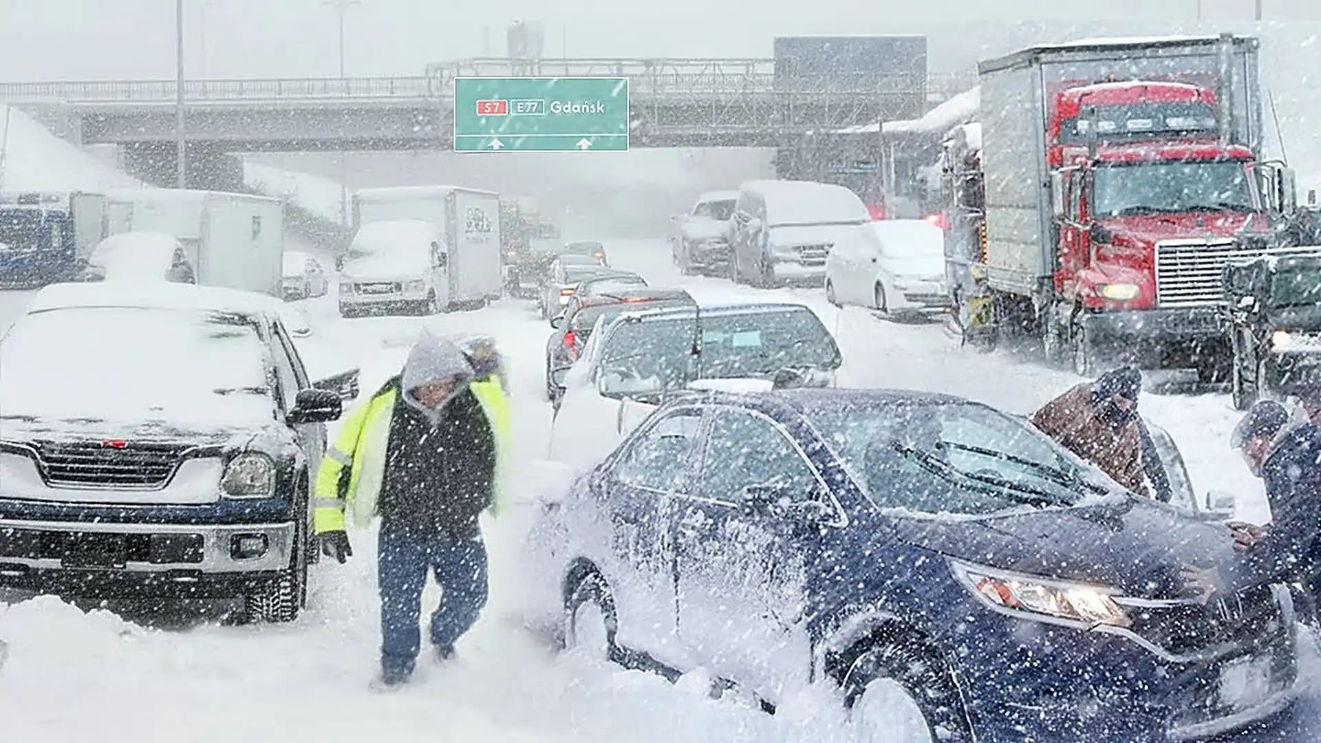
Early-January snow in Poland, the Baltics and parts of Germany already triggered multi-hour traffic standstills and rolling rail delays. With two further cold shots ahead, expect renewed airport de-icing queues, school closures in higher terrain, sporadic power line icing and extended delivery times on trans-European corridors (notably PL A2/A4, DE A4/A9, CZ D1, AT A10/A12, IT A22, CH A2, UK M62/A66).
Travel & safety in january 2026 Europe
Plan around night frosts; the worst ice forms pre-dawn and on shaded stretches, bridges and ramps.
Carry winter kits: blankets, chargers, water, high-visibility gear and traction aids; use winter tyres/chains in Alpine and Carpathian corridors.
Expect speed restrictions and rolling closures on mountain motorways; check operator feeds before departure.
Method & caveats
Outlook based on ECMWF HRES 2-m minimum temperature fields for 9–23 Jan 2026. Local outcomes depend on cloud cover, wind, elevation and proximity to water. For 24–48 h detail, follow national meteorological warnings and transport authority updates.
Europe weather forecast january 2026
Europe faces two impactful cold waves in January. The North and East take the brunt with severe, persistent frost; the West and South ride sharp contrasts that still produce dangerous ice. Expect repeat disruption on iconic cross-continental routes and plan journeys conservatively.
Europe braces for two Arctic blasts in January 2026 — severe frost and transport disruption ahead
ECMWF flags cold peaks on 9–12 and 19–21 Jan with −20…−25 °C in the North and East; black ice and snow to snarl A2/A4 (PL), D1 (CZ/SK), A10/A12 (AT), A22 (IT), A2 (CH), M62/A66 (UK) and more.
The Founder and Chief Meteorologist at Pogodnik.com. With over 15 years of operational experience in synoptic analysis and climate forecasting, he specializes in storm tracking, magnetic storms, and atmospheric dynamics. A recognized expert in Ukraine’s meteorological sector, he maintains strategic collaborations with global agencies, including NOAA and ECMWF, to ensure high-precision data integration. His analytical reviews and scientific contributions are regularly featured in leading media outlets dedicated to weather science and environmental trends.