Hail and Damaging Winds in Europe on June: France, Belgium, Netherlands and Germany at Risk
Severe Storms in Europe on June: Where Hail, Damaging Winds and Heavy Rain May Hit After the Heat
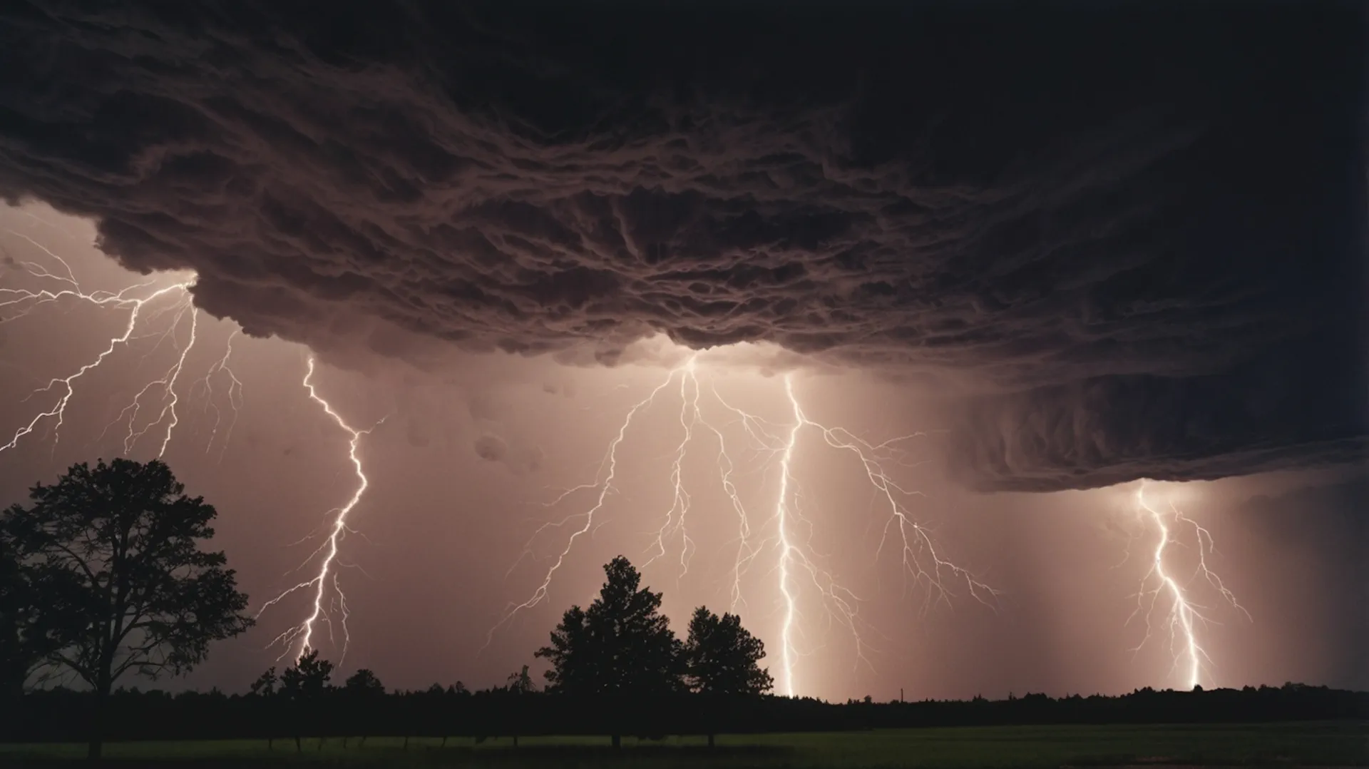
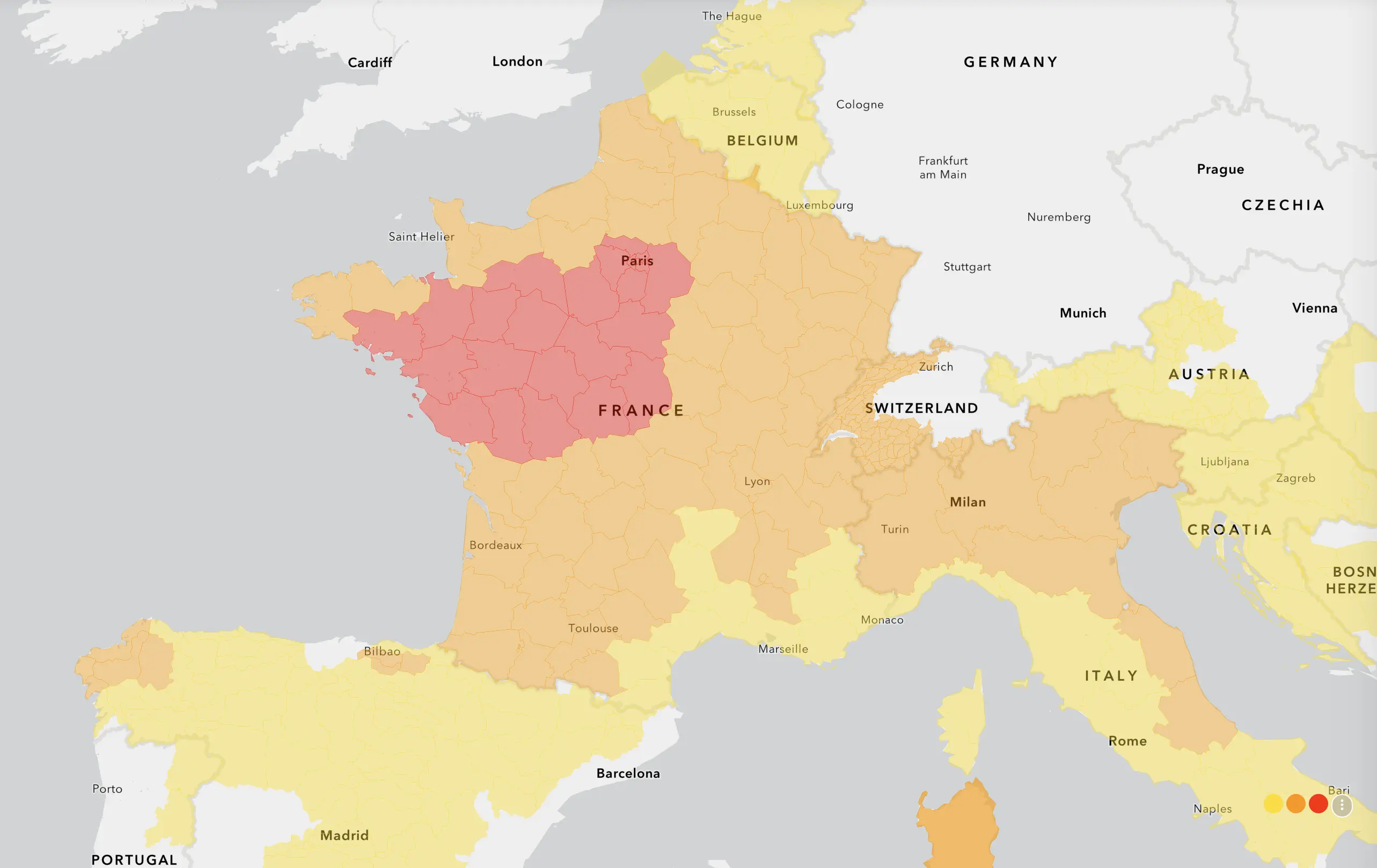
Against the backdrop of Saharan heat over Western Europe, the risk of sharp and locally dangerous thunderstorms is increasing. ESTOFEX has issued a Level 2 risk zone from northeastern France through Belgium and the Netherlands into northwestern Germany. The main threats are damaging wind gusts, large hail, locally very large hail, intense rainfall and short-term flooding.
The severe weather threat is not a continent-wide storm outbreak. It is a focused risk of locally dangerous storm cells and storm clusters where hot, unstable air meets a more humid and slightly cooler boundary. The highest-risk corridor runs from far northeastern France into Belgium, the Netherlands and northwestern Germany, with surrounding Level 1 areas extending into nearby parts of France, Germany and the western Alpine region.
Heat is turning into storm energy. After several days of strong warming, deep moisture and instability are now overlapping across parts of northwestern and central Europe. If storms form and organize, they may quickly produce damaging winds, large hail and heavy downpours over a narrow corridor.
Why severe storms are developing after the heat
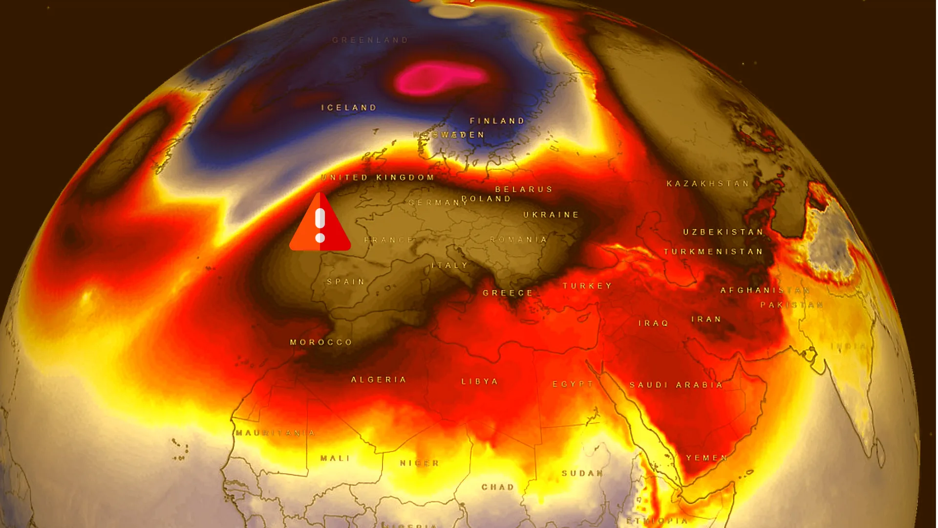
The current setup is the storm-producing side of Europe’s heat episode. A blocking ridge has been extending from northwest Africa toward central Europe, supporting sunshine, strong heating and very warm air near the ground. At the same time, moisture has been feeding into the region from the Atlantic and nearby seas.
When a hot, deeply mixed air mass meets stronger moisture convergence and a subtle upper-level disturbance, thunderstorms can form rapidly. Not every location will be hit, but the strongest cells can become intense. This is why the main concern is local severity: one town may see only heat and clouds, while another nearby area can receive large hail, wind damage and flash flooding.
ESTOFEX Level 2: the main risk zone
Risk area
Main hazards
Timing
Why it matters
Northeastern France
Large hail, damaging gusts, heavy rain
Afternoon and evening
Storm initiation may occur near moisture boundaries and local convergence zones.
Belgium
Damaging gusts, large to very large hail, intense rain
Late afternoon into evening
Storms may organize into clusters and produce swaths of damaging wind.
Netherlands
Damaging gusts, heavy rain, hail
Evening into night
Storm clusters may move north or northeast, creating short-term flooding and wind damage.
Northwestern Germany
Damaging gusts, hail, heavy rain
Evening and night
Storms moving out of Benelux may grow upscale and affect parts of northwestern Germany.
What makes this storm setup dangerous
Several ingredients are overlapping in the Level 2 corridor. Instability is forecast to be strong enough for vigorous updrafts, especially from far northeastern France toward Benelux and northern Germany. Moisture levels are high, and the lower atmosphere is deeply mixed by the heat. That combination can support both large hail aloft and powerful downdrafts near the ground.
Wind shear is not extreme everywhere, but it becomes more supportive toward Benelux and northwestern Germany. This means that some storms may organize into multicell clusters, and a few supercells cannot be ruled out. If cold pools merge, a larger thunderstorm cluster may develop and produce a corridor of damaging winds.
Key threats on June 19
Threat
Where most likely
Possible impact
What to do
Damaging wind gusts
Belgium, Netherlands, northwestern Germany
Broken branches, fallen trees, power interruptions, dangerous conditions for outdoor events
Secure loose objects, avoid parks during storms, stay away from trees and temporary structures.
Large hail
NE France, Belgium, Netherlands, W/NW Germany
Damage to cars, roofs, greenhouses, crops and solar panels
Move vehicles under cover and avoid driving through hail cores.
Very large hail
Most likely in the strongest isolated cells
Serious damage to property and injury risk outdoors
Seek indoor shelter immediately if severe storm warnings are issued.
Do not drive through flooded roads and watch local drainage-sensitive areas.
Frequent lightning
All active thunderstorm areas
Risk for people outdoors, sports events, construction sites and open fields
Move indoors when thunder is heard and avoid open terrain and water.
Large hail: why 2–5 cm stones can be dangerous
Hail between 2 and 5 cm can cause real damage. Stones around 2 cm can dent vehicles and damage crops. Hail near 4–5 cm can break skylights, damage roofs, smash greenhouses and injure people caught outdoors. The most dangerous hail usually falls from the strongest storm cores, where powerful updrafts keep ice suspended long enough for it to grow.
Hail risk is highest when strong instability overlaps with organized updrafts. In this setup, the strongest storms may briefly pulse to severe intensity, and isolated very large hail is possible where cells remain discrete before merging into clusters.
Damaging gusts: the main risk for Belgium, Netherlands and NW Germany
Damaging winds may become the most widespread severe hazard if thunderstorms merge into a larger cluster. The hot and deeply mixed air near the ground supports strong evaporative cooling inside storms. When rain-cooled air rushes downward and spreads outward, severe gusts can hit quickly.
This is especially important for central and eastern Belgium, the Netherlands and northwestern Germany. Even without a classic windstorm, a thunderstorm cluster can produce local corridors of tree damage, power outages and dangerous travel conditions.
Heavy rain and short-term flooding
Storms in this environment can also produce intense rainfall over a short time. The main flood concern is not a widespread all-day rain event, but short bursts of very heavy rain from slow-moving, colliding or clustering storms. Urban areas, underpasses, low roads and small streams can respond quickly.
Drivers should take this seriously. A severe storm may reduce visibility within minutes, cover road markings and flood low sections of roads before official disruption reports appear.
Risk by country
Country
Highest-risk areas
Main hazards
Practical advice
France
Far northeast, especially near the Belgian border
Large hail, damaging gusts, heavy rain
Check Météo-France and Meteoalarm warnings before evening travel.
Belgium
Central and eastern Belgium
Damaging gusts, large hail, intense rain
Avoid outdoor events during active warnings and move cars away from trees.
Netherlands
Southern, central and eastern areas if storms organize northward
Gusts, hail, lightning, heavy rain
Follow KNMI and Meteoalarm updates; watch for rapid changes in the evening.
Germany
Northwest and western-central Germany
Damaging gusts, large hail, local flooding
Follow DWD warnings, especially if storms move in from Belgium or the Netherlands.
Switzerland and southwest Germany
Western Alps, Black Forest and nearby areas
Heavy rain, hail, severe downbursts
Mountain and lake activities should be adjusted quickly if storms develop.
Why storms may be very local
One of the most important details is that severe storms may not cover the entire risk zone. Storm formation depends on where the cap breaks, where local convergence is strongest and where heating remains sufficient after any morning cloud cover. That means the forecast can verify with scattered but intense damage reports rather than widespread storms everywhere.
This is typical for severe thunderstorm days after heat. The atmosphere may hold large storm energy, but only a few corridors may release it. Those corridors can still be dangerous, especially if storms cluster or move repeatedly through the same areas.
What could change during the day
Forecast factor
If it increases
If it decreases
Sunshine and surface heating
Higher storm energy, stronger updrafts, greater hail and wind risk
Storms may remain more isolated or weaker
Moisture convergence
More focused storm initiation from NE France to Benelux
Storms may struggle to form despite heat
Cold pool organization
Higher damaging wind risk as storms merge into a cluster
More isolated hail-producing cells, less widespread wind damage
Storm track
Risk may shift deeper into the Netherlands and NW Germany
Belgium or NE France may remain the main impact zone
Maps and tools to monitor
Because this is a local severe-storm setup, live tools matter. Forecast risk maps show where the atmosphere is most favorable, but radar, satellite and lightning data show where storms are actually forming.
Tool
What it shows
Why it matters
ESTOFEX storm forecast
Severe thunderstorm risk areas for Europe
Shows the main Level 2 corridor and surrounding Level 1 risk.
Meteoalarm
Official national weather warnings across Europe
Shows warnings from national meteorological services in one place.
LightningMaps
Real-time lightning activity
Useful to see where storms are becoming active and moving.
EUMETSAT satellite
Cloud growth and storm-top cooling
Helps track rapidly developing storm clusters.
National radar networks
Rain intensity and storm movement
Best tool for short-term decisions in Germany, Belgium and the Netherlands.
Safety advice for travel and outdoor plans
Check official warnings before driving between France, Belgium, the Netherlands and northwestern Germany.
Do not shelter under trees during thunderstorms.
Move cars away from trees, scaffolding and weak temporary structures before storms arrive.
Pause cycling, hiking, lake activities and outdoor sports when thunder is heard.
Avoid underpasses and low roads during intense rainfall.
Keep phone alerts enabled, especially during evening travel.
Pogodnik app
Before trips and outdoor plans, check thunderstorms, wind and warnings in the Pogodnik app. Track hourly weather, precipitation, wind, cloud cover and local changes before storms arrive. Download the Pogodnik Android app: https://play.google.com/store/apps/details?id=com.bitltd.pogodnik
Main takeaway
Europe’s heat episode is now producing a sharper severe-storm risk along its northern and western edge. ESTOFEX Level 2 highlights the corridor from northeastern France through Belgium and the Netherlands into northwestern Germany, where storm cells may produce damaging gusts, large hail, heavy rain and short-term flooding.
The key message is local danger, not blanket panic. Many places may avoid severe storms, but the cells that do form can become intense quickly. People in the Level 2 corridor should follow official warnings, radar and lightning updates through the afternoon, evening and night.
FAQ: Europe severe storms on June 19
What does ESTOFEX Level 2 mean?
Level 2 means an increased risk of severe thunderstorms within the highlighted area. It does not mean every location will be hit, but it signals that severe weather reports may cluster where storms organize.
Where is the highest storm risk?
The highest risk runs from far northeastern France into Belgium, the Netherlands and far northwestern Germany.
What are the main hazards?
The main hazards are damaging wind gusts, large hail, locally very large hail, intense rainfall, lightning and short-term flooding.
Could Germany see severe storms?
Yes. Northwestern and western-central Germany are in or near the main risk corridor, especially if storm clusters move out of Belgium and the Netherlands.
Is this related to the European heatwave?
Yes. Heat has helped build instability, while moisture and local convergence zones now provide a focus for storm development.
How should people monitor the situation?
Use official national warnings, Meteoalarm, radar, lightning maps and local emergency alerts. The most dangerous storms may develop quickly and affect only a narrow corridor.
The Founder and Chief Meteorologist at Pogodnik.com. With over 15 years of operational experience in synoptic analysis and climate forecasting, he specializes in storm tracking, magnetic storms, and atmospheric dynamics. A recognized expert in Ukraine’s meteorological sector, he maintains strategic collaborations with global agencies, including NOAA and ECMWF, to ensure high-precision data integration. His analytical reviews and scientific contributions are regularly featured in leading media outlets dedicated to weather science and environmental trends.