France Heatwave and Fontainebleau Wildfire: Paris Faces Extreme Heat, Smoke and Bad Air
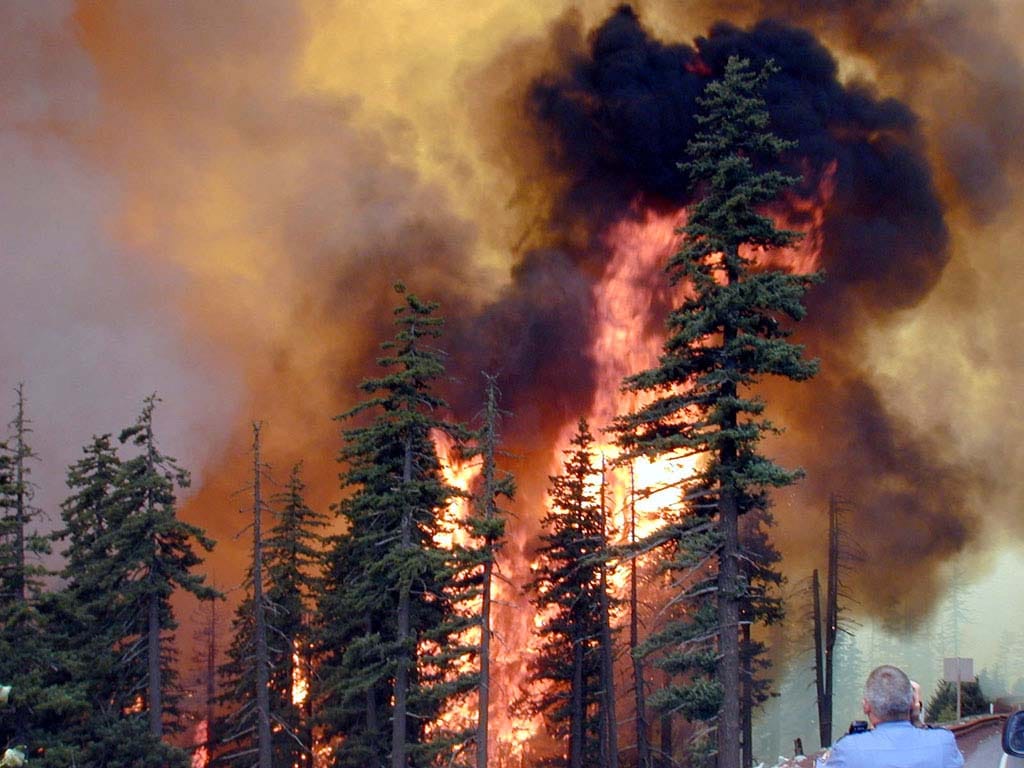
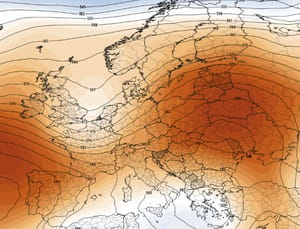
France’s third major heatwave of the summer has moved into a dangerous new phase. Temperatures above 40°C have been recorded in several regions, exceptionally warm nights are preventing homes and bodies from cooling, and dry vegetation has turned forests far beyond the Mediterranean into potential fire zones. The clearest warning came from Fontainebleau, where a major wildfire erupted only about 70 kilometres south of Paris, forcing evacuations and disrupting one of France’s busiest road and rail corridors.
Paris heatwave: the capital is forecast near 35°C on July 14, around 34°C on July 15 and 33°C on July 16. Nights remain unusually warm, including a minimum near 25°C into Wednesday.
Fontainebleau fire: more than 800 hectares burned, more than 400 firefighters were deployed and up to 800 residents were evacuated.
Paris air quality: Airparif expects bad air quality across Île-de-France on July 14, with ozone potentially exceeding the information threshold.
When will Paris cool down: temperatures should begin easing from Thursday, July 16, but genuine relief will be gradual and daytime readings may remain above 30°C.
France heatwave and Paris wildfire in four numbers
35°C Forecast maximum in Paris on July 14
800+ ha Area affected by the Fontainebleau forest fire
26 French departments under red heat vigilance on July 14
32,000 ha Estimated land burned across France so far in 2026
Météo-France heat alert: the dangerous nights are not over
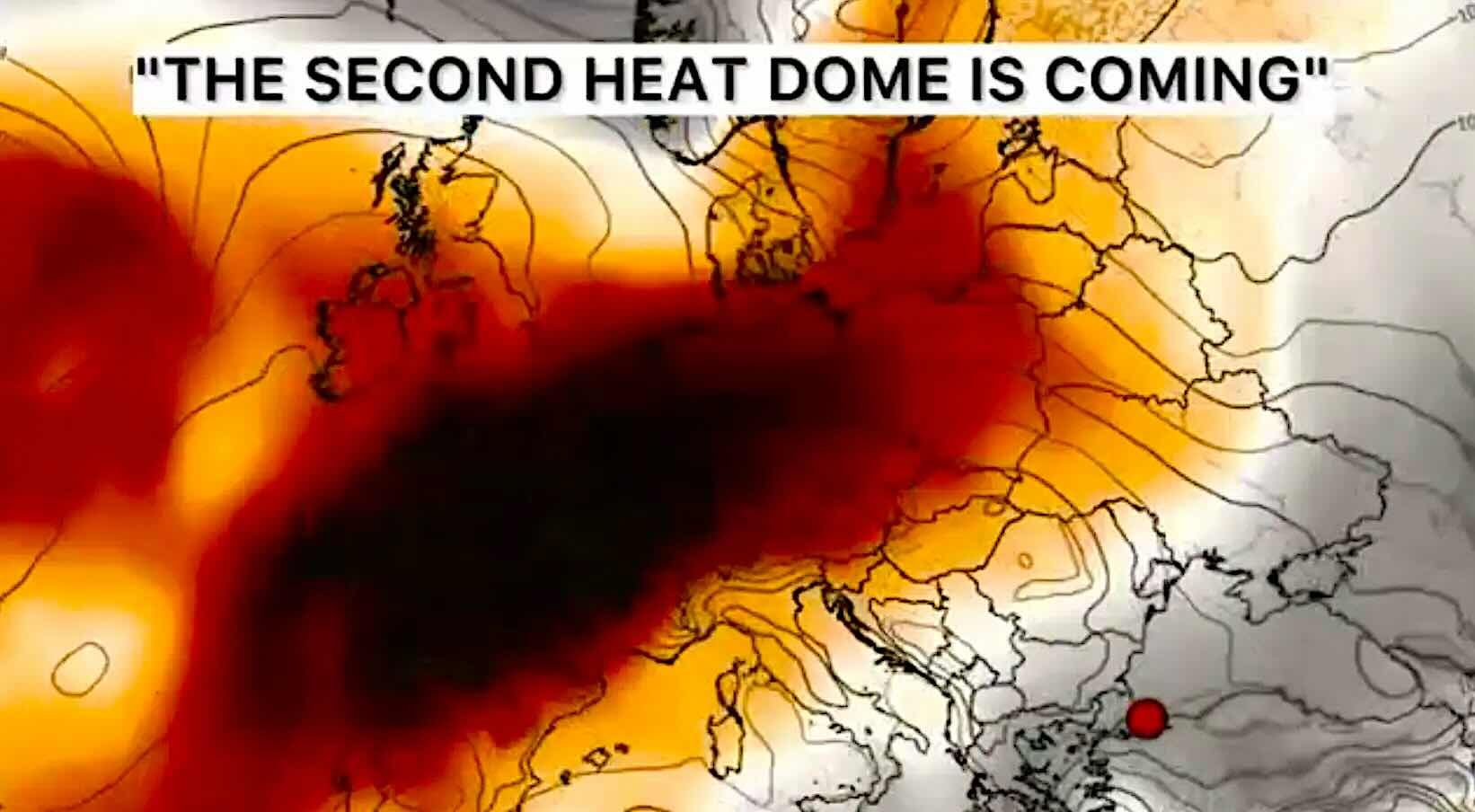
Météo-France placed 26 departments under red heat vigilance for Tuesday, July 14, with another 50 under orange vigilance. The hottest air remains entrenched over much of central, eastern and southern France.
Afternoon temperatures of 36–39°C remain widespread away from the cooler Channel and Atlantic coasts. Local values close to 40°C are possible in the Rhône Valley, Provence and the southwest.
Paris is no longer expected to reach the 40°C readings recorded during the historic June heatwave, but the current episode remains dangerous because it is prolonged. The city is forecast near 35°C on July 14 and around 34°C on July 15.
The Wednesday morning minimum in Paris may remain near 25°C. That is an exceptionally warm night for the capital and provides little recovery for people, homes, public transport and healthcare services.
Paris and Fontainebleau forecast: July 14–18
Date
Paris forecast
Fontainebleau forecast
Main risk
Confidence
Tuesday, July 14
Hot and mostly sunny, around 35°C; night near 22–25°C
High near 36°C, weak winds and high cloud
Severe heat and ozone
High
Wednesday, July 15
High cloud, around 34°C; very warm morning near 25°C
High near 35°C, risk of a late-afternoon thunderstorm
Heat, lightning and gusts
High for heat, moderate for storms
Thursday, July 16
Still hot, around 33°C; night near 22°C
High near 35°C, but morning may fall near 17°C; storm possible
First partial relief
Moderate-high
Friday–Saturday, July 17–18
Gradual decline expected, but temperatures may remain above seasonal averages
Fewer extreme nighttime readings, though fire danger may remain elevated
Slow improvement
Moderate
The key message is that cooling will be gradual rather than dramatic. Thursday may bring a noticeably fresher morning outside central Paris, especially around Fontainebleau, but afternoon heat will remain significant.
Météo-France expects the national downward trend to continue from Thursday through the end of the week. Temperatures will nevertheless remain several degrees above normal in many areas.
Fontainebleau wildfire: the fire that brought the crisis to the Paris region
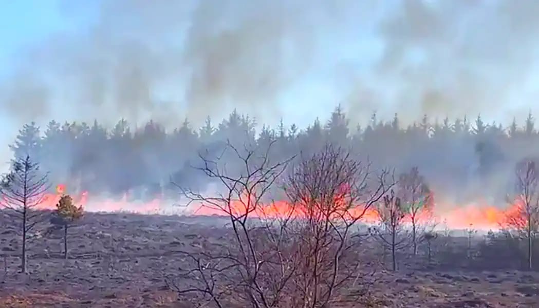
The Fontainebleau forest fire began on Sunday afternoon, July 12, close to the A6 motorway. By Monday morning, flames had travelled across more than 800 hectares of one of France’s most famous historic forests.
More than 400 firefighters worked through the night, supported by helicopters and two Canadair water-bombing aircraft. For the first time in the Greater Paris region, Canadair aircraft collected water directly from the River Seine to attack a major forest fire.
The fire forced the closure of parts of the A6 motorway linking Paris with Lyon and southern France. High-speed rail services to and from Paris Gare de Lyon were also disrupted.
Up to 800 people were evacuated. The most exposed communities included areas around Le Vaudoué, Noisy-sur-École, Milly-la-Forêt and the western edge of the Fontainebleau forest.
By Monday afternoon, authorities said the main blaze was largely contained. That does not mean the danger has disappeared. Hot spots can remain active below the surface, and wind can cause new flare-ups or carry smoke toward neighbouring towns.
Why fires near Paris are no longer unthinkable
The Fontainebleau wildfire was not caused by temperature alone. A fire still requires an ignition source, and authorities are investigating the circumstances surrounding several reported starting points.
Weather determined how quickly the fire could spread. Repeated heatwaves, a lack of significant rainfall, record-dry soils, low afternoon humidity and dry forest litter created highly flammable conditions.
Météo-France says average soil moisture across France had reached a record low for early July by July 9, falling below the already severe levels recorded in 2022 and 2025.
The meteorological fire danger now extends across much of France. This is no longer only a Mediterranean problem affecting Provence, Corsica or Occitanie. Forests in Île-de-France, Centre-Val de Loire, Burgundy and the Atlantic regions can also become dangerous during prolonged heat and drought.
Paris air quality: ozone, wildfire smoke and the pollutants to watch
Heat and wildfire smoke affect air quality in different ways. During the current Paris heatwave, the main official regional concern is ground-level ozone.
Airparif expects air quality to be bad across Île-de-France on July 14. Strong sunshine encourages ozone formation, while weaker winds limit the dispersal of locally produced pollution. Ozone concentrations may exceed the information and recommendation threshold.
Wildfire smoke creates another risk: fine particles. The most useful indicators for smoke are PM2.5 and PM10. Fine PM2.5 particles can travel far from a fire and penetrate deep into the lungs.
A city-wide smoke emergency has not been confirmed for all of Paris. Smoke impacts can be highly local and depend on wind direction. Residents south and southeast of Paris, closer to Fontainebleau, should monitor PM2.5 and visibility especially carefully.
Pollutant
Main source during this event
What it may feel like
Best response
Ozone — O₃
Produced by sunlight acting on traffic and industrial pollutants
Eye or throat irritation, coughing, chest discomfort during exercise
Avoid intense outdoor activity during the afternoon and early evening
PM2.5
Wildfire smoke, combustion and traffic
Smoke smell, hazy sky, respiratory irritation
Reduce exposure, close windows during smoke peaks and use filtered indoor air
PM10
Ash, coarse smoke particles, dust and road pollution
Visible haze, eye and upper-airway irritation
Limit outdoor exposure when levels rise
NO₂
Road traffic and combustion
Respiratory irritation, especially near major roads
Choose routes away from heavy traffic when possible
Check Paris air quality in Weather Forecaster
Weather Forecaster shows air-quality conditions for your location alongside the hourly weather forecast. During a heatwave or wildfire event, check the overall air-quality index and the individual values for PM2.5, PM10, ozone and nitrogen dioxide.
Do not rely only on whether you can smell smoke. Ozone has no obvious smoke smell, and fine particles may remain elevated after visible smoke has moved away.
Check the dominant pollutant. The same overall air-quality category can be caused by ozone, smoke particles or traffic pollution.
Watch PM2.5 when smoke is visible or detectable. A rising PM2.5 value is more useful than the smell alone.
Watch ozone during sunny afternoons. Ozone usually becomes more problematic later in the day rather than early in the morning.
Compare several hours. Choose the cleaner and cooler window for walking, exercise or travel.
Use your exact location. Conditions near Fontainebleau, southern Seine-et-Marne and central Paris may differ significantly.
Check wind direction. A change in wind can move smoke into or away from your neighbourhood within a few hours.
What to do if wildfire smoke reaches your area
Move indoors when smoke becomes visible or irritating. Choose the coolest indoor room that can be kept reasonably clean.
Close windows during the smoke peak. Reopen them when PM2.5 levels fall and the outdoor air becomes cleaner.
Use recirculation in vehicles. Keep windows closed when driving through smoke or ash.
Use a HEPA air cleaner where available. Avoid devices that deliberately generate ozone.
Avoid indoor particle sources. Do not smoke, burn candles or incense, or carry out unnecessary frying when outdoor smoke is already elevated.
Reduce strenuous activity. Exercise increases the amount of polluted air inhaled.
A well-fitted FFP2 mask can reduce particle exposure. It does not protect against ozone or other gases.
Keep prescribed respiratory medication available. Follow the treatment plan provided by your doctor.
How to stay safe during the Paris heatwave
Stay in a cool place during the hottest hours. The most difficult period in Paris is often from mid-afternoon into early evening.
Drink water regularly. Do not wait until you feel thirsty.
Close shutters and curtains during the day. Ventilate when outdoor temperatures are lower, usually overnight or early in the morning.
Cool the body directly. Use cool water on the face, neck, arms and legs.
Avoid alcohol. It increases dehydration and can reduce awareness of heat illness.
Move exercise and errands to the morning. Avoid intense outdoor activity between noon and late afternoon.
Check on older or isolated people. A phone message is not always enough; make sure they have water and access to a cooler place.
Never leave children or animals in a vehicle. Interior temperatures can become fatal within minutes.
Heat exhaustion and heat stroke: when to call for help
Heavy sweating, weakness, dizziness, headache, nausea or muscle cramps may indicate heat exhaustion. Move the person into a cool place, loosen clothing and provide water if they are fully conscious.
Confusion, fainting, seizures, very hot skin or loss of consciousness may indicate heat stroke. This is a medical emergency.
In France, call 15 for urgent medical assistance or 112 for the European emergency number. For a fire emergency, call 18 or 112.
Travel near Fontainebleau: roads, trains and forest access
The A6 and Paris–Lyon rail corridor were disrupted during the fire. Even after the main routes reopen, local restrictions may remain in place for firefighting operations, inspections and the removal of dangerous trees.
Check traffic and railway information before travelling from Paris toward Fontainebleau, Lyon or southern France. Do not enter closed forest roads, footpaths or evacuation zones.
Forest visitors should postpone hikes around Fontainebleau, Milly-la-Forêt, Noisy-sur-École and Le Vaudoué until local authorities confirm that access is safe.
When will Paris cool down?
The first decline begins on Thursday, July 16. Paris is forecast near 33°C rather than 35°C, while Fontainebleau may experience a much fresher morning near 17°C.
This will not be an immediate end to the France heatwave. Daytime temperatures remain well above normal, and weak winds may allow heat and air pollution to linger.
Thunderstorms are possible around Fontainebleau on Wednesday and Thursday. They may produce temporary cooling, but they also bring risks from lightning, gusty winds and new fire starts if rainfall is limited.
A more widespread reduction in temperatures is expected toward Friday and the weekend as the hottest air retreats farther east. Forecast confidence decreases beyond three to four days, and the dry ground will keep wildfire danger elevated even after temperatures begin falling.
What happens if the heat lasts longer?
If the ridge of high pressure remains stronger than forecast, Paris and central France could continue to experience afternoon temperatures above 32–34°C into the weekend.
The greatest worsening would come from another sequence of tropical nights. Buildings would retain more heat, electricity demand would increase and ozone concentrations could remain elevated.
Continued heat without meaningful rain would also dry vegetation further. Even where the Fontainebleau fire is contained, the risk of a new wildfire would remain high across Île-de-France and neighbouring regions.
Stronger thunderstorms would bring another type of danger: dry lightning, damaging wind gusts, fallen branches and rapid local flooding.
Main forecast conclusion
The Paris heatwave and Fontainebleau wildfire are part of the same compound weather emergency. The fire required an ignition source, but repeated heat, exceptionally dry soil and low humidity created the conditions for rapid spread.
Paris remains dangerously hot through Wednesday. Thursday brings the first sign of relief, especially at night outside the dense urban centre, but afternoon heat will continue.
Air pollution deserves the same attention as temperature. Airparif expects bad air quality across Île-de-France on July 14 because ozone will build under hot, sunny and weak-wind conditions. Wildfire smoke may add local PM2.5 pollution depending on wind direction.
Check the heat alert, fire map, wind and individual air pollutants before outdoor activity. During this event, the safest hour can vary significantly between central Paris, southern suburbs and the Fontainebleau area.
FAQ: France heatwave, Paris air quality and Fontainebleau fire
How hot will Paris be?
Météo-France forecasts around 35°C on July 14, 34°C on July 15 and 33°C on July 16. Nights will remain unusually warm.
Is Paris under a red heat alert?
Greater Paris has been included in the highest heat-alert zone during the current episode. Alert levels should be checked daily because the map can change as the hottest air shifts east.
Where is the wildfire near Paris?
The fire affected the Fontainebleau forest area about 70 kilometres south of Paris, close to the A6 motorway and communities including Le Vaudoué and Noisy-sur-École.
Is the Fontainebleau wildfire contained?
Authorities said the main blaze was largely contained by Monday afternoon, but firefighters continued monitoring hot spots and the effect of wind.
Is wildfire smoke affecting Paris air quality?
Smoke impacts depend on wind direction and may be local. Airparif’s confirmed regional concern for July 14 is bad air quality caused mainly by high ozone. PM2.5 should be monitored for changing smoke conditions.
When will Paris cool down?
Temperatures should begin falling gradually from Thursday, July 16. Paris may still reach around 33°C, so the first improvement will be partial rather than a complete end to the heatwave.
Which air pollutant should I watch during a wildfire?
PM2.5 is the most important indicator for fine wildfire smoke. During sunny heatwaves, ozone should also be monitored because it may rise even without visible smoke.
Can an FFP2 mask protect against wildfire smoke?
A properly fitted FFP2 mask can reduce exposure to fine particles, but it does not remove ozone or gaseous pollutants.
Weather alerts, fire perimeters, road closures and air-quality readings can change rapidly. Check the latest official bulletins before travelling or entering a forest area.
The Founder and Chief Meteorologist at Pogodnik.com. With over 15 years of operational experience in synoptic analysis and climate forecasting, he specializes in storm tracking, magnetic storms, and atmospheric dynamics. A recognized expert in Ukraine’s meteorological sector, he maintains strategic collaborations with global agencies, including NOAA and ECMWF, to ensure high-precision data integration. His analytical reviews and scientific contributions are regularly featured in leading media outlets dedicated to weather science and environmental trends.