🌨 Synoptic Analysis · March 2026
False Spring Ends: Arctic Blast to Engulf Western and Central Europe — Frost, Snow, and Anomalies up to -11°C
After weeks of unseasonable warmth, a Greenland block has disrupted the Atlantic flow, allowing a Siberian cold core to sweep across Europe. We are facing the sharpest temperature reversal in years. Let’s break down the maps, mechanisms, and the forecast through early April.

Map 1. Windy.com, Friday March 27, 2026, 05:00 UTC. Surface temperatures: Paris +1°C, Reims -1°C, Cologne 0°C, Frankfurt 0°C, Munich -2°C, Innsbruck -6°C, Vaduz -5°C, Bern -2°C. The purple core over the Alps indicates seasonal lows. The blue zone covers France, Germany, Benelux, and Switzerland.
What Happened to the Weather? How “False Spring” Turned into an Arctic Blast
As recently as mid-March 2026, meteorologists recorded anomalously warm weather across Western Europe — temperatures 5–8°C above the climate norm, with gardens in bloom and outdoor cafes packed. This was a false spring — a meteorological phenomenon well-known in folk calendars, but unexpected in its 2026 scale.
Now, nature is striking back. The Arctic blast in Europe — one of the most significant in recent years — has already begun. By the evening of March 24, the first cold air masses will reach the British Isles and NW France. The peak of the cold spell will occur on March 27–28, with temperature anomalies in several regions reaching 7 to 11°C below normal.
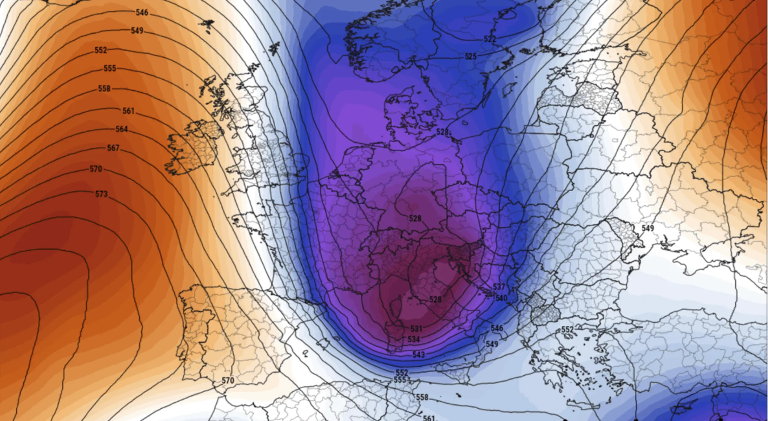
Map 2. Geopotential 500 hPa (~5500 m altitude). The blue-purple zone indicates abnormally low values of 522–528 dam over the UK, France, Germany, and the Alps (March norm is ~560 dam). To the left, a warm Atlantic ridge (573 dam) creates a Greenland block, cutting Europe off from mild maritime air. Europe is trapped in a “cold pocket.”
Greenland Block and Upper Trough: The Synoptic Engine
The 500 hPa map reveals the main culprit: the Greenland block. This powerful anticyclonic ridge over the North Atlantic and Greenland (570–573 dam) has effectively closed the door on the warm, moist Atlantic air that usually buffers Europe.
When the Atlantic flow is blocked, the atmosphere seeks an alternative path. Consequently, a deep upper-level trough has formed over Western and Central Europe — a meridionally oriented dip in the polar jet stream. The geopotential at its core (522–528 dam) is more typical for mid-January than late March.
Forecasted Temperatures for March 27, 2026 (05:00 UTC) — Windy.com Data
| City / Region | Country | Temperature | Anomaly from Norm |
|---|---|---|---|
| Innsbruck | 🇦🇹 Austria | -6°C | -12°C |
| Vaduz | 🇱🇮 Liechtenstein | -5°C | -11°C |
| Munich | 🇩🇪 Germany | -2°C | -9°C |
| Bern | 🇨🇭 Switzerland | -2°C | -9°C |
| Reims | 🇫🇷 France | -1°C | -8°C |
| Paris | 🇫🇷 France | +1°C | -7°C |
| Cologne | 🇩🇪 Germany | 0°C | -7°C |
| London | 🇬🇧 UK | +3°C | -5°C |
The Polar Vortex Split and La Niña: An “Ideal Storm”
1. Sudden Stratospheric Warming (SSW)
In February-March 2026, the stratosphere saw a temperature spike of 30–40°C over the North Pole, disrupting the stratospheric polar vortex. The cold air trapped at the pole began “leaking” into the troposphere.
2. Polar Vortex Split
The vortex split into two fragments — the most destructive type of collapse. This led to a weakened polar jet and a “wavy” circulation, allowing Arctic air to penetrate mid-latitudes easily.
3. The La Niña Influence
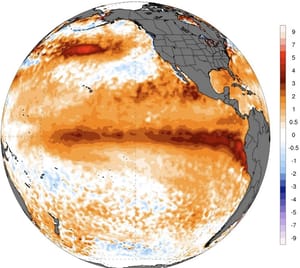
Active since Autumn 2025, La Niña systematically weakens the Azores High, increasing the likelihood of winter-like intrusions into Europe well into April.
Timeline: What to Expect and When
🔬 Synoptic Verdict
The late March 2026 Arctic blast is a textbook result of stratospheric events: SSW → Vortex Split → Greenland Block → Deep European Trough. Surface temperatures on March 27–28 will be typically mid-winter. Expect snow, frost, and winter conditions across Western and Central Europe through the start of April.
The “False Spring” is over. Winter is back — if only for a while.
Frequently Asked Questions
A Greenland block is a high-pressure system over Greenland that prevents warm Atlantic air from reaching Europe, forcing Arctic air southward instead.