World Weather Disasters: Tropical Storms, Tornadoes, Flash Floods, Heat and Wildfire Risk Hit Multiple Regions
The last several days have brought a sharp burst of high-impact weather across the world: tropical storms threatening Mexico and Central America, tornadoes and flooding in the United States, a damaging tornado in southern China, deadly storm damage in New York City, expanding heat advisories across the central U.S., and critical wildfire conditions across the western states. This is not one isolated disaster. It is a global pattern of warm-season hazards arriving together: too much rain in one region, too much heat in another, and violent storms where humid air, wind shear and unstable atmosphere collide.
The most important weather disaster stories now are Tropical Storm Cristina near Central America, Tropical Storm Boris near southern Mexico, a major severe-storm setup over the U.S. Northern Plains, EF2 tornado damage and flooding in Kansas, deadly storm impacts in New York City, a tornado in Guangxi, China, dangerous heat from the Plains to the Ohio Valley, and critical fire-weather conditions across the western United States. These are the stories most likely to keep drawing Google Discover traffic because they combine active warnings, human impact, video-friendly damage, travel disruption, flood risk and clear public-safety relevance.
Why these weather disasters matter now
The global weather map is entering a classic early-summer danger zone. In the eastern Pacific, the first named systems of the season are already producing flood and mudslide threats near steep terrain. In the United States, the same week is bringing a collision of hazards: tornado risk in the Northern Plains, flash flooding in Kansas, extreme heat in the central states, and dry thunderstorms that could ignite new wildfires in the West. In Asia, a tornado damaged a logistics warehouse in Guangxi, China, showing again that violent rotating storms are not only a U.S. problem.
For readers, this matters because the most dangerous weather events are often not the biggest storms on satellite. A slow tropical storm near mountains can become a flood disaster. A short-lived tornado can destroy a warehouse roof. A fast-moving summer storm can kill with falling trees. A heat dome can become dangerous before people are acclimated. A dry thunderstorm can start a fire even when little rain reaches the ground.
The strongest global weather stories to watch
Rank
Event
Region
Main hazard
Traffic potential
1
Tropical Storm Cristina
Nicaragua, Honduras, El Salvador, Guatemala
Heavy rain, flooding, mudslides
Very high: active tropical storm, multi-country flood risk, mountain terrain.
Tropical Storm Cristina: Central America faces flood and mudslide danger
Tropical Storm Cristina is the most urgent tropical weather story on the map. The storm remained near the Pacific coast of Central America on June 9 with maximum sustained winds near 75 km/h, but the headline is not wind. The main threat is rainfall. Forecasters warned that heavy rain could produce flooding and mudslides across Nicaragua, Honduras, El Salvador and Guatemala during the next several days.
The storm was nearly stationary or moving very slowly near the coast, which is one of the worst possible patterns for flood risk. A slow tropical system can keep feeding moisture into the same region for many hours. In Central America, that rainfall does not need to be record-breaking everywhere to become dangerous. Mountain slopes, volcanic terrain, narrow valleys and urban drainage problems can turn 100–200 mm of rain into flash flooding, landslides and road closures. Isolated totals near 300 mm would be enough to create life-threatening conditions in vulnerable zones.
Cristina is a rain-first threat. The danger is not limited to the storm center. Communities far from the exact track can still face flooding, mudslides, washed-out roads and dangerous river rises if rain bands repeatedly move over the same terrain.
Tropical Storm Boris formed just offshore of Guerrero, Mexico, on June 8 and quickly became a serious short-term hazard for the southern coast. Tropical storm warnings were issued along parts of the coastline, but again the most dangerous impact is rainfall. The storm was forecast to reach the Guerrero coast and weaken over land, but tropical moisture interacting with mountainous terrain can produce flash flooding and mudslides even as the wind core weakens.
The Boris setup is dangerous because the storm formed close to shore. That leaves little time for preparation and makes the rain threat more immediate. Mountainous parts of Guerrero and nearby southern Mexico can respond quickly to intense tropical rainfall. Valleys, drainage basins and steep roads are especially vulnerable, and even a weakening tropical storm can leave a damaging flood footprint.
For Google Discover, Boris has strong traffic potential because the story has several powerful signals: named storm, Mexico landfall risk, flooding rains, mudslides, warnings, and a short timeline. Those elements usually perform better than a generic tropical update because they answer the public question directly: who is at risk and what happens next?
United States: Northern Plains face tornadoes, very large hail and damaging winds
The next major U.S. severe-weather story is the Northern Plains setup. The Storm Prediction Center placed parts of the region under an Enhanced Risk for June 9, with storms capable of very large hail, damaging winds and tornadoes. The core zone extends from eastern North Dakota and northeastern South Dakota into northwestern Minnesota.
The atmospheric setup is classic severe-storm material: a strengthening low-pressure system moving out of the northern Rockies, a warm front lifting northward, increasing low-level moisture, steep mid-level lapse rates and strengthening wind fields. When these ingredients overlap, storms can organize quickly and produce violent local impacts. The most dangerous scenario would be discrete supercells forming before storms merge into larger clusters, because that is when tornado and very large hail risk is usually highest.
This is a high-value story for U.S. readers because it is both forecast-driven and practical. People in the risk area need to know that this is not just routine thunderstorm weather. Very large hail can destroy roofs, vehicles and crops. Tornadoes can develop rapidly. Damaging wind swaths can knock out power over wide areas.
Kansas EF2 tornado and flooding: one storm system, two kinds of disaster
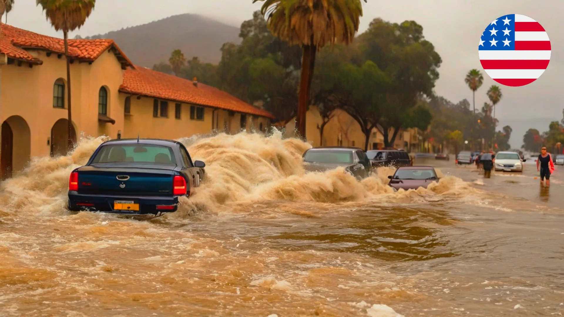
The Riley, Kansas event shows why severe weather cannot be judged by one hazard alone. An EF2 tornado damaged structures near Riley on June 4, while the same storm system caused flooding across northeast Kansas, prompting a state disaster emergency declaration and multiple water rescues. That combination — tornado damage plus flood rescues — makes the event one of the strongest weather-disaster stories of the last several days.
The tornado was on the ground for about 10 minutes, with the strongest damage estimated around EF2 intensity. At least five structures were damaged. But the flood side of the storm was equally important: roads were closed by high water and debris, and vehicles were swept into fast-moving floodwaters in Jackson County.
The editorial lesson is clear: when severe storms train over the same region, the final disaster may not be the tornado alone. Flooding can continue after the wind has passed. Roads may become impassable. Low-water crossings can turn deadly. For readers, this is a strong reminder that “turn around, don’t drown” is not just a slogan — it is the difference between a close call and a rescue.
Deadly storms in New York City: urban trees become a hidden hazard
New York City’s storm story is different from the tropical and tornado headlines, but it has strong public-interest value. An elderly man was killed when a falling tree struck him during severe storms on June 6. The city received hundreds of fallen-tree reports, roads were disrupted, and thousands of customers lost power through the weekend.
Fast-moving summer storms can be especially dangerous in big cities because people often underestimate them. The sky darkens, a gust front arrives, and within minutes large branches or entire trees can fail. In dense urban areas, that risk is concentrated around parks, sidewalks, roads, parked cars and power lines. The NYC case is a reminder that a storm does not need a tornado label to be deadly.
For weather coverage, this story works because it is human, urban and practical. It connects severe storms to daily life: walking through a park, driving under trees, commuting during a cold front, or assuming that a short storm cannot be dangerous.
Guangxi tornado: violent rotating storms are not only an American story
A tornado struck Xingning District in Nanning, Guangxi, China, on June 7, damaging a logistics warehouse, tearing away sections of roof, lifting metal sheets into the air and causing power outages. Four people were injured. Video from the area showed the kind of dramatic roof damage that often drives strong reader interest, especially when tornadoes occur outside the usual U.S. tornado news cycle.
The event developed as severe storms moved across parts of Nanning, bringing heavy rain and damaging winds. The roof damage also caused electrical disruptions when debris was carried into power infrastructure. That cascading effect — tornado, roof failure, power lines, outage, cleanup — is exactly why short-lived severe storms can become a local disaster.
For a global audience, the Guangxi event matters because tornado reporting is improving outside North America. More videos, local emergency reports and social media evidence are making these events more visible. The atmosphere does not care about borders; when instability, moisture and wind shear align, tornadoes can occur in many parts of the world.
Central U.S. heat: the first dangerous heat dome of the season expands
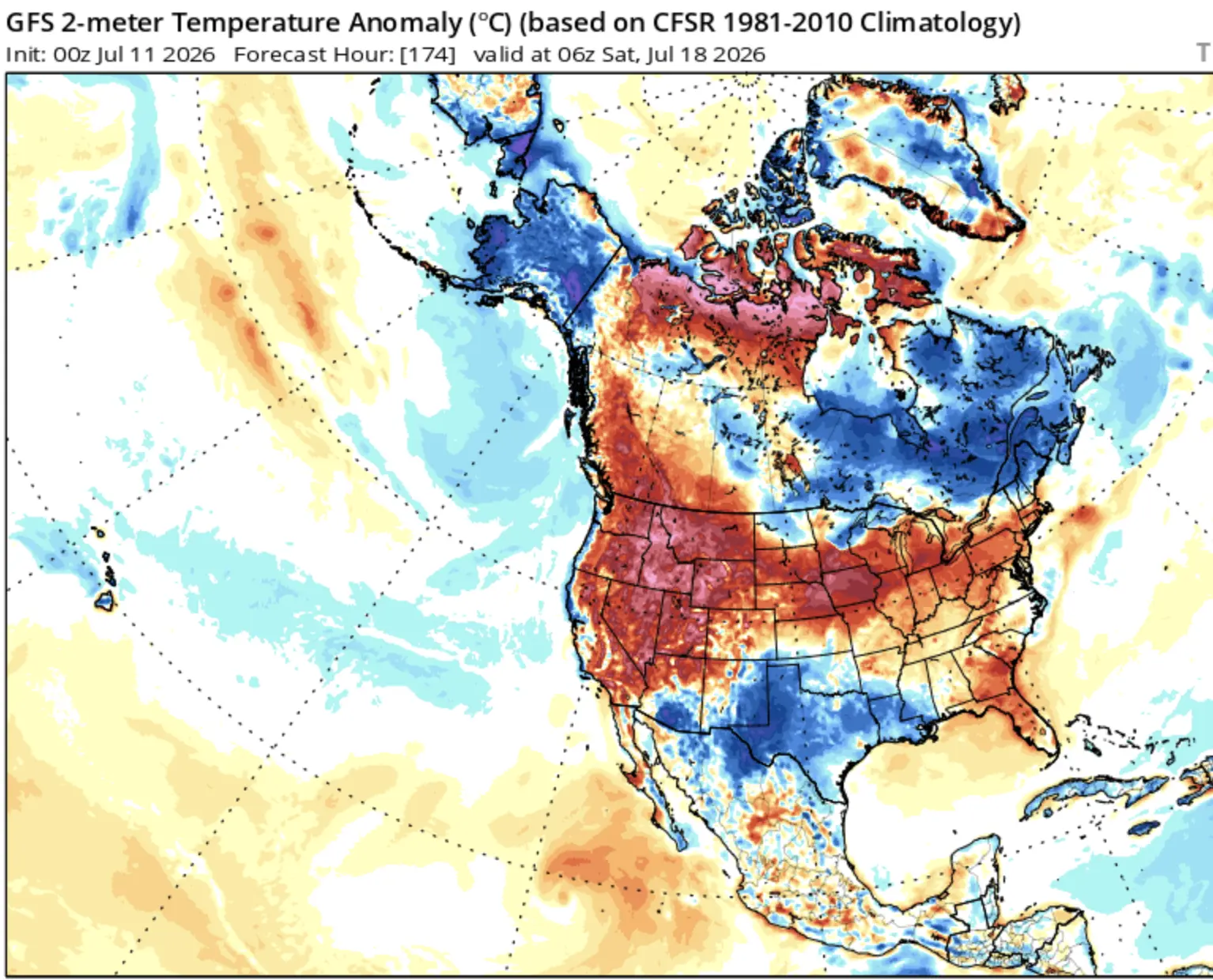
Heat is the quiet disaster in this roundup. A strengthening heat dome is forecast to spread dangerous heat from the Plains toward the Ohio Valley and parts of the eastern United States. Heat Advisories were issued across portions of Kansas, Oklahoma, Arkansas, Missouri, Illinois and Texas, with heat index values forecast near 40–42°C, or 104–108°F.
This event is especially important because early-season heat can hit harder than similar temperatures later in summer. Many people are not yet acclimated, schools and workplaces may not be fully prepared, and vulnerable people may delay using cooling because it still feels “too early” for dangerous summer heat. The risk is highest for older adults, young children, outdoor workers, people with chronic health conditions and those without reliable air conditioning.
The story also has long-tail SEO value because readers search for heat index, HeatRisk, heat dome, symptoms of heat exhaustion, heat advisories by state and how long the hot weather will last. The key is to frame it as a health and safety event, not just a temperature map.
Western U.S. wildfire weather: dry thunderstorms could start new fires
Critical fire-weather conditions are developing across the Southwest, Great Basin and central Rockies. The setup includes strong southwest winds, humidity near 5–15%, dry fuels and isolated dry thunderstorms. That is a dangerous combination because lightning can start fires while little rain reaches the ground.
The Watchers reported that the Day 1 Critical fire-weather area covered more than 382 000 km² and included around 2.8 million people. The Day 2 Critical area remained large as well, with parts of the Southwest and Great Basin still under concern. Winds of 30–50 km/h, stronger gusts, single-digit or low-teen humidity values and poor overnight recovery can allow fires to spread rapidly once they start.
Dry thunderstorms are one of the most important wildfire triggers in the western U.S. A storm can look like rain on radar, but if the lower atmosphere is very dry, much of the rain evaporates before reaching the ground. Lightning still reaches the surface. Gusty outflow winds can then push new fires quickly through dry grass, brush or forest fuels.
RSOE EDIS signals: storm reports remain active worldwide
RSOE EDIS event monitoring adds another layer to the picture. Its event list shows active categories for storms, severe weather, floods and outdoor fires, including numerous storm entries in the United States during the June 8 period, a severe-weather event in Indonesia, flood listings, and many outdoor fire entries across multiple regions. The EDIS feed is useful not because every event becomes a global headline, but because it shows the density of hazard signals behind the larger stories.
For editorial selection, the strongest stories are the ones where Watchers reports detailed impacts and RSOE confirms that the broader hazard category is active: storms, floods, severe weather and fires. That is why the final selection favors tropical rainfall threats, tornadoes, flood rescues, heat advisories and wildfire weather rather than weaker one-line events with little human impact.
What readers should watch next
Next signal
Why it matters
Most exposed areas
Cristina rainfall totals
Heavy rain over mountains can quickly trigger deadly mudslides.
Nicaragua, Honduras, El Salvador, Guatemala.
Boris inland rainfall
Weakening storms can still produce damaging floods after landfall.
Guerrero and southern Mexico.
Northern Plains storm reports
Enhanced Risk days can produce tornadoes, very large hail and wind damage.
North Dakota, South Dakota, Minnesota.
U.S. heat advisories
HeatRisk may expand eastward and affect more population centers.
Plains, Mississippi Valley, Ohio Valley, East Coast later.
Red Flag Warnings
Dry lightning plus wind can create rapid fire starts.
New Mexico, Arizona, Nevada, Utah, Colorado, western U.S.
Urban storm damage
Tree failures and outages can become deadly even without tornadoes.
Large cities under fast-moving severe storms.
How to stay safer during this active weather period
Hazard
Smart action
Why it helps
Tropical rainfall
Avoid mountain roads, river crossings and landslide-prone slopes during heavy rain.
Flooding and mudslides can occur away from the storm center.
Tornadoes
Move to a basement or small interior room on the lowest floor when warnings are issued.
Flying debris is the main killer in tornadoes.
Large hail
Protect vehicles, roofs, crops and animals before storms arrive.
Very large hail can cause serious property and agricultural damage.
Urban windstorms
Stay away from trees, parks, scaffolding and power lines during strong gusts.
Falling trees and branches can be deadly.
Extreme heat
Limit outdoor activity, hydrate, use cooling spaces and check on vulnerable people.
Heat illness can develop before people recognize the danger.
Wildfire weather
Avoid outdoor burning and anything that can spark in dry grass or brush.
Fires can spread rapidly under low humidity and gusty winds.
If you are traveling, working outdoors, watching tropical weather, planning a route through storm-prone areas or checking heat risk for vulnerable relatives, use official emergency alerts together with a local weather forecast. The strongest disaster signal is always the one that reaches your road, your neighborhood or your home.
FAQ: global weather disasters this week
What is the biggest global weather disaster threat right now?
The most urgent threat is heavy rainfall from Tropical Storm Cristina near Central America, because flooding and mudslides can develop quickly in mountainous terrain across Nicaragua, Honduras, El Salvador and Guatemala.
Is Tropical Storm Boris still dangerous after landfall?
Yes. Even if Boris weakens over land, tropical moisture can continue producing flash flooding and mudslides in southern Mexico, especially in steep terrain and drainage basins.
Where is the main tornado risk in the United States?
The strongest short-term forecast signal is in the Northern Plains, especially eastern North Dakota, northeastern South Dakota and northwestern Minnesota, where very large hail, damaging winds and tornadoes are possible.
Why is the Kansas event important?
It combined a confirmed EF2 tornado with significant flooding, road closures, a state disaster emergency declaration and water rescues. That makes it a clear example of multi-hazard severe weather.
Why is the central U.S. heat wave dangerous?
Heat index values near 104–108°F can cause heat-related illness, especially before people are acclimated to summer heat. Older adults, children, outdoor workers and people without reliable cooling are most at risk.
What makes dry thunderstorms dangerous?
Dry thunderstorms can produce lightning with little rainfall reaching the ground. That can ignite fires in dry fuels, while gusty winds help new fires spread quickly.
The Founder and Chief Meteorologist at Pogodnik.com. With over 15 years of operational experience in synoptic analysis and climate forecasting, he specializes in storm tracking, magnetic storms, and atmospheric dynamics. A recognized expert in Ukraine’s meteorological sector, he maintains strategic collaborations with global agencies, including NOAA and ECMWF, to ensure high-precision data integration. His analytical reviews and scientific contributions are regularly featured in leading media outlets dedicated to weather science and environmental trends.