
New Cold Wave Forecast for Europe: Arctic Air Surge Raises Risk of Severe Frost and Flight Cancellations
Meteorological forecast models indicate a renewed surge of Arctic air into Europe in late January 2026, driven by a possible polar vortex split. The pattern could trigger another cold wave with heavy snow, widespread frost and major flight disruptions at key European airports.
Rising risk of cold anomalies as the polar vortex weakens
According to the latest forecast model guidance, a sudden stratospheric warming (SSW) event is developing over the Arctic, weakening the polar vortex and increasing the likelihood of a split around January 25, 2026. Such a disruption often allows Arctic air masses to spill southward into the mid-latitudes of the Northern Hemisphere, affecting both North America and Europe during late January and early February.
The polar vortex is a large-scale circulation of extremely cold air surrounding the Arctic. When it remains strong and stable, the cold stays confined to high latitudes. When it weakens or splits, Arctic air can escape southward, producing prolonged periods of severe cold, snowstorms and widespread winter impacts.
Synoptic background and mechanisms behind the cold outbreak
The current atmospheric setup reflects a combination of a moderate but impactful sudden stratospheric warming event and persistent atmospheric blocking. As the polar vortex weakens, the jet stream becomes more amplified and meandering, steering Arctic air masses south and southeast across Europe. This mechanism is typical of major cold outbreaks, when intense frost and snow spread across large parts of the continent.
An additional factor is the persistence of very cold air over the Arctic basin and strong high-pressure systems near Greenland. These features help trap cold air near the pole while simultaneously forcing it southward into continental Europe. Together, these processes create favourable conditions for a large-scale cold surge late in January.

Expected impacts across Europe
If the polar vortex split scenario materialises, Europe could face several significant consequences.
1. A renewed wave of extreme frost. Model analysis suggests that after January 25, a stronger inflow of Arctic air may develop, driving temperatures well below seasonal averages across northern and eastern Europe. ECMWF guidance and earlier forecasts have already pointed to a second Arctic cold wave in January 2026, with nighttime lows locally dropping to −20…−25°C.
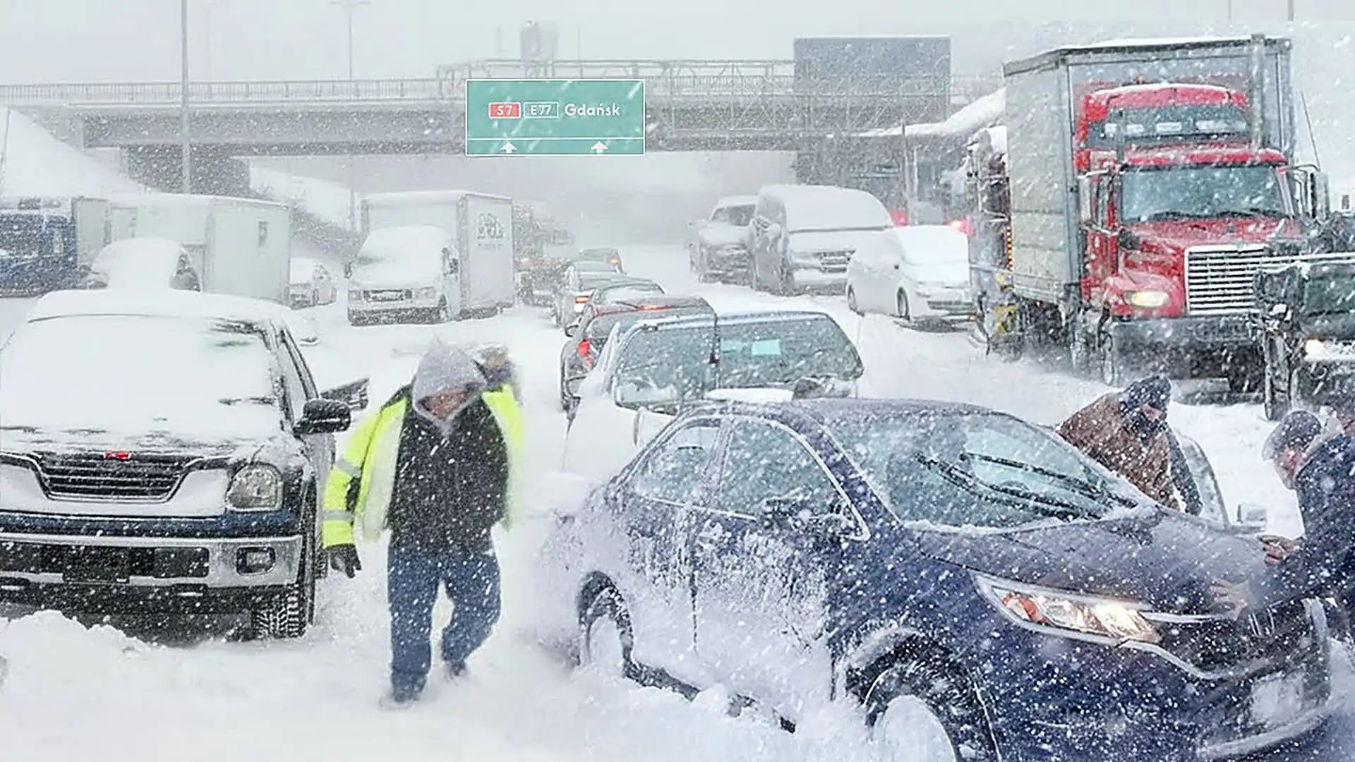
2. Increased snowfall and blizzard risk. As cold air interacts with moist Atlantic and Mediterranean systems, widespread snowfall and blizzard conditions may develop. Northern, Central and Eastern Europe are particularly vulnerable, with a high risk of deep snow cover, road blockages and major logistical disruptions.
3. Renewed flight cancellations and transport disruption. Earlier in January, several major European airports experienced mass flight cancellations and delays due to severe frost, snowfall and ground icing, especially in northern regions and Lapland. A renewed cold surge later in the month could intensify these problems, affecting major hubs, regional connections and international routes.
4. Ice and freezing rain in Central Europe. In addition to snowfall, there is an elevated risk of freezing rain and glaze ice, which has already caused disruptions in the Czech Republic, Austria, Slovakia and Hungary, delaying flights and slowing rail and road transport.

Transport infrastructure under pressure
European transport networks remain highly vulnerable to prolonged winter extremes. With repeated cold waves and snowfall, several sectors face elevated risk.
Aviation: Airports across northern and central Europe may require intensified de-icing operations, reduced runway capacity and temporary closures. Recent reports already confirmed flight cancellations caused by frozen ground equipment and aircraft icing before departure.
Rail transport: Snow and ice increase the risk of speed restrictions and local service suspensions on key rail corridors linking major European cities, particularly in Germany, Austria and the Czech Republic.
Major road corridors: Heavy snowfall and persistent frost may severely degrade driving conditions on trans-European highways, especially routes linking Poland, Germany and Central Europe. Traffic accidents, closures and emergency maintenance could trigger prolonged congestion.
When is the cold peak expected?
Meteorologists and ensemble model guidance indicate that the peak of the next Arctic air intrusion is most likely after January 25, 2026, potentially extending into early February. During this period, the risk of anomalously low temperatures increases sharply across northern and eastern EU countries, as well as Scandinavia.
While exact temperature values will depend on the final configuration of air masses and jet stream dynamics, current projections already show a persistent negative temperature anomaly pattern, typically associated with deep polar circulation events.
What should residents and travellers expect?
Weather experts advise travellers to plan journeys carefully, particularly when flying to or through northern Europe in late January and early February. Monitoring official forecasts, airline advisories and airport updates will be essential.
Drivers should also prepare for icy roads, heavy snow and reduced visibility, ensuring vehicles are winter-ready and allowing extra travel time.
Overall, meteorological signals point to a renewed Arctic influence across Europe in late January 2026, driven by structural changes in the polar vortex. This scenario increases the likelihood of severe frost, heavy snow and widespread transport disruption. As winter remains highly active, European residents and travellers should stay alert and prepared for rapidly evolving weather warnings.





