Spring 2026 Forecast Flip: A Split Polar Vortex, Rising El Niño Signal, and a New Weather Map for the U.S., Canada, and Europe
Spring 2026 no longer looks like a normal transition from winter into warmth. New data shows that weather across the United States, Canada, and Europe is now being shaped by two major forces at the same time: a lingering Polar Vortex core over North America and a rapid ENSO shift from La Niña toward neutral conditions, with a growing El Niño signal beyond spring. One thing is becoming clear: this will not be a calm, steady, predictable spring. Regional contrasts are set to sharpen, and weather changes are more likely to come in swings than in smooth seasonal progress.
What Has Changed in the Latest Data
The biggest shift compared to earlier scenarios is that the atmosphere is no longer behaving as “pure winter,” but it has not fully settled into a stable spring pattern either. Earlier forecasts focused on a strong stratospheric warming event and the risk of a sharp response in the form of broad Arctic outbreaks. Now the picture has become more refined. The Polar Vortex was indeed strongly disrupted, but instead of a simple “ice blast for everyone at once” scenario, a more complex pattern is playing out: a leftover Polar Vortex core remains over eastern Canada, continuing to feed the cold reservoir for Canada and the northeastern United States, while milder air masses are strengthening across other parts of the continents.
The ENSO picture has also become clearer. Earlier, it was possible to describe the setup as a fast exit from La Niña toward a warm phase. Now official guidance allows for a more precise wording: for Spring 2026, the base-case scenario is not an already established El Niño, but a transition toward ENSO-neutral conditions, with El Niño odds rising more clearly closer to summer. In other words, during spring the ocean is not yet dictating the weather as strongly as a mature ENSO phase would in winter, but it is already reshaping the larger atmospheric background.
What Our Earlier Forecasts Got Right — and What Needed Adjustment
Three key ideas from our earlier forecasts have held up well. First, La Niña really is losing influence faster than it appeared at the start of winter. Second, March and early April are shaping up not as months of steady cold or steady warmth, but as a period of weather whiplash. Third, the U.S. and Canada are not moving into a single unified spring pattern: the West and South of the U.S. remain warmer, while the North and East stay more closely tied to the Canadian cold reservoir.
That said, some earlier wording needed to be corrected. First, the idea of a “fast super El Niño” is not yet supported at the level of official agencies. Yes, some model systems and weather media have pointed to the possibility of a very strong event in the second half of 2026, but NOAA’s official position remains more cautious: El Niño becomes more likely by summer, while its eventual strength remains uncertain. Second, for Europe the main issue now is not a sweeping cold outbreak, but a contrast-driven spring following an exceptionally wet February. In several parts of western and southern Europe, saturated soils and elevated hydrological background conditions have already increased sensitivity to new storms.
The United States: A Warmer Western Half, but Winter Still Holds On in the North and East
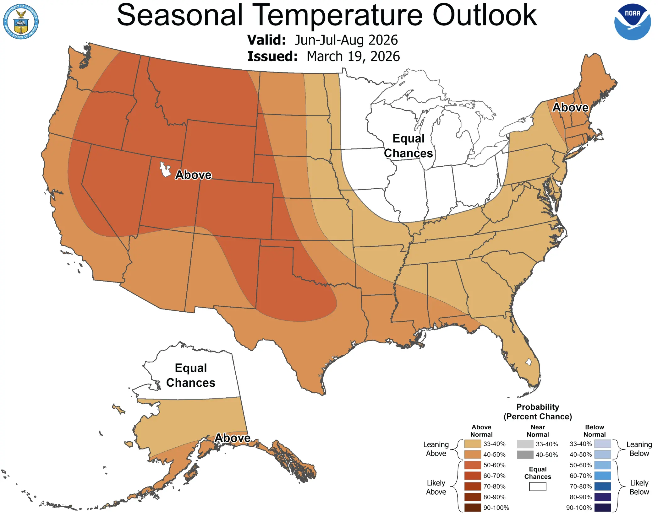
For the United States, Spring 2026 is looking more and more like a season of geographic split. Across the West and much of the South, the warm background is becoming more established. That includes the southern and central West, the southern and central Plains, the Lower and Middle Mississippi Valley, Tennessee, the Southeast, and the southern Mid-Atlantic. In these areas, spring is likely to feel much more advanced on average than it will across the northern tier.
But it is important not to confuse a warmer seasonal background with the absence of cold. The residual Polar Vortex core over eastern Canada is still keeping enough cold air nearby that individual intrusions can reach the Upper Midwest, the Great Lakes region, and the Northeast. So the U.S. is entering spring not with a nationwide freeze and not with a nationwide warm-up, but with a strongly contrasted pattern: a warmer West and South versus a more weather-sensitive, cold-vulnerable North and East.
This matters especially for March and the first half of April. In these periods, one frontal system can bring near-April warmth to the South and West, then 24 to 48 hours later deliver snow, freezing rain, and sharp cold wind to the Northeast. Those waves — not a long-lasting deep freeze — are likely to be the signature of Spring 2026 in the United States.
Precipitation in the U.S.: Where Flooding Threatens and Where Drought Still Matters
In precipitation terms, the United States is also dividing into two very different spring stories. A wetter signal continues across the Great Lakes region, the Ohio Valley, and parts of the Mississippi basin. In these areas, spring cyclones and transitional frontal systems are more likely to bring rain and, at times, late-season snow. When rainfall overlaps with snowmelt, the risk of localized flooding and rapid rises in water levels increases.
Across the Southwest and parts of the southern tier, by contrast, spring may trend drier. That means even when some rain events do occur, moisture deficits can still build quickly, and the threat of drought and early fire-weather stress does not disappear. Hydrologically speaking, the U.S. in Spring 2026 is dealing with two separate challenges at once: too much water and lingering winter conditions in the North and Northeast, and not enough water in the Southwest.
Canada: Not a Smooth Spring, but a Jagged One
Canada is especially important this season because it remains the main cold reservoir for all of North America. Even if the country does not end up looking “record cold” on a seasonal average, southern Canada and adjacent regions continue to act as the launch zone for late-winter cold surges into the United States.
Spring 2026 in Canada does not look like a smooth, steady warm-up. Instead, it looks like a sequence of abrupt atmospheric resets. One week may bring rapid snowmelt, sustained above-freezing temperatures, and the feeling of an early spring. The next may return snow, frost, and strong winds. That kind of regime is risky not only for transportation, but also for hydrology: fast snowmelt, river ice breakup, then another freeze and refreezing cycle create stress across river systems and infrastructure.
Southern Canada remains one of the most sensitive zones in all of North America in the updated forecast. Put simply, spring there is likely to feel like a constant tug-of-war between the leftover winter cold reservoir and the strengthening seasonal warm-up.
Europe: Not a Total Freeze, but a High-Contrast and Hydrologically Risky Spring
For Europe, the latest data matters because it shifts the emphasis away from the earlier “broad Arctic strike” narrative. It now looks clearer that Spring 2026 there will be shaped less by the direct role of future El Niño and more by a combination of Atlantic storm influence, high-latitude blocking, and the already very wet background established across parts of western and southern Europe.
February 2026 already showed how sensitive Europe has become to prolonged wet episodes. Western and southern parts of the continent saw exceptional wetness, heavy rain, and flooding. That means March and April are beginning with catchments already loaded with moisture, so any new storm systems are likely to work in a more dangerous way than they would under dry antecedent conditions.
Temperature-wise, the updated forecast looks less severe than the earlier “Europe-wide ice outbreak” ideas. A more likely scenario is one in which central, southern, and parts of northern Europe lean warmer or near warm, while the West and Northwest stay closer to normal because of a more active cyclone zone, and the Southwest can occasionally turn cooler and wetter under low-pressure influence.
That does not eliminate cold reversals. Quite the opposite: in this kind of “nervous” spring regime, Europe often sees several very mild days followed by a short northerly or northeasterly setback with wet snow, frost, and a sharp temperature drop. In other words, the key word for Europe is not “freeze,” but “contrast.”
What Is Happening with El Niño — and Why It Is Already Part of the Story
The El Niño theme is clearly strengthening in the latest data. Ocean conditions are changing rapidly: subsurface heat is increasing across the Pacific, warm anomalies are expanding, and the classic La Niña structure is fading. That is what has encouraged a number of forecasts to talk about a growing El Niño signal.
But if the goal is to improve the forecast rather than repeat dramatic headlines, the wording has to stay careful. The most accurate phrasing is this: during Spring 2026, the Pacific is transitioning toward ENSO-neutral conditions, while the probability of El Niño rises more noticeably closer to summer. That is a very important signal for the second half of the year, but it is not evidence that El Niño is already directly controlling weather across the U.S., Canada, and Europe right now.
In other words, El Niño is no longer a distant idea on the horizon — it is a real and rising 2026 scenario. But for March and April, its direct weather role is still secondary compared to faster-moving atmospheric drivers such as stratospheric warming, jet-stream changes, blocking patterns, and the placement of the residual cold core over Canada.
Why the New Forecast Is Better Than the Earlier One
The improvement in the new forecast is not that it became more dramatic, but that it became more precise. The earlier expectation of a chaotic, wave-based spring was correct, but now the main contrast zones are better defined. For the United States, the key boundary lies between the warmer West and South and the colder, more vulnerable North and East. For Canada, it is the ongoing fight between snowmelt and renewed cold. For Europe, the forecast has shifted from “a large cold outbreak is possible” toward a more realistic scenario of a mild background, high moisture, elevated flood sensitivity, and short-lived winter setbacks.
The new forecast is also more closely anchored to official and higher-confidence data. We can now see that a super-strong El Niño remains a possibility, not a confirmed fact. We can see that the Polar Vortex did not simply “break” in a vague sense, but left behind a very specific residual core over eastern Canada. And we can see that Europe’s February conditions make the themes of spring flooding and soil saturation much more important than they looked earlier in the season.
Main Takeaway
Spring 2026 will not be boring. The Polar Vortex has already disrupted the familiar late-winter pattern, and its leftover core is still influencing North America. La Niña is fading, and the El Niño signal is becoming more visible, but it is not yet taking over the forecast in an immediate way. The U.S. gets a warmer West and South, but with the risk of cold reversals in the North and East. Canada enters a jagged spring with sharp swings and high hydrological sensitivity. Europe gets not a total freeze, but a mildly contrasting spring with elevated risk of wet episodes, localized flooding, and short winter comebacks.
If everything has to be summed up in one sentence, it would be this: Spring 2026 is not a season of one dominant script, but a season of struggle between the leftovers of winter circulation and a new oceanic phase.
The Founder and Chief Meteorologist at Pogodnik.com. With over 15 years of operational experience in synoptic analysis and climate forecasting, he specializes in storm tracking, magnetic storms, and atmospheric dynamics. A recognized expert in Ukraine’s meteorological sector, he maintains strategic collaborations with global agencies, including NOAA and ECMWF, to ensure high-precision data integration. His analytical reviews and scientific contributions are regularly featured in leading media outlets dedicated to weather science and environmental trends.