U.S. Wildfire Risk Forecast: Red Flag Warnings, Heat Wave, Fire Danger
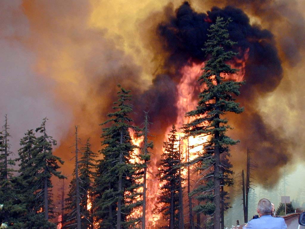
The weather threat in the United States over the next few days is not mainly about tornadoes or flooding. It is about a much more stubborn and dangerous combination: historic heat, very dry air, strong wind, and landscapes that are drying out far too fast for March. That is the kind of setup that can turn one spark into a fast-moving grass fire or brush fire before people have time to react.
A historic March heat event has already rewritten parts of the record book in the Southwest. The Watchers reports that Las Vegas reached 95°F on March 19, setting a new March record there, while near Martinez Lake, Arizona, temperatures hit 110°F on March 20, setting a new highest March temperature ever recorded in the United States. The same report notes that temperatures across parts of the Southwest were running about 20 to 30°F above average, with the heat expected to expand farther into the central United States.
Official U.S. guidance backs up that broader picture. In its latest short-range forecast discussion, the Weather Prediction Center said the record-breaking heat wave would continue in the West and intensify into the central United States, with highs in parts of the Plains reaching the 80s and 90s, or about 30 to 40 degrees above average for this time of year. The WPC also warned that the Southwest could once again climb into the 90s and 100s, and it stressed that the unusual timing and prolonged nature of the heat would increase the risk of impacts, especially for people without effective cooling.
But heat alone is only part of the problem. The fire-weather side of the forecast is what makes this setup especially serious. The WPC says gusty winds, very low relative humidity, anomalous warmth, and dry fuels are combining to create elevated to critical fire weather conditions across portions of the Four Corners region, the central and southern Rockies, and the Great Plains. It adds that the environment will be favorable for extreme fire behavior and rapid fire spread.
The Storm Prediction Center sharpens that threat geographically. For Saturday, the SPC places a critical fire weather area over parts of central and eastern Wyoming, northwest Colorado, southwest South Dakota, and the western Nebraska Panhandle, with winds around 20 to 25 mph and relative humidity as low as 10 to 15 percent. For the following day, the SPC shifts a critical area into portions of the Texas Panhandle, South Plains, Rolling Plains, and southwest Oklahoma, showing that the danger is not disappearing so much as sliding south and east with the evolving pattern.
The Watchers’ second report lines up closely with those official forecasts. It highlights Red Flag Warnings across Wyoming, Nebraska, Colorado, and South Dakota, with examples of humidity dropping into the single digits and gusts reaching 35 to 45 mph in some areas. That matters because once grasses and brush are this dry, the weather does not need to be extreme everywhere to create a dangerous fire day. It only takes one corridor where heat, wind, and cured fuels overlap.
And the fuels are a major part of this story. A National Interagency Fire Center fuels advisory says above-normal to exceptional grass loads are widespread across the central and southern Great Plains, and that dry, unusually hot weather through most of March will leave those fuels historically dry for this time of year. The advisory warns that as the upper ridge begins to weaken later in March, the potential for wind-driven wildfire outbreaks may increase, and it notes that spread rates of 2 to 5 miles per hour have already been observed this season in the advisory area.
That is why this forecast should not be treated as just another warm spell headline. The NIFC says the national preparedness level rose to PL 2 on March 20 as fire activity expanded across multiple geographic areas. It also reported 821 fires nationwide over the previous week, with 47 new large incidents and 28 large fires still uncontained. Most activity, according to NIFC, is centered in the Southern and Rocky Mountain areas, which fits the same corridor now sitting under unusual heat and repeated fire-weather concerns.
There is also an important forecast nuance here: some areas will cool briefly, but the broader pattern is not fully breaking down. The WPC says a front will bring some relief to parts of the Northwest, northern Rockies, and Plains, but the Southwest is likely to stay on the warm side of a stalled boundary into early next week. In the medium range, the WPC says the early-season heat may ease somewhat at first, then rebuild by midweek, with another stretch of well-above-average warmth and renewed fire weather concerns possible from the Southwest into the Plains on Tuesday and Wednesday.
A Red Flag Warning does not mean a wildfire is already burning. It means warm temperatures, very low humidity, and stronger winds are expected to combine into a much higher fire danger. In practical terms, this is the kind of forecast where outdoor burning, dragging chains, equipment sparks, roadside ignitions, and even one careless cigarette can become the start of a fast-moving fire.
So the bottom line is clear. The most serious U.S. weather threat over the next few days is a heat-and-fire pattern, not a classic severe-storm outbreak. The Southwest remains dangerously hot for March, while the central Rockies, High Plains, and then parts of Texas and Oklahoma face repeated windows of critical fire weather. The map may shift from day to day, but the overall message stays the same: where hot air, low humidity, wind, and dry grass come together, wildfire danger rises quickly.
The Founder and Chief Meteorologist at Pogodnik.com. With over 15 years of operational experience in synoptic analysis and climate forecasting, he specializes in storm tracking, magnetic storms, and atmospheric dynamics. A recognized expert in Ukraine’s meteorological sector, he maintains strategic collaborations with global agencies, including NOAA and ECMWF, to ensure high-precision data integration. His analytical reviews and scientific contributions are regularly featured in leading media outlets dedicated to weather science and environmental trends.