US & Canada Spring 2026 Forecast (March–April–May): A Warm West, a Wetter Great Lakes Belt, and a Drought Battle in the South
Spring 2026 across North America is arriving in a “split-screen” mode. Seasonal guidance keeps pushing a warm signal across much of the western and southern United States, while precipitation odds stack up toward the Great Lakes and parts of the Mississippi–Ohio Valley corridor. Canada stays closer to a classic spring swing pattern: snowmelt timing matters as much as the storms themselves. The bigger climate backdrop is changing fast too: La Niña is fading toward ENSO-neutral, with longer-range guidance hinting at El Niño later in 2026—meaning spring won’t be locked into one stable regime for long.
Canada monthly temperature anomaly forecast (updated weekly; next 28 days). This is a trend tool—useful for “warmer/colder than normal” lean, not day-by-day weather.NOAA CPC Official 90-day outlooksNOAA CPC provides the official temperature and precipitation outlooks for March–April–May 2026, plus written discussions explaining the drivers.Copernicus C3S multimodel monthly precipitation probabilities (North America)Copernicus multimodel rainfall probability maps help flag where “wetter/drier than normal” is most likely on a monthly scale.
Quick Outlook: Spring 2026 (US & Canada)
March: The warm edge expands across the West and South, but late-winter pushbacks still clip the northern tier. Drier odds hold over the Southwest and parts of the southern Plains; the Great Lakes–Ohio Valley corridor leans wetter, raising early flooding concerns where snowmelt and rain overlap.
April: Warmer-than-normal odds expand north. Storm tracks stay active near the central U.S. belt into the Great Lakes, while parts of the West remain on the drier side. Late frosts can still bite after warm spells—especially inland and north.
May: A faster shift toward “summer-style” precipitation: fewer long-duration rain events, more downpours and thunderstorms. Flood risk becomes more localized (flash-flood prone), while drought and early fire-weather stress can intensify where spring rains miss.
Main risks: drought persistence in parts of the South and Southwest, spring flood potential near the Great Lakes and major river basins, and “false spring” temperature swings that trigger early growth followed by frost.
Reality check: what February set up for spring
February left a clear message for planning: dryness is already widespread in the United States, and that matters because spring storms don’t “reset” hydrology instantly. A large portion of the Lower 48 entered late winter under abnormal dryness to drought categories, and that background dryness supports bigger temperature spikes and faster soil moisture loss once spring sun strengthens. In other words: even when storms return, drought recovery can lag—especially if precipitation comes in short bursts instead of long soaking rains.
The spring 2026 drivers: fading La Niña, rising ENSO-neutral, and a noisy jet stream
The Pacific is moving through a transition phase. NOAA’s ENSO outlook expects La Niña to fade toward ENSO-neutral during February–April 2026, with neutral conditions favored into summer. Independent plume guidance also heavily favors ENSO-neutral through spring, with El Niño probabilities rising later in 2026. The practical takeaway for March–May: fewer “locked-in” La Niña patterns and more week-to-week regime changes.
On top of that, late-winter stratospheric variability (the same storyline we tracked through winter) keeps the door open for short cold pullbacks in early spring. That does not cancel the warm seasonal lean in the West and South—it simply means March and early April can still deliver sharp reversals across the northern tier.
March 2026 forecast: warm West/South, wetter Great Lakes belt, drought still fighting back
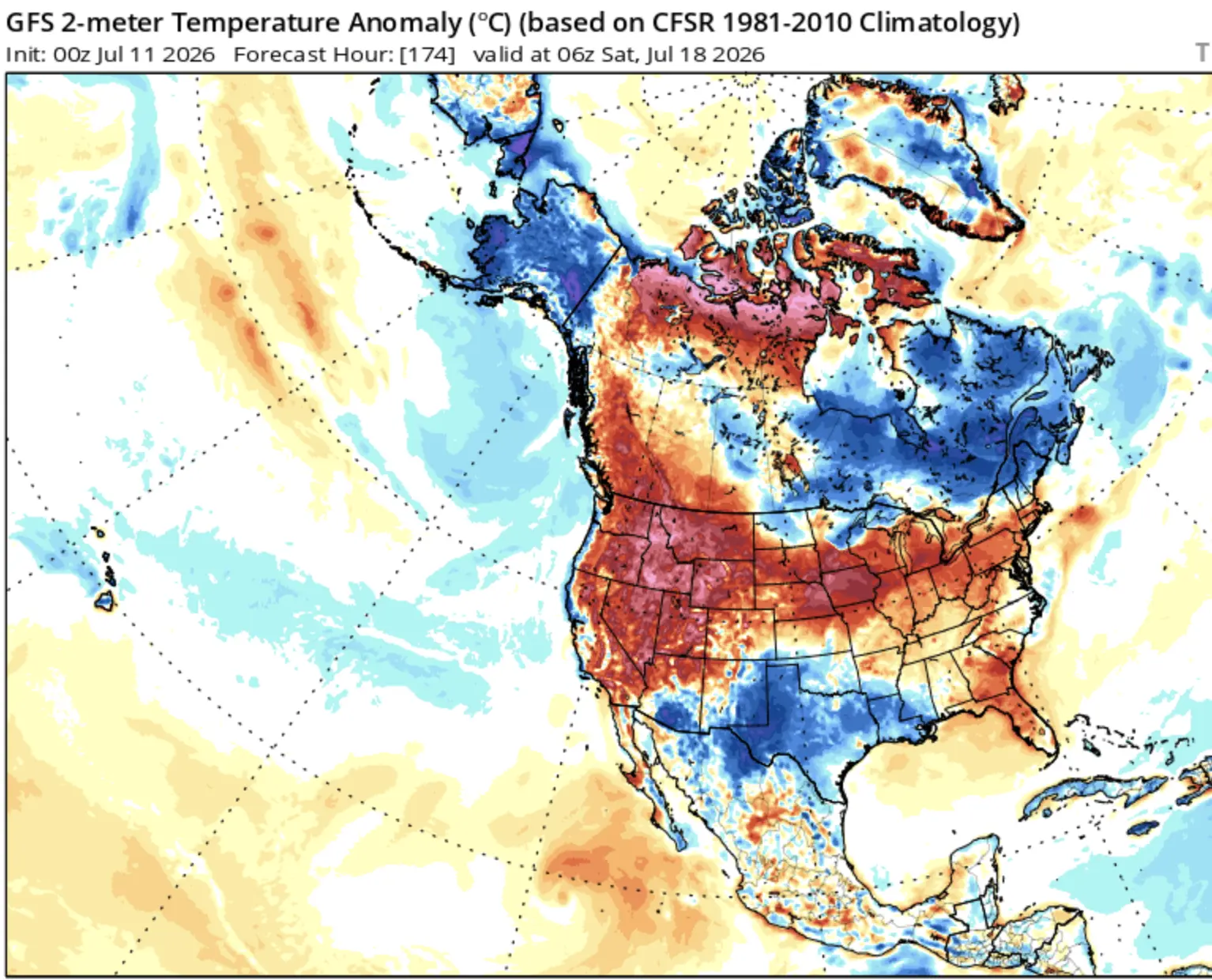
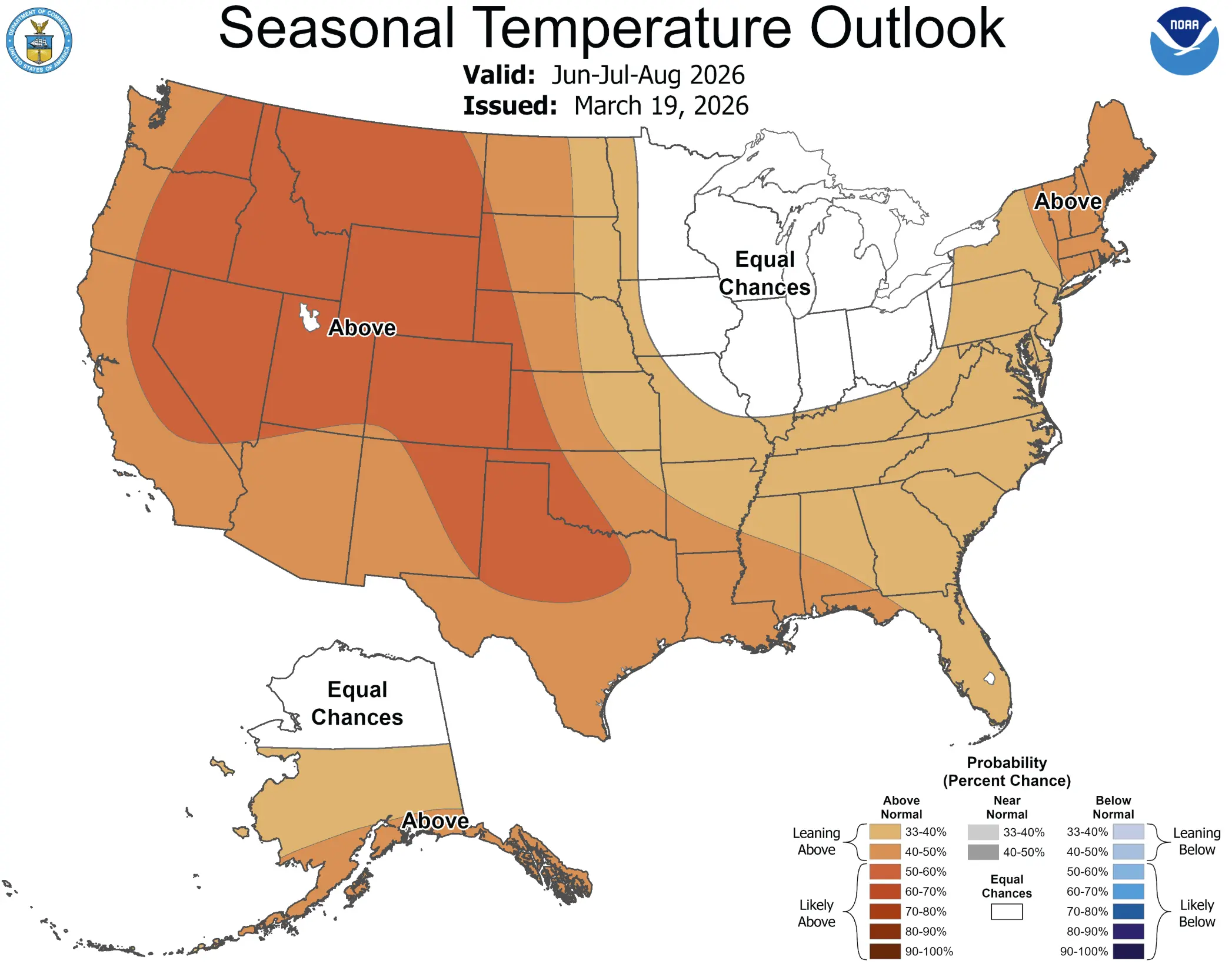
NOAA’s March–April–May temperature outlook strongly favors above-normal temperatures across the southern and central West, the southern and central Plains, and much of the Lower Mississippi/Tennessee Valley into the Southeast and southern Mid-Atlantic. A modest cool lean is still present in a northern corridor—especially near the western Great Lakes and adjacent Upper Midwest.
On precipitation, the signal is cleaner than many spring seasons: below-normal precipitation odds dominate the southern two-thirds of the western U.S. and extend into parts of the central/southern Plains. Meanwhile, above-normal precipitation is favored around the Great Lakes, Ohio Valley, and nearby Mississippi Valley corridor—exactly the setup that raises river response risk when snowmelt and rain coincide.
Copernicus multimodel precipitation probabilities for March 2026: wetter odds cluster into Canada and parts of the northern/central belt, while drier odds appear across sections of the Southwest.
Where flooding risk rises first in March
The earliest spring flooding concerns concentrate where three ingredients overlap: lingering snowpack or late-season ice, a shift toward frequent rain events, and already-elevated soil moisture or streamflow sensitivity. In 2026, that puts the Great Lakes basin, parts of the Ohio Valley, and adjacent Mississippi Valley zones in the higher-watch category. Canada’s southern drainage basins also need close attention when mild surges accelerate melt: once rivers break up, rapid rises can follow even with “normal” rainfall.
Where drought risk stays stubborn in March
The Southwest and a broad southern tier remain the most drought-vulnerable because the seasonal precipitation odds tilt drier and temperatures tilt warmer. This combination increases evaporative demand and accelerates soil moisture loss. If March storms miss, drought intensification can happen quickly—especially in windier, low-humidity patterns behind spring fronts.
April 2026 forecast: warmer days expand north; storm energy shifts toward severe-weather season
April is when the sun starts doing real work. The warm seasonal lean spreads northward and increases the probability of earlier warm spells—especially across the interior West and southern/central U.S. At the same time, the active precipitation corridor near and east of the Plains becomes more convective: fewer long-duration rain shields, more bursts of heavy rain and strong thunderstorms.
For Canada, April is the “timing month.” A week of early warmth can erase snowpack fast, but a late cold pullback can re-freeze meltwater, jam rivers, and delay the true spring flush. That’s why flood risk in Canada often hinges less on the seasonal anomaly and more on the sequence of warm-cold-warm regimes.
Copernicus multimodel precipitation probabilities for April 2026: the monthly signal weakens overall, meaning confidence drops and week-to-week pattern changes matter more.
May 2026 forecast: thunderstorm season grows; flash-flood risk becomes more localized
May typically marks the handoff from “spring storms” to “summer storms.” In 2026, that transition may be sharper because the background warmth expands and the ENSO system is moving toward neutral. When the atmosphere warms faster, storms can shift from long steady rains to shorter, heavier downpours. That changes flood risk: it becomes less about broad river flooding and more about localized flash flooding—especially in urban corridors and steep terrain.
The West and parts of the southern tier remain the early-season fire-weather concern zones if spring precipitation underdelivers. The seasonal drought outlook emphasizes that snowpack is below average in several drought-affected regions, which is a red flag heading into late spring and early summer water supply season.
Copernicus multimodel precipitation probabilities for May 2026: signals are sparse, which is typical—late spring often requires shorter-range monitoring for real impacts.
Bottom line for Spring 2026 planning
If you want one sentence: Spring 2026 favors a warm West and South, a wetter Great Lakes–Ohio Valley belt, and a continued drought fight across large parts of the southern tier—while Canada rides the melt-and-storm timing rollercoaster. The fading La Niña means the pattern can flip more often, so the most important practical move is tracking 10–15 day updates around melt surges and major storm windows.
FAQ: simple meteorology terms
What does “above-normal temperature odds” actually mean?
It means the monthly or seasonal background leans warmer than the long-term average. Cold snaps can still happen, especially in March and early April, but they’re more likely to be shorter or shifted in timing.
What is ENSO-neutral and why does it matter?
ENSO-neutral means the tropical Pacific is not strongly in El Niño or La Niña mode. Neutral conditions often allow more week-to-week pattern variability across North America compared to a strong ENSO phase.
Why can flooding increase during a “warm spring”?
Warmth accelerates snowmelt. If rain arrives during melt, runoff spikes and rivers rise fast—especially in basins with remaining ice or saturated ground.
What is “drought persistence” in a seasonal outlook?
It’s the expectation that drought conditions are likely to continue because the outlook favors warmer temperatures, below-normal precipitation, or both—so soil moisture recovery is less likely.
Why do spring forecasts become less confident in May?
Because late spring weather is driven more by short-lived storm systems and thunderstorms, which are harder to pin down months in advance. Seasonal models are best at broad tendencies, not specific event timing.
The Founder and Chief Meteorologist at Pogodnik.com. With over 15 years of operational experience in synoptic analysis and climate forecasting, he specializes in storm tracking, magnetic storms, and atmospheric dynamics. A recognized expert in Ukraine’s meteorological sector, he maintains strategic collaborations with global agencies, including NOAA and ECMWF, to ensure high-precision data integration. His analytical reviews and scientific contributions are regularly featured in leading media outlets dedicated to weather science and environmental trends.