The Split Polar Vortex and the Emerging El Niño: How It May Affect Weather in the United States, Canada, and Europe
Spring 2026 is beginning not simply as a transition from winter to warmth, but as a major restructuring of the entire atmospheric system across the Northern Hemisphere. On one side, a major sudden stratospheric warming event is developing over the Arctic, and it has already disrupted the Polar Vortex and triggered a reversal of winds in the stratosphere. On the other side, in the equatorial Pacific, La Niña is weakening rapidly, while the ENSO system is moving toward a neutral phase, after which the second half of 2026 increasingly points toward the development of El Niño. It is exactly this combination of processes that is making weather across the United States, Canada, and Europe so volatile, contrasting, and difficult to describe with a simple linear forecast.
The key point here is that the Polar Vortex and stratospheric warming shape short- and medium-range weather — on the scale of weeks, while El Niño works as a slower seasonal background re-organizer — on the scale of months. That is why March and part of April will be determined first of all by the consequences of the stratospheric удар on the polar circulation, not by a fully established El Niño. But the oceanic transition is already changing the atmospheric background and preparing a new regime for summer, autumn, and the next winter.
What is actually happening to the Polar Vortex
As of early March, a strong sudden stratospheric warming event is unfolding over the Arctic. According to descriptions of this event, stratospheric temperatures rose sharply, while the westerly zonal wind at the 10 hPa level and 60° north latitude weakened and reversed into easterly flow, which formally matches the major SSW criterion. At the same time, the structure of the Polar Vortex became distorted and split. This is not just a dramatic phrase, but a real dynamical restructuring: instead of a compact circular circulation, two main lobes are forming, and that sharply increases the chance of a wavier jet stream and abnormal cold transport into the mid-latitudes.
It is important not to confuse the two levels. The Polar Vortex exists both in the stratosphere and in the lower layers of the atmosphere. A strong hit to the upper part of the system does not mean instant frost at the surface, but it does sharply increase the chance that within 1–3 weeks the tropospheric circulation becomes more blocked, and the jet stream becomes more distorted and amplified. These are exactly the periods that usually produce sharp temperature swings: one region starts to feel almost springlike, while the neighboring one gets snow and icy wind.

Why a disrupted vortex does not automatically mean an “ice age”
This is one of the most common myths. The breakdown or split of the Polar Vortex does not mean that all of North America or all of Europe falls into extreme cold at the same time. The real atmospheric response after a major SSW often looks quite different: high-latitude blocking patterns develop, the usual west-to-east flow weakens, the jet stream bends more strongly, and cold air is released in waves. As a result, some regions get thawing weather or early spring, while others see short but sharp winter intrusions. That is exactly the most realistic pattern right now.
What is happening with La Niña and when El Niño may begin
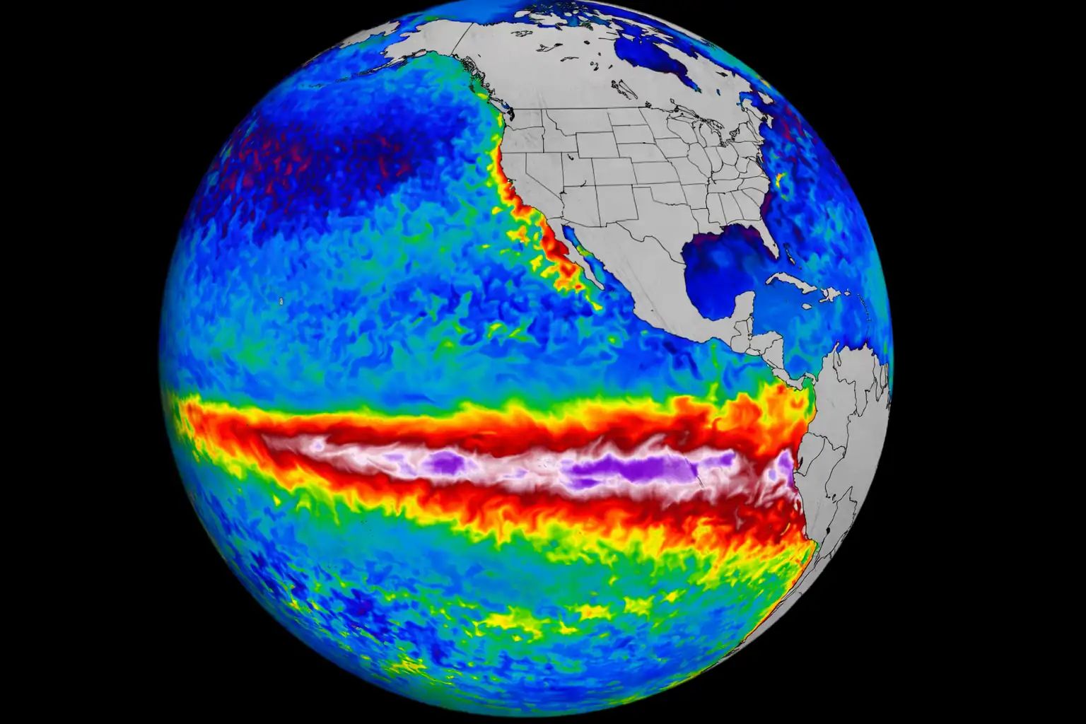
Strictly speaking, El Niño has not started yet. In its February diagnostic update, NOAA said that the transition from La Niña to ENSO-neutral conditions is expected during February–April 2026 with a probability of around 60%, and the neutral phase is likely to continue through summer. The WMO gives a very similar picture: for March–May 2026, neutral conditions are the most likely outcome, while the chance of El Niño begins to increase more noticeably later, during the May–July period and beyond. IRI also showed, at the end of February, a dominant neutral-phase signal for early spring along with a sharp drop in the probability of La Niña persistence. This means that, at the moment, it is more accurate to talk about the formation of an El Niño signal, not its full arrival.
From a practical standpoint, this matters a great deal. La Niña usually supports one familiar set of atmospheric circulation habits, while the neutral phase makes the picture more changeable. When the ocean stops holding the atmosphere in one stable mode, other factors gain influence — in this case the Arctic, the Atlantic, blocking patterns, and stratospheric processes. That is why Spring 2026 does not look like a smooth warm spring, but rather like a season in which the atmosphere is trying to find a new balance.

United States: a warm background in the West, but cold is still nearby
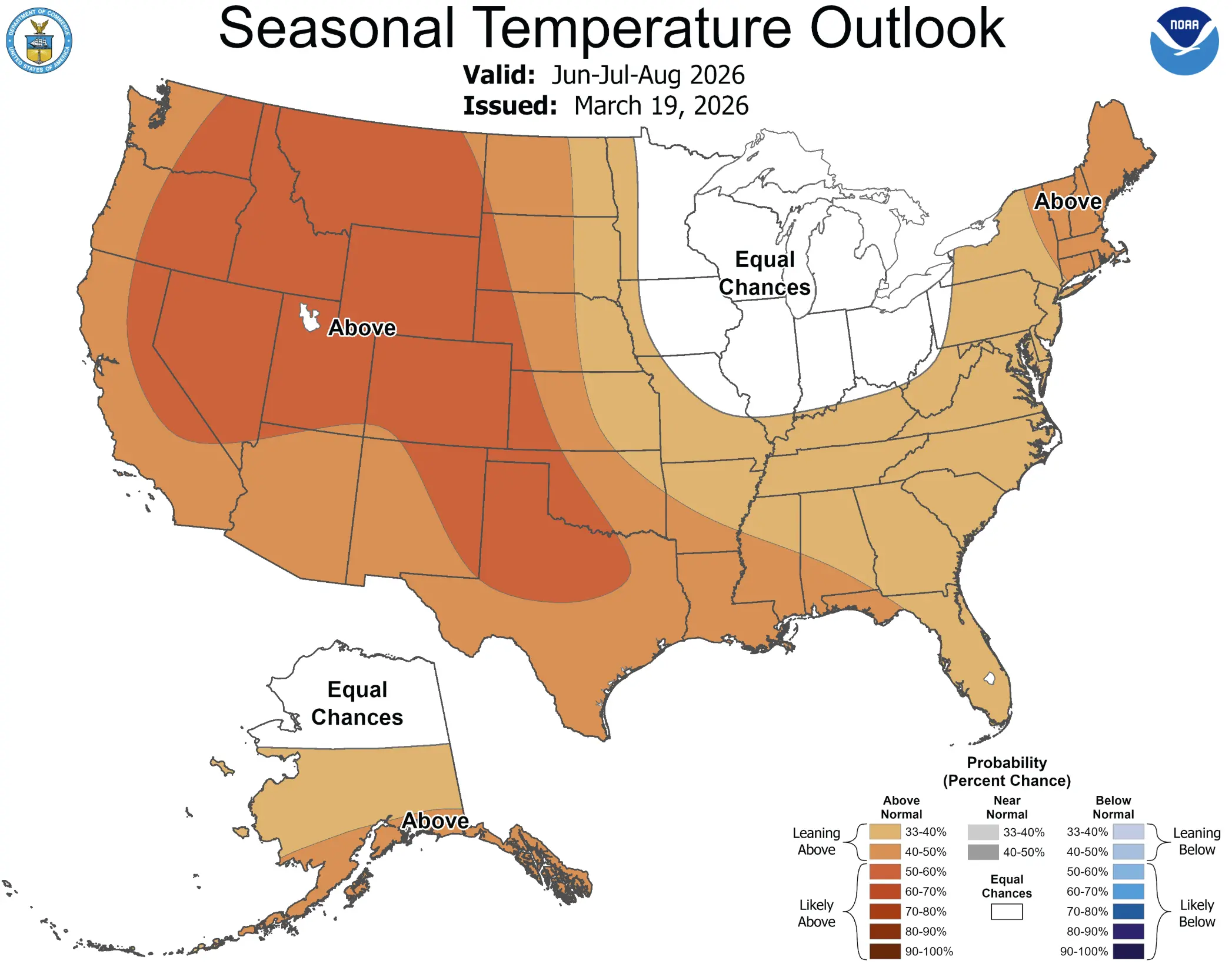
NOAA’s official outlook for the March–April–May 2026 season shows the highest chances of above-normal temperatures across the southern and central parts of the western states, the southern and central Plains, the Lower Mississippi Valley, Tennessee, the southeastern United States, and the southern part of the Mid-Atlantic region. In other words, much of the West and South of the United States leans toward a warmer spring scenario, not a prolonged winter. That is an important correction to all the dramatic stories about a “total Arctic invasion.”
At the same time, both forecasts and the winter verification itself show that the northern and eastern United States remain vulnerable to individual cold pulses. When a ridge of high pressure strengthens over the western part of the continent, while lower pressure remains over Canada and the northern United States, Arctic air gets a pathway southward into the Upper Midwest, the Great Lakes, and the Northeast. So for the U.S., the key spring 2026 scenario is not a nationwide freeze, but a combination of a warm western background with repeated late-winter intrusions across the northern and eastern parts of the country.
In terms of precipitation, NOAA sees a wetter signal around the Great Lakes, the Ohio Valley, and part of the Mississippi basin, while the Southwest and part of the southern tier remain under the risk of a drier scenario. That means spring in the United States will be not only temperature-contrasted, but also hydrologically split: in the north and northeast, late-season snow and flooding concerns remain possible, while the Southwest continues to deal with drought pressure.
Canada: the cold reservoir still plays the leading role
Canada remains the main source of cold air for the entire North American continent. Even if the average seasonal background there does not look extreme, it is Canadian air masses that form most of the late-winter intrusions into the United States. Model and seasonal guidance for Spring 2026 indicate that southern Canada and the adjacent northern strip of the U.S. remain highly sensitive to circulation swings, especially in March when the aftereffects of stratospheric warming are still strongest.
For Canada itself, this means a very uneven spring. One week may bring rapid snowmelt, above-freezing temperatures, and the feeling of early spring, while the next may return snow, frost, and strong winds. This type of regime is dangerous for rivers, transportation systems, and energy infrastructure not because of one record-breaking event, but because of the constant alternation between thaw and renewed cold. In that sense, Spring 2026 in Canada looks more like a season of hydrological and infrastructure risk than a season of “record cold.”

Europe: the Atlantic, blocking, and short winter comebacks
For Europe, the future El Niño is not playing a direct role over the next few weeks. What matters much more is how blocking patterns over Greenland, the Arctic, and the North Atlantic reorganize after the stratospheric warming. That will determine whether the mild Atlantic flow remains dominant over western Europe and how far colder air can push into eastern and central Europe. After strong SSW events, Europe often ends up in an “early spring in waves” scenario: several very mild days, then a sharp northerly or northeasterly setback with wet snow and frost, and then another thaw.
The WMO seasonal outlook for March–May 2026 generally gives a higher probability of above-normal temperatures across a large part of the Northern Hemisphere mid-latitudes, including Europe. But it is essential not to confuse the seasonal average background with day-to-day weather. “Warmer than normal” does not mean no snow, no frost, and no cold intrusions. It only means that, on average, mild episodes are likely to be more frequent or stronger. Against the background of a disrupted Polar Vortex, Europe can still receive a series of short but unpleasant cold returns.
Why Spring 2026 looks so contrasty
This season is unusual because processes of different nature are working at the same time. Stratospheric warming disrupts the winter regime from above and does so quickly, while the ENSO transition reshapes the atmospheric background more slowly and more deeply. As a result, we do not get either a clean late winter or a clean early spring. Instead, we get an in-between regime where weather systems become more nervous: warm surges and cold setbacks alternate more often, and the boundaries between them become sharper.
That is why March 2026 should be understood not as a month of one clear scenario, but as a month of regime struggle. For the United States, this is a struggle between a warm West and a colder Northeast. For Canada, between snowmelt and late winter relapses. For Europe, between Atlantic influence and blocking, between early spring and short winter blows.
What this means for the coming weeks and for the second half of 2026
Over the next 2–6 weeks, the main weather director is the Polar Vortex and the aftereffects of the major SSW. That raises the risk of late-winter cold returns, a wavier jet stream, blocking patterns, and strongly contrasting weather episodes. But the closer we get to summer, the more the ocean will take over. As ENSO-neutral conditions become established and the chances of El Niño increase, the character of the summer–autumn circulation will begin to shift, and then the winter of 2026/27 as well. That is where El Niño will start to play a much more direct role — first of all in North America, and partly in the Atlantic–European sector through more complex teleconnections.
Main conclusion
The split of the Polar Vortex and the development of the El Niño signal are not two separate stories, but two parts of the same major climate turn in 2026. Right now, the Polar Vortex is breaking the familiar logic of late winter and making March more chaotic. At the same time, the oceanic system is moving away from La Niña and preparing the atmosphere for a new phase. For the United States, this means a warm background in the West and South, but with the risk of late cold strikes in the North and East. For Canada, it means a jagged spring with large swings and the continued role of the continent’s main cold reservoir. For Europe, it means an early but nervous spring, where blocking, the Atlantic, and short winter returns remain entirely possible.