Saharan Heatwave Expands Across Europe: Which Countries Face the Highest Risk
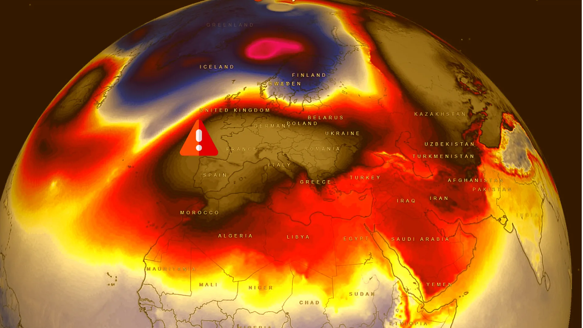
A new surge of Saharan heat is pushing into Europe, turning mid-June weather into a high-impact heat event for millions of people. Spain and France are taking the first hit, while the hot air mass is expected to expand toward Germany, Italy, Czechia and nearby countries. The pattern brings more than just hot afternoons: tropical nights, wildfire danger and severe thunderstorms along the edge of the heat could become the real hazards of the week.
The main risk zone includes Spain, France, Germany, Italy and Czechia, with Austria, Switzerland, Poland, the Balkans and parts of the United Kingdom also worth monitoring. Temperatures above 35°C are a broad concern across parts of western and central Europe. Local peaks near 40–42°C are possible only in the hottest southern or southwestern areas if confirmed by national weather services. The most dangerous combination is heat by day, poor cooling by night, rising wildfire danger and severe thunderstorms on the heat boundary.
Saharan heat can push daytime temperatures above 35°C and make nights dangerously warm in large European cities.
This is a health-risk weather event, not just a summer forecast. Older adults, children, outdoor workers, tourists, people with heart or respiratory conditions and anyone without reliable cooling should follow local heat alerts and reduce exposure during the hottest hours.
What is happening now?
A very warm air mass from North Africa and the Sahara is moving north into Europe. The strongest early heat signal is over the Iberian Peninsula and France, while the heat then expands northeast toward Germany, Italy, Czechia, Austria, Switzerland and parts of Poland.
The timing makes this event more serious. Europe is still in early summer, but the atmosphere is already producing a high-end heat pattern: rising temperatures, drier air, poor night-time cooling in cities and a higher chance of severe thunderstorms where the hot air mass collides with cooler and more humid air.
The most important point for readers is simple: the danger is not only one extreme number on a thermometer. A heatwave becomes more dangerous when it lasts several days, when nights stay warm, when urban areas cannot cool down and when dry vegetation increases the risk of wildfires.
Why this could become a heat dome pattern
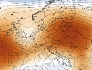
A heat dome develops when a strong ridge of high pressure locks hot air over a region. It works like a lid: fronts are pushed away, winds weaken, the ground heats repeatedly and temperatures rise day after day. If the pattern persists, nights also remain unusually warm.
A heat dome traps hot air under a persistent high-pressure ridge, allowing heat to build over several days.
That is why the main risk is not only a daytime maximum of 35–40°C. If temperatures stay above 20°C overnight, the body has less time to recover from daytime heat. These are called tropical nights, and they are especially dangerous for older adults, children, people with chronic illness, outdoor workers and anyone without air conditioning.
Countries facing the highest heat risk
Country
Heat risk
Main hazards
What to monitor
Spain
High, especially the south, center and inland areas
Temperatures above 35°C, local 40°C risk, tropical nights, wildfire danger
AEMET maximum temperature alerts, fire-weather warnings and local heat-health advice
France
Very high, especially the south, southwest, central regions, Rhône Valley and the Paris area
35–40°C heat, tropical nights, health stress, wildfire danger
Météo-France heat vigilance, maximum temperatures, night-time minimums and forest-fire weather
Germany
Elevated, especially the south, west and Upper Rhine Valley
Mid-30s°C heat, humid discomfort and severe thunderstorms on the heat boundary
DWD heat warnings, thunderstorm warnings and severe-weather advance notices
Italy
High, especially the north, central regions and major cities
Heat, tropical nights, Alpine-edge storms and wildfire danger
Meteoalarm, Protezione Civile and regional warning bulletins
Czechia
Elevated as heat spreads into central Europe
30–35°C heat, humid conditions and local thunderstorms
CHMI heat and thunderstorm alerts
Austria and Switzerland
Elevated, especially lowlands and pre-Alpine areas
Heat, storms on the edge of the dome and local hail risk
GeoSphere Austria, MeteoSwiss and Meteoalarm warnings
Poland and the Balkans
Locally elevated if the heat expands farther east or southeast
Heat, dry spells, storm fronts and wildfire danger
IMGW, Meteoalarm and national meteorological services
United Kingdom
Moderate, especially southern and eastern England
Elevated temperatures and urban heat stress
Met Office regional forecasts and heat-health alerts
Where could 35–42°C occur?
The temperature risk must be framed carefully. 35°C and above is a broad concern for parts of western and central Europe. 40–42°C should not be presented as a continent-wide forecast. It is a local risk for parts of southern and southwestern Europe only when supported by national meteorological services or fresh model guidance.
Temperature range
Most likely areas
What it means
30–34°C
Germany, Czechia, northern Italy, Austria, Switzerland, Poland and southern UK
Rising heat stress, especially in cities and humid air
35–38°C
France, Spain, Italy, southern Germany, the Rhine Valley and inland Europe
Dangerous heat, high UV exposure and heat exhaustion risk
39–40°C
Southern and central France, southern Spain and inland southwestern Europe
Heatstroke risk, high danger for older people, children and outdoor workers
41–42°C
Only locally in southern or southwestern Europe when confirmed by fresh forecasts
Potentially dangerous heat requiring activity restrictions and protection of vulnerable people
City heat map: where to watch temperatures closely
City
Country
Risk
Main factor
Madrid
Spain
High
Inland heat, strong daytime warming and tropical night risk
Paris
France
High later in the week
Urban heat island and possible nights above 20°C
Lyon
France
Very high
Rhône Valley heat corridor and poor night cooling
Milan
Italy
High
Lowland humidity, heat and Alpine-edge storm risk
Rome
Italy
High
Urban and tourist heat exposure
Munich
Germany
Elevated
Heat and possible storms along the heat boundary
Berlin
Germany
Elevated
Rising temperatures and urban heat build-up
Prague
Czechia
Elevated
Heat spreading into central Europe
Vienna
Austria
Elevated
Danube lowland heat and local thunderstorm risk
London
United Kingdom
Moderate
Higher temperatures in southern and eastern England
Tropical nights: why they are dangerous
A tropical night is a night when the temperature does not fall below 20°C. This matters because the body cannot recover properly after daytime heat. Sleep quality drops, the heart works harder, dehydration risk increases and heat stress can build up over several days.
The highest-risk groups are older adults, children, pregnant people, people with chronic illness, outdoor workers, tourists and residents of apartments without air conditioning. Large cities are especially vulnerable because concrete, asphalt and dense buildings hold heat long after sunset.
Storms on the edge of the heat
Extreme heat can also increase severe thunderstorm risk along its boundary. When very hot air meets cooler and more humid air, the atmosphere can become unstable. That is when thunderstorms, intense rain, hail and damaging wind gusts can develop quickly.
This scenario is especially important for Germany, the Alps, northern Italy, Czechia, Austria, Switzerland and Poland. A region can experience dangerous heat during the day and then face a severe storm front by evening. Readers should monitor not only temperature but also warnings for thunderstorms, severe storms, hail and damaging winds.
Storm hazard
Where it may develop
Why it matters
Severe thunderstorms
Germany, Czechia, Austria, Switzerland, northern Italy and Poland
Storms can form rapidly on the boundary between hot and cooler air
Large hail
Alpine and pre-Alpine regions, northern Italy and central Europe
Hail can damage vehicles, roofs, crops, greenhouses and solar panels
Damaging wind gusts
Thunderstorm lines and outflow boundaries
Strong gusts can break branches, damage roofs and disrupt power
Flash flooding
Urban areas, valleys and mountain foothills
Short intense rainfall can overwhelm drainage systems quickly
Wildfire danger will rise
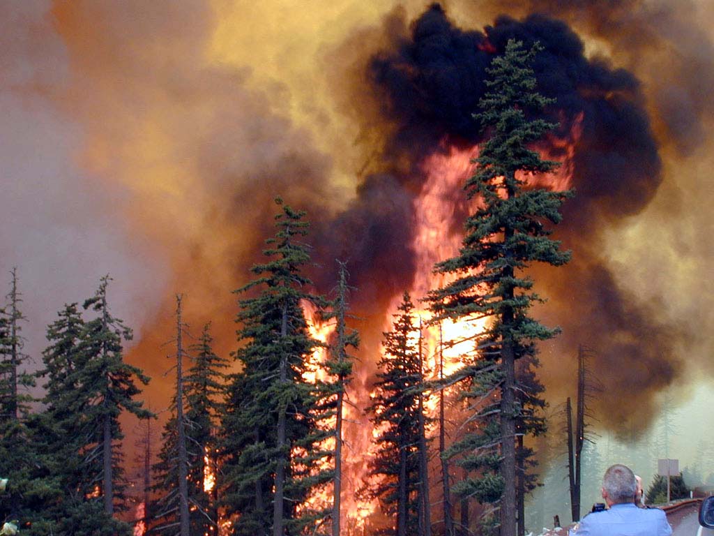
Heat dries grass, shrubs and forest litter quickly. If wind and low humidity are added, fire danger can increase even in regions that were not critically dry before. The Mediterranean, southern France, Spain, Italy, Greece, the Balkans and parts of central Europe should monitor fire danger closely during this heatwave.
EFFIS and Copernicus provide fire-danger maps and forecasts for Europe and the Mediterranean region. The key is not only where fires are burning now, but where the fire-weather index is increasing because of heat, wind and dry fuels.
Wildfire risk can rise before flames appear on the map. When dry vegetation, heat and wind overlap, a small spark can become a fast-moving fire. Avoid open flames, do not discard cigarettes and never park vehicles on dry grass.
What this means for travelers and Ukrainians in Europe
For Ukrainians living, working or traveling in Poland, Germany, Czechia, Italy, France, Spain, Austria, Switzerland and other European countries, this heatwave is a practical risk. It can affect work schedules, children’s routines, health, transport, weekend travel and outdoor plans.
Where you are
What to check
What to watch
France
Heat vigilance, daytime maximum and night minimum
Southern France, central France, the Paris region, night heat and wildfire danger
Spain
AEMET maximum-temperature warnings
Southern Spain, inland regions, tropical nights and urban heat
Germany
DWD heat and thunderstorm warnings
Daytime heat, evening storms, humidity and UV exposure
Italy
Meteoalarm, Protezione Civile and regional bulletins
Urban heat, Alpine storms and wildfire danger in the south
Czechia
CHMI heat and thunderstorm alerts
Rising temperatures and storm-front risk
Poland
IMGW and Meteoalarm warnings
If heat expands eastward, watch storms along the air-mass boundary
How to stay safer during the heatwave
Risk
What to do
Why it matters
Heatstroke
Avoid direct sun during peak heat, wear light clothing and use shade
Above 35°C, the body can lose cooling efficiency quickly
Dehydration
Drink water regularly before strong thirst begins
Thirst can appear after dehydration has already started
Tropical nights
Ventilate early, then close windows and blinds during the day
Without night cooling, heart and nervous-system stress increases
Cars in heat
Never leave children, pets or older people inside a car, even briefly
Car interiors heat much faster than outside air
Storms after heat
Watch radar and warnings, avoid trees during thunderstorms
Storms on the heat edge can bring hail, lightning and damaging gusts
Wildfire danger
Do not light fires, discard cigarettes or park on dry grass
Dry vegetation can ignite from a small spark
Warning maps to follow
Meteoalarm is the main public portal for live weather warnings across Europe, including heat, thunderstorms and severe-weather alerts.
Météo-France is essential for France, especially heat vigilance, maximum temperatures, tropical nights and forest-fire weather.
AEMET should be checked for Spain, especially southern, central and inland regions under high maximum-temperature risk.
DWD should be followed in Germany for heat warnings and thunderstorm warnings along the edge of the hot air mass.
EFFIS / Copernicus is important for wildfire danger, especially across the Mediterranean, southern France, Spain, Italy, Greece, the Balkans and parts of central Europe.
Pogodnik app
Track temperature, UV index, thunderstorms and local weather changes in the Pogodnik app. If you live in Europe, travel across the region or plan a weekend route, check hourly temperature, thunderstorm risk, wind, cloud cover and local updates for your exact location. Download the Pogodnik Android app: https://play.google.com/store/apps/details?id=com.bitltd.pogodnik
Main takeaway
Saharan heat is returning to Europe at a dangerous moment. Summer is still in its early stage, but the atmosphere is already behaving like a major heatwave pattern. Spain and France are taking the first hit, then the heat spreads toward Germany, Italy, Czechia and other parts of central Europe.
The main risk is not only the daytime maximum. Tropical nights, urban overheating, heat stress, wildfire danger and severe storms on the edge of the heat all make this a high-impact weather situation. This is the kind of event where the forecast should be checked by the hour, not once a day.
FAQ: Saharan heat and heat dome Europe 2026
What is Saharan heat?
Saharan heat refers to very hot air from North Africa and the Sahara moving north into Europe through Spain, France and then central Europe.
What is a heat dome?
A heat dome is a persistent high-pressure pattern that traps hot air over a region. Fronts are deflected, winds weaken, the surface heats repeatedly and nights can stay very warm.
Where will the strongest heat be?
The main risk areas are Spain, France, Italy, Germany and Czechia. The highest temperatures are most likely in southern and southwestern Europe, especially parts of France and Spain.
Could Europe reach 42°C?
40–42°C should be treated as a local risk, not a broad Europe-wide forecast. It should only be used for specific southern or southwestern areas when supported by national weather services or fresh model guidance.
Why are tropical nights dangerous?
When temperatures stay above 20°C overnight, the body cannot recover properly from daytime heat. This increases sleep problems, dehydration, blood-pressure stress and cardiovascular strain.
Why can severe storms happen after extreme heat?
Severe storms often form along the boundary between very hot air and cooler, more humid air. That boundary can support intense rain, hail, lightning and damaging wind gusts.
What should travelers and Ukrainians in Europe do?
Check local warnings, follow daytime and night-time temperatures, avoid peak heat activity, drink water regularly, never leave children or pets in a car, and monitor thunderstorm and wildfire risk through Meteoalarm, national weather services and the Pogodnik app.
Sources and methodology
This article is based on reporting and monitoring from The Guardian, Météo-France, Copernicus Climate Change Service, Copernicus / EFFIS / JRC, Meteoalarm, DWD and European national meteorological services. Temperature ranges are separated into broad-risk values and local extreme values. Heat warnings, thunderstorm warnings and wildfire danger should be checked through live official services because they can change during the day.
The Founder and Chief Meteorologist at Pogodnik.com. With over 15 years of operational experience in synoptic analysis and climate forecasting, he specializes in storm tracking, magnetic storms, and atmospheric dynamics. A recognized expert in Ukraine’s meteorological sector, he maintains strategic collaborations with global agencies, including NOAA and ECMWF, to ensure high-precision data integration. His analytical reviews and scientific contributions are regularly featured in leading media outlets dedicated to weather science and environmental trends.