Japan Flood Alert: Nagoya Breaks 136-Year Rainfall Record as More Torrential Rain Looms
Nagoya has just recorded the heaviest one-hour rainfall in its 136-year observation history, flooding roads and homes and forcing thousands of people into emergency shelters. Japan Meteorological Agency data show 104.5 mm — 4.1 inches — fell in one hour on September 8, breaking the previous all-time Nagoya record of 97.0 mm set in September 2000. And the danger is not finished: another multi-day period of rain and thunderstorms remains in the forecast.
Nagoya flooding — what matters now
104.5 mm in one hour: Nagoya’s heaviest hourly rainfall in 136 years of observations.
219.5 mm in one day: one of the wettest September days in the city’s record.
Level 5: the Shonai River reached Japan’s highest flood-emergency level during the peak.
3,500 people: moved into emergency shelters during the flooding.
More rain ahead: the five-day forecast still shows renewed heavy-rain episodes.
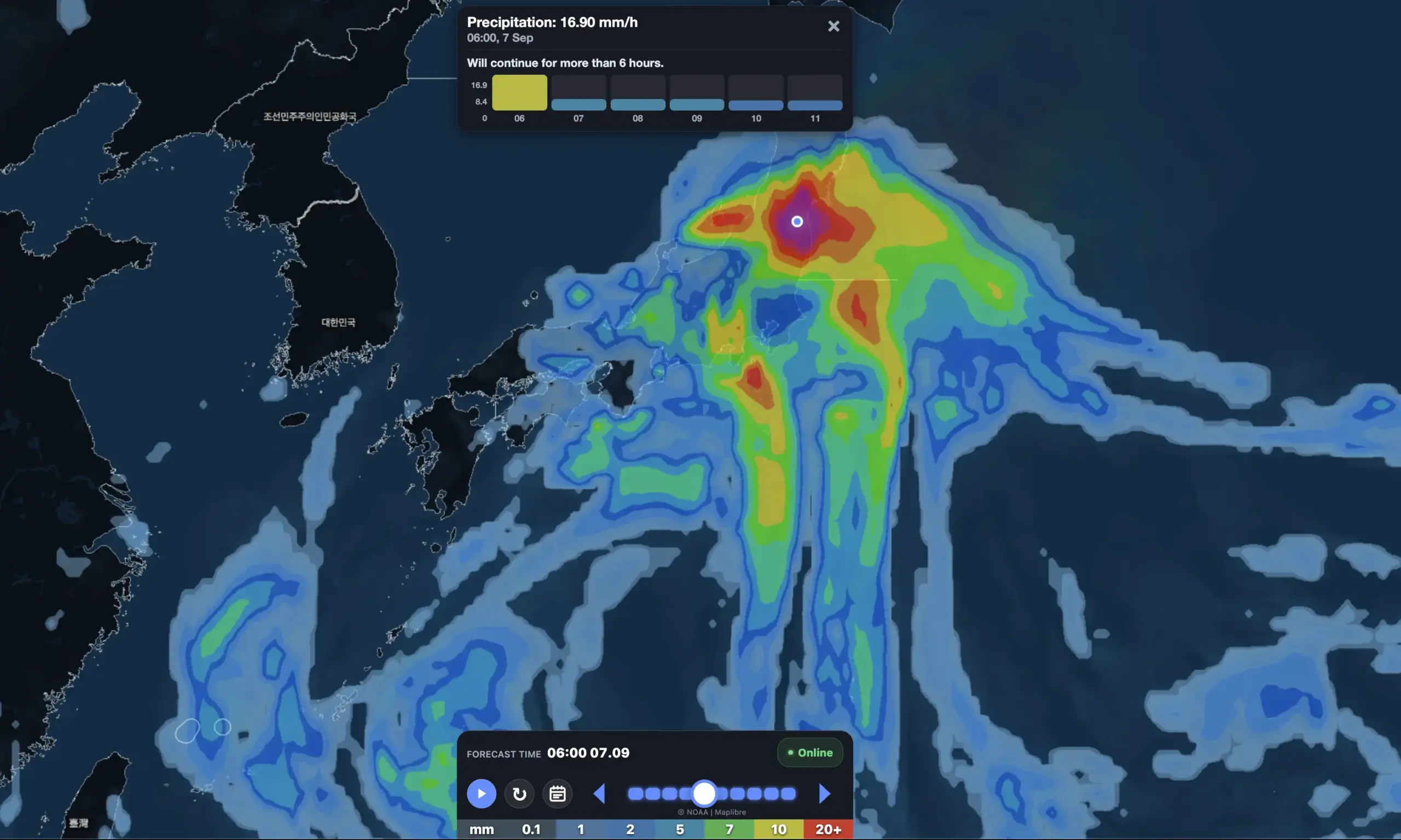
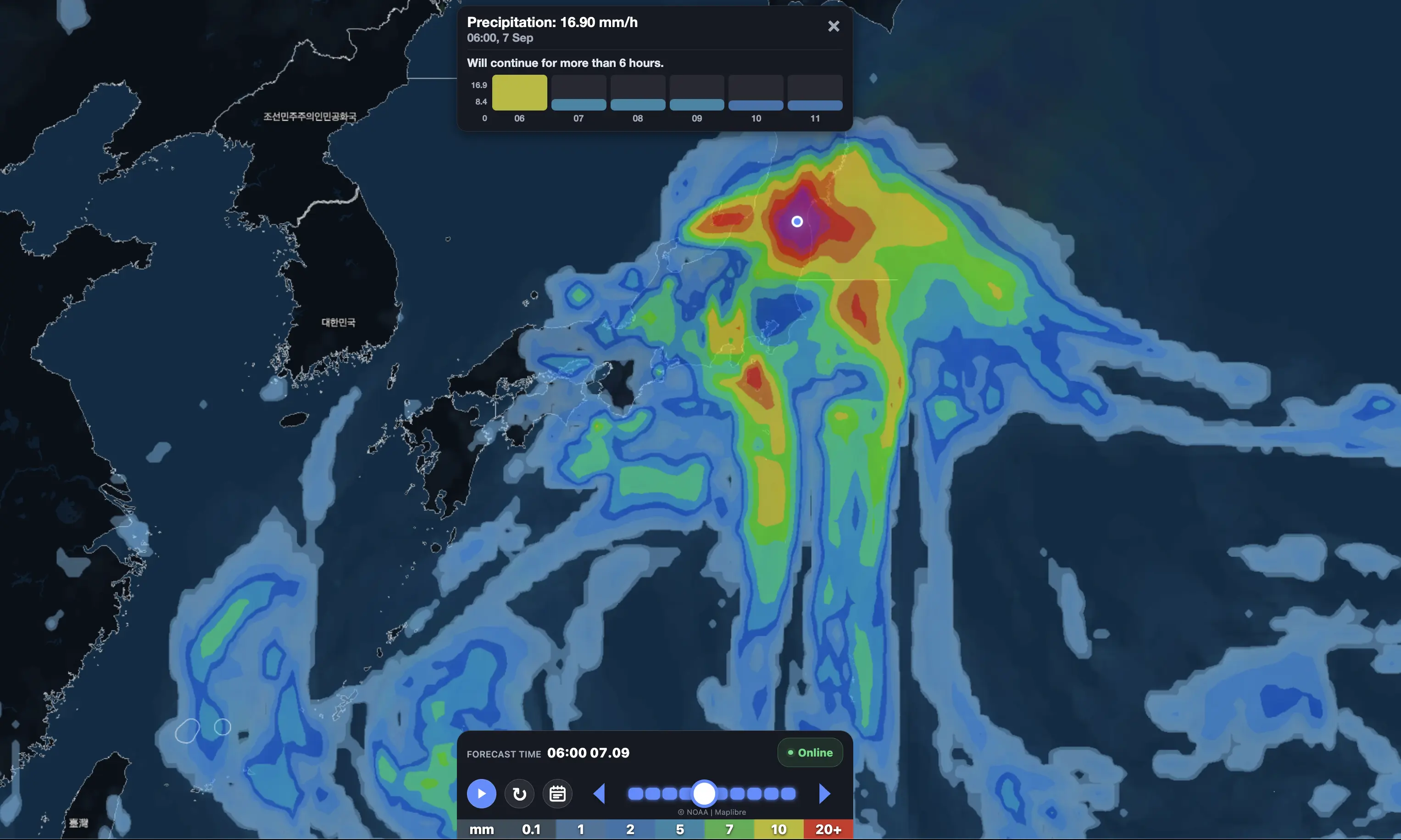
The record came during a violent linear precipitation band over Aichi and neighboring Gifu.
By the end of September 8, Nagoya had received 219.5 mm — 8.6 inches — of rain in one day.
For several hours, this was not simply a “heavy rain warning.”
It became a life-threatening flood emergency.
JMA issued a Level 5 Flood Special Warning for the Shonai River, which flows through Aichi and Gifu, saying flooding may already have been occurring and urging people in vulnerable areas to immediately secure their safety.
What happened in Nagoya?
The rainfall intensified extraordinarily quickly on Tuesday afternoon.
At Nagoya’s official observation station in Chikusa Ward, JMA measured:
104.5 mm in one hour;
23.0 mm in just 10 minutes;
219.5 mm during September 8;
a maximum wind gust of about 12.9 m/s.
The one-hour total broke Nagoya’s previous all-time record, while the daily total became the third-highest September daily rainfall in the city’s long historical record.
The observation series dates back to 1890.
That makes the 104.5 mm hourly total especially remarkable:
No hour of rain measured at Nagoya’s official station had ever been wetter in 136 years of records.
Flooding spread through the city
The rain overwhelmed drainage systems within a very short period.
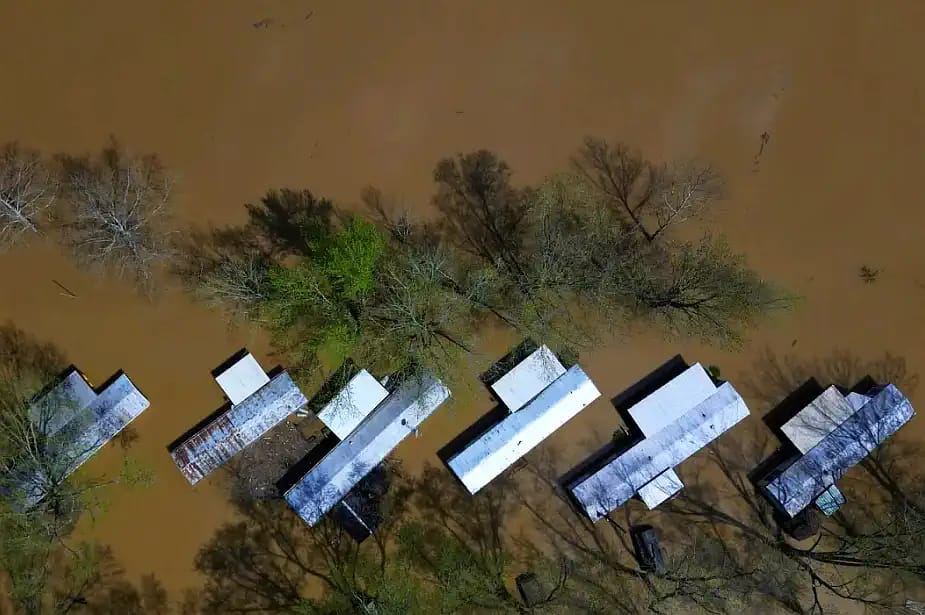
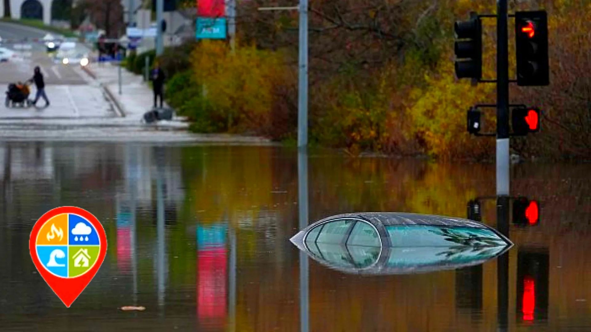
Associated Press reports that roads and homes were flooded, pedestrians and vehicles became stranded, and parts of Nagoya’s bus and subway systems were temporarily suspended. Around 3,500 people sought refuge in emergency shelters.
The flooding also affected preparations for the Asian Games.
About 400 athletes and staff staying in temporary accommodation were briefly moved to higher ground because of the flood risk. Some event buildings developed roof leaks, but officials reported no serious damage and no injuries among the athletes.
Nagoya Mayor Ichiro Hirosawa said the September 19 opening of the Asian Games is not currently expected to be delayed.
Why the Shonai River warning reached Level 5
The Shonai River basin received extreme rainfall not only in central Nagoya but across upstream areas in Aichi and Gifu.
JMA issued a Level 5 flood emergency, its highest river-flood category.
A Level 5 warning means conditions may already be catastrophic in some inundation zones.
JMA explicitly warned that people should not wait for a later alert if evacuation instructions had already been issued. If normal evacuation was no longer safe, residents were told to move to the safest and highest location available.
That is one reason the 104.5 mm figure matters beyond the city center.
Rain falling upstream can continue raising rivers even after the rain in downtown Nagoya weakens.
Is the flood emergency over?
The worst phase has eased, but this is not a full all-clear.
By September 9, the highest emergency warnings had been downgraded.
However, Nagoya still faces concerns from:
saturated ground;
elevated rivers and drainage channels;
weakened slopes;
renewed thunderstorms;
additional heavy rainfall.
JMA’s September 9 local forecast says the Tokai region remains under the influence of the front and humid air, with rain and thunderstorms and locally very intense rainfall still possible.
Current Nagoya advisories include heavy-rain concern related to ground loosening, flood risk and thunderstorms into Wednesday night and early Thursday.
That matters because landslides can occur after the peak rainfall.
Why did the rain become so extreme?
The setup involved an active frontal zone over Japan interacting with very warm and moisture-rich tropical air.
Former Typhoon No. 24 Krovanh had already weakened, but its moisture continued feeding the front.
This created ideal conditions for a linear precipitation band — 線状降水帯.
A linear rain band is especially dangerous because storms repeatedly travel across approximately the same corridor.
One thunderstorm may last only 20 or 30 minutes.
But if several storms follow the same route, rainfall can accumulate at an extraordinary rate.
That is what happened across parts of Aichi and Gifu.
The Nagoya record was not simply “a rainy afternoon.”
It was a highly concentrated convective event.
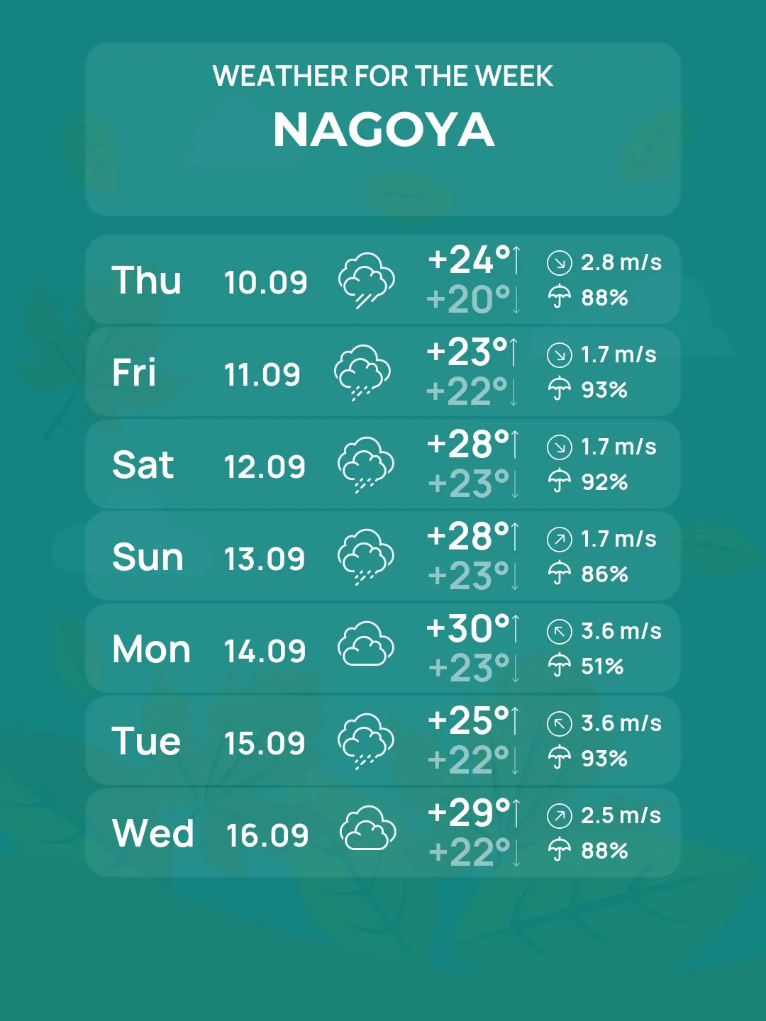
Nagoya 5-day forecast: more heavy rain is possible
The latest Weather Forecaster forecast model does not show a clean return to dry weather.
Instead, it shows another unsettled five-day period.
The most important number in this table is September 11: roughly 96 mm.
That does not mean Nagoya will definitely receive exactly 95.6 mm.
But after a record flood event, even a strong model signal for another 50–100 mm episode deserves attention.
September 9: another 40 mm possible
Weather Forecaster gives around 41 mm for Wednesday.
JMA also expects rain and thunderstorms over Tokai, with locally very intense rainfall possible.
Peak model gusts reach about 14 m/s — 51 km/h.
That means individual thunderstorms could arrive with:
intense rain;
abrupt wind gusts;
lightning;
poor visibility.
Because drainage systems and rivers have just been stressed by more than 200 mm of daily rainfall, Wednesday rain could create problems faster than it normally would.
September 10: cooler but not completely dry
Thursday brings a noticeable temperature drop.
The Weather Forecaster high falls from nearly 30°C Wednesday to about 24°C Thursday.
Rainfall drops to around 5 mm in the city model.
This could provide an important recovery window.
But saturated soil will remain an issue.
A day with light rain does not immediately remove landslide danger.
September 11: the next major risk day
Friday currently stands out as the biggest concern in the new model run.
Weather Forecaster projects around:
95.6 mm of precipitation.
The temperature stays unusually low for early September at around 22°C.
The combination suggests a persistent rain event rather than just an isolated afternoon thunderstorm.
If later forecasts continue showing 70–100+ mm, Friday could become the next major flood-watch period for Aichi.
This forecast needs to be checked repeatedly over the next 24–36 hours.
September 12: temporary improvement
Saturday currently looks much calmer.
Weather Forecaster gives less than 1 mm of precipitation and temperatures recovering to around 29°C.
If this verifies, it may provide the first meaningful drying window after several unstable days.
But rivers and slopes could still react to rainfall that occurred one or two days earlier.
September 13: rain may return again
Sunday is not currently dry.
Weather Forecaster brings precipitation back to around 42 mm.
That means the overall pattern is not:
flood → dry weather.
It is closer to:
record flood → more storms → short break → another rain episode.
Tajimi and eastern Gifu also remain vulnerable
The extreme rainfall corridor was not limited to Nagoya.
JMA also confirmed a new one-hour rainfall record at Tajimi in Gifu Prefecture, where 93.0 mm was observed, breaking the previous station record of 83.5 mm.
Weather Forecaster’s latest five-day forecast for Tajimi shows:
Date
Rain
Sep. 9
47.8 mm
Sep. 10
2.0 mm
Sep. 11
82.3 mm
Sep. 12
2.3 mm
Sep. 13
20.3 mm
The pattern is extremely similar to Nagoya.
That supports the idea that Friday’s renewed rainfall signal is regional, not simply one anomalous Nagoya grid point.
The biggest danger now: saturated ground
Yesterday’s flood changed the meaning of every new rainfall forecast.
Before the record storm, 30–50 mm could have been mainly a drainage issue.
After more than 200 mm in one day, the same 30–50 mm may produce a faster response because:
soil is saturated;
streams remain elevated;
riverbanks are stressed;
drains may be clogged with debris;
slopes have already absorbed large amounts of water.
This is why the current landslide advisory is important even after the rainfall rate falls.
Transport disruption could return quickly
Tuesday’s flooding temporarily disrupted buses and subway services in Nagoya.
Travel conditions improved after the heaviest rain ended, but another strong thunderstorm cluster could again affect:
subway entrances;
underpasses;
local roads;
rail services;
bus routes.
Anyone traveling Friday should recheck warnings before leaving if the 90+ mm Weather Forecaster signal remains in later runs.
Asian Games: no delay for now
The September 19 Asian Games remain scheduled to proceed.
Around 400 athletes and staff were evacuated temporarily during Tuesday’s flooding, but they later returned, and officials reported no injuries.
Several venues had roof leaks, but Mayor Hirosawa said current damage is not sufficient to threaten the Games opening.
The bigger concern now is the weather over the next several days.
Repeated heavy rain could complicate cleanup and final preparations even if no major venue damage has occurred.
Model signal vs official warning
OBSERVED / JMA
Nagoya recorded:
104.5 mm in one hour — all-time record;
219.5 mm on September 8;
a new rainfall extreme in records beginning in 1890.
JMA also issued a Level 5 Flood Special Warning for the Shonai River during the peak of the event.
CURRENT OFFICIAL CONTEXT
The Level 5 emergency has eased, but JMA continues to forecast rain, thunderstorms and locally very intense rainfall in Tokai, while Nagoya remains vulnerable to flood and landslide impacts.
The model shows:
41 mm September 9;
96 mm September 11;
42 mm September 13.
That is a warning signal for repeated heavy-rain episodes, not an official flood warning.
What should people do?
Residents should continue checking JMA warnings even when rainfall temporarily stops.
Avoid:
flooded underpasses;
riverbanks;
drainage channels;
steep slopes after heavy rain.
If another evacuation advisory is issued, act before water blocks escape routes.
Do not assume the city is safe simply because Wednesday or Thursday morning looks quieter.
The strongest Weather Forecaster risk in the next five days currently comes Friday, September 11.
Track Nagoya heavy rain in Weather Forecaster
Check hourly rain, wind and local conditions for Nagoya and other Japanese cities in Weather Forecaster. During flood events, always follow JMA warnings and local evacuation instructions.
Nagoya has just experienced a historic rainfall event.
On September 8, 104.5 mm fell in one hour, breaking every previous one-hour rainfall measurement at the official Nagoya station since records began in 1890.
The city received 219.5 mm in one day.
Roads and homes flooded.
Public transport was disrupted.
Around 3,500 people moved into shelters, while roughly 400 Asian Games athletes and staff were temporarily evacuated.
JMA issued its highest Level 5 flood emergency for the Shonai River.
And now comes the most important part:
the weather pattern has not fully broken.
Weather Forecaster shows another significant rain episode today, a short lull Thursday, then an even stronger 95.6 mm model signal Friday.
So the current Nagoya story is no longer simply:
“Record rain happened yesterday.”
It is:
“Nagoya just broke a 136-year rainfall record — and the atmosphere is still capable of producing more flooding rain over the next several days.”
The Founder and Chief Meteorologist at Pogodnik.com. With over 15 years of operational experience in synoptic analysis and climate forecasting, he specializes in storm tracking, magnetic storms, and atmospheric dynamics. A recognized expert in Ukraine’s meteorological sector, he maintains strategic collaborations with global agencies, including NOAA and ECMWF, to ensure high-precision data integration. His analytical reviews and scientific contributions are regularly featured in leading media outlets dedicated to weather science and environmental trends.