Hurricane Erin makes meteorological history as Atlantic’s fastest-intensifying Cat 5 threatens East Coast surge
Nature has just delivered a masterclass in explosive cyclogenesis that will rewrite textbooks.Hurricane Erin has become one of the fastest-strengthening Atlantic storms on record, achieving what meteorologists call “bomb-genesis” on steroids – a metamorphosis from tropical storm to Category 5 hurricane in a mere 24 hours that defies conventional intensification models.
Hurricane Erin makes meteorological history as Atlantic’s fastest-intensifying Cat 5 threatens East Coast surge.
As of 1700 UTC August 17, 2025, Hurricane Erin represents a textbook example of rapid intensification in a warming climate regime. The storm underwent a period of astonishingly rapid intensification, reaching Category 5 status before weakening to Category 4, with maximum sustained winds fluctuating between 150-160 mph. The central pressure likely bottomed out near 915-920 mb at peak intensity, placing Erin among the most powerful August hurricanes on record for the central Atlantic basin.
The storm’s compact wind field – currently extending hurricane-force winds only 30 miles from the center – is characteristic of rapidly intensifying systems in low-shear environments. However, this deceptively small footprint is misleading. Advanced satellite-derived wind field analysis indicates significant expansion is imminent, with the radius of maximum winds expected to double or triple within the next 72-96 hours.
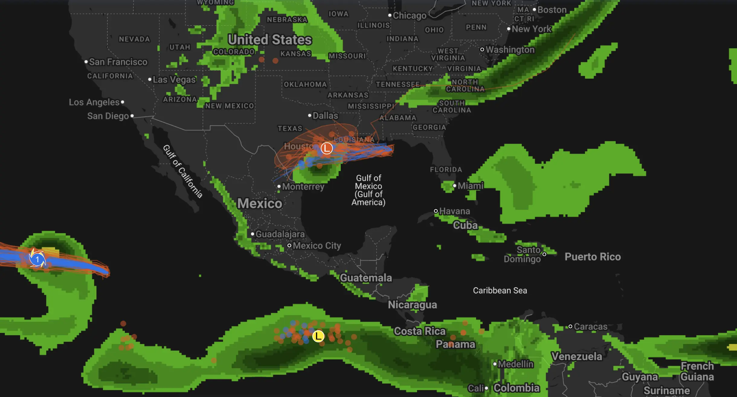
Current position analysis places Erin at approximately 18.5°N, 67.2°W, tracking west-northwest at 17 mph. The storm is experiencing optimal environmental conditions: sea surface temperatures exceeding 29°C, minimal vertical wind shear (less than 10 knots), and abundant mid-level moisture creating a textbook intensification scenario.
Atmospheric Dynamics and Steering Mechanisms
The synoptic pattern governing Erin’s trajectory is dominated by a robust Bermuda High positioned northeast of the storm, creating a classic recurvature setup. Current 500-mb analysis shows a pronounced ridge axis extending from 35°N to 25°N, effectively blocking northward progression and maintaining the westward component of motion.
Critical to understanding Erin’s future track is the evolution of a mid-latitude trough approaching from the continental United States. GFS and ECMWF ensemble guidance suggests this trough will begin to erode the western periphery of the Bermuda High by August 19-20, initiating the classic Atlantic hurricane recurvature pattern.
The storm’s compact inner core structure, evidenced by a well-defined eye wall replacement cycle visible on satellite imagery, indicates mature tropical cyclone characteristics. Microwave analysis reveals concentric eye wall structures – a hallmark of intense hurricanes that typically precede size expansion and eventual weakening.
Track Forecast and Probability Corridors
Near-term trajectory (24-72 hours): Erin will continue west-northwest passage north of the Greater Antilles. The storm will pass approximately 150-200 km north of Puerto Rico and the Virgin Islands, maintaining sufficient distance to avoid direct landfall while producing significant peripheral impacts.
Mid-range forecast (Days 3-5): The critical inflection point occurs around August 20-21 as the approaching trough begins to capture Erin’s circulation. Model consensus indicates a gradual turn to the north-northwest, then north, as the storm begins the classic Atlantic recurvature pattern. This transition will occur somewhere between 70°W and 65°W longitude.
Extended outlook (Days 6-10): Strong waves and rip currents are possible along the East Coast of the United States as early as next week. While direct landfall probability remains low (less than 20% for any individual coastal segment), the expanding wind field will generate significant marine impacts across the western Atlantic.
The most concerning scenario involves a slower recurvature than currently modeled, which would maintain Erin’s westward component longer and bring the storm closer to the U.S. coastline. Cape Hatteras and the Outer Banks face the highest relative risk due to their geographical prominence, though current probability distributions favor an offshore track.
Potential Impact Assessment
Caribbean Basin: Current tropical storm watches for the northern Leeward Islands reflect the storm’s proximity and outer wind field effects. Rainfall totals of 3-6 inches with isolated higher amounts will trigger flash flooding concerns across Puerto Rico and the Virgin Islands. Storm surge of 2-4 feet above normal high tide levels threatens exposed coastal areas.
U.S. East Coast: The expanding wind field poses the most significant threat. As Erin grows to 2-3 times its current size, dangerous rip currents and surf conditions will develop from Florida to Maine. Wave heights of 15-25 feet are forecast for offshore waters, with 8-12 foot surf reaching coastal areas.
Marine Interests: All shipping lanes from the Caribbean to the Mid-Atlantic will experience significant disruption. The storm’s large wind field expansion means impacts extending 300-400 nautical miles from the center, affecting major shipping corridors including the Port of Miami-New York route.
Climate Context and Intensification Analysis
Erin’s explosive development exemplifies the new reality of Atlantic hurricane behavior in a warming climate regime. This type of explosive strengthening is happening more frequently as planet-warming pollution tips the scales toward hotter oceans that fuel powerful storms. The storm’s intensification rate of 60 mph in 9 hours places it among the top 5% of all observed rapid intensification events in the satellite era.
Ocean heat content analysis reveals anomalously deep warm water – the storm traversed areas with 26°C isotherms extending to 150-200 meters depth, providing the thermal energy necessary for such dramatic intensification. These conditions reflect the broader pattern of enhanced hurricane fuel availability across the Atlantic basin.
Forecast Confidence and Key Uncertainties
High confidence exists for the next 72 hours regarding both track and intensity. The storm will maintain major hurricane strength while passing north of the Caribbean islands. Beyond Day 3, confidence decreases significantly due to the complex interaction between Erin’s circulation and the approaching mid-latitude pattern.
The primary uncertainty centers on recurvature timing and the storm’s ultimate closest approach to the U.S. coast. A 48-hour delay in the trough’s arrival could shift Erin’s track 100-200 miles westward, dramatically altering impact potential for the Eastern Seaboard.
Hurricane Erin represents a paradigm shift in Atlantic tropical cyclone behavior – compact, explosively intensifying systems that challenge traditional forecasting approaches. While direct U.S. landfall remains unlikely, the storm’s evolution into a large, powerful hurricane will generate widespread marine impacts across the western Atlantic basin. Coastal communities from North Carolina to New England should prepare for significant surf and rip current conditions beginning midweek, regardless of the storm’s ultimate track.
The Founder and Chief Meteorologist at Pogodnik.com. With over 15 years of operational experience in synoptic analysis and climate forecasting, he specializes in storm tracking, magnetic storms, and atmospheric dynamics. A recognized expert in Ukraine’s meteorological sector, he maintains strategic collaborations with global agencies, including NOAA and ECMWF, to ensure high-precision data integration. His analytical reviews and scientific contributions are regularly featured in leading media outlets dedicated to weather science and environmental trends.