Fall 2025: What This Warm Fall Really Means for Winter 2026
The meteorological dice are rolling across North America, and the pattern emerging for Fall 2025 reads like a classic La Niña playbook—with a twist that seasoned forecasters recognize as the precursor to winter’s harsh realities. We’re looking at what I call “the deceptive warmth phenomenon”—a fall season that will lull the continent into a false sense of climatic security before winter delivers its cold knockout punch.
The ENSO Driver: Weak La Niña Takes the Wheel
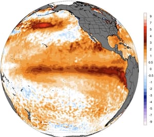
The tropical Pacific is already signaling its intentions. Sea surface temperatures across the ENSO 3.4 region have been steadily cooling throughout August 2025, with trade wind intensification driving the classic upwelling pattern that defines La Niña conditions. While we’re technically still in ENSO-neutral territory, the oceanic trajectory is unmistakable—we’re heading toward a weak La Niña event that will influence atmospheric patterns across North America through the Fall 2025 and early winter seasons.
Current analysis shows the characteristic “wave-like” cooling pattern across the central tropical Pacific, with temperature anomalies running 0.5 to 1.0°C below normal. The North American Multi-Model Ensemble (NMME) and ECMWF seasonal models are in strong agreement: La Niña conditions have approximately a 60-70% probability of developing by October-November 2025, with the event likely persisting through January 2026 before transitioning back to neutral conditions.
September-November Fall 2025: The False Promise
Temperature Outlook: Widespread Warmth Across the Lower 48
The Fall 2025 temperature pattern will be dominated by a persistent high-pressure ridge extending from the southwestern United States through the eastern seaboard. This configuration, driven by the La Niña teleconnection pattern, will deliver above-normal temperatures across 70-80% of the continental United States. The most significant warm anomalies—running 2-4°F above the 1991-2020 climate normal—will center across the Southwest, southern Plains, and Southeast.
However, there’s a critical atmospheric break in this warm pattern. The Pacific Northwest, particularly Washington and Oregon, along with northern Idaho and western Montana, will experience near-normal to slightly below-normal temperatures. This reflects the influence of the North Pacific High’s positioning, which will periodically allow Pacific storm systems to penetrate inland, bringing cooler marine air masses.
Canada presents a more complex picture. Eastern provinces from Ontario through the Maritimes will see above-normal temperatures, while the Prairie provinces and British Columbia experience more variable conditions, with periodic cold air masses dropping south from the Arctic.
Precipitation: The Classic La Niña Fingerprint
The precipitation pattern for Fall 2025 bears the unmistakable signature of weak La Niña influence. The southern tier of states—from California through Texas and extending into the Southeast—will experience below-normal precipitation, with some areas seeing rainfall deficits of 25-40% below average. This dry pattern extends into south-central Canada, affecting southern Alberta, Saskatchewan, and Manitoba.
Conversely, the northern United States will see near-normal to above-normal precipitation. The Pacific Northwest benefits from enhanced storm track activity, while the Great Lakes region and Northeast experience typical Fall storm patterns with adequate moisture. The Ohio Valley and central Plains represent transition zones where precipitation variability will be high, reflecting the seasonal battle between competing air masses.
October-November: The Transition Intensifies
The Jet Stream Evolution
By mid-to-late Fall 2025, the atmospheric pattern begins its critical evolution. The jet stream configuration will become increasingly amplified, with pronounced ridging over the western United States and eastern Canada, while developing deeper troughing over the central Plains and Great Lakes. This pattern sets the stage for what I term “the winter preparation phase”—where atmospheric dynamics begin organizing for the seasonal transition.
Early Snow Signals: November’s Preview
November 2025 deserves special attention from a snowfall perspective. The forecast models indicate above-normal snowfall potential across the central Rockies, northern Plains, and Great Lakes region. Specifically, states like Colorado, Wyoming, Nebraska, Iowa, Wisconsin, Michigan, and northern Illinois show enhanced snowfall probabilities for November.
This early snow pattern is meteorologically significant for two reasons: first, it reflects the strengthening temperature gradient between the warming southern regions and the cooling northern areas; second, it establishes the crucial snow albedo feedback mechanism that will enhance winter’s cold air mass production across central and western Canada.
The La Niña Historical Context: What Past Events Reveal
Analysis of weak La Niña events from 1980-2024 provides crucial insights into Fall 2025’s likely evolution. Historical composites show that weak La Niña falls consistently produce:
Above-normal temperatures across 60-70% of the continental United States
Enhanced ridging over the North Pacific and eastern North America
Suppressed storm activity across the southern United States
Increased jet stream variability leading to periodic temperature swings
However—and this is the critical forecasting element—these same weak La Niña events have historically transitioned into notably colder-than-normal winters across much of North America. The fall warmth is meteorologically deceptive, masking the atmospheric reorganization occurring aloft.
Regional Breakdown: State-by-State Implications
Pacific Coast: Washington and Oregon experience cooler, wetter conditions than the interior. California sees warm, dry weather continuing drought concerns.
Intermountain West: Above-normal temperatures dominate, with early mountain snowfall in Colorado and Wyoming by November.
Great Plains: The region splits—northern areas (North Dakota, Minnesota) see normal to cool conditions with early snow, while southern plains (Texas, Oklahoma) experience persistent warmth and dryness.
Great Lakes: Variable conditions with warm early fall transitioning to more typical late-season patterns. Enhanced lake-effect snow potential by late November.
Southeast: Persistent warmth and dryness, extending the growing season but increasing wildfire risk across the region.
Northeast: Above-normal temperatures early, transitioning to more variable conditions by late fall as the polar jet begins its seasonal southward migration.
The Canadian Perspective: Prairie Preparation
Western Canada faces a particularly interesting fall pattern. The development of above-normal snow cover across Alberta, Saskatchewan, and Manitoba by November creates what meteorologists call “the continental refrigerator effect.” This enhanced snow albedo will prove crucial for winter cold air mass development, setting up the pattern reversal expected for December 2025-February 2026.
The Atmospheric Setup: Winter’s Hidden Blueprint
While fall appears benign on the surface, the atmospheric configuration is systematically organizing for winter’s assault. The persistent North Pacific High and La Niña teleconnection will gradually weaken the polar vortex structure, allowing Arctic air masses greater access to southern latitudes by December 2025.
Sea ice extent across the Arctic has been tracking near-normal levels, providing adequate cold air source regions. Combined with the expected snow cover expansion across central and western Canada, the ingredients for a notably colder winter are falling into place behind fall’s warm façade.
Meteorological Irony in Action
Fall 2025 represents a classic example of seasonal forecasting’s inherent complexity. The widespread warmth and generally benign conditions mask a fundamental atmospheric reorganization driven by La Niña’s influence on global circulation patterns.
For agricultural interests, the warm fall extends growing seasons but raises concerns about winter crop vernalization. For energy markets, reduced heating demand in fall will likely transition sharply to increased demand by December. For winter recreation, early mountain snowfall provides promising base development, while lower elevations may see delayed season starts.
The message for preparedness is clear: enjoy fall’s warmth, but prepare for winter’s reality. The atmospheric stage is being set for a notable seasonal transition, where La Niña’s true influence will be felt not in autumn’s gentle embrace, but in winter’s firm grip on North America’s weather patterns.
Final Confidence Assessment: High confidence in above-normal fall temperatures across most of the United States, moderate confidence in the precipitation patterns, and high confidence that this warm fall represents the classic “calm before the storm” that precedes La Niña winter impacts.
The Founder and Chief Meteorologist at Pogodnik.com. With over 15 years of operational experience in synoptic analysis and climate forecasting, he specializes in storm tracking, magnetic storms, and atmospheric dynamics. A recognized expert in Ukraine’s meteorological sector, he maintains strategic collaborations with global agencies, including NOAA and ECMWF, to ensure high-precision data integration. His analytical reviews and scientific contributions are regularly featured in leading media outlets dedicated to weather science and environmental trends.