Extreme Heat Warnings: NOAA Issues Alerts for Record-Breaking Heatwave in South-Central Texas

A powerful early-season heatwave is sweeping across south-central Texas, with the National Oceanic and Atmospheric Administration’s (NOAA) National Weather Service (NWS) issuing a suite of heat-related warnings to address the life-threatening conditions. Forecasts indicate temperatures soaring to 44.5°C (112°F), potentially shattering May records in cities like Austin, San Antonio, and Alice. High humidity will exacerbate the heat, pushing heat index values to dangerous levels. NOAA’s warnings, including Heat Advisories and Excessive Heat Warnings, underscore the severity of this unseasonal event, urging residents to take immediate precautions.
Meteorological Setup: A High-Pressure Ridge Fuels the Heat
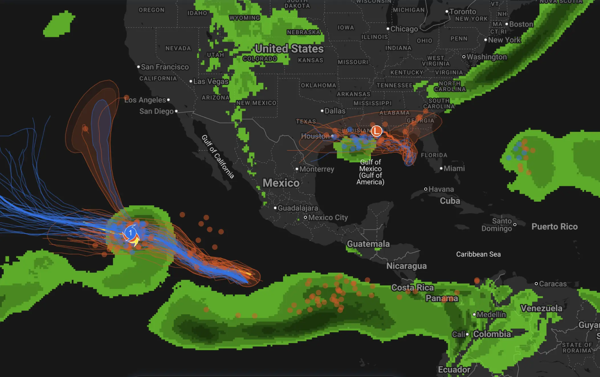
The extreme heat is driven by a formidable high-pressure ridge, a synoptic-scale feature that has established itself over the southern Plains. This ridge, characterized by subsidence—sinking air that warms adiabatically—creates a heat dome, locking in scorching temperatures and suppressing convective activity. Warm, moist air advecting from the Gulf of Mexico is further amplifying the heat, with dew points in the mid-20s°C (mid-70s°F) contributing to oppressive humidity.
The NWS forecast, valid through 05:00 EDT on May 15, 2025, highlights triple-digit temperatures across south-central Texas, with Alice projected to endure some of the highest values through Tuesday, May 20. The heat index, which accounts for the combined effects of temperature and humidity, is expected to reach 44°C (111°F) in Alice on Wednesday, May 14, and 43°C (110°F) on Saturday, May 17. These values indicate a “feels-like” temperature far exceeding the actual air temperature, posing significant risks to human health.
Video analyses from Tropical Tidbits depict the ridge’s expansive footprint, with 500-hPa height anomalies signaling its intensity. The absence of upper-level troughs or jet stream perturbations means the heat dome will likely persist, with minimal relief until mid-next week. This prolonged event, atypical for mid-May, aligns with climatological shifts toward earlier and more intense heatwaves.

NOAA’s Warning Systems: Heat Advisories and Excessive Heat Warnings
NOAA’s NWS has deployed a tiered warning system to communicate the heatwave’s dangers. The following alerts are active across south-central Texas, effective through at least Wednesday, May 14, and potentially extending into the weekend:
Heat Advisory: Issued for counties encompassing Austin, San Antonio, Alice, Orange, and San Diego, this advisory targets areas where the heat index is expected to range from 40.5°C (105°F) to 43°C (110°F) for at least two consecutive days. The advisory signals a moderate risk of heat-related illnesses, particularly for vulnerable populations such as the elderly, children, and outdoor workers.
Excessive Heat Warning: In effect for portions of Jim Wells County, including Alice, this warning is reserved for the most extreme conditions, where the heat index exceeds 43°C (110°F) or air temperatures surpass 41°C (106°F) for extended periods. The warning, triggered by the forecast of 44°C (111°F) heat index values on Wednesday, indicates a high likelihood of heatstroke and other severe health impacts without proper precautions.
These warnings are informed by NWS heat index thresholds, which vary by region to account for local acclimatization. In south-central Texas, where residents are accustomed to warm springs, the early onset of summer-like conditions has heightened the alerts’ urgency. The NWS has also issued Special Weather Statements for adjacent areas, advising vigilance as temperatures approach advisory criteria.
The recent storms in Alice on May 8, which injured four and prompted a disaster declaration, have compounded the region’s vulnerability. Damaged infrastructure and disrupted utilities may limit access to air conditioning, amplifying the heatwave’s impact. NOAA’s warnings emphasize the need for community-level preparedness in these hard-hit areas.
Impacts and Risks of the Heatwave
The heatwave poses multifaceted risks to public health, infrastructure, and the environment. High heat index values reduce the body’s ability to thermoregulate, as sweat evaporation is hindered by saturated air. This increases the incidence of heat exhaustion—marked by symptoms like fatigue, nausea, and muscle cramps—and heatstroke, a life-threatening condition involving neurological dysfunction and organ failure.
Urban centers like Austin and San Antonio face additional challenges due to the urban heat island effect, where impervious surfaces absorb and re-radiate heat, elevating local temperatures by 2–5°C (4–9°F). Rural areas, such as Alice, are not spared, as high humidity and limited cooling resources exacerbate conditions. The agricultural sector, a cornerstone of Texas’s economy, is also at risk, with heat stress threatening livestock and reducing crop yields.
Power grids are under strain as air conditioning demand surges, raising the specter of rolling blackouts. Transportation infrastructure, including asphalt roads and rail lines, may deform under prolonged heat, disrupting commerce and emergency response. The NWS’s maximum heat index forecast graphic for May 13, 2025, illustrates the widespread nature of the threat, with nearly all of south-central Texas under alert.
NOAA’s Safety Guidance
To combat the heatwave’s dangers, NOAA and the NWS have issued detailed safety recommendations:
Hydration: Consume water regularly, even without thirst, and avoid dehydrating beverages like alcohol or caffeine.
Cool Environments: Seek air-conditioned spaces, such as homes, libraries, or designated cooling centers. In Alice, local authorities have opened temporary shelters for storm-affected residents.
Time Outdoors: Minimize outdoor activities between 10 a.m. and 6 p.m., when solar radiation peaks. If work is unavoidable, take frequent breaks in shaded or cooled areas.
Vulnerable Populations: Monitor infants, the elderly, and those with chronic illnesses, ensuring they remain cool and hydrated.
Warning Signs: Recognize symptoms of heat-related illnesses, such as dizziness or confusion, and seek immediate medical care if heatstroke is suspected.
The NWS advises employers to implement heat safety protocols, including providing water, rest, and shade for outdoor workers. Pet owners are urged to ensure animals have access to water and shelter, as high temperatures can be equally dangerous for pets.
Contextualizing the Heatwave: Climate Trends
While the heatwave is a discrete meteorological event, it aligns with broader trends in extreme weather. NOAA’s climate data indicate that heatwaves are becoming more frequent, intense, and prolonged across the United States, driven by rising global temperatures. In Texas, the interplay of Gulf moisture and high-pressure systems creates a fertile ground for such events, with urban growth amplifying their impact.
The early timing of this heatwave—mid-May rather than July or August—raises concerns about seasonal shifts. NOAA’s Climate Prediction Center notes that above-average temperatures may persist into late spring, potentially setting the stage for a challenging summer. Mitigation strategies, such as expanding urban tree canopies and enhancing cooling infrastructure, are gaining traction in Texas cities to address these evolving risks.
Forecast Outlook and Community Response
Wednesday, May 14, marks the heatwave’s peak, with Alice and surrounding areas facing the highest heat index values. The NWS anticipates a slight weakening of the high-pressure ridge by mid-next week, potentially allowing weak frontal systems to introduce cooler air. However, above-normal temperatures are likely to linger, necessitating ongoing vigilance.
Communities across south-central Texas are mobilizing to support residents. In Alice, relief efforts are addressing both storm recovery and heat preparedness, with local organizations distributing water and cooling supplies. Austin and San Antonio have expanded cooling center hours, while public awareness campaigns are promoting NOAA’s safety guidelines.
Residents are encouraged to stay updated via NWS alerts, available through NOAA Weather Radio, mobile apps, and local media. The agency’s heat index forecast graphic, released on May 13, 2025, serves as a critical tool for planning daily activities. As Texas navigates this extreme heat event, collective action and informed decision-making will be essential to safeguarding lives and livelihoods.