Europe Heat Dome Forecast: What Is Known as of May 22, 2026
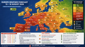
Key points: The main heat episode is expected from May 22 to May 29, 2026. The core of the heat begins over Iberia, then shifts into France, Benelux, Germany and the British Isles during the weekend of May 23–25. Southern Spain and parts of Portugal may reach +35…+38°C. Paris and London may approach or exceed +30°C, with some forecasts indicating around +32°C. The UK has heat-health alerts in force from May 22 to May 27. By May 26–29, the warm air mass is expected to spread farther into central Europe, northern Italy, the Alpine region and the Balkans, while storm risk increases along the edges of the heat dome.

What changed by May 22, 2026?
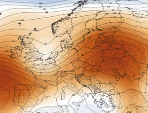
By May 22, the forecast signal had become much clearer. The event is no longer just a distant model idea: western Europe is already entering the first major heat episode of the season. The background pattern shows a strengthening upper-level ridge pushing north from northwest Africa into Iberia, France, the UK and central Europe. This ridge is the engine of the heat dome.
The key detail is the speed of the reversal. Earlier in May, much of Europe experienced an unusually cool spell linked to Arctic air. Now the continent is moving quickly into a summer-like setup. In many places, the change may feel abrupt: from cool spring weather to strong sunshine, dry air, hot afternoons and warm urban nights in less than a week.
| Forecast status on May 22 | What it means | Confidence level |
|---|---|---|
| Heat dome over western Europe | High pressure traps and compresses warm air near the surface | High |
| Major Iberian heat | Spain and Portugal face the highest temperatures first | High |
| France and UK heat peak | Paris, London and southern England may approach +30…+32°C | High to moderate |
| Eastward spread next week | Germany, Benelux, Alps, Italy and the Balkans turn much warmer | Moderate |
| Thunderstorms on the edge | Localized storms may form where heat meets moisture or cooler air | Moderate |
Why this is a heat dome, not just normal late-May warmth
A heat dome develops when a strong high-pressure ridge becomes established over a large region. Air inside the high pressure sinks, compresses and warms. Clouds are suppressed, rainfall becomes limited, and solar heating increases day after day. The effect is similar to placing a lid over a pot: heat builds underneath and has difficulty escaping.
In this case, the ridge is being fed by very warm air moving north from northwest Africa. That warm plume is expected to spread across Iberia first, then expand into western and central Europe. The result is a late-May temperature anomaly that may reach 10–15°C above normal in parts of western Europe.
| Heat dome ingredient | Current signal | Weather impact |
|---|---|---|
| Upper-level ridge | Strengthening over western and central Europe | Supports broad warming and stable weather |
| Surface high pressure | Building under the ridge | Suppresses clouds and widespread rain |
| African warm plume | Moving north from Iberia into France and the UK | Raises temperatures rapidly |
| Dry air and sunshine | Favored inside the high-pressure core | Increases fire risk and urban heat stress |
| Unstable margins | Likely near the Alps, central Europe and Balkans later | Can trigger local thunderstorms |
Forecast by date: May 22–29, 2026
The hottest conditions will not arrive everywhere at once. The event begins over Iberia, peaks over western Europe through the weekend, then extends farther east during the final week of May. The exact eastern boundary remains uncertain, but the signal for above-normal temperatures is strong.
| Date | Main heat zone | Expected weather | Main risk |
|---|---|---|---|
| May 22, Friday | Spain, Portugal, southwest France | Heat intensifies, many areas above +30°C | Heat stress, strong sun, rising fire danger |
| May 23, Saturday | Iberia, France, Benelux, western Germany | Summer-like warmth spreads north and east | Urban heat, dehydration, dry vegetation |
| May 24, Sunday | France, UK, Benelux, western Germany | Potential peak for parts of western Europe | Possible local May records, health impacts |
| May 25, Monday | UK, France, Germany, Alps, northern Italy | Heat dome remains strong; warmth expands | Hot cities, travel stress, wildfire risk |
| May 26, Tuesday | Central Europe, Alps, northern Italy, Balkans | Very warm air spreads farther east | Thunderstorms possible on the margins |
| May 27, Wednesday | Germany, Czechia, Austria, Slovakia, Hungary | Above-normal warmth continues | Heat fatigue and localized storms |
| May 28–29 | Central and southeast Europe | Warm pattern likely persists, but details depend on ridge position | Storm risk rises where cooler air approaches |
Spain and Portugal: the first and strongest heat zone
Spain and Portugal remain the leading hotspot of this event. Inland and southern areas are expected to see the highest temperatures, with forecast values widely in the low to mid-30s and locally reaching the upper 30s. For late May, these values are much closer to midsummer than to normal spring weather.
The most exposed areas are southern Spain, inland Andalusia, parts of Extremadura, inland Portugal and the lower valleys where heat can pool. Coastal areas may be moderated by sea breezes, but even there the sun angle is now high enough to create strong heat stress during the afternoon.
| Area | Possible maximum temperature | Peak window | Key concern |
|---|---|---|---|
| Southern Spain | +35…+38°C | May 22–25 | Dangerous afternoon heat |
| Central Spain | +32…+36°C | May 23–25 | Hot urban conditions and dry air |
| Southern Portugal | +33…+37°C | May 23–25 | Wildfire danger and heat stress |
| Atlantic coastal zones | +25…+31°C | May 22–26 | Strong sun despite cooler sea influence |
France: records may be challenged
France is one of the key countries to watch because the heat plume is expected to expand directly from Iberia into the southwest, west and eventually north of the country. Southwest France may see values in the low to mid-30s, while Paris and other northern cities may climb toward +30°C or higher.
The risk in France is not only high daytime temperature. Warm nights may become a problem in urban areas if the air mass remains stagnant. Cities such as Paris, Nantes, Bordeaux, Toulouse and Lyon may feel significantly hotter because of concrete, asphalt, limited nighttime cooling and the urban heat island effect.
| French region | Likely temperature range | Timing | Main impact |
|---|---|---|---|
| Southwest France | +31…+35°C | May 22–25 | Strong heat and possible local records |
| Western France | +28…+33°C | May 23–25 | Unusual late-May warmth |
| Paris region | +29…+32°C | May 24–27 | Urban heat and transport discomfort |
| Eastern France | +26…+31°C | May 25–28 | Heat followed by possible storm risk |
United Kingdom and Ireland: unusual heat and health alerts
The United Kingdom is under a much stronger heat signal than is typical for late May. Southern England, the Midlands, East Anglia and London are expected to experience the highest values, with temperatures potentially reaching around +30…+33°C in the hottest spots. This is why heat-health alerts are important: the risk is not just the temperature itself, but the early timing of the event.
As of May 22, amber heat-health alerts are in force for several English regions, including London, the South East, East of England, East Midlands and West Midlands, with yellow alerts covering other parts of England. These alerts run through May 27, highlighting the possible strain on health and social care systems.
Ireland is expected to be warm but generally less extreme. Inland eastern and southeastern areas may approach the low to mid-20s, while Atlantic-facing coasts remain cooler due to the sea influence. Scotland and northern England should also be warmer than normal, though not as hot as southern England.
| UK and Ireland zone | Expected maximum | Peak window | Risk level |
|---|---|---|---|
| London and southeast England | +30…+33°C | May 24–26 | High for vulnerable groups |
| Midlands and East Anglia | +29…+33°C | May 24–26 | High heat-health concern |
| Northern England | +24…+29°C | May 24–27 | Moderate |
| Scotland | +20…+25°C | May 24–27 | Lower but still warm for May |
| Ireland | +20…+25°C | May 25–27 | Moderate UV and heat exposure |
Germany, Benelux and central Europe: summer arrives fast
Germany, Belgium, the Netherlands and Luxembourg are expected to move into the warmer part of the event during the weekend and early next week. The first push will be strongest across western Germany, the Rhine corridor and Benelux, where temperatures may climb into the upper 20s and locally near +30°C.
By May 26–28, the warm air should spread deeper into central Europe. Czechia, Austria, Slovakia and Hungary may experience widespread above-normal temperatures. The most important uncertainty is storm development: if cooler or more humid air approaches from the north or west, the edge of the heat dome could become unstable.
| Region | Possible temperature | Most likely timing | Forecast note |
|---|---|---|---|
| Belgium and Luxembourg | +26…+30°C | May 23–26 | First strong summer signal |
| Netherlands | +24…+29°C | May 23–26 | Coasts cooler, inland warmer |
| Western Germany | +27…+31°C | May 24–27 | Warmest in Rhine and urban areas |
| Central Germany | +25…+30°C | May 25–28 | Heat expands eastward |
| Czechia and Austria | +25…+30°C | May 26–28 | Storm risk may rise near mountains |
| Hungary and Slovakia | +27…+32°C | May 26–29 | Humid heat possible |
Italy, the Alps and the Balkans: heat plus thunderstorm potential
Italy and the Balkans are likely to warm more clearly after the heat dome matures over western Europe. Northern Italy, the Po Valley, Slovenia, Croatia, Serbia, Bosnia and parts of the western Balkans may see temperatures in the upper 20s to low 30s later in the period.
The Alpine region is more complex. Valleys can become very warm, while mountain areas may act as thunderstorm triggers. If moist air is present, strong afternoon heating can lead to convective showers or storms near the Alps, northern Italy, Austria and the western Balkans.
| Area | Expected pattern | Timing | Risk |
|---|---|---|---|
| Northern Italy | Hot and increasingly humid | May 25–29 | Thunderstorms near Alps |
| Central Italy | Warm to hot | May 26–29 | Heat stress in cities |
| Alpine valleys | Strong daytime warming | May 25–28 | Mountain storms |
| Croatia and western Balkans | Summer-like temperatures | May 26–29 | Local storms and heat fatigue |
| Serbia, Bosnia and Hungary | Very warm, locally hot | May 27–29 | Humidity and storm risk |
Eastern Europe and Ukraine: warmer trend, but lower confidence
For eastern Europe, including Ukraine, the forecast is less certain than for western Europe because the core of the heat dome is expected to mature farther west first. However, by May 27–29, warmer-than-normal air may spread eastward into parts of Poland, Slovakia, Hungary, Romania, Moldova and western Ukraine.
The key question is how far east the ridge expands before Atlantic or northern European disturbances begin to weaken it. If the high-pressure zone remains strong, eastern Europe will see a more obvious warm-up. If the ridge shifts or breaks down earlier, the region may instead see a mix of warm air, cloudiness and thunderstorms.
| Eastern European area | Current signal as of May 22 | Timing | Confidence |
|---|---|---|---|
| Poland | Warmer, especially west and south | May 26–29 | Moderate |
| Romania | Warm to locally hot | May 27–29 | Moderate |
| Moldova | Possible warmer trend | May 27–29 | Low to moderate |
| Western Ukraine | Potential warm-up if ridge expands east | May 27–29 | Low to moderate |
| Baltic states | Less direct heat-dome influence | Late period | Lower |
Health risk: why this heat is dangerous even before summer
Late-May heat can be more dangerous than the same temperature in July because people are less acclimatized. Homes, schools, transport networks and workplaces may not yet be operating in full summer mode. Many people underestimate the sun strength, especially after a cool spell.
The highest risk is for older adults, young children, people with heart or respiratory conditions, outdoor workers, tourists and anyone attending large events. Warm nights are also important: if temperatures remain high overnight, the body has less time to recover from daytime heat stress.
| Group | Why risk is higher | Practical advice |
|---|---|---|
| Older adults | Heat regulation is weaker and dehydration risk is higher | Stay indoors during peak heat and drink regularly |
| Children | They overheat faster and may not ask for water in time | Keep them out of parked cars and direct midday sun |
| Outdoor workers | Long exposure to sun and hot surfaces | Shift heavy work to morning and take shade breaks |
| Tourists | Long walking routes and poor local awareness | Plan shaded stops and avoid afternoon sightseeing |
| People with chronic illness | Heat can worsen heart, lung and kidney stress | Follow medical advice and keep medication cool |
Wildfire and drought concerns
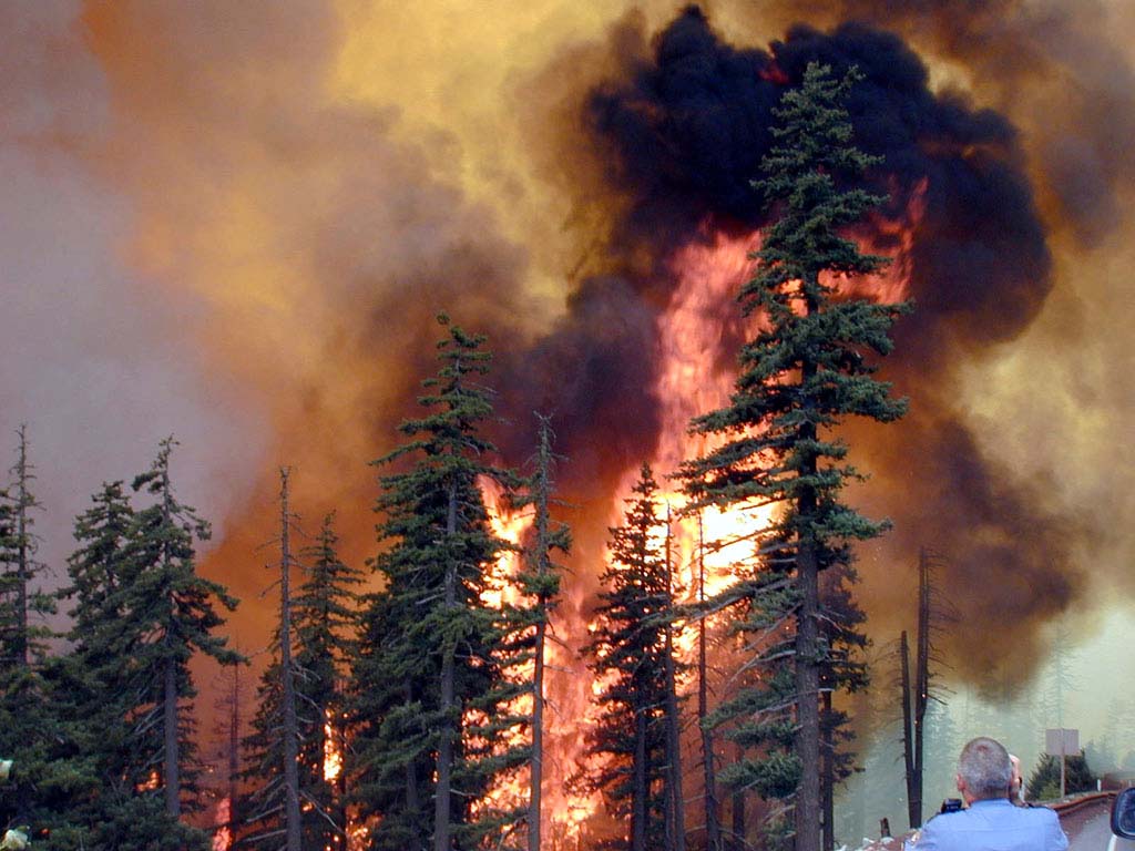
The heat dome will increase evaporation and dry out surface vegetation, especially in areas that already had dry soil or limited recent rainfall. The wildfire risk is most important in Portugal, Spain, southern France, parts of Italy and the western Balkans. Even if the event lasts only several days, strong sun, hot air and local wind can quickly raise fire danger.
Farmers should also watch soil moisture. Warmth can accelerate crop growth after a cool period, but excessive heat and dry wind can stress young plants. Vineyards, orchards, vegetables and recently planted crops may require careful irrigation management, especially where rainfall has been limited.
Model comparison: what ECMWF and GFS agree on
As of May 22, the broad agreement between major forecast models is strong. Both ECMWF-type and GFS-type guidance support a major ridge over western Europe, a warm plume from northwest Africa and a period of unusually high temperatures across western and central Europe. The main disagreement is not whether the heat happens, but exactly where the hottest core sits and how long it persists.
| Forecast question | Current model agreement | Remaining uncertainty |
|---|---|---|
| Will western Europe turn hot? | Yes, strong agreement | Exact daily records by city |
| Will Spain and Portugal be the hottest zone first? | Yes, high confidence | Local maxima in inland valleys |
| Will the UK and France approach record territory? | Yes, possible in several areas | Cloud cover and sea-breeze effects |
| Will heat spread into central Europe? | Likely | How far east and how long |
| Will storms develop? | Likely on the margins | Timing, coverage and severity |
Bottom line for Europe
As of May 22, 2026, Europe is facing a notable late-May heat dome event. The highest confidence is for Spain, Portugal, France, the UK, Benelux and western Germany, where abnormal warmth is already expected through the weekend and early next week. The strongest heat may reach +35…+38°C in Iberia and around +30…+33°C in parts of France and southern England.
The event is important because it arrives after a cool spring pattern and before many people are prepared for sustained summer heat. The main hazards are heat stress, wildfire risk, dry soils, urban overheating and localized thunderstorms near the edge of the hot air mass. The key advice is simple: treat this as a real early-season heat event, not just a pleasant warm weekend.
FAQ: Europe heat dome forecast as of May 22, 2026
When will the heat peak in Europe?
The first peak is expected from May 23 to May 26 across western Europe, especially Spain, Portugal, France, the UK, Benelux and western Germany. Central and southeastern Europe may feel the strongest warmth from May 26 to May 29.
Which countries will be hottest?
Spain and Portugal are expected to be the hottest at first, with possible highs of +35…+38°C. France, southern England, Benelux and western Germany may also see unusually high late-May temperatures near or above +30°C.
Will the heat reach eastern Europe and Ukraine?
Possibly, but confidence is lower. The warmest core is expected over western Europe first. By May 27–29, warmer air may spread into Poland, Romania, Moldova and western Ukraine if the ridge expands far enough east.
Why is this heatwave unusual?
It follows a cool period and arrives before the main summer season. In some areas, temperatures may climb 10–15°C above normal, which increases health risks because people are not yet fully acclimatized.
Will there be thunderstorms?
Yes, thunderstorms are possible near the edges of the heat dome, especially around the Alps, northern Italy, central Europe and parts of the Balkans later in the period.
What should tourists and residents do?
Avoid peak afternoon sun, drink water regularly, use sun protection, check local heat warnings and do not leave children, pets or vulnerable people in parked vehicles.
Our Free Weather App – https://play.google.com/store/apps/details?id=com.bitltd.pogodnik