Europe Hit by a Late-November Snowfall Collapse

Between 23 and 25 November, large parts of Europe were hit by a powerful Arctic outbreak that brought widespread snowfall from the Balkans to Hungary, Poland and the Pyrenees. Transport networks stalled, mountain passes closed, and Meteoalarm issued multiple alerts.
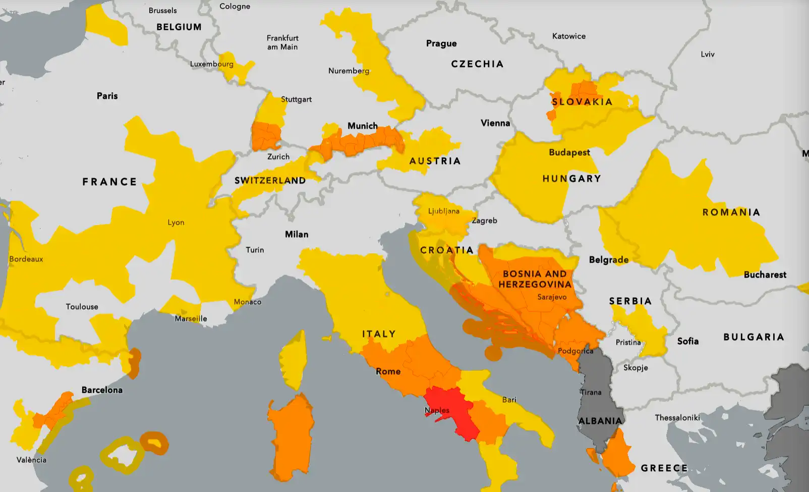
Where the Snow Fell
Balkans
Heavy snow paralysed Sarajevo and caused red-level warnings in Croatia, where strong winds overturned vehicles and forced road closures.
Hungary
Western Hungary saw 10–15 cm of snow, stranding buses and isolating several villages.
Spain & the Pyrenees
Early alpine conditions brought sub-zero temperatures and increased avalanche danger above 1500 m.
Central Europe
Poland recorded its first major snowfall of the season with widespread traffic disruption. Snow also reached western Ukraine.
Why It Happened
An Arctic air surge collided with moist Atlantic and Mediterranean flows, creating active snow fronts across Europe.
Meteoalarm Overview
- Bosnia & Herzegovina – snow/ice alerts
- Croatia – red-level storm and snow warnings
- Spain – snow/frost alerts in the Pyrenees
- Central Europe – freeze-thaw risk
Snow Forecast
More snow is expected in the Baltics, Poland, Czechia and the Alps during the next 24 hours.
Where Snow Falls Tomorrow (26 November)
| City | Weather | Temperature |
|---|---|---|
| Riga | Wet snow | +2 → –2°C |
| Vilnius | Snow/sleet | +1 → –3°C |
| Warsaw | Wet snow | +2 → –1°C |
| Prague | Snow with rain | +2 → –1°C |
| Zurich | Wet snow | +3 → –1°C |

Gleb Perov is the founder and chief meteorologist of POGODNIK, a leading weather forecasting service in Eastern Europe. With over 15 years of hands-on experience in meteorology and climate analysis, he has worked private weather services.
Gleb is the author of numerous scientific and analytical publications on climate, magnetic storms, and atmospheric processes. He regularly collaborates with major international agencies such as NOAA, ECMWF.


 in Two Decades")
