Dangerous Ice Storms Loom Over Northeastern US This Weekend
The National Weather Service has issued a Winter Weather Advisory for Upper Bucks, Lehigh, and Northampton counties north of Philadelphia, as well as portions of New Jersey, Connecticut, Massachusetts, Vermont, and New Hampshire.
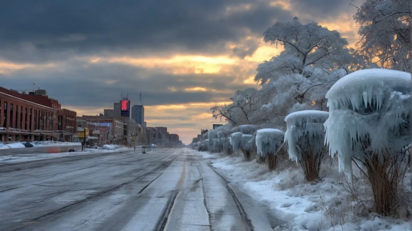
What to Expect:
Ice Accumulation: A light glaze to 2.5 mm (one-tenth of an inch) of ice.
Temperatures: Hovering around -2°C (20°F) overnight, rising to 4–9°C (40°F) by Saturday afternoon.
Hazards: Slippery roads, increased risk of falls, and potential travel delays.
Residents are urged to exercise caution when venturing outdoors, especially on stairs and sidewalks, and to drive slowly on icy roads.
Rain will move in, with temperatures climbing to a milder 10–15°C (50°F). Breaks in the rain are expected, but freezing rain could linger in colder areas.
Warmer air sweeps in, pushing temperatures to 16–20°C (60°F). While Sunday promises mostly dry weather, rain may return by nightfall.
Elsewhere in the U.S.:
The Pacific Northwest remains under siege by relentless storms, bringing torrential rain and heavy snow to the region. Northern California, the Cascades, and the Sierra Nevada could see up to 125 mm (5 inches) of rain and 90 cm (3 feet) of snow by Sunday. Flood risks, mudslides, and swollen rivers are a growing concern.
Meanwhile, the central U.S. basks in unseasonably warm temperatures, with potential record-breaking highs through the weekend.
Whether you’re navigating icy roads in the Northeast or monitoring rising rivers in the Northwest, stay tuned to local forecasts and prepare for rapidly changing conditions.

Gleb Perov is the founder and chief meteorologist of POGODNIK, a leading weather forecasting service in Eastern Europe. With over 15 years of hands-on experience in meteorology and climate analysis, he has worked private weather services.
Gleb is the author of numerous scientific and analytical publications on climate, magnetic storms, and atmospheric processes. He regularly collaborates with major international agencies such as NOAA, ECMWF.


