Unpacking the Fury: A Guide to Hurricanes, Tornadoes, and Storm Surges
The Earth’s weather is a powerful force, capable of unleashing breathtaking beauty and devastating destruction. Hurricanes, tornadoes, and storm surges are among the most potent of these forces, capable of upending lives and landscapes in a matter of hours. Understanding these phenomena is crucial for preparedness and safety, especially for those living in areas prone to these severe weather events.
Hurricanes: The Force of Nature’s Fury
Hurricanes, also known as typhoons or cyclones depending on their location, are massive rotating storms with intense winds, heavy rain, and destructive storm surges. They form over warm ocean waters, fueled by the heat and moisture they absorb.
Formation and Development:
- Tropical Depression: A cluster of thunderstorms with organized circulation and sustained winds of up to 38 mph (62 km/h).
- Tropical Storm: A depression that intensifies with sustained winds of 39-73 mph (63-118 km/h). It’s given a name at this stage.
- Hurricane: A tropical storm with sustained winds exceeding 74 mph (119 km/h).
Hurricane Structure:
- Eye: The calm center of the storm, with clear skies and low wind speeds.
- Eyewall: A ring of intense thunderstorms surrounding the eye, experiencing the strongest winds and heaviest rainfall.
- Spiral Bands: Bands of thunderstorms spiraling outward from the eyewall, producing rain and wind gusts.
Hurricane Impacts:
- Strong Winds: High winds can cause widespread damage to buildings, trees, power lines, and infrastructure.
- Heavy Rainfall: Flooding is a major threat, particularly in low-lying areas and urban zones with inadequate drainage systems.
- Storm Surge: A rise in sea level caused by the hurricane’s powerful winds pushing water toward the shore, inundating coastal areas.
- Tornadoes: Hurricanes can spawn tornadoes, adding further danger to the already perilous storm.
Hurricane Season:
Hurricanes occur most frequently in the Atlantic and Eastern Pacific basins, with seasonality varying slightly across regions. The Atlantic hurricane season runs from June 1st to November 30th, peaking in September.
Saffir-Simpson Hurricane Wind Scale
| Category | Sustained Winds(MPH) | Damage | Storm |
|---|---|---|---|
| One | 74-95 | Minimal: Unanchored mobile homes, vegetation and signs. | 4-5 feet |
| Two | 96-110 | Moderate: All mobile homes, roofs, small crafts, flooding. | 6-8 feet |
| Three | 111-130 | Extensive: Small buildings, low-lying roads cut off. | 9-12 feet |
| Four | 131-155 | Extreme: Roofs destroyed, trees down, roads cut off, mobile homes destroyed. Beach homes flooded. | 13-18 feet |
| Five | More than 155 | Catastrophic: Most buildings destroyed. Vegetation destroyed. Major roads cut off. Homes flooded. | Greater than 18 feet |
Tornadoes: The Whirlwind of Destruction
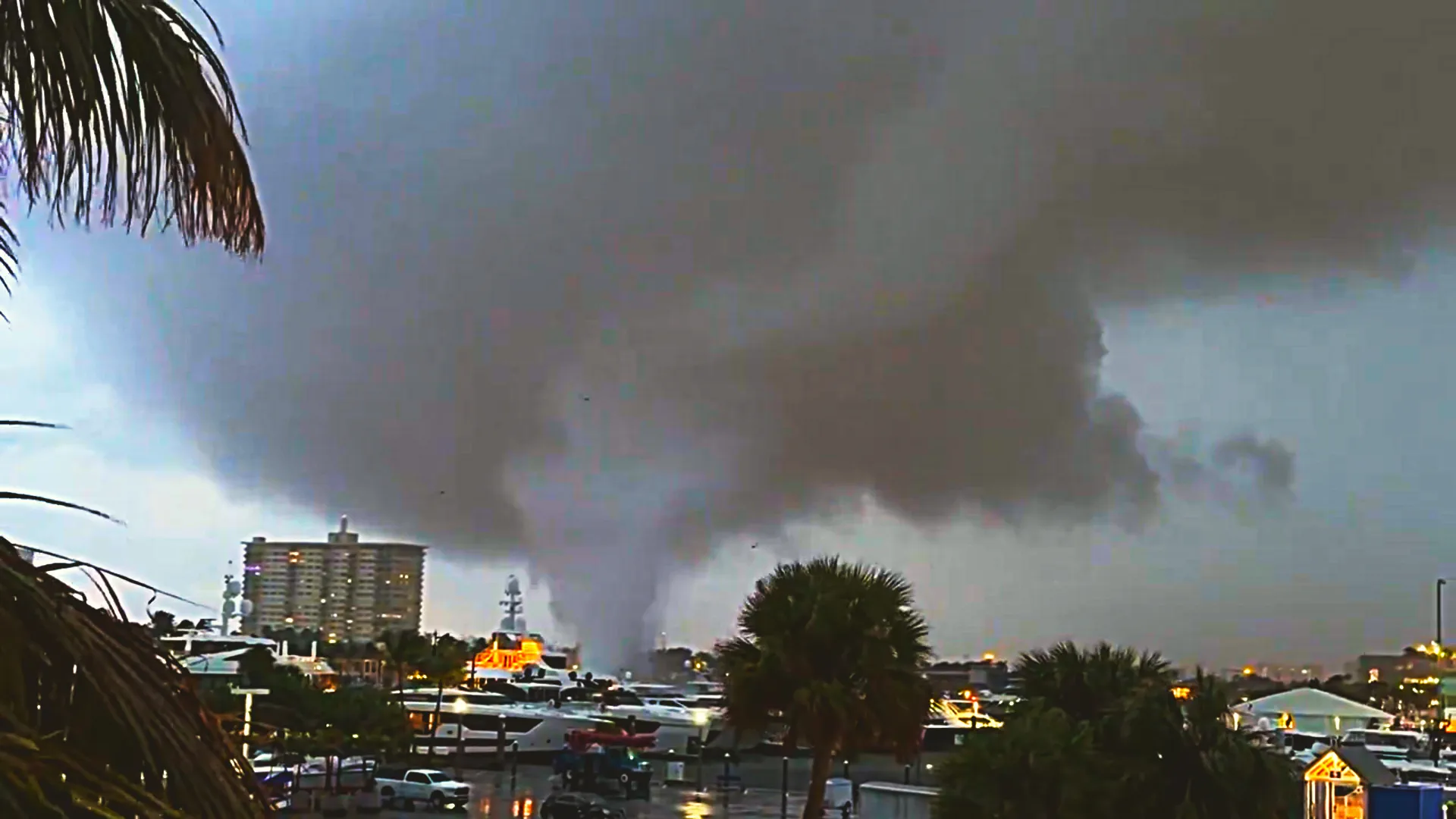
Tornadoes are violently rotating columns of air that extend from a thunderstorm cloud to the ground. They are known for their intense winds, which can reach speeds exceeding 300 mph (480 km/h), creating a funnel-shaped vortex of destruction.
Formation:
Tornadoes form when a powerful thunderstorm encounters strong wind shear, where winds change direction or speed with height. This creates a spinning vortex within the thunderstorm, which can eventually descend to the ground as a tornado.
Tornado Types:
- Supercell Tornadoes: The most powerful and destructive tornadoes, formed within large, rotating thunderstorms known as supercells.
- Non-Supercell Tornadoes: Tornadoes that form in other types of thunderstorms, usually weaker and less frequent.
Tornado Impacts:
- Extreme Winds: The intense winds can cause significant damage to buildings, trees, and other structures.
- Debris and Flying Objects: Tornadoes pick up debris and projectiles, turning them into deadly missiles.
- Flooding: Tornadoes can produce heavy rainfall, leading to flash flooding in vulnerable areas.
Tornado Season:
While tornadoes can occur year-round, the peak season varies by location. In the United States, the “Tornado Alley” region spanning from Texas to Nebraska experiences the highest frequency, with the peak season running from April to June.
Tornadoes are measured using the Enhanced Fujita (EF) Scale, which categorizes them based on their wind speed and the level of destruction they cause. The scale ranges from EF0 (winds of 65-85 mph) to EF5 (winds exceeding 200 mph), with the higher-category tornadoes being the most devastating.
Storm Surges: The Rising Tides of Destruction
Storm surges are an abnormal rise in sea level caused by strong winds pushing water towards the shore during a hurricane or other severe storm. They are particularly dangerous as they combine the force of high tides with the storm’s powerful winds, creating a wall of water that can inundate coastal areas.
Factors Influencing Storm Surge:
- Storm Strength: The stronger the hurricane, the higher the potential storm surge.
- Size and Shape of the Storm: A wider storm can push more water towards the shore.
- Tidal Stage: High tides exacerbate the impact of storm surges.
- Coastal Topography: The shape and slope of the coastline influence the extent and height of the surge.
Storm Surge Impacts:
- Coastal Flooding: Storm surges can inundate coastal communities, causing widespread damage to buildings, infrastructure, and ecosystems.
- Erosion: The powerful waves and surges erode shorelines, damaging beaches and coastal structures.
- Saltwater Intrusion: Storm surges can push saltwater inland, contaminating freshwater sources and damaging crops.
Storm Surge Forecasting:
Meteorologists use sophisticated models and data analysis to forecast storm surge heights and areas of impact. This information is crucial for evacuation planning and minimizing the loss of life and property.
Preparing for the Fury
Regardless of your location, understanding these weather phenomena and taking proactive steps to prepare for their potential impact is crucial for your safety and well-being.
Hurricane Preparedness:
- Develop an Evacuation Plan: Identify escape routes and safe zones in case of evacuation orders.
- Secure Your Property: Bring in loose objects, reinforce windows, and stock up on supplies.
- Create a Hurricane Kit: Include water, food, flashlights, batteries, first-aid supplies, and other essential items.
- Stay Informed: Monitor weather forecasts and heed warnings issued by local authorities.
Tornado Preparedness:
- Know Your Safe Room: Identify a designated safe room or shelter within your home or community.
- Be Alert to Warning Signs: Watch for dark, green skies, loud roars, or funnel clouds.
- Seek Shelter Immediately: Head to your designated safe room or shelter upon hearing a tornado warning.
- Stay Informed: Monitor weather forecasts and alerts from the National Weather Service.
Storm Surge Preparedness:
- Know Your Evacuation Zone: Identify your flood risk level and evacuation routes.
- Prepare for Coastal Flooding: Elevate valuable items, secure belongings, and evacuate if necessary.
- Stay Informed: Monitor weather forecasts and storm surge warnings from local authorities.
Facing the Fury: Lessons Learned
The devastating impacts of hurricanes, tornadoes, and storm surges highlight the importance of preparedness, community resilience, and continuous learning. These events serve as reminders of the power of nature and the importance of respecting its force. Through education, responsible planning, and ongoing research, we can mitigate the risks posed by these destructive weather phenomena and build a more resilient future for ourselves and our communities.
Gleb Perov is the founder and chief meteorologist of POGODNIK, a leading weather forecasting service in Eastern Europe. With over 15 years of hands-on experience in meteorology and climate analysis, he has worked private weather services.
Gleb is the author of numerous scientific and analytical publications on climate, magnetic storms, and atmospheric processes. He regularly collaborates with major international agencies such as NOAA, ECMWF.


