In late October 2025, the US experienced a series of powerful storm events: a tornado near Elberta, Alabama, massive power outages in Texas, and an unofficial tornado near South Fort Worth, Texas. These events indicate increased atmospheric disturbance dynamics, a combination of thunderstorms, strong winds, heavy rain, and possibly tornadoes. Below are details, an analysis of the mechanics of the events, and a forecast for the coming days.
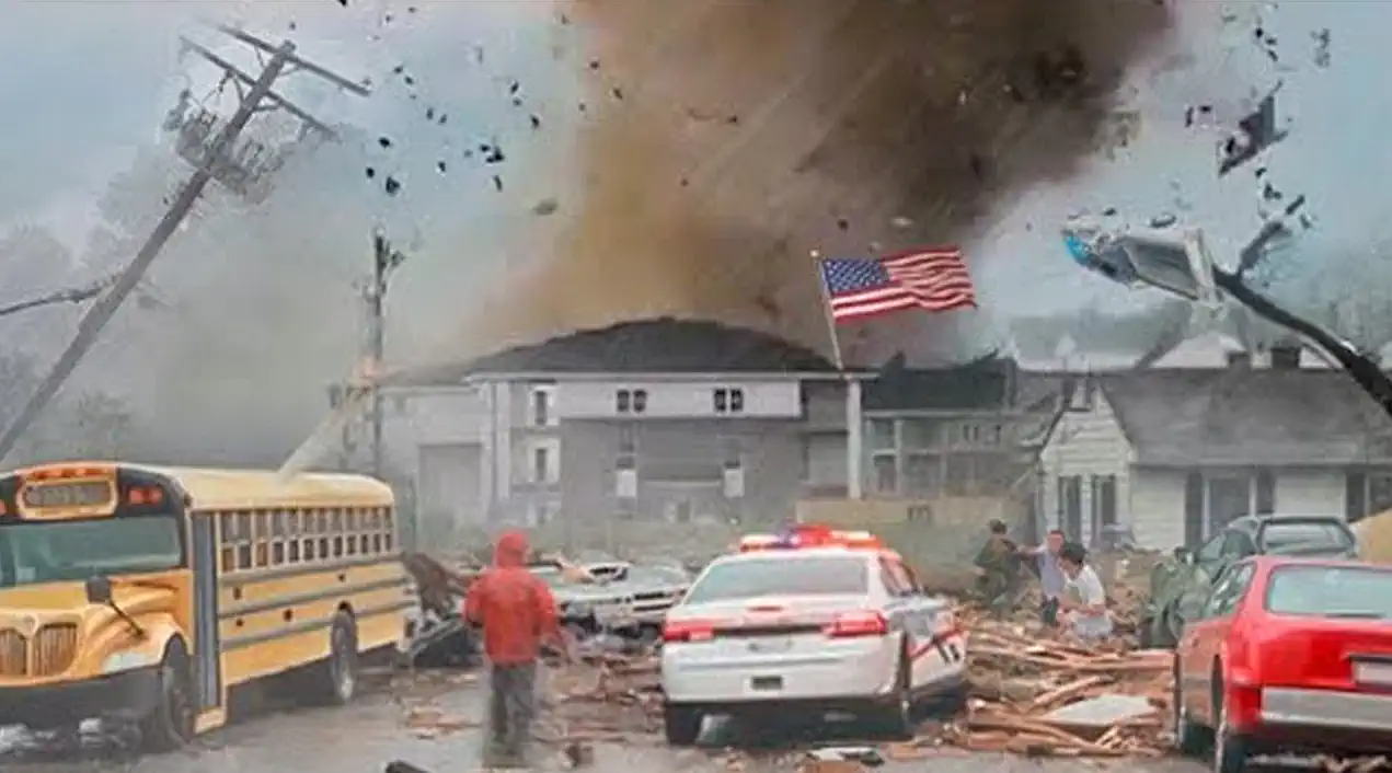
On the night of October 26, 2025, a tornado was confirmed in Baldwin County, Alabama, near Elberta: radars A “tornado-warned storm” was recorded, and videos of the destruction have emerged. Although the official storm survey is not yet complete, damage to several buildings has already been documented. Eyewitnesses report flashing lights, increasing winds, and trees falling suddenly.
Synoptic analysis shows that this area was influenced by moist, warm air near the surface, strong vertical wind shear, and a frontal disturbance from higher altitudes. This combination is a classic prerequisite for tornadoes, even in states where they are less common.
Forecast: Although the primary tornado conditions in Baldwin County are currently fading, residual instability will persist for the next 12-24 hours. Strong winds are still possible, and aftershocks or localized thunderstorms are possible. Residents should remain alert, especially in damaged areas.
A storm system moved through southeast Texas, including the Houston area and parts of North Texas (Fort Worth). More than 260,000 customers were left without power due to severe storms and wind gusts. In North Texas, in the South Fort Worth area, an unofficial tornado was recorded, causing significant damage.
The main impact occurred between late Friday evening and Saturday morning, when gusts of wind, heavy rain, and hail created dire conditions. In Houston, the alarm is sounding: power lines have been downed, leaving tens of thousands of homes without power.
According to the analysis, a strengthening, moist southerly flow, combined with a front and increased convection, has generated a powerful line of thunderstorms. Winds exceeded 50-70 mph (≈80-110 km/h) in some areas, which is sufficient to cause damage and outages.
Forecast: Further thunderstorms and squalls are possible again, especially at night and in the morning hours. Areas of Texas and adjacent areas may experience increased instability for several more days. Storm intensity is expected to gradually decrease over the next week, but the potential for localized severe events remains.
General Analysis and Synoptic Conclusions
Taken together, these events are more than just a series of random storms, but a prime example of how warm, moist low-lying air, strong wind shear, and frontal interactions can produce extreme weather—even in areas less prone to tornadoes. Infrastructure (power grids, lines) is vulnerable, resulting in widespread outages, damage to buildings, and evacuations.
Such systems, moving from the south to the northeast, often make their first impact overnight or early in the morning, when observed convection can suddenly intensify. Recreation, transportation, and power grids are all at risk.
Forecast for the Coming Days
– East Alabama: Residual convection and thunderstorms will persist into the morning; Then, stabilization. – Southeast and northern Texas: another 24-48 hours of risky conditions: thunderstorms, squalls, hail. After that, activity will gradually decrease. – The general trend across the southern United States: transition from the active phase of storms to a period of recovery and moderate weather. However, atmospheric moisture remains high, so squalls are possible even with a “normal” front.
Gleb Perov is the founder and chief meteorologist of POGODNIK, a leading weather forecasting service in Eastern Europe. With over 15 years of hands-on experience in meteorology and climate analysis, he has worked private weather services. Gleb is the author of numerous scientific and analytical publications on climate, magnetic storms, and atmospheric processes. He regularly collaborates with major international agencies such as NOAA, ECMWF.


 in Two Decades")
 in Two Decades")
