Bomb Cyclone Alert: Storm Bert to Slam UK and Ireland with Fierce Winds, Flooding, and Snow Chaos
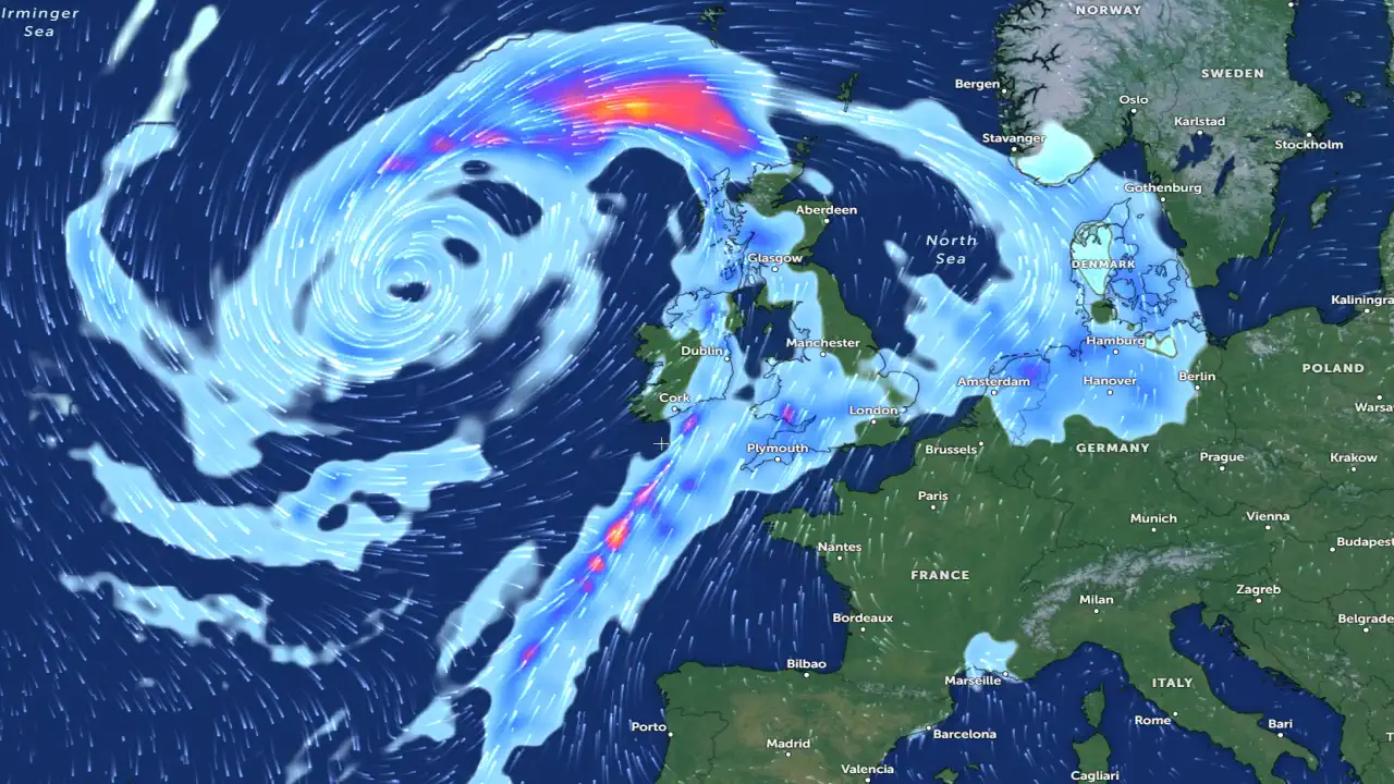
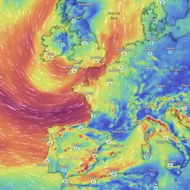
As Storm Bert barrels toward the United Kingdom and Ireland, it promises to bring an extreme weekend of weather. Meteorologists warn the storm will undergo explosive cyclogenesis on Saturday, November 23, 2024, transforming it into a "bomb cyclone" with a rapid pressure drop of over 24 hPa in just 24 hours. Here's what to expect from this second named storm of the European storm season.
Massive floods due to Strom Bert in the #Chippenham in north-west #Wiltshire, #UK 🇬🇧 (25.11.2024)#StormBert pic.twitter.com/lWWJhpTAd2
— City Weather (@ukcityweather) November 25, 2024
Winds Packing a Punch
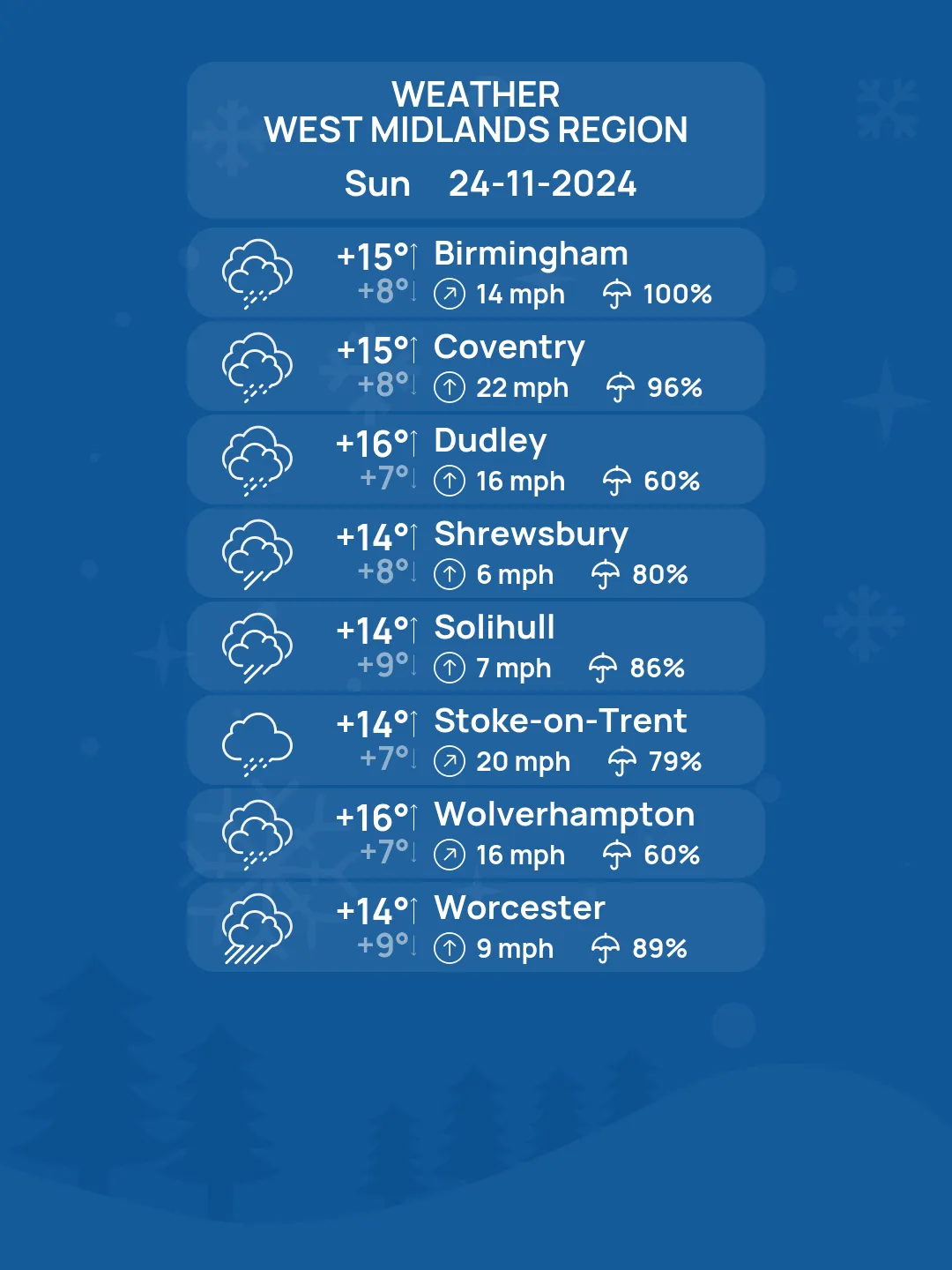
Storm Bert is expected to unleash wind speeds of up to 112 km/h (70 mph) along coastal regions, particularly around the Irish Sea. These powerful gusts could cause significant damage, power outages, and travel disruptions across both Ireland and the UK.
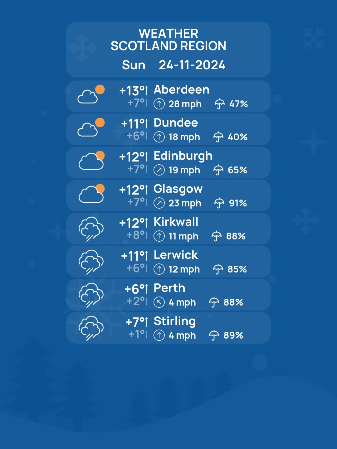
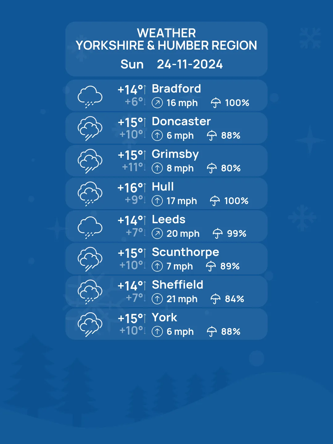
A Yellow warning has been issued for much of the UK, with Scotland and northern England bracing for widespread gusts between 65–100 km/h (40–60 mph).
Ireland may face elevated wind alerts over the weekend, with meteorologists forecasting potential Orange status warnings in western counties.
A Torrential Rain Threat
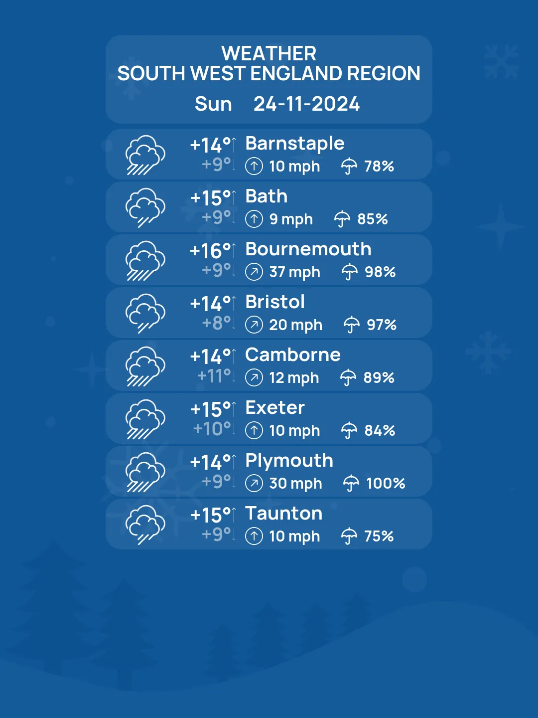
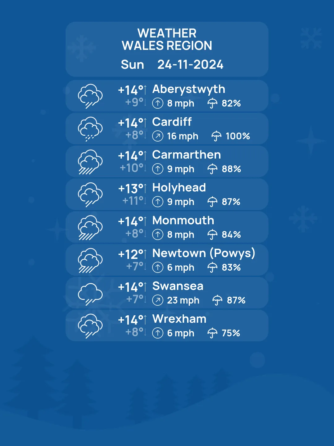
For those in southwest England, Wales, and parts of Ireland, prepare for a deluge. Rainfall totals could reach up to 125 mm (5 inches) in some areas—equivalent to a month's worth of rain in a single day.
Urban flooding and river overflow are likely, especially in saturated areas of western and southwestern Ireland.
Wales, Dartmoor, and South Wales are flagged as high-risk zones for flooding.
Snowstorm Meets Flooding Risk
As the storm tracks northeast, colder northern regions of England and Scotland face a snowy onslaught. Higher elevations in the Highlands and Grampians could accumulate 30–40 cm (12–16 inches) of snow, creating blizzard-like conditions. Meanwhile, rising temperatures in southern regions may turn snow to rain, compounding flooding risks as melted snow swells water levels.
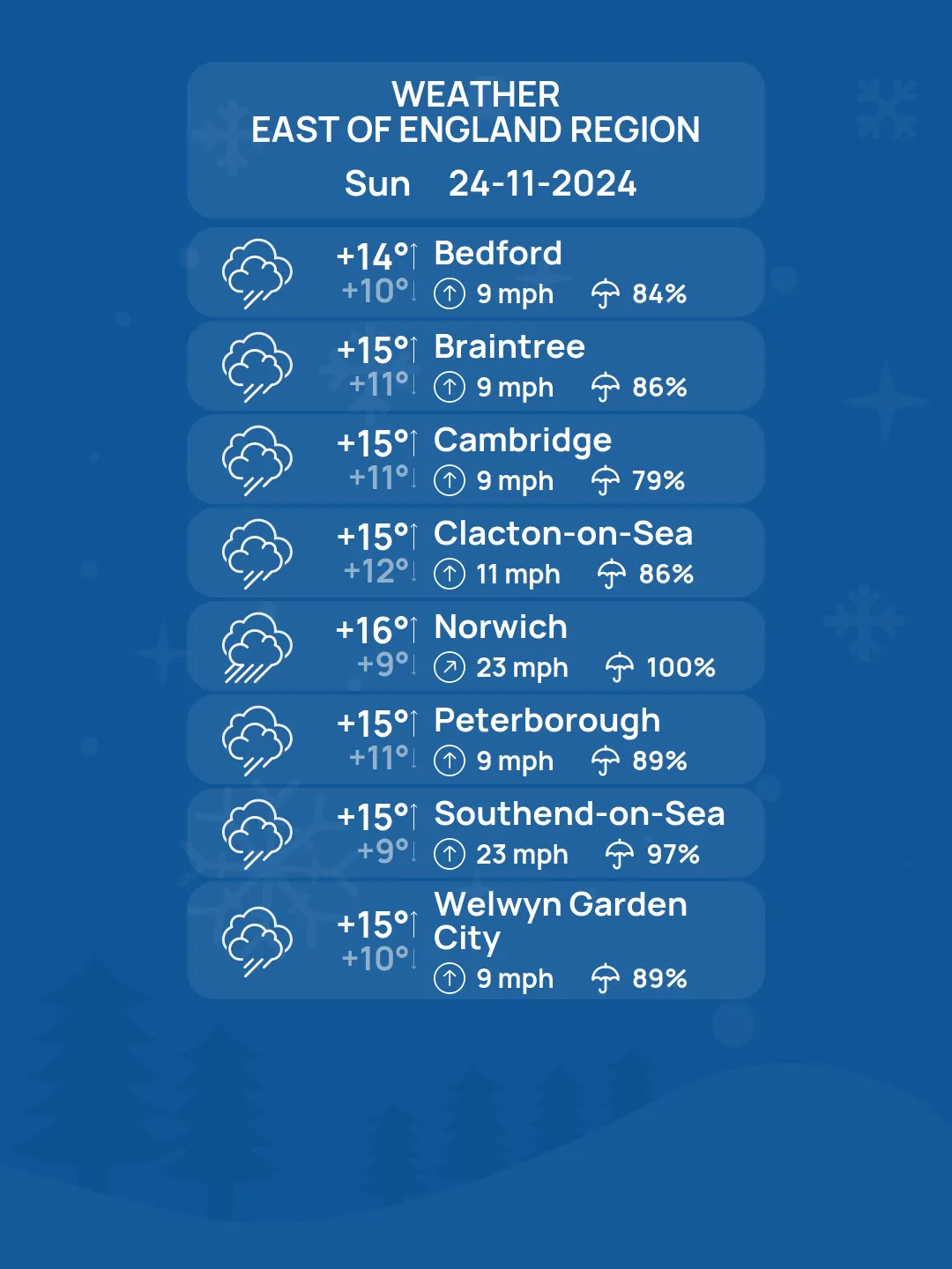
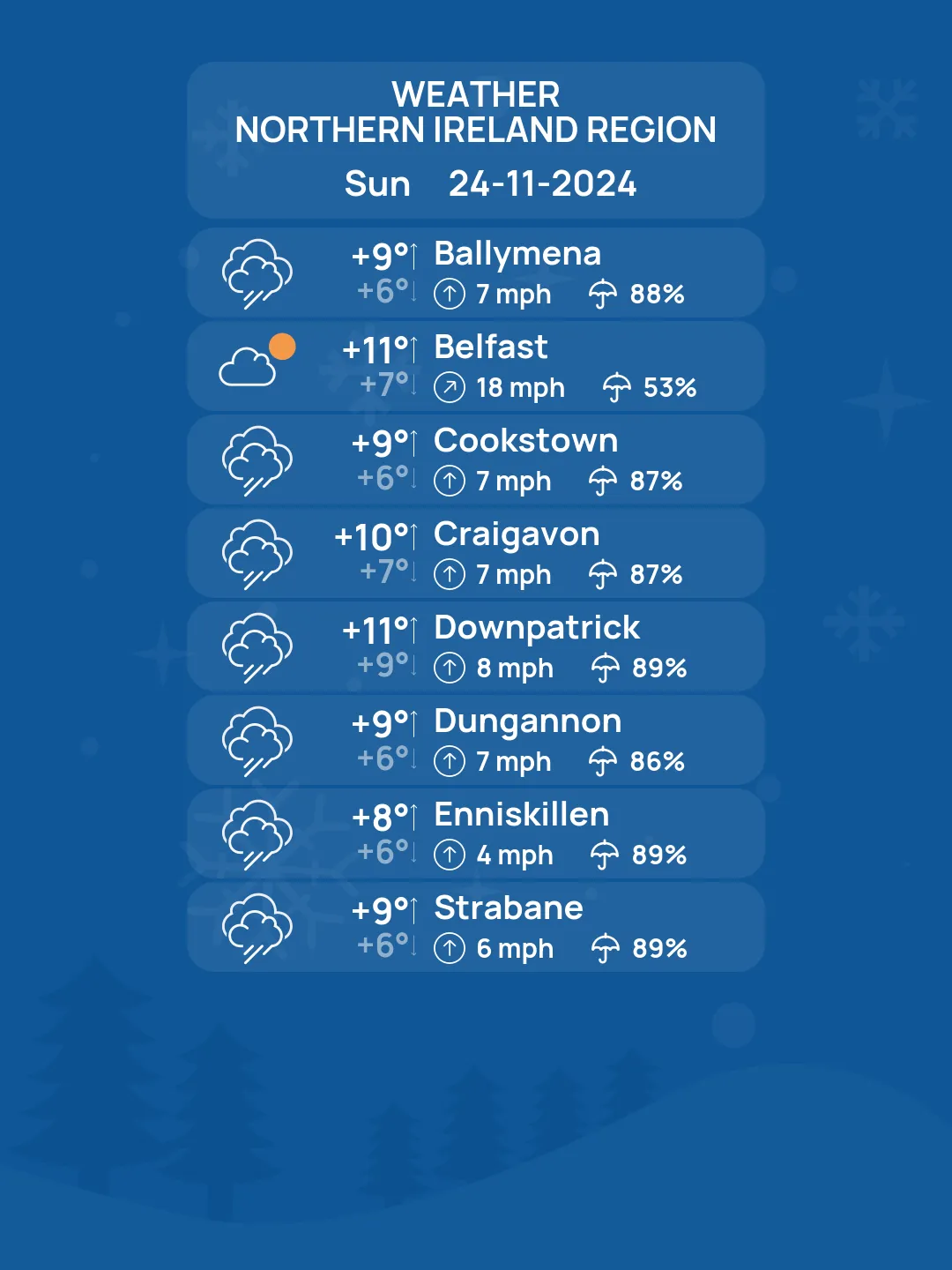
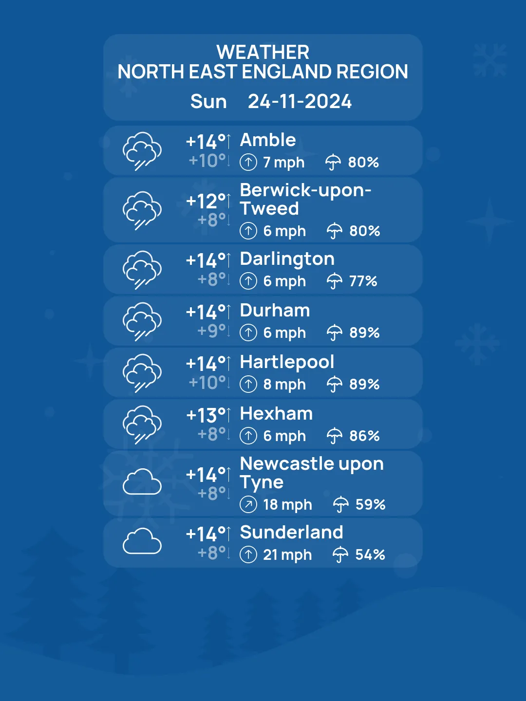
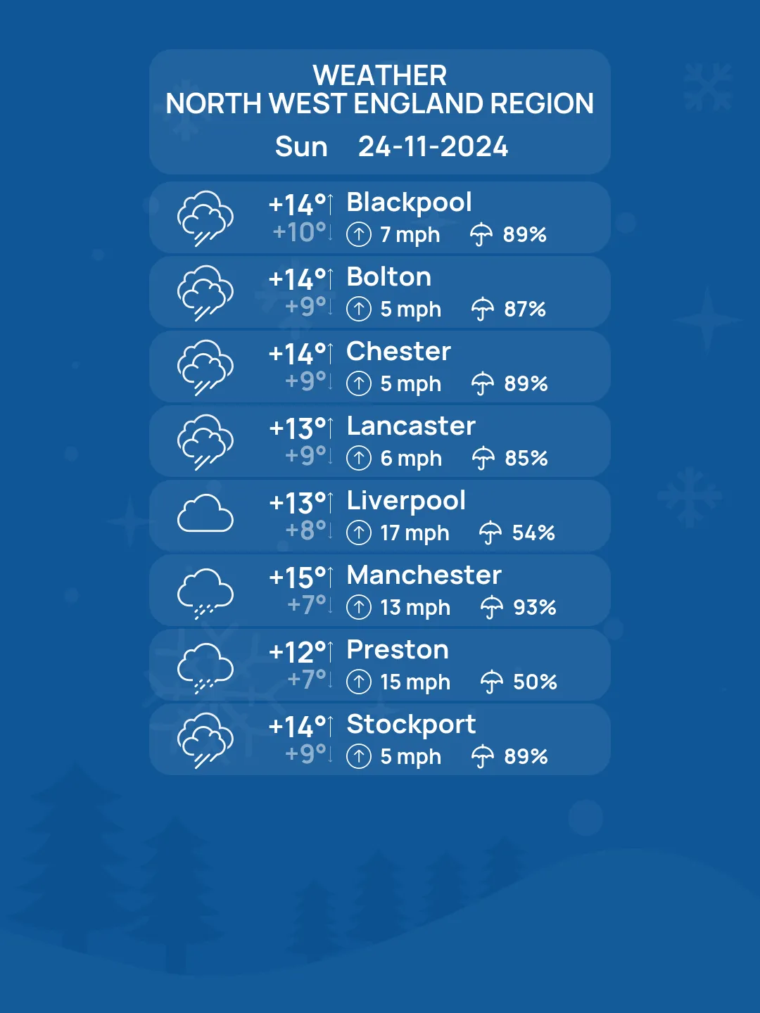
Temperature Whiplash
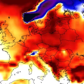
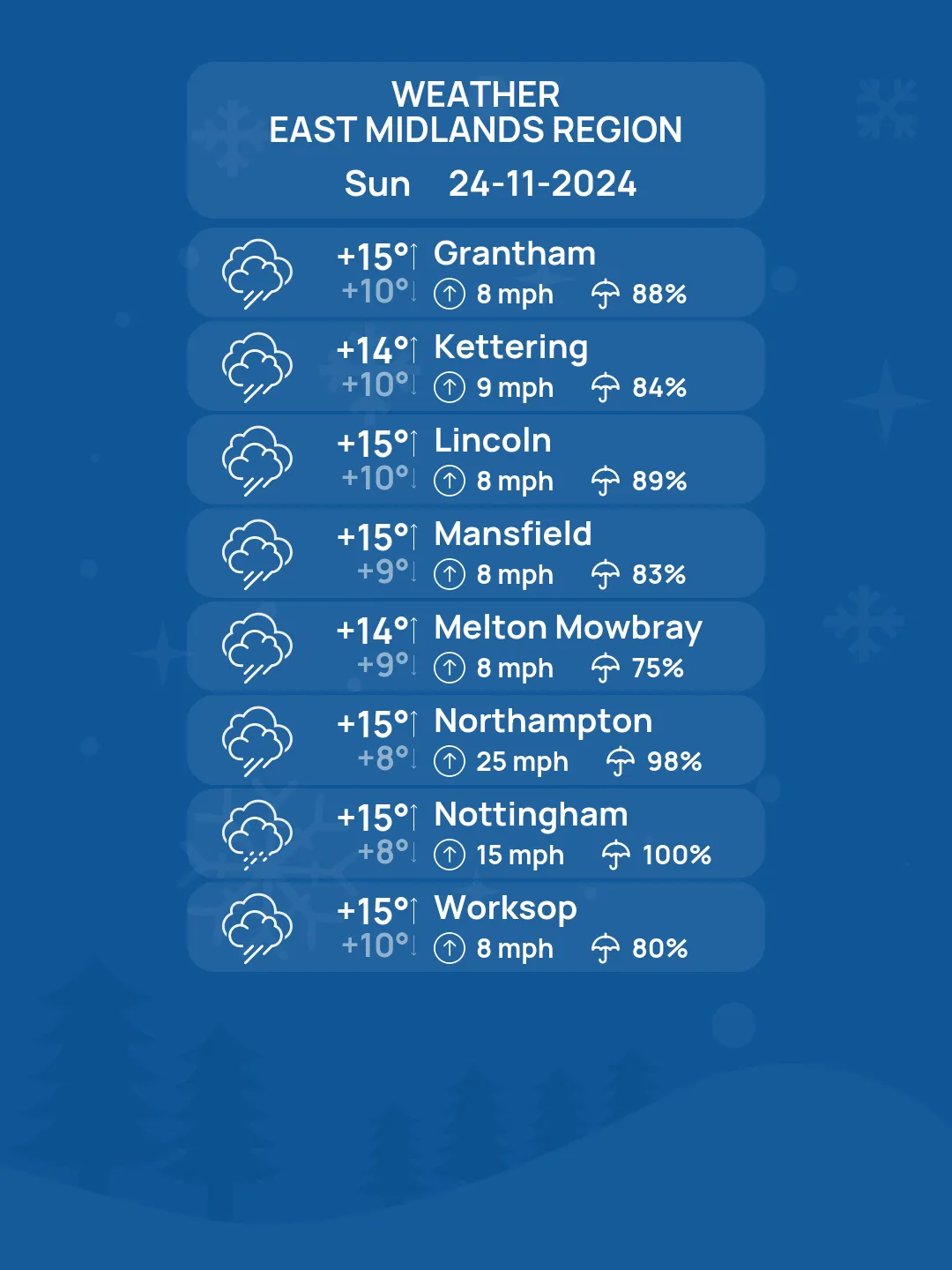
Storm Bert's influence will also bring sharp contrasts in temperature:
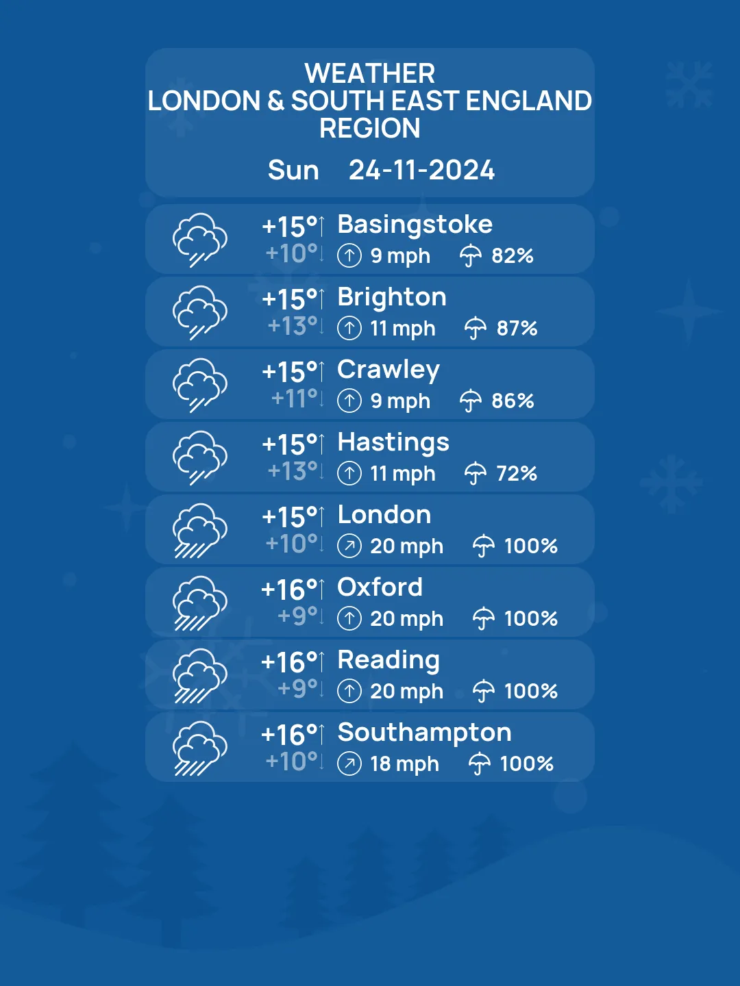
Southern and central England will see unseasonably warm conditions, with highs of 12–15 °C (54–59 °F).
Northern areas, however, will remain chilly at 2–7 °C (36–45 °F), sustaining the risk of wintry weather.
Impacts to Watch
Flooding: Urban and rural flooding in low-lying and coastal regions is highly likely.
Travel Chaos: Disruptions are expected on railways, roads, and flights, particularly in storm-hit areas.
Power Outages: Damaging winds could bring down power lines, leading to localized blackouts.
Safety Measures
Authorities are urging residents to stay updated via official weather services and heed all warnings. Stock up on essentials, avoid unnecessary travel, and prepare for possible power outages. If you're in high-risk zones for flooding or snow, consider securing your property and having an emergency kit ready.
Storm Bert's arrival marks a dramatic escalation in this year's storm season, serving as a reminder of nature's unpredictable power. Stay safe and informed as this weather bomb delivers its wrath.
Founder and chief forecaster of the Pogodnik service. He has many years of experience in the meteorological service. He is the author of numerous scientific publications and popular articles about the weather.

