Meteorologist Analysis: Atmospheric River Impact on California
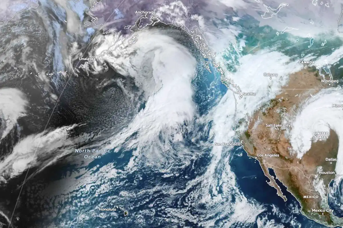
An atmospheric river (AR) is set to bring a potent mix of heavy rain and snowfall to California and neighboring regions, with significant impacts expected from November 25 to November 27. This weather system is classified as a moderate-to-strong AR event, with its intensity reaching AR 3 on the Ralph et al. scale in central areas, and persisting AR 2 conditions in Southern California.
Rainfall and Flooding Concerns
Central and Southern Sierra Nevada: 76–152 mm (3–6 inches) of rainfall.
Sierra Foothills, San Joaquin Valley, and Central Coast Ranges: 25–102 mm (1–4 inches).
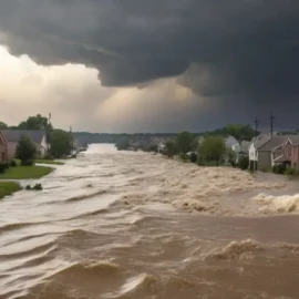
Flash flood risks are elevated due to already saturated soils from previous storms, particularly in low-lying and urban areas. Marginal risk (≥ 5%) for exceeding flash flood thresholds is in effect.
Snowfall Totals and Winter Storm Impacts
Above 7,000 feet (2,130 m) in the Sierra Nevada: 30–150 cm (1–5 feet) of snow, with the heaviest accumulation near Yosemite and Sequoia National Parks.
Central Utah and west-central Colorado: 30–90 cm (1–3 feet) in higher terrains.
Winter Storm Warnings have been issued for the Central and Southern Sierra Nevada, with travel hazards, potential power outages, and structural risks due to heavy snow loads.
Hazards and Prolonged Effects
Coastal Impacts: Southern California may experience persistent AR 2 conditions for over 72 hours, leading to possible landslides along steep terrain.
Travel Disruptions: Major highways and mountain passes, including I-80 through Donner Pass, are likely to face hazardous conditions and closures.
Power Outages: Prolonged rain and snow can lead to treefalls and disruptions to electrical infrastructure.
Flash Flooding: Urbanized regions and burn scars are at high risk for sudden flooding events.
Comparative Context
This AR event follows closely behind another system that caused record-breaking rainfall, landslides, and fatalities. The rapid succession of these storms underscores the need for preparedness in vulnerable regions. Historical data suggests that similar back-to-back events exacerbate soil instability, raising the risk of widespread landslides.
Storm Overview:
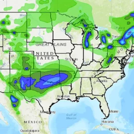
Western U.S. (Nov. 25 – 27):
Sierra Nevada:
A subtropical moisture plume, driven by an upper-level trough from the northeast Pacific, will bring torrential rain to lower elevations and heavy snowfall to higher altitudes. Coastal California may experience flash flooding, particularly in areas below 2,440 m (8,000 feet). Rainfall could lead to rock and mudslides.
Snowfall: 0.9 – 1.2 m (3 – 4 feet) of snow in the Sierra Nevada, with isolated higher totals.
Travel Hazards: Poor visibility and debris flows may disrupt roadways, including mountain passes.
Rockies:
Snowfall between 2.5 – 7.6 cm (1 – 3 inches) will affect the Colorado Rockies and Intermountain West. I-25 corridor travelers should expect slippery conditions, with temperatures in Denver dropping from 7 °C (45 °F) on Monday to near freezing by midweek.
Midwest (Nov. 26 – 28):
Light rain will spread across the Ohio Valley and Upper Midwest. Northern Minnesota and Wisconsin may see moderate snow on Monday.
Windy conditions of up to 56 km/h (35 mph) could result in blowing snow, reducing visibility.
Northeast (Nov. 28 – Dec. 1):
By Thanksgiving Day, a developing low-pressure system will bring rain across the Mid-Atlantic and southern New England. Higher elevations in northern New England could see snow.
Coastal Storm Potential:
A significant storm may develop on Friday, Nov. 29, bringing heavy rain to coastal areas and snow to interior regions. Impacts on travel corridors, including major airports and highways, are likely.
Travel Impacts:
Western States: Hazardous road conditions due to heavy snow and flooding. Delays expected on mountain passes.
Rockies: Snow accumulation and windy conditions could affect visibility and road safety, particularly on interstates.
Midwest and Ohio Valley: Rain and scattered snow showers will create slick conditions, but impacts are less severe than in the Rockies.
Northeast: Coastal storms could cause disruptions late in the week, with potential snow in higher elevations and rain along the coast.
Temperature Trends:
Western U.S.: Persistent cold in the Rockies and Sierra Nevada. Denver will see highs plummet from 7 °C to 0 °C (45 °F to 32 °F).
Midwest: Near-average cold conditions with daytime highs in the 30s °F (-1 to 4 °C).
Northeast: Mild early-week conditions give way to colder air by Thanksgiving weekend, especially in northern regions.
Advisories and Preparedness:
Monitor Alerts:
Winter storm and flood advisories are likely across affected regions. Keep track of National Weather Service updates.
Travel Timing:
If possible, travel before or after peak storm activity (Wednesday and Friday).
Equip vehicles with snow tires and emergency kits. Allow extra time for detours and delays.
Founder and chief forecaster of the Pogodnik service. He has many years of experience in the meteorological service. He is the author of numerous scientific publications and popular articles about the weather.

