Analyzing the Unprecedented European Heat Dome
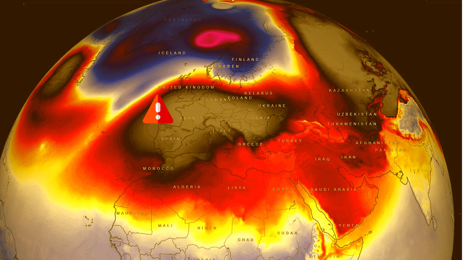
A substantial weather event is unfolding over Europe as a powerful heat dome establishes itself, bringing unseasonably warm conditions to the continent.
The heat dome, a common feature in summer, is extraordinary for the winter season. It involves a high-pressure system settling over a vast area for an extended period, often weeks. This creates a 'lid' effect, trapping warmer air masses underneath.
A high-pressure blocking system, forming a robust heat dome, is gripping western and southern Europe. This pattern is set to persist through the coming week, defying typical December weather expectations.
The central pressure of this heat dome measures around 1045 mbar, indicative of a formidable atmospheric force. This configuration creates a pronounced temperature inversion, trapping warm, dry air aloft while preventing the intrusion of cold waves.
Elevated areas, especially above 500 meters, are experiencing significantly higher temperatures, with an anomaly of 12-14 °C above the long-term average. However, the lowlands, particularly prone to the inversion effect, are witnessing warmer conditions aloft while the surface experiences colder temperatures.
The heat dome is anticipated to strengthen further over the weekend, expanding its influence eastward. The stability it brings means dry weather, with no precipitation expected until the heat dome weakens around the 20th. Post that, a cold front might lead to a quick temperature drop, remaining above normal.


