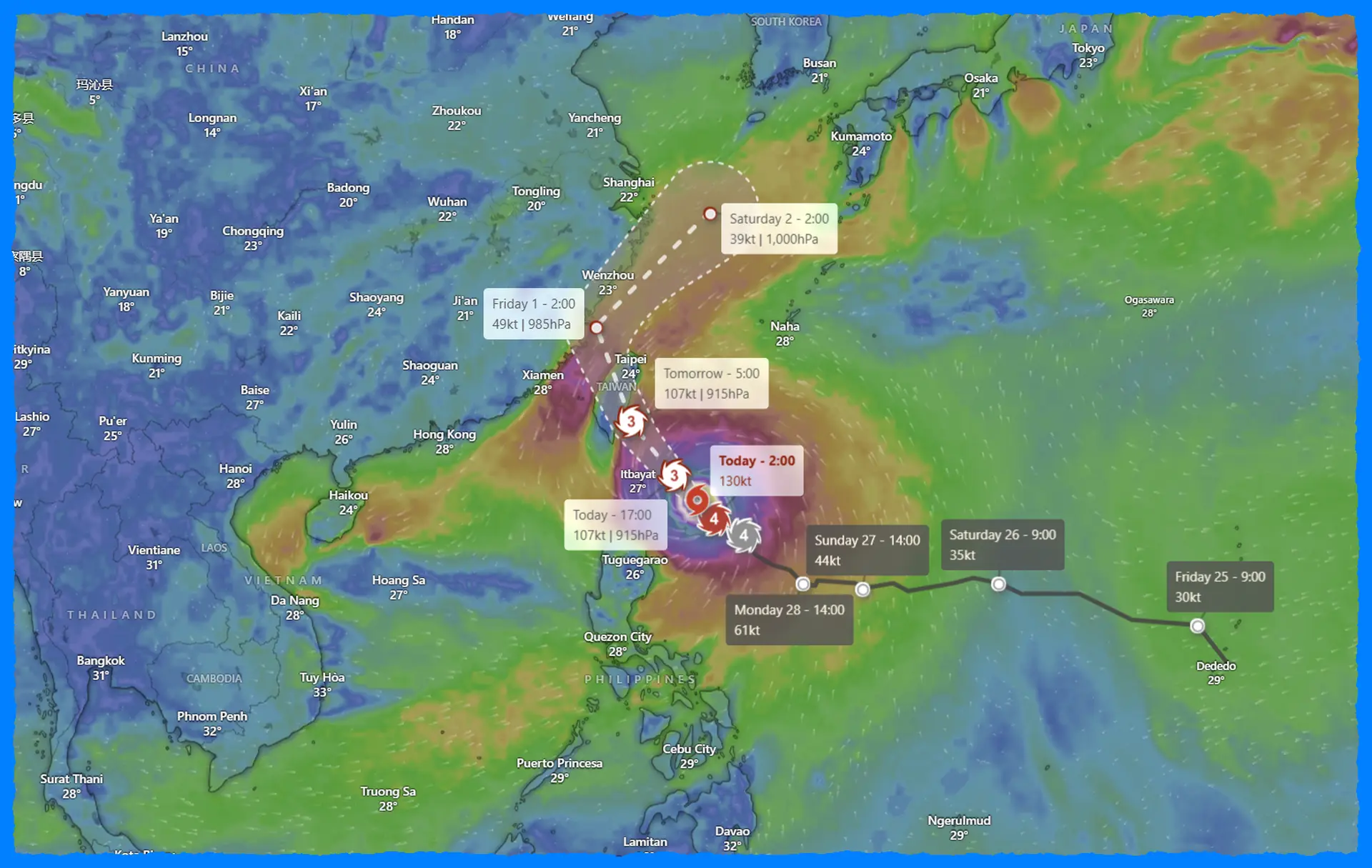
Typhoon Kong-rey Makes Historic Landfall in Taiwan as Strongest Storm Since 1996


Typhoon “Kong-rey” made a powerful landfall along the coast of Taitung County, Taiwan, early on October 31, 2024, marking it as the strongest typhoon to hit the island since Typhoon Herb in 1996 and the first to strike after mid-October in recorded history. The typhoon brought devastating winds and torrential rains, leading to significant disruptions across the island. With gusts exceeding 260 km/h (162 mph) and rainfall totals topping 500 mm (20 inches) in parts of eastern Taiwan, Kong-rey caused one fatality, extensive property damage, and knocked out power for over 500,000 homes. Over 8,000 residents were evacuated as a precaution.
Meteorological History and Landfall
Kong-rey intensified to a Category 4-equivalent super typhoon on October 30, with peak sustained winds reaching 250 km/h (155 mph) before making landfall. At the time of impact in Taitung County, the storm's central pressure had dropped to approximately 925 hPa, with maximum sustained winds near 184 km/h (114 mph) and gusts hitting 230 km/h (145 mph), according to the Joint Typhoon Warning Center (JTWC).
Following its arrival, an “Extremely Torrential Rain Advisory” was issued for the island's eastern and mountainous regions, including Hsinchu, Taichung, and Yilan, due to anticipated rainfall and the risk of flash floods and landslides. As of Thursday evening, Kong-rey continued to unleash torrential rain across eastern Taiwan, with conditions expected to persist into Friday.
Regional Impact and Damage
Taitung County and the outlying Lanyu Island, directly in the typhoon's path, faced the brunt of Kong-rey's force. Winds of over 260 km/h were recorded in Lanyu before wind measurement equipment was disabled due to the storm. Power outages affected nearly half a million homes, and at least 73 injuries were reported. Tragically, one person was killed by a falling tree.
As of Thursday, emergency response teams, including 34,000 soldiers, were on standby to assist in rescue operations. Nearly 500 flights were canceled across Taiwan, disrupting both international and domestic travel, while schools and financial markets were temporarily closed.
Severe Flooding and Landslide Risks
Heavy rainfall led to severe flooding in areas such as Hualien and Taichung. The continuous downpour triggered a small landslide along Xiwan Road in Xizhi District, damaging infrastructure and leaving roads impassable. CWA forecasters warned that additional rainfall could exacerbate flash flood conditions and further landslides.
Path Forward and Future Expectations
As of 06:00 UTC on Wednesday, Kong-rey's center was located roughly 40 km north-northeast of Taitung, moving northeastward at 17 km/h. The typhoon is expected to turn further north, continuing along the Taiwan Strait. The storm's strength is likely to diminish as it encounters Taiwan's rugged terrain and begins interacting with a baroclinic zone, accelerating its extratropical transition.
Gene Huang, a forecaster with the Central Weather Administration (CWA), noted that Kong-rey would weaken substantially as it moves into the Taiwan Strait. Huang advised residents to stay indoors, highlighting the risk of high winds and unpredictable shifts in the storm's path due to Taiwan's complex topography.
Historic Context and Meteorological Significance
Typhoon Kong-rey is significant both for its strength and its timing. It is the first typhoon to make landfall in Taiwan after mid-October, with its intensity surpassing any storm to hit the island since 1996. Taiwan's location in the Pacific makes it vulnerable to frequent typhoons, but such late-season storms are exceptionally rare, marking Kong-rey as a potentially climate-influenced anomaly.
Meteorologists are closely monitoring Kong-rey's progression and its impact on Taiwan's eastern and northern regions. The interactions between Kong-rey and Taiwan's mountains could yield valuable data, enhancing predictive models for similar systems in the future.