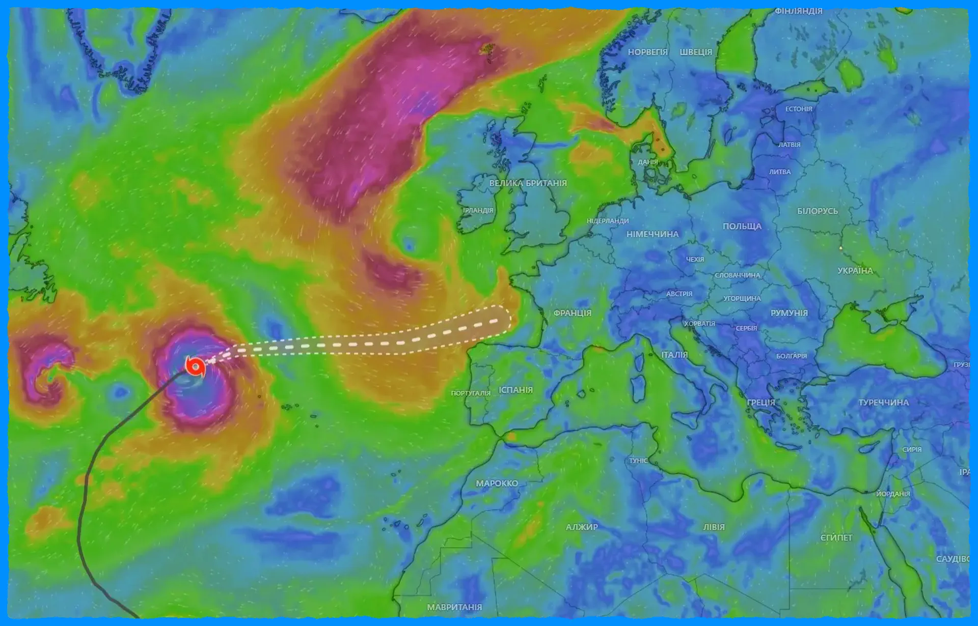
Former Hurricane Kirk is moving towards Europe and could be felt in the coming days.
The weather forecast says it will reach northwestern Spain and France on Wednesday, October 9, and will continue onwards, potentially affecting the UK as well.
Kirk is currently packing winds of 120 km/h (75 mph) and is centred about 1,055 km (655 mi) west of the Azores. It is expected to bring 20-40 mm (0.7-1.5 in) of rain to the northernmost regions of Spain and parts of the UK and Scotland. There is also talk of strong winds, especially if the hurricane passes through the UK.
It is important to note that although Kirk will weaken as it transitions into an extra-tropical storm, it will still remain powerful and could cause strong winds and high waves along the US East Coast and in the Caribbean.
The hurricane is moving towards Europe and could cause serious weather changes, especially in Germany. Although the weather will still be quite mild on Monday, a sharp deterioration is expected by Thursday.
It is important to remember that ex-hurricane Kirk has already weakened, but it can still bring strong winds and heavy rainfall, which can be dangerous. The risk of gusts is especially high in the mountainous regions of the Eifel and Sauerland, as well as in low-lying areas such as the Bay of Cologne. Significant impacts are possible in at least some places.
It is also worth keeping in mind that several cyclones are expected to pass through this week, which will only increase the rainfall. This increases the risk of flooding, especially towards the weekend. It is therefore important to monitor local weather service updates and recommendations to prepare for possible climate anomalies.