
Europe is on the brink of a substantial weather shift this week, with an intense Arctic cold outbreak targeting eastern, central, and southeastern regions. The impending winter storm is anticipated to be the season's most severe, particularly impacting the Balkan peninsula. Projections indicate the potential for up to 50 cm (20 inches) of snow across regions spanning from Romania to Ukraine. This notable event is expected to extend through the end of November, marking a significant departure from the mild weather observed in recent weeks.
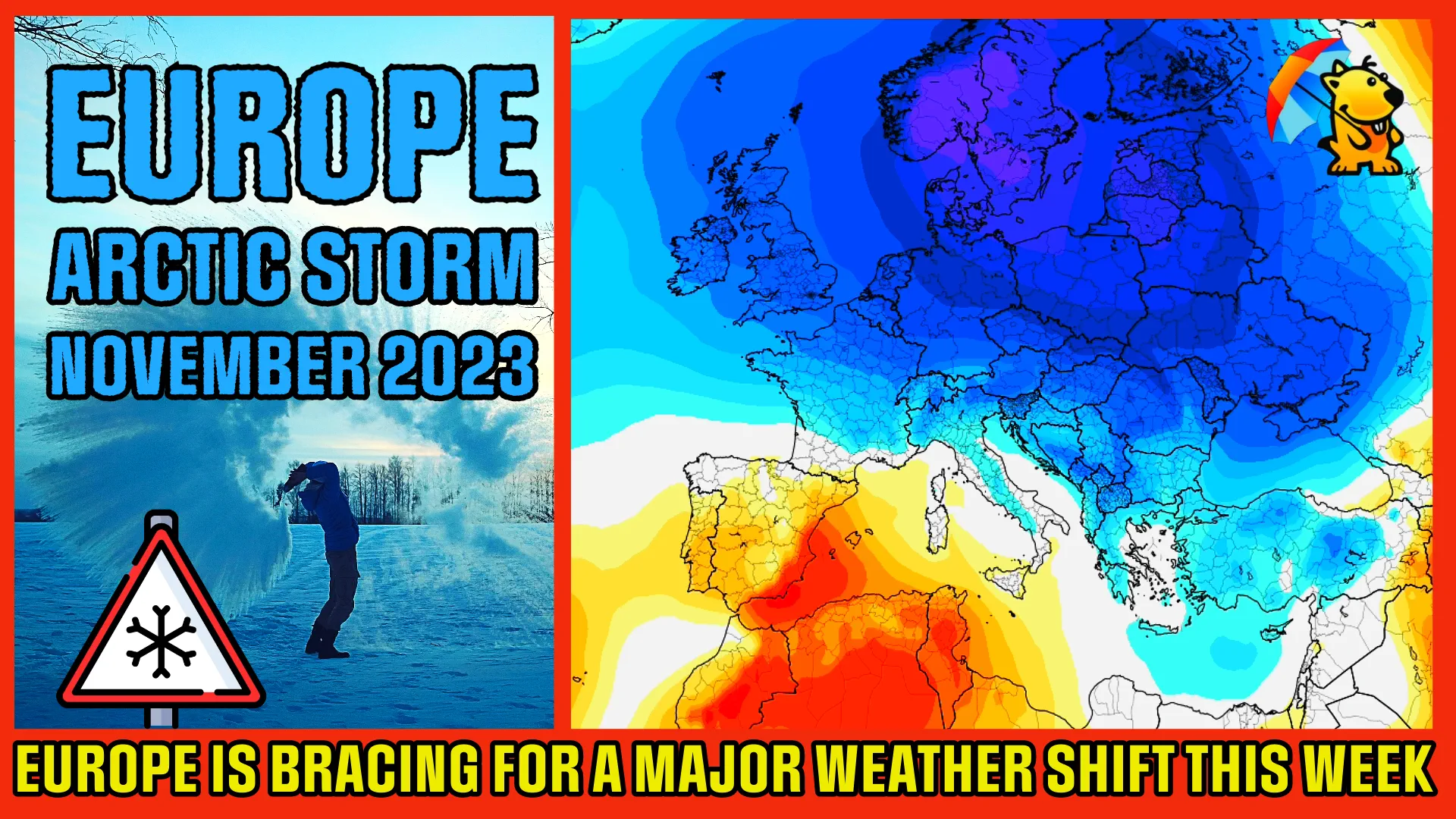
Following an extended period of unusually warm weather, Europe is poised for a noteworthy meteorological transformation. A distinct dipole pattern is taking shape, featuring a robust high-pressure system in the west and a deep, cold trough in the east. Commencing this weekend, this pattern will usher in a significant Arctic cold outbreak across eastern and central Europe, extending into the Balkans.
As colder Arctic air interacts with warmer Mediterranean and Black Sea regions, a potent winter storm is forecasted to develop over Greece, rapidly intensifying into a substantial blizzard in Bulgaria, Romania, Moldova, and Ukraine from Saturday to Sunday, November 25 – 26, 2023. This event is anticipated to blanket areas from Sofia through Bucharest to Odesa and Kyiv with substantial fresh snow, reaching local accumulations of approximately 50 cm (20 inches) in just 36 – 48 hours, accompanied by strong winds.
In the aftermath of this storm, central Europe will experience a significant drop in temperatures, with considerable snowfall expected in the northern Alps due to persistent north-northwesterly winds. Meanwhile, other regions will witness less snowfall, as the initial cold surge acts more as a swift-moving frontal system with limited moisture, until it encounters warmer air masses towards the Eastern Mediterranean.
This prominent dipole weather pattern is a classic setup for an intense cold outbreak from the Arctic into Europe. Temperatures across eastern and central Europe are projected to decrease significantly, around 8 – 12 °C (14 – 22 °F) below normal on Saturday. While the west maintains near-normal temperatures, the Arctic cold pool will intensify over Eastern Europe and the Balkans through Sunday and Monday, November 26 and 27.

Looking ahead, weather models indicate that the Arctic cold will persist and potentially intensify across central Europe by mid-next week, with the possibility of westward expansion. A new winter storm is expected to develop over the Benelux countries, moving towards the Alpine region, bringing more snow to parts of west-central Europe and the Balkans.
As this extensive cold spreads towards Western Europe, snowfall is likely to follow. Fresh snowfall is forecasted over eastern France, Benelux, and Germany by Monday night, extending east-southeast over the Alps towards the Balkans on Tuesday. The most significant cold, however, will remain over Scandinavia and the Baltic region, with temperatures potentially dropping to -20 °C (-4 °F) or lower.