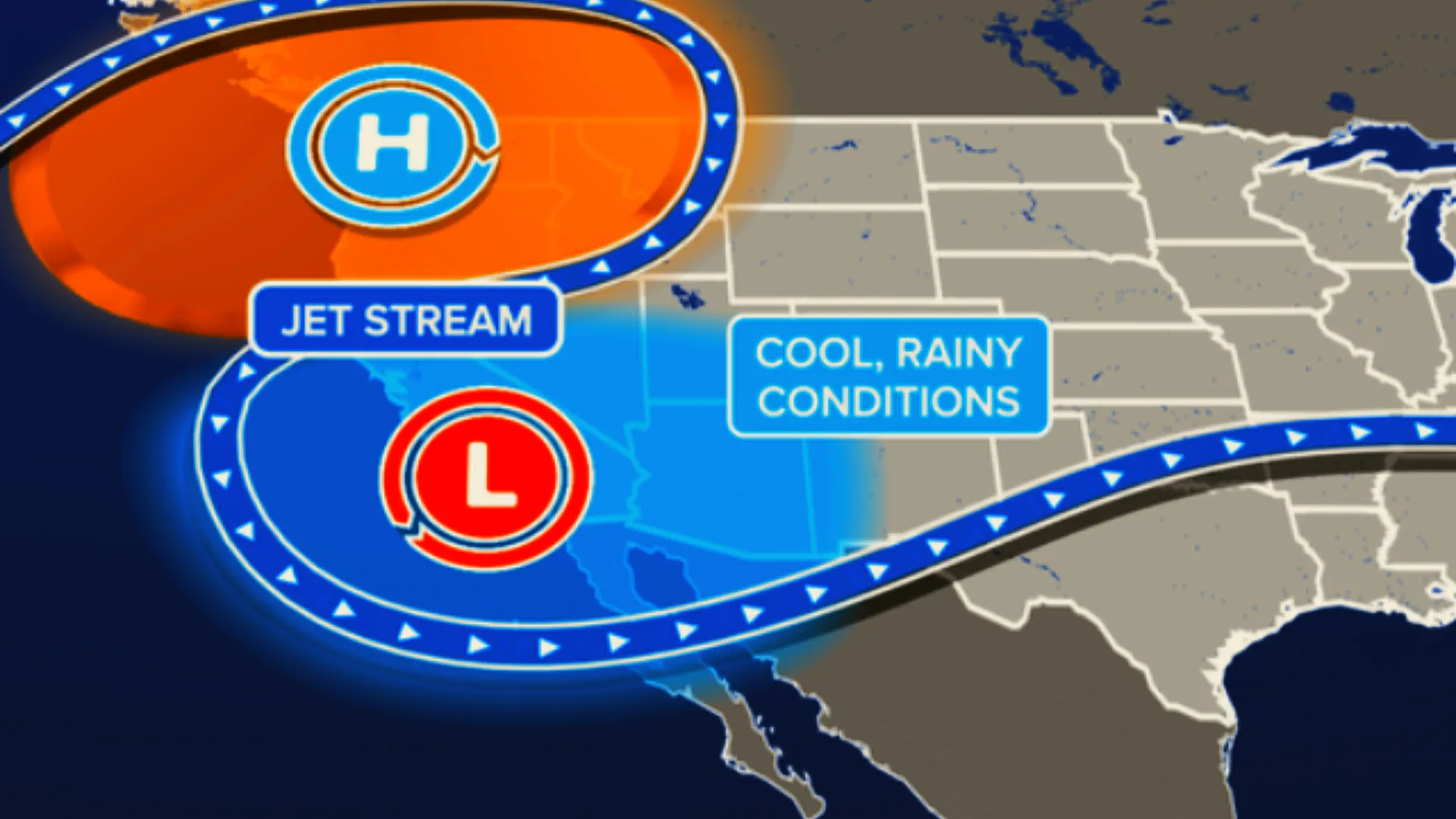
Canada experienced a record-breaking week of weather, with extreme heat in the North and torrential rains in Eastern Canada. A unique atmospheric pattern, known as a Rex block, was responsible for the unusual weather patterns.
In the Arctic Circle, communities recorded Canada's hottest temperatures ever, with temperatures soaring into the mid-30s Celsius (mid-90s Fahrenheit). Fort Good Hope recorded a scorching 37 degrees Celsius (98.6 Fahrenheit), marking the highest temperature ever recorded in August in the Northwest Territories. Little Chicago, N.W.T., reached 36 degrees Celsius (96.8 Fahrenheit) multiple times, setting the highest temperature ever recorded in the region, and Inuvik experienced record heat with temperatures reaching 34.8 degrees Celsius (94.6 Fahrenheit).
A Rex block is a meteorological phenomenon where a high-pressure system becomes trapped north of a low-pressure system. This creates a blocking pattern, similar to a backwards "S" on weather maps. This pattern can lead to persistent weather conditions, such as heatwaves, droughts, or heavy rainfall.
The intense heatwave persisted for four consecutive days, with temperatures remaining in the lower 30s Celsius (lower 90s Fahrenheit) through the weekend. Remarkably, these temperatures were 10 degrees Celsius (18 Fahrenheit) higher than those recorded in the southernmost parts of Canada.
In contrast, Eastern Canada faced a deluge of rain from the remnants of Hurricane "Debby". Montreal experienced its wettest day on record on August 9, 2024, with 158 millimeters (6.2 inches) of rain falling at Montreal Airport, surpassing the previous record of 87.6 millimeters (3.4 inches) set in 1880. The rainfall led to widespread flooding across Quebec, with many communities recording rainfall totals well over 100 millimeters (3.9 inches), and some nearing 200 millimeters (7.9 inches) by the time the storm subsided early on August 10.
The unusual weather was driven by a Rex block, a rare atmospheric phenomenon where a high-pressure system becomes trapped north of a low-pressure system, causing stagnation in weather patterns. This led to extreme conditions being locked in place for several days, resulting in historic heat in the North and the unusual track of remnants of Hurricane "Debby", which brought heavy rainfall to interior sections of Eastern Canada.
As the week ended, cooler air moved into southern Canada, bringing relief from the heat, while the North began to see a slight easing of temperatures.