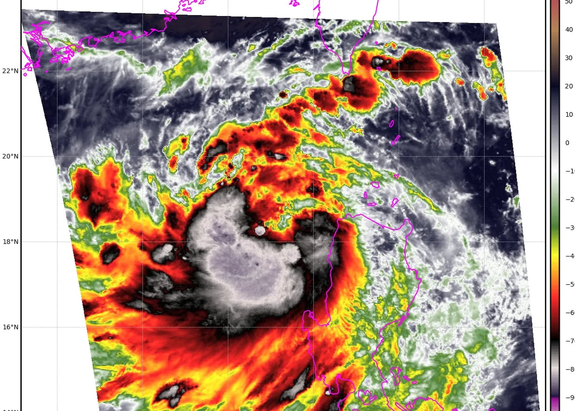
Tropical Storm “Yagi” EntengPH Strikes the Philippines: A Detailed Forecast
As the world grapples with the increasing frequency and intensity of extreme weather events, the people of the Philippines have once again found themselves in the path of a powerful storm. On September 2nd, 2024, Tropical Storm "Yagi," known locally as "Enteng," made landfall in the eastern part of the archipelago, unleashing a torrent of rain, winds, and chaos.
The storm has already claimed the lives of 11 individuals, with many more still unaccounted for. The devastation has been widespread, with numerous communities experiencing severe flooding and landslides that have disrupted transportation, communication, and essential services.
As the storm continues to wreak havoc, it is crucial to understand the forecast and the potential impact it may have on the region.
Trajectory and Intensity
Tropical Storm "Yagi" EntengPH originated in the western Pacific Ocean and has been steadily gaining strength as it approached the Philippine archipelago. The storm is currently classified as a Category 2 system, with maximum sustained winds of up to 100 miles per hour (160 kilometers per hour).
The storm's trajectory has been closely monitored by the Philippine Atmospheric, Geophysical, and Astronomical Services Administration (PAGASA), the country's official weather bureau. According to their latest projections, Yagi is expected to continue moving in a westward direction, making landfall on the eastern coast of the Philippines and then traversing the central part of the country.
Heavy Rainfall and Flooding
One of the primary concerns with Tropical Storm "Yagi" is the intense rainfall it is expected to bring. PAGASA has issued heavy rainfall warnings for several provinces, including Bicol, Eastern Visayas, and parts of Mindanao. These regions are particularly vulnerable to flooding and landslides due to their geography and the prevalence of deforestation.
Forecasters predict that some areas may receive up to 20 inches (500 millimeters) of rainfall over the next 72 hours, with the potential for even higher amounts in isolated locations. This deluge of water could overwhelm drainage systems, leading to widespread flooding that could submerge homes, disrupt transportation, and compromise essential infrastructure.
Wind Damage and Power Outages
In addition to the heavy rains, Tropical Storm "Yagi" is also bringing with it sustained winds of up to 100 miles per hour, with even stronger gusts. These powerful winds have the potential to topple trees, damage buildings, and disrupt power lines, leaving communities without electricity for an extended period.
The National Disaster Risk Reduction and Management Council (NDRRMC) has already reported numerous incidents of damaged homes, fallen trees, and power outages across several provinces. As the storm continues to move inland, these wind-related impacts are expected to worsen, posing a significant threat to the safety and well-being of the affected populations.
Humanitarian Response and Preparedness
The Philippine government, in collaboration with local and international aid organizations, has mobilized a comprehensive response to the crisis. Evacuation centers have been established, and emergency supplies, including food, water, and medical assistance, are being distributed to the most affected areas.
However, the scale of the disaster is such that the response efforts will need to be sustained over the coming days and weeks. Authorities are urging residents in high-risk areas to heed evacuation orders and take necessary precautions to ensure their safety.
Furthermore, the long-term recovery efforts will require significant resources and coordination, as communities work to rebuild their homes, restore essential services, and address the environmental damage caused by the storm.