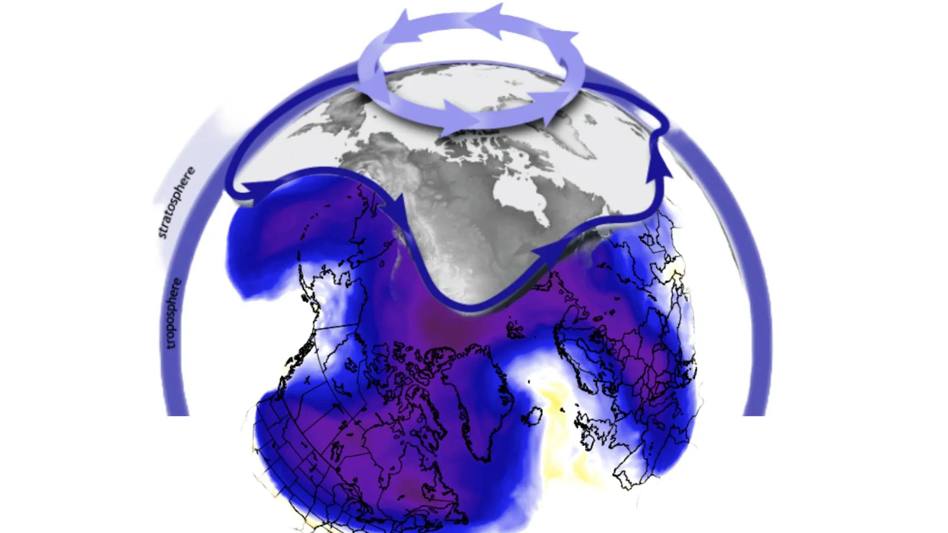
The polar vortex is a critical component of the Earth's atmospheric system, particularly during the winter months. This year, however, the polar vortex has entered the month of October at its weakest level in four decades, raising significant concerns among meteorologists and climatologists regarding potential implications for winter weather patterns across North America and Europe. The weakened state of the polar vortex not only challenges our understanding of seasonal weather forecasting but also poses a substantial risk for unusual cold outbreaks in various regions, especially the eastern United States, Canada, and parts of Europe.
To comprehend the significance of a weakened polar vortex, it is essential to first understand its role and functioning. The polar vortex consists of a large area of low pressure and cold air surrounding the Earth's poles. It is strongest during the winter months and serves to contain the frigid polar air within the Arctic Circle. When strong, the polar vortex acts like a barrier, preventing cold air from spilling into lower latitudes. However, when it weakens, this containment fails, allowing polar air to intrude into more temperate regions, which can result in severe winter weather, including extreme cold, heavy snowfall, and ice storms.
As of early October 2024, the polar vortex has exhibited a notable degree of instability and weakness, triggering significant shifts in atmospheric circulation. This unprecedented thinning of the vortex is thought to be influenced by a combination of high-pressure anomalies over the Pacific Ocean and Greenland, which disturb the usual symmetrical structure of the vortex. Traditionally, one would expect the polar vortex to strengthen and extend down to the lower levels of the atmosphere as October progresses; however, the presence of these high-pressure systems is conspicuously preventing such development, leading to an unusual weather pattern across the Northern Hemisphere.
Reports indicate that the polar vortex currently appears smaller than typical for this time of year and is displaced toward Siberia. This geographical shift highlights a significant deviation from standard climatic behavior, suggesting that polar air may become more readily available to areas that typically enjoy milder winters.
The ramifications of a weakened polar vortex for winter weather patterns are profound. Meteorological models indicate that the instability of the vortex promotes an increased likelihood of cold air masses penetrating into the eastern United States and Canada. Initially, the first two weeks of October are expected to see the polar vortex weaken further, possibly marking it the weakest in the last 66 years. This forecast suggests a disruption that can propagate through various atmospheric layers, eventually influencing surface weather and leading to increased snowfalls and cold outbreaks.
Furthermore, a strong high-pressure system over Greenland is anticipated to exert pressure that may fragment the polar vortex into smaller segments. This could bring polar air southward, exacerbating already challenging weather conditions. Already, discussions surrounding the North Atlantic Oscillation (NAO) and its potential negative values for at least the first half of October complicate predictions. A negative NAO is often conducive to more snowfall and bitterly cold temperatures in the eastern U.S., leading to concerns over the impact this winter may have on agriculture, infrastructure, and daily life.
Despite these predictions, it is important to underscore that the nature of weather is inherently unpredictable, and the patterns observed in October may still evolve. The interactions between high and low-pressure systems across the North Pacific and Aleutians remain dynamic. Indeed, if these atmospheric pressures shift in response to changes in oceanic temperatures or other climatic influences, the potential for cold air incursions may diminish, altering forecasts as the season progresses.
In conclusion, the current state of the polar vortex represents a significant concern for winter weather forecasting across North America and Europe. With the vortex weaker than in years past, an increased likelihood of colder, more severe winter weather is on the horizon. The complexities associated with atmospheric interactions demonstrate the need for careful monitoring and research in order to understand the implications of such events fully. As we approach winter, both regions must prepare for the possibility of a season marked not just by cold air but by the unpredictable nature of climate systems that could disrupt daily life in unprecedented ways.