
Central Europe Braces for Massive Rainfall Event: Potential for Catastrophic Flooding
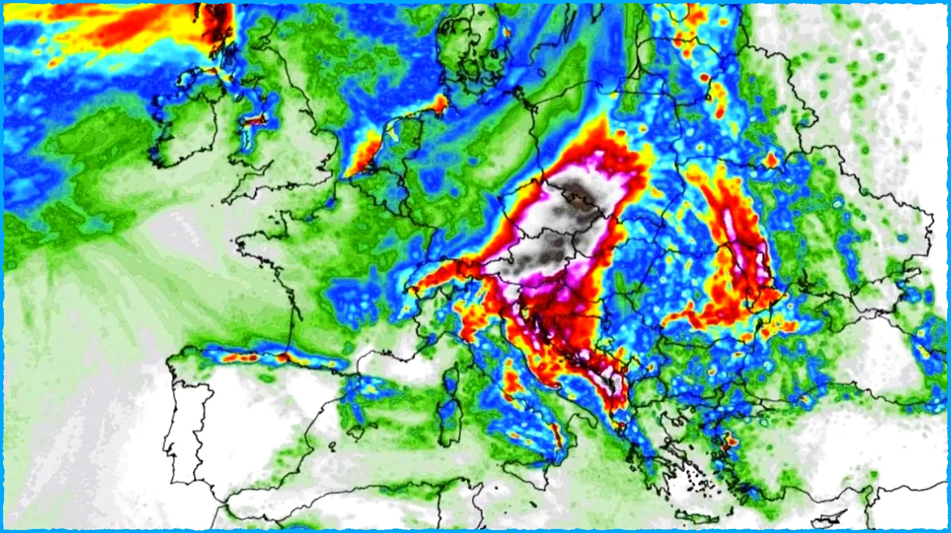
Central Europe is on high alert as weather models predict a significant rainfall event in the coming days, potentially leading to catastrophic flooding. The culprit?
A slow-moving upper-low system, fueled by the unusually warm waters of the Mediterranean Sea currently experiencing a marine heatwave.
The Perfect Storm: Warm Waters, Upper-Low, and a Cold Front
The Mediterranean Sea is currently experiencing temperatures 4-6 °C (7.2-10.8 °F) above average in some regions, a phenomenon known as a marine heatwave. This unusually warm water adds significant moisture to the atmosphere, setting the stage for potentially heavy precipitation.
Adding to the concern, a large upper trough is forecast to develop over Europe on September 11th, bringing a cold front to central Europe and the Mediterranean. This combination of a moisture-laden atmosphere and a cold front could trigger severe flash floods and other weather-related hazards.
Areas Most at Risk
Regions most vulnerable to extreme rainfall and potential flooding include:
- Northern Italy
- Slovenia
- Croatia
- Bosnia and Herzegovina
- Austria
- Czech Republic
- Western Hungary
- Slovakia
- Southern Poland
Beyond Flooding: Colder Temperatures and Potential Impacts
This shift in weather patterns is not only expected to bring heavy rainfall but also colder temperatures, with much of western and central Europe experiencing conditions 8-12 °C (14.4-21.6 °F) below the mid-September average. This cold spell could last for several days as the upper-low system weakens.
The combination of heavy rainfall, potential flooding, and significantly colder temperatures could have a significant impact on:
- Infrastructure: Flooding can disrupt transportation, communication networks, and power infrastructure, potentially causing widespread disruption.
- Agriculture: Heavy rains and flooding can damage crops and livestock, impacting food security and livelihoods.
- Public Health: Floods can lead to waterborne diseases and create breeding grounds for mosquitoes, posing risks to public health.
- Economic Activity: Flooding can cause significant damage to businesses and homes, disrupting economic activity and impacting local economies.
Preparedness is Key
Authorities in the affected areas are urging residents to take necessary precautions:
- Stay informed: Monitor weather updates from reliable sources and follow instructions from local authorities.
- Prepare an emergency kit: Ensure you have essential items such as food, water, first aid supplies, and a battery-powered radio.
- Secure your property: Take steps to protect your home and belongings from potential flooding.
- Be aware of your surroundings: Avoid flooded areas and pay attention to any warnings or advisories.
This weather event underscores the growing threat of extreme weather events driven by climate change. As temperatures continue to rise and weather patterns shift, we can expect to see more frequent and intense precipitation events, highlighting the need for increased preparedness and adaptation measures.