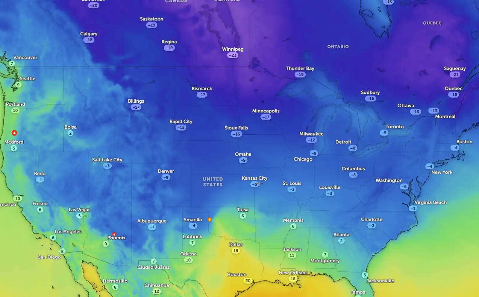
As 2025 kicks off, millions across the central and eastern United States are preparing for a significant winter storm that promises to deliver a potent mix of heavy snow, sleet, and freezing rain. Widespread travel disruptions, power outages, and dangerous conditions are expected to define the first weekend of the new year.
Stretching from the northern Plains to the mid-Atlantic, the storm is anticipated to create havoc from Friday, January 3, through Monday, January 6. Meteorologists predict snow accumulations exceeding 10 centimeters (4 inches), along with ice buildup over a tenth of an inch and strong wind gusts reaching up to 55 km/h (35 mph). These factors could lead to treacherous blizzard-like conditions and make roads hazardous for travelers.
The National Weather Service (NWS) reports growing confidence in the storm's intensity, predicting it will reach its peak between Saturday afternoon and Sunday night, January 4–5. During this period, residents should expect a cocktail of severe weather, including freezing drizzle, sleet, and heavy snow.
The storm is set to make its mark across several regions. It will first hit the northern Plains on Friday before shifting southeastward to impact the Central Plains, Ohio Valley, Tennessee Valley, and mid-Atlantic. This sprawling system is likely to leave icy trails and snow-covered landscapes across its path.
Winter storm watches are already in effect for parts of Kansas, with the NWS warning of accumulations of snow, sleet, and ice over the weekend. By Sunday evening, strong winds could cause significant blowing and drifting snow as the storm begins to taper off. On its heels, extreme cold temperatures are expected to grip much of the region into early next week.
Models show the heaviest snowfall concentrating along the central Plains and Mississippi Valley, particularly north of Interstate 70. These areas could face substantial travel delays and potential power outages caused by heavy snow and ice buildup.
Meanwhile, in the mid-South, forecasters are keeping a close eye on what could become a significant ice storm. This icy threat stretches from southern Kansas and the Ozarks to the Tennessee Valley. Freezing rain and sleet are expected to coat trees and power lines, leading to widespread power outages and treacherous driving conditions.
As Sunday unfolds, January 5, conditions may continue to worsen across parts of the central Plains and lower Ohio Valley. The wintry mix of snow and ice will likely impact areas further east in the Ohio Valley, mid-South, Central Appalachians, and possibly stretch into the mid-Atlantic by Sunday night.
By Monday, January 6, the storm is forecast to weaken as it crosses into the Appalachian region. However, wintry weather is still expected to linger across portions of the mid-Atlantic states and might even reach southern areas like the Carolinas.
The Weather Channel has officially named this major winter system Winter Storm Blair. As Blair unleashes its force across broad swaths of the country, it serves as a stark reminder of how unpredictable winter can be. Residents are encouraged to stay informed through official channels and prepare for rapidly changing conditions as this powerful storm system moves through.
Stay safe, stay warm—and wherever you may be this weekend—stay vigilant.