Tropical Storm "Pulasan" Brings Varied Impacts to Okinawa, Japan and Sets its Sights on Shanghai, China

As the world continues to experience an intense and unpredictable hurricane season, another storm has made headlines in Asia. Tropical Storm "Pulasan" made its way across Okinawa, Japan, on Wednesday night, September 18, 2024, leaving behind a trail of varied impacts. While the storm is described as disorganized, it poses a significant concern for the region, particularly Shanghai, China, which is still recovering from the aftermath of Typhoon "Bebinka" just a week ago.
Impact on Okinawa, Japan
Pulasan's passage over Okinawa brought varying wind speeds to different parts of the region. According to Meteorologist Robert Speta of WestPacWX, the storm's right side experienced the most severe weather, with wind speeds reaching up to 96 km/h (60 mph) in certain areas such as Yoron. The storm's disorganized nature, likened to "scrambled eggs" by Speta, resulted in scattered and unpredictable weather patterns across the region.
As the storm continues to move northwestward, Okinawa and the southern Japanese islands can expect more rain and shifting winds in the coming days. However, a cold surge is developing further north, hinting at the onset of colder weather. This shift in weather patterns is a welcome change for the region, which has been experiencing a prolonged period of hot and humid weather.
Shanghai, China in the Crosshairs
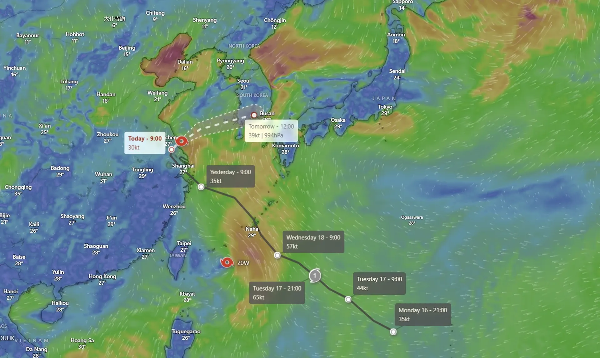
Tropical Storm "Pulasan" is now heading towards Shanghai, marking the second storm to hit the city in under a week, following the intense Typhoon "Bebinka". While Pulasan is not as intense as its predecessor, it poses a significant concern for the region due to the potential for further damage. Shanghai is still recovering from the aftermath of Typhoon "Bebinka", and the added stress of another storm could exacerbate the existing damage.
According to the latest forecast, Pulasan is expected to make landfall south of Shanghai on Thursday, September 19. The storm's impact on China is heavily dependent on its track and position relative to its center of circulation. Meteorologist Robert Speta emphasized that even a small deviation in the storm's track could result in significant changes to the severity of the impact.
Forecast and Track
According to the JTWC Prognostic Reasoning released at 03:00 UTC on September 19, Pulasan (15W) is forecast to continue tracking northwestward along the periphery of the subtropical ridge to the northeast through 03:00 UTC on September 20. Around that time, Pulasan is anticipated to make landfall near Shanghai, as a trough begins to break down an extension of the ridge, creating a weak steering environment and causing very slow track speeds.
As the storm makes landfall, it is expected to gradually weaken. However, once the system moves back over water, a steady intensification trend will follow. Strong vertical wind shear will limit the intensity to a peak of 75 km/h (46 mph), preventing the storm from intensifying into a more powerful system.
Extratropical Transition
After making landfall, Pulasan is expected to start tracking east-northeastward as the ridge takes over as the primary steering influence once again. Around 03:00 UTC on September 21, track speeds are expected to increase significantly due to interaction with the jet stream, marking the beginning of its extratropical transition. The system will then move briskly along the southern coast of South Korea through the Korea Strait and into the Sea of Japan.
As a result of the baroclinic zone being pushed south by the trough, Pulasan is forecast to complete its extratropical transition quickly by 03:00 UTC on September 22. This rapid transition will mark the end of Pulasan's life as a tropical storm, as it merges with the mid-latitude westerlies and becomes a part of the larger-scale weather pattern.
Conclusion
Tropical Storm "Pulasan" may not be as intense as its predecessor, Typhoon "Bebinka", but it poses a significant concern for the region due to the potential for further damage. As the storm makes its way towards Shanghai, China, it is essential for residents to remain vigilant and take necessary precautions to ensure their safety. With the storm's forecasted track and intensity, it is crucial for authorities to be prepared for the worst-case scenario and to provide adequate support to those affected by the storm.